Hurricane Ian: As Myakka River basin drains, flood danger increases downstream
Major and possibly record breaking flooding will continue through the weekend as rainfall from Hurricane Ian drains through the Myakka and Peace River drainage basins, with major implications for North Port and other areas downstream, according to the National Weather Service in Ruskin.
The Myakka River at Myakka State Park was expected to crest at 12.7 feet at 8 a.m. Saturday – more than two feet above major flood stage, said Rodney Wynn, a forecaster with the weather service.
It was already at 12.3 feet at 8 a.m. Friday. Major flood level is 10.5 feet.
Internet, cellular providers still working to restore service in Ian-affected areas
That could impact Duette, Myakka City, Hidden River, Warm Mineral Springs and North Port.
North Port has 80-miles of canals and waterways, including the Myakkahatchee Creek, which is part of Big Slough.
“It’s going to be at flood (stage) for at least another five days,” Wynn said. “As far as our forecast goes – Wednesday morning it’s still at moderate flood.”

Total inches of rainfall in North Port, Myakka City and other areas
A total of 21.45 inches of rainfall was recorded in North Port over the three-day period that included the impact of Hurricane Ian, according to hydrological data from the Southwest Florida Water Management District..
At the head of the Myakka River in Manatee County 15.03 inches fell; 15.87 inches in Myakka City, 13.41 inches at the Myakka River State Mark and 18.24 inches at Warm Mineral Springs. The amounts were in line with predictions for what Ian could produce across the area.
Stormwater from the 594-square-mile Myakka River Watershed flows south through North Port and out into Port Charlotte.
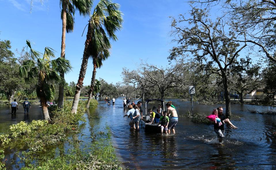
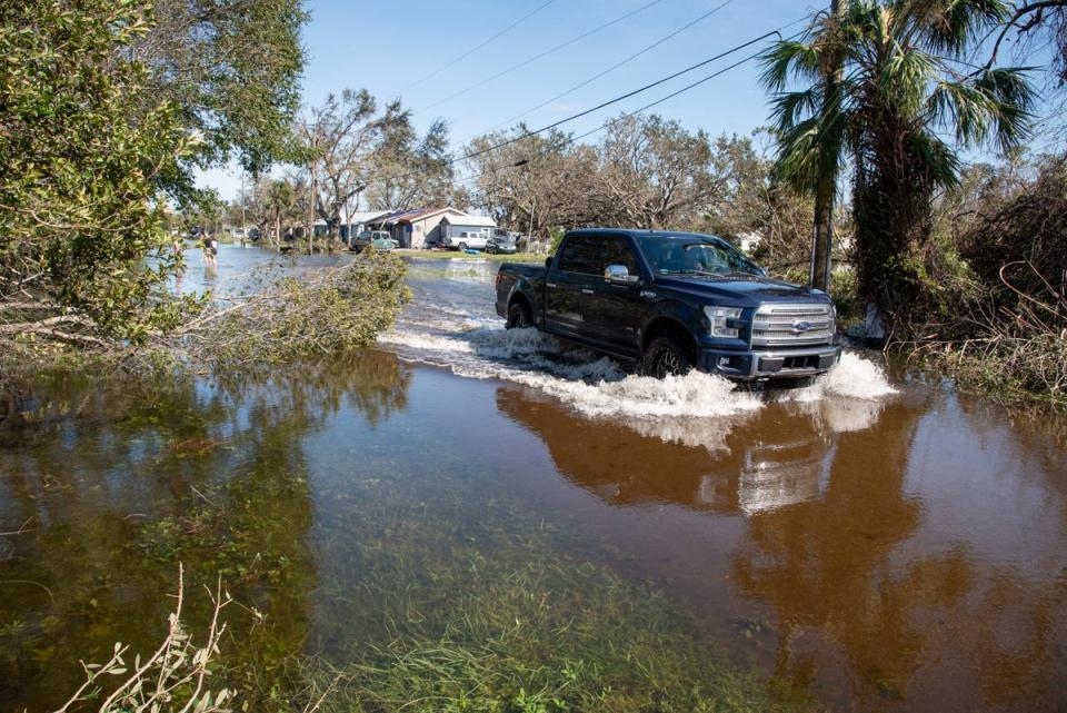
In the past that prompted persistent flooding and the aftermath of Hurricane Ian likely means city residents are looking at some of the worst flooding seen.
North Port Public Works started lowering the levels in the city’s waterways for two weeks, in anticipation of a severe storm.
North Port spokesman Jason Bartolone told 107.9 FM, WSRZ Sarasota: “We knew going into this event that flooding was going to be an issue in the days after.
"We have areas that traditionally flood, it all depends on the water that comes in to the north of us and then moves down into North Port, so we’re looking at those levels very closely,” he added. “We do know that we’re going to experience flooding and it is going to continue, so the danger is not over even though the storm has passed.”
That water flow means that a road passable one day – or even a few hours earlier – may again flood.
“Again we want everybody to stay safe, stay home, stay off the roads because conditions are changing quickly,” he said.
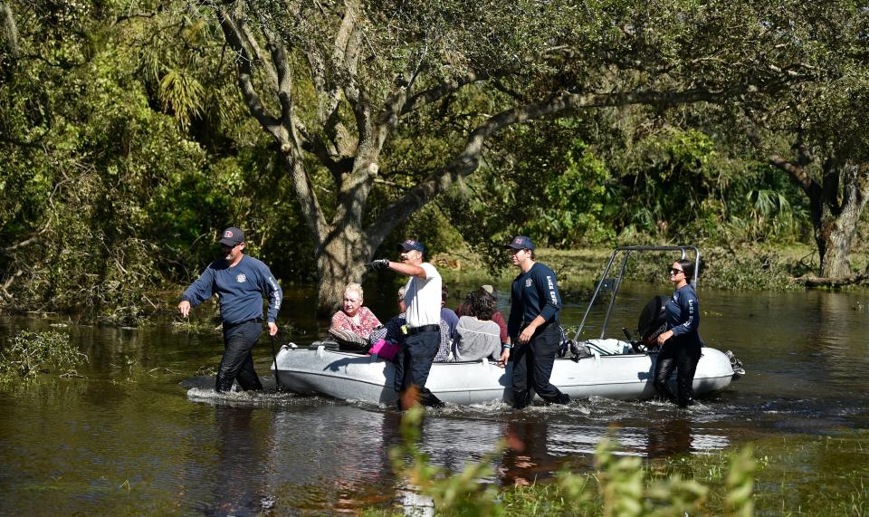
100 National Guardsmen are being housed at the George Mullen Activity Center Friday night. San Pedro Catholic Church is being used as a staging area for residents to be evacuated to a shelter in North Sarasota County.

North Port spokesman Josh Taylor confirmed Friday that the banks around a water control structure on the Cocoplum Waterway near North Port Boulevard had washed out. That structure was less than three years old.
“So far, on the evaluation of that is that it doesn’t appear, so far, that it is causing major issues because that is open anyway right now,” Taylor said. “That water control structure was open to let the water out anyway.”
The $2.47 million structure is one of 23 gated water control structures and 41 weirs that help move water through drainage canals and waterways in the city.
Rainfall and wind speeds still unofficial
The National Weather Service has not been able to access all of its official rainfall access points.
The current unofficial totals from the NWS had Nokomis receiving 14.2 inches of rain as of 7 a.m. Thursday, East Warm Mineral Springs 8.99 inches at 7:15 a.m. Thursday and North Port at 6.91 inches at 7 a.m. Thursday.
The fastest winds recorded in the region were 124 mph at 3:27 p.m. Wednesday in Punta Gorda, shortly after Hurricane Ian made landfall. Later, 110 mph winds were recorded in Grove City – along the east side of Charlotte Harbor in Charlotte County at 4:26 p.m.
In Lee County, the highest winds recorded were 140 mph in Cape Coral at 5:20 p.m. Wednesday.
Winds of 86 mph were measured at Sarasota-Bradenton International Airport at 6:10 p.m.
In Sarasota, winds of 75 mph were recorded at 5:32 p.m. Wednesday. Winds reached 59 mph in North Port at 4 p.m.; 56 mph in Nokomis at 2:28 p.m.; and 47 mph at 1:30 p.m.
No wind reports were available from Venice, though offshore of South Venice a 104 mph gust was measured at 5 p.m. and Sarasota Bay Marker 17 recorded 106 mph.
Wynn stressed all those measurements are unofficial.

A recent history of flooding
As recently as last July the city of North Port dealt with significant flooding in the aftermath of Tropical Storm Elsa.
Then, North Port had the most impact with 10 to 11 inches falling.
At that time, the city urged voluntary evacuation of flood prone neighborhoods as the river flow resulted in water rising as much as two feet overnight and some roads were covered in nearly four feet of water.
In 2021, the most impacted areas were in the North Port Estates area and along the Myakkahatchee Creek.

Back then, city emergency services personnel traversed flooded streets in vehicles in high ground clearance offering aid and rescuing stranded city residents and city officials noted that the flooding wasn’t a preparation issue – it was a capacity issue.
Hurricane Ian hit the region at time when rivers were low compared to previous years.
“We got a little slow start on the rivers this year,” Wynn said. “Usually our rivers are full or at flood stage by the end of July or August. It took a little longer this year.”
“With Hurricane Ian coming through it quickly dumped record amounts of rainfall in pretty much all of the basins around the region.
“If people have not been out lately and they’re not used to it being very high, they may be surprised,” he added. “Just use caution when walking in the rivers or doing anything near the riverbank.”
Earle Kimel primarily covers south Sarasota County for the Herald-Tribune and can be reached at earle.kimel@heraldtribune.com. Support local journalism with a digital subscription to the Herald-Tribune.
This article originally appeared on Sarasota Herald-Tribune: Myakka River flow endangers North Port after Hurricane Ian

