As Hurricane Ian makes landfall, Northeast Florida officials scramble to prepare region
As the eyewall of Hurricane Ian began moving onshore at Sanibel Island near Fort Myers at noon Wednesday — the most significant tropical threat to Florida's West Coast in decades — government and emergency officials in Northeast Florida scrambled to prep residents for the storm's slow crawl across the peninsula, where it's forecast to weaken before punching through the East Coast and out into the Atlantic sometime Thursday evening as a tropical storm.
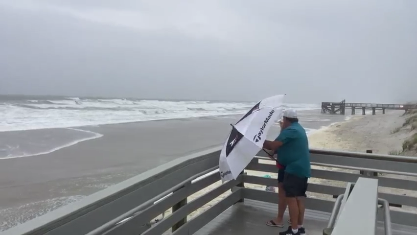
For Jacksonville and the larger region, Ian, whose strength was just shy of a fearsome Category 5 hurricane when it reached Florida, is forecasted to drop as much as 15 inches of rain, with some localized amounts reaching 18 inches, in addition to tropical storm strength winds and 3 to 5 feet of storm surge for coastal and riverfront areas.
"It's very difficult to determine the actual impact of storms of this magnitude," Jacksonville Mayor Lenny Curry said during a Wednesday morning news conference. "While we do not want to overreact, we also want to ensure we've done enough to prepare should this storm strengthen or shift as it approaches."
Curry did not order mandatory evacuations for Jacksonville, though he recommended residents in the lowest-lying neighborhoods, and particularly those that have flooded in past hurricanes like Matthew and Irma, consider staying with friends or one of four shelters the city has opened.
Officials in St. Johns, Clay and Nassau counties ordered evacuations for their most vulnerable areas, including the City of St. Augustine in St. Johns and the communities on the north and south prongs of Black Creek, a tributary of the St. Johns River in Clay that is particularly prone to flooding. The National Weather Service said Black Creek could reach moderate to major flood stage depending on the rainfall total from Ian.
Hurricane Ian Live Updates: The latest as Northeast Florida residents prepare
Forecast: See the latest forecast, tracking map
Shelters: Here are the emergency shelters opening in Jacksonville, Northeast Florida
Evacuations: Evacuation orders and recommendations for Northeast Florida
Schools across the region were closed Wednesday and will re-open Monday.
Forecasters expect the worst weather conditions to begin Thursday evening and last through early Friday morning.
Ian is expected to pass near Jacksonville in the Atlantic Ocean as a tropical storm after slogging across the Florida Peninsula on a northeast track, bringing torrential rain to Central and Northeast Florida along the way. Government forecasters believe Ian could bring storm surge of about 3 to 5 feet to the Beaches cities but are not expecting the water to top the dunes, though the effects could intensify or weaken depending on how far offshore Ian remains.
Concerns about flooding along St Johns River and tributaries

Much of the flooding concern is centered on the St. Johns River and its tributaries. Ian's arrival has coincided with more extreme tides that are common in the fall. Portions of the St. Johns, including in downtown Jacksonville, were already nearing minor flood stage at high tide Wednesday morning — before the city had begun feeling Ian's strength.
The possibility of river-driven flooding has raised concern Ian may replicate some of the damage Hurricane Irma brought to the region in September 2017, when a cocktail of natural forces — including the seasonally higher-than-normal tides — contributed to surprising and intense flooding in downtown, Riverside, San Marco and other riverfront neighborhoods across the city. Jacksonville emergency responders rescued some stranded residents in boats.
In the South Shores neighborhood, a 1920s–vintage community off Atlantic Boulevard west of Bishop Kenny High School that suffered flood damage during Irma, David Gum and his wife were keeping a close eye on the river, which snakes past their home.
Gum grew up in the house and can still conjure memories of when he was about 10 years old in 1964 and Hurricane Dora hit Jacksonville, flooding the streets around his home. The power was out for 11 days, and he and other neighborhood kids rowed boats through neighbors' yards.
Only 2017's Hurricane Irma has flooded the South Shores neighborhood that badly since, but they both keep memories of that storm stored on their phones in photos: flooded streets, neighbors on boats, a flooded garage and a submerged car.
Now they're worried about their home perched on the shores of the St. John's as Hurricane Ian crosses the state.
"If you want to feel some real wind, go out back," Gum said, pointing to his backyard.
But the couple is more worried about a potential flood than wind speeds.
The South Shores neighborhood is quiet. Some of the houses have no cars in the driveway and the lights are off. Gum says his neighbors are either still at work (a teacher and a firefighter) or have evacuated the neighborhood as the storm approaches.
Throughout flood-prone areas, residents and businesses prepare
Other areas of flood-prone areas of Jacksonville show signs of Hurricane Ian preparation. Employees at a smoke shop in San Marco were moving merchandise off the floor and onto higher shelves since the storm flooded during Hurricane Irma.
Workers were putting boards on the windows of Hollingsworth, an appliance store also in San Marco. Other businesses have already long since boarded windows.

JEA officials said they have crews stationed at all areas across the city and region in preparation for potential power outages and stress on the water and sewer system. JEA CEO Jay Stowe said 300 crews from outside the area are fortifying the utility's workforce and will help respond to outages.
Some retail shops were set to close Wednesday, including Starbucks and the Orange Park Mall. No grocery stores had announced closures.
Rush hour traffic was lighter than normal across the city Wednesday morning with schools closed. Gas stations and stores were busy but with only sporadic reports of shortages of fuel, water and other essentials.
Duval County shelters
• Legends Center, 5130 Soutel Dr. (General and special needs)
• Lavilla Middle School, 501 N Davis St. (Houseless and homeless individuals)
• Landmark Middle School, 101 Kernan Blvd. (General and pet friendly)
• Atlantic Coast High School, 9735 R G Skinner Pkwy (Special needs and pet friendly)
Duval County has no mandatory evacuations, but residents in Zones A or B or who experienced flooding in previous storms should consider evacuating.
St Johns County shelters
• Pacetti Bay Middle School, 245 Meadowlark Lane (Special needs)
• Southwoods Elementary, 4750 State Road 206 (Pet-friendly)
• Pedro Menendez High School, 600 State Road 206 West (General population)
Evacuation orders are in effect for Zone A, Zone B and the portion of Zone F south of County Road 214. The zones include the entirety of the city of St. Augustine, city of St. Augustine Beach and waterfront properties.
Nassau County shelters
• Hilliard Middle Senior High,1 Flashes Drive, Hilliard (Special needs)
• Callahan Middle School, 450121 Old Dixie Highway (General and pet friendly)
Nassau County has issued an evacuation order for zones A and D.
Clay County shelters
• Lake Asbury Junior High, 2851 Sandridge Rd, Green Cove Springs (Special needs)
• Keystone Heights High, 900 SW Orchid Ave., Keystone Heights (General and pet friendly)
• Orange Park High School, 2300 Kingsley Ave., Orange Park (General and pet friendly)
• Wilkinson Elementary School, 4965 County Road 218 West, Middleburg (General)
• Clay High School, 2025 W. State Road 16, Green Cove Springs (General)
Clay County issued "highly recommended" evacuations starting noon Wednesday for Zone A, Zone B, and Zone C, as well as the North and South Prongs of Black Creek.
This article originally appeared on Florida Times-Union: Hurricane Ian makes landfall, Northeast Florida officials scramble

