Before and after Hurricane Ian: Satellite images show significant damage to Sanibel Island vacation destinations
The National Oceanic and Atmospheric Administration has started to release satellite imagery of areas in southwest Florida damaged by Hurricane Ian.
In an interactive map published Friday, parts of Caya Costa, Captiva, and Sanibel Island were shown. Areas of Cape Coral and Fort Myers along the Caloosahatchee River were, too.
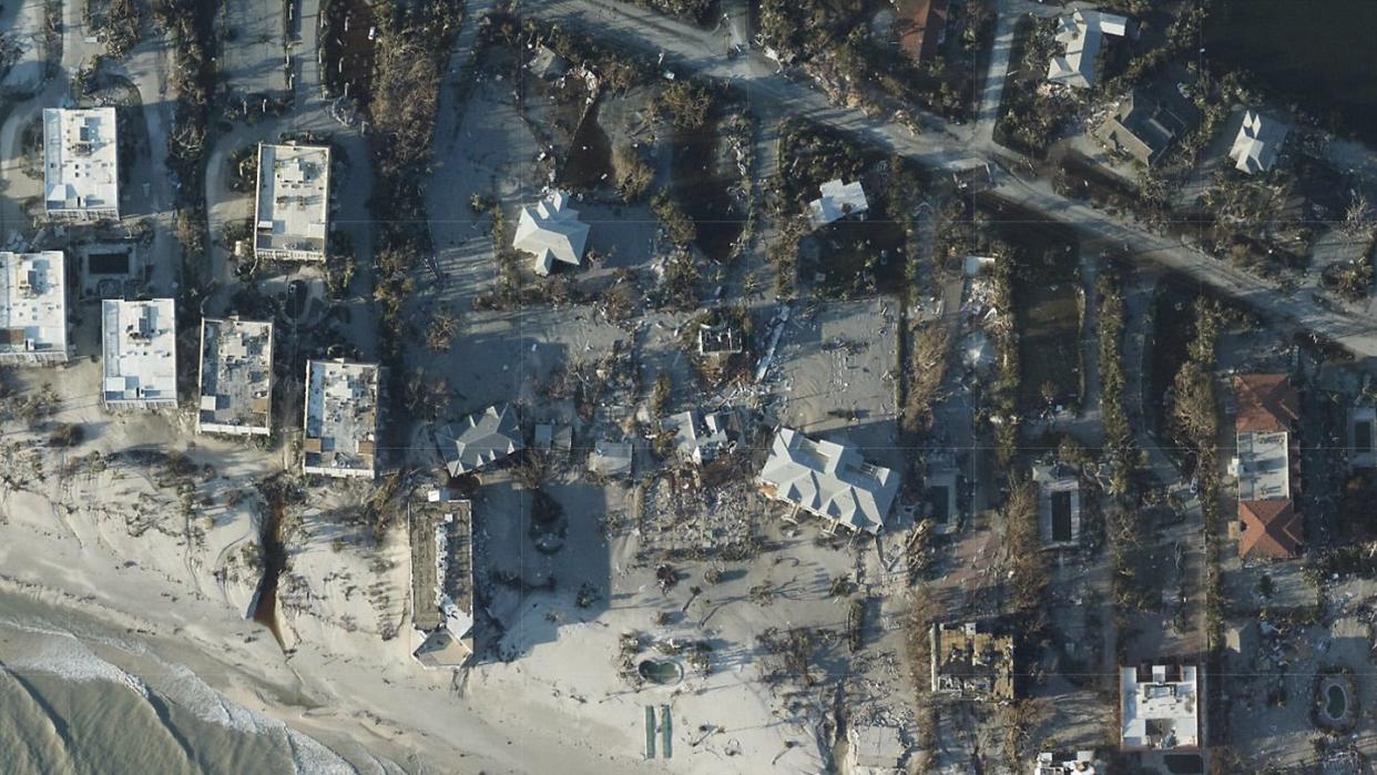
The images made clear that several holiday destinations on Sanibel Island were particularly hard hit by the storm, Using satellite photos courtesy of Google Earth taken last year, these interactive sliders reveal the significant damage done.
Loggerhead Cay, Gulf Breeze Cottages
Island Inn
Mitchell's SandCastles
More Hurricane Ian pictures, videos
This article originally appeared on Fort Myers News-Press: Sanibel Island Hurricane Ian before, after satellite pictures of damage

