Hurricane Ian update: Storm nears SC. Thousands lose power. Water surges near Myrtle Beach
As a public service, The Greenville News, Spartanburg Herald-Journal and Anderson Independent Mail are making storm coverage free to readers as long as the region is threatened. Check back for updates through the day. To help us continue keeping you informed, please consider supporting us with a digital subscription. Click here to subscribe to The News. Click here to subscribe to the Herald-Journal. Click here to subscribe to the Independent Mail.
After losing strength as it unleashed a deadly wallop across the state of Florida, Ian re-strengthened into a Category 1 hurricane as it approached the coast of South Carolina Friday.
The storm's second U.S. landfall officially came at 2:05 p.m. near Georgetown with maximum sustained winds of 85 mph.
Hurricane-force winds could be felt 70 miles from the center of the storm and tropical-storm-force winds could be felt as far as 275 miles from the center.
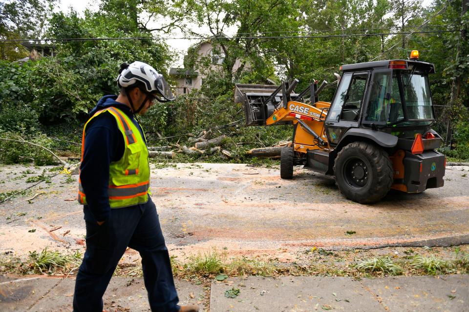
Reports of damage along the South Carolina coast began before landfall.
Recovery from Hurricane Ian:SC surveys damage and begins recovery efforts
The Pawleys Island Police Department reported at 1:23 p.m. that the end of the Pawleys Island pier had collapsed and was floating to the south in rough surf.
The end of the Pawleys Island pier has collapsed & is floating south. pic.twitter.com/ajJsWeXWfN
— Pawleys Island PD (@PawleysIslandPD) September 30, 2022
By 1:36 p.m., water rushed over the Murrells Inlet Marshwalk.
This water just keeps coming in. Folks are still around.
The covered deck is where I was earlier, water halfway to that second story deck next to wicked tuna.
This is insane. #Ian #scwx pic.twitter.com/IHgYVe3y5C— Aaron Smith (@PeeDee_WxSC) September 30, 2022
The storm surge was expected to reach up to 7 feet.
The flood-prone Charleston area had weathered sustained periods of heavy rain by early afternoon as outer bands from Ian reached inland.
President Joe Biden declared an emergency and ordered federal assistance for South Carolina, according to the White House. As of 11 a.m. Friday, Ian was about 60 miles south of Charleston. Wind gusts at 1 p.m. reached 43 mph at Greenville Municipal Airport and 38 at Greenville-Spartanburg Airport.
Live look:See the South Carolina coastline as Hurricane Ian approaches for a second U.S. landfall
The National Weather Service said the Upstate can expect the heaviest rainfall between Friday afternoon and early Saturday morning. The intensity of wind gusts picked up early Friday morning as rain associated with Ian reached parts of the Upstate by noon Friday.
Nearly 200,000 people without power after Ian makes landfall
In South Carolina, as of about 5:45 p.m., nearly 181,000 customers were without power after Ian's landfall, according to poweroutage.us, which collects, records and aggregates live power-outage data from utilities all over the country.
In Horry County, more than 60,000 customers of Santee Cooper, Horry Electric Cooperative and Duke Energy were without power as of about 5:45 p.m. About 47,500 customers in Charleston County were without power while more than 17,000 in Georgetown and Williamsburg counties were without power.
Outages were minimal in the Greenville area.
Ian loses status as hurricane it moves inland
The National Hurricane Center reported that Ian had lost its status as a hurricane before 5 p.m. as it moved inland. It was centered just northwest of Conway and headed toward North Carolina with maximum sustained winds of 70 mph around 4:45 p.m.
Winds must be sustained at 74 mph according to official measurements for a tropical system to be a hurricane.
Tropical-storm-force winds, of course, are capable to inflicting serious damage. Officials continue to urge caution throughout the region.
The storm was expected to approach the Greensboro, North Carolina, area by 2 a.m. Saturday.
South Carolina Emergency Management posts public safety alert
Conditions are worsening as Hurricane Ian makes landfall along the South Carolina Coast. High winds and flooding due to storm surge have already caused damage and blocked roads in several coastal communities.
Over the next few hours, your safety is the most important:
* Be aware of potential flash flooding and storm surge. If there is any possibility of a flash flood, move to higher ground. Do not wait to be told to move.
*Monitor official, local sources for emergency information. Be sure to keep a battery operated, solar-powered, or hand-crank-operated radio or television for use during power outages.
* Stay inside a well-constructed building away from the windows and the doors, even if they are covered. Go to an interior first-floor room, closet, or under the stairs.
* Be alert. Tornadoes are very often spawned during hurricanes. If the “eye” of the storm passes over your area, be aware that severe conditions will return with winds from the other direction in a very short time.
* Do not walk through moving water. Six inches of moving water can make you fall. If you absolutely have to walk in water to get to safety, walk where the water is not moving. Use a stick to check the firmness of the ground in front of you.
* Do not drive into flooded areas. If floodwaters rise around your car, abandon the car and move to higher ground if you can do so safely. You and the vehicle can be quickly swept away.
* Limit non-emergency calls. Be sure to keep calls brief to minimize any network congestion. Wait at least 10 seconds before redialing a call. For non-emergencies, try sending text messages.
Several emergency shelters are open: https://scemd.org/stay-informed/emergency-shelters/
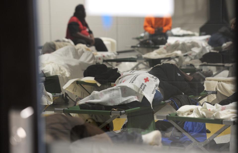
Red Cross opens shelter at North Charleston elementary school
Friday in Charleston began damp and gusty, but by 11 a.m. the morning’s light drizzle had turned vicious. Sheets of rain blew sideways in the wind, forcing the few cars left on the road to creep through rising floodwaters.
The weather was no better in North Charleston. On Thursday, the Red Cross had opened a shelter inside the Matilda Dunston Elementary School, and by Friday afternoon 53 people had gathered there, preparing to ride out the storm.
Janie Hamilton, 72, arrived at the school around 8:00 am Friday morning. She has a disability and lives alone, she said, in a part of town prone to flooding. Her daughter had planned to drive down from Charlotte to pick her up, but Hamilton decided to go to Matilda Dunston instead.
There, she made herself comfortable in the cafeteria, working a crossword puzzle and following the news from Florida on her phone.
“You just gotta have faith and trust in God,” she said of the hurricane, shaking her head. Hamilton's thoughts were with her family elsewhere in the Charleston area.
“I’m just praying for them to be OK,” she said.
Edward William, 33, came to Matilda Dunston on Thursday night. William, who arrived in Charleston from Nashville four or five days ago, is homeless and felt unsafe outdoors.
“A person can be homeless in weather, but not in a hurricane,” he said.
If the shelter hadn’t been open, William said he would have struggled.
“I’d have found a gas station that was open, maybe where I could have hugged up against a wall,” he said. Another option would have been to “crawl into a dumpster” – but, he wondered, would that really be safe in a hurricane?
“The main goal is to stay out of the rain,” William said. “The water – that’s what can carry you away.”
SC Gov. Henry McMaster holds Friday afternoon press conference
South Carolina power outage map for Hurricane Ian
As of 1:15 p.m., Greenville County had 1,644 without power while Spartanburg County was at 218. Click here for the latest Duke Energy outages.
Downtown Spartanburg businesses see light crowds Friday afternoon
Lance Sprouse, an employee at the Tulip Tree in downtown Spartanburg, said he has worked in the service industry since 2005. Sprouse said restaurants typically see less customers from in town, while some out-of-towners from coastal areas are more likely.
“I’ve noticed that areas get a surge of people who have evacuated. A lot of folks are hesitant of getting out in the storm. Tonight we have 14 reservations," Sprouse said. "For lunch, we’ve only had one table. What stinks is we can’t do outdoor seating, so if it does get busy we’re gonna have to try and manage it [inside]”
Are airports open?What to know about flying through the Carolinas amid Hurricane Ian
Alex Brevik, Bond Street Wine general manager, said he expects business to pick up Friday night.
“I think it’s going to start quiet, but as the night goes on it may be relatively busy. I think it’s going to be busy because it’s Spartanburg, it’s always busy. We have everything we need, and a very safe basement if need be," Brevik said.
Elizabeth Malone, manager of Bar 1884 and Miyako, said Friday's lunch crowd was lighter than usual.
“We have about 20 people now for lunch, and it’s usually busier than this. I feel it will drive customers away," Malone said. "We’re going to play it by ear, especially since employees here live in the Campobello area. 1884 is also going to be open, but our outside will be closed due to the obvious wind and rain. As far as I know, if it gets bad we will close early in order for our staff to get home safely”
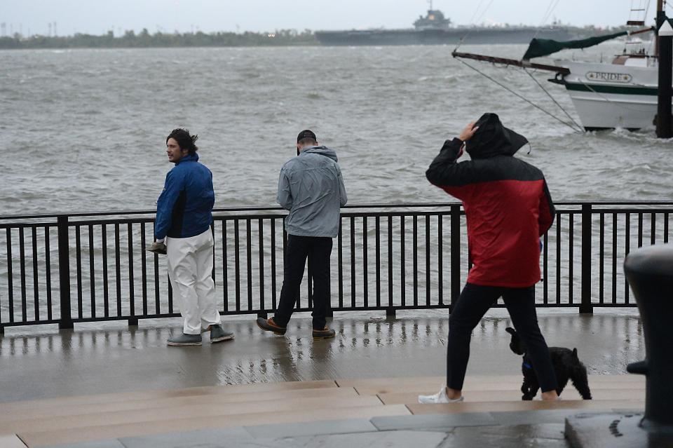
Charleston, SC prepares for Hurricane Ian
Dark clouds hung low over Charleston Friday morning as the Holy City steeled itself for the impact of Hurricane Ian.
Powerful wind gusts rocketed across the harbor, buffeting a sailboat outside the Charleston Aquarium like a child’s toy. But the rain was light, and flooding, so far, was minimal.
“This is not that bad,” said Sam Weinick, 23, a Charleston native making his way towards the waterfront to watch the storm come in. His friend, Seth Ensley, 24, nodded in agreement. “An ordinary rainstorm looks worse than this right now.”
But there were eerie signs of a city bracing for trouble. The Ravenel Bridge was nearly empty – an unusual sight, according to Weinick.
Sideways rain at town hall. 🌧️ pic.twitter.com/TpiT9lUn1L
— Pawleys Island PD (@PawleysIslandPD) September 30, 2022
“It’s rare to only see one car at a time,” he said.
Weinick and Ensley weren’t the only people braving the impending storm. Vickie Neighbour, a Charleston native who lives just four blocks from the harbor, had taken her miniature schnauzer Abby for a quick walk before conditions worsened.
Neighbour’s home is on high ground, she said, so flooding wasn’t a big concern. But wind damage could be a different story.
Abby barked as her owner braced herself against the gusts.
“It’s Abby’s first hurricane,” said Neighbour.
Joe Biden approves emergency declaration for SC
FEMA announced that federal emergency aid has been made available to the state of South Carolina to supplement the state, tribal and local response efforts due to emergency conditions resulting from Hurricane Ian, according to a press release from FEMA.
The President’s action authorizes FEMA to coordinate all disaster relief efforts to alleviate the hardship and suffering caused by the emergency on the local population and to provide appropriate assistance, to save lives, to protect property, public health and safety and to lessen or avert the threat of a catastrophe for all 46 South Carolina counties.
There are currently 24 road closures and 18 traffic lights out throughout the city. Please stay off the roads if you can and avoid barricaded areas. #chstrfc Continue to stay up to date here: https://t.co/FnRPjLmvJF
— Charleston P.D. (@CharlestonPD) September 30, 2022
FEMA is authorized to identify, mobilize and provide at its discretion, equipment and resources necessary to alleviate the impacts of the emergency. Emergency protective measures, including direct federal assistance, under the public assistance program, will be provided at 75% federal funding.
Ian's eastern trek will keep impact moderate in Upstate South Carolina
NWS meteorologist Clay Chaney said Ian's consistent eastern shift means a downward rainfall impact for the Greenville-Spartanburg area.
"Not too much has changed, we are looking at a downward trend as far as rainfall goes. We still expect modern to heavy rainfall to begin roughly between 10 and noon. It could lead to some localized, flash flooding. Overall, most of the rain should lift out of the area by daybreak Saturday.
"By Saturday afternoon, we should actually be able to dry out and remain dry. We may have a 30 percent chance of rain on Sunday, but nothing compared to Friday. After midnight tonight, the wind should subside pretty rapidly. [Hurricane Ian] It continues to nudge to the east with each advisory."
From the Lowcountry:Hurricane warnings issued for Jasper, Beaufort counties for Tropical Storm Ian
Greenville, Spartanburg schools and events postponed or canceled
As Greenville and Spartanburg counties prepare for the effects of Hurricane Ian to begin early Sept. 30, event cancellations, postponements and closings are happening throughout the area.
Public schools in Greenville, Spartanburg, Anderson, Pickens and Oconee counties have announced that Friday will be an eLearning day due to concerns about hazardous conditions.
Kickoffs for football games were changed, and some school events have been canceled. South Carolina's football game against SC State was moved up to Thursday night. Clemson's showdown in Death Valley vs. NC State is still scheduled for Saturday night, though earlier this week, officials with ESPN's College GameDay said they were looking at potential indoor options for the popular pregame show.
Here is a list of festivals and things going on with changes announced thus far.
This is a developing story. Check back for updates.
- USA Today reports contributed to this story.
This article originally appeared on Herald-Journal: Hurricane Ian hits SC coast with wind and rain as damage is reported

