Will Hurricane Ian's punch echo Irma's Jacksonville impact after cross-state slog?
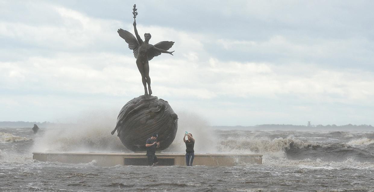
As Jacksonville watches the approach of the state’s next hurricane, memories of Hurricane Irma five years ago hang like a shadow over Northeast Florida.
“Right now, the [forecasted] path is west of where Irma was, which is good news. The problem is … we don’t have any confidence in where it’s going to go,” said Jacksonville University marine biologist Quinton White, who arranged Monday for the school’s 48-foot research vessel to be pulled from a St. Johns River tributary and moved to higher ground.
Since Irma submerged miles of homes and businesses in September 2017, White said the risk from flooding has been magnified by river dredging that deepened the shipping channel from the ocean to Jacksonville’s port.
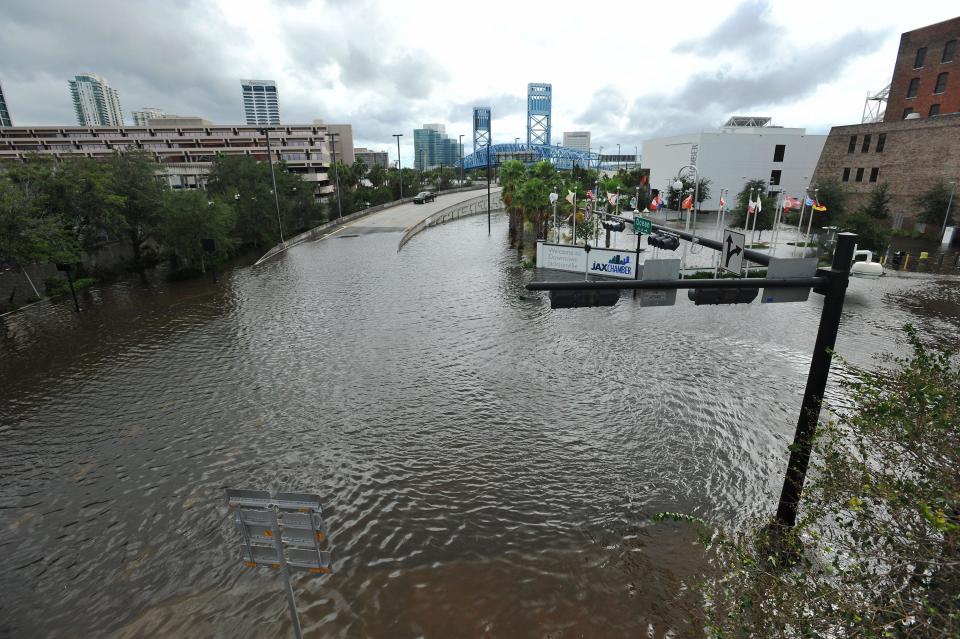
That work, which was completed in May, cleared a path where ocean water will push against the river’s efforts to drain stormwater from the hurricane’s rains.
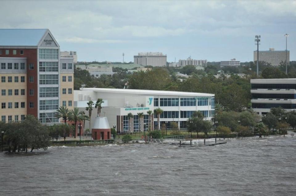
"If you flooded in Irma, now is the time to take precautions," National Weather Service meteorologist Angie Enyedi said. "... The more vulnerable areas again will be in open areas on the coast and really focused in the St. Johns River basin."
The weather service Monday evening issued a storm-surge watch — notice of "a possibility of life-threatening inundation from rising water moving inland" — from the Altamaha Sound in Georgia to the Flagler/Volusia county line, including along the St. Johns.
Hurricane Ian's projected path from Florida's west coast through the peninsula's interior echoes elements of Irma's route from Collier County inland to Georgia, but it's unclear how closely the new storm's path will resemble its predecessor.
“Flooding rain” is expected in parts of Northeast Florida and Southeast Georgia between Wednesday and Friday, the Weather Service said, but the storm’s path and pace of travel will be critical to how Northeast Florida is affected.
The Weather Service projected 6 to 12 inches of rainfall total, less than amounts logged in some First Coast areas during Irma.
Elevated high tides are expected to produce minor flooding on parts of the St. Johns, with more flooding possible on the St. Marys River at the Georgia border and along the Santa Fe River winding from Keystone Heights through North Central Florida.
Wherever it moves, Ian’s arrival time will determine whether runoff is draining into rivers that are at high or low tide, but that’s among many details that remain unknown.
"Water levels in the northern reaches of the St. Johns can rise with little advance notice," the St. Johns River Water Management District said in a statement outlining steps that agency is taking to to prepare its properties and encouraging people to be alert.
Times-Union staff writer Dan Scanlan contributed to this report.
This article originally appeared on Florida Times-Union: Memories of Irma linger as Jacksonville readies for Hurricane Ian

