Hurricane Ian bringing flooding to Onslow Friday morning, several North Topsail roads closed
Update 12:15 p.m. Friday
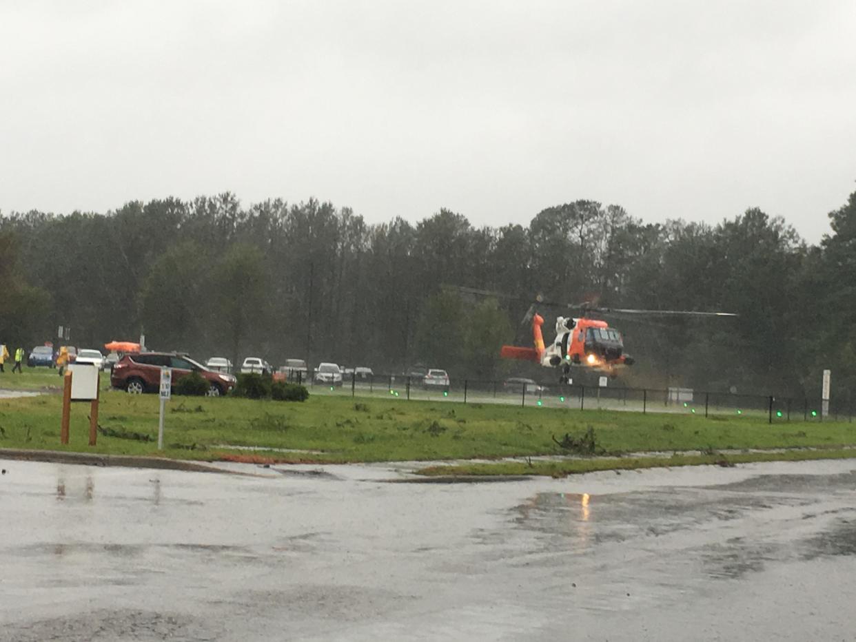
As Hurricane Ian continues its path up the east coast and into eastern North Carolina, flooding has already begun in much of Onslow County.
The Town of North Topsail Beach posted on Facebook Friday morning photos of flooding in the roadway near Richard Peters Park at 465 New River Inlet Road, a result of overwash coming across from Onslow County Beach Access #4. That access is closed.
The town also closed New River Inlet Road at Seagull Lane due to the high water.
The National Weather Service said early Friday morning that there have been minimal changes to the impacts of Ian on eastern North Carolina, but are encouraging drivers to avoid flooded roads, especially as high tide nears within the next couple of hours.
Onslow County also posted on its Facebook page Friday morning that the county continues to see periods of heavy rain, and there have been isolated reports of downed trees in the county. If you don't need to be on the roads today, stay home.

Update 9 a.m. Friday
As Hurricane Ian continues it's path up the east coast and into eastern North Carolina, more than 1,000 people in Jacksonville are without power early Friday morning.
Crews with Duke Progress Energy reported around 7:30 a.m. Friday morning, power was lost for customers between Henderson Drive and Gum Branch Road due to tree limbs falling on the equipment. Crews expect power to be back up around 12:15 p.m.
According to the National Weather Service in Newport, there have been minimal changes to the impacts of Ian on eastern North Carolina. However, due to a slight eastern shift in the storm's track, the entire area remains under a Tropical Storm Warning with some areas also under a Storm Surge Warning or Storm Surge Watch.
Currently, the White Oak River in Onslow County is under a Storm Surge Watch.
Update: 5:30 p.m. Thursday
The National Weather Service released a briefing at 5 p.m. Thursday saying there have been minimal changes to the storm.
However, they are reminding coastal residents that Hurricane Ian has a very large wind field and impacts will occur well away from the center of the storm. The winds are expected to eventually shift to the southeast as the storm approaches the South Carolina coast Friday.
The Onslow area is expected to see three to four inches of rainfall and flash flooding is possible in areas with the heaviest rainfall.
Update: 5 p.m. Thursday
Tropical Storm Ian has now strengthened back into a category 1 hurricane. The Onslow County Board of Commissioners has declared a state of emergency for all unincorporated areas of Onslow County.
"Based upon our Emergency Services report, we would recommend, as a precaution, that we consider a state of emergency for Onslow County," Onslow County Manager Sharon Griffin read during Thursday afternoon's emergency meeting. "We urge citizens to be careful in travel and stay off the roads, if possible, if the weather conditions deteriorate overnight and into tomorrow. We do anticipate that travel could be treacherous and we're continuing to watch the forecast."
The Board of Commissioners unanimously approved the proclamation for a state of emergency.
Onslow County Emergency Services Director Norman Bryson presented a report from the National Weather Service prior to the vote, explaining to the commissioners the impacts Onslow County could potentially see as a result of Tropical Storm, now Hurricane, Ian.
These include two to three feet of storm surge at North Topsail Beach and one to three feet in Swansboro. He said this is expected to occur around noon tomorrow, which is also high tide, creating a more severe impact.
Bryson also said the heaviest rainfall for the Onslow County area is expected from 2 a.m. Friday morning to 8 p.m. Friday evening, with the county seeing a potential four to six inches. The county could also see upwards of 50 mile per hour wind gusts, with most of the storm sitting at between 20 and 40 mile per hour winds.
Griffin said the county is not, at this time, activating shelters or recommending anyone evacuate.
Update: 3:45 p.m. Thursday
Jacksonville Mayor Sammy Phillips declared a state of emergency for the city of Jacksonville as of 5 p.m. Thursday evening.
The National Hurricane Center said Thursday afternoon that Ian will approach the coast of South Carolina on Friday and the center will move farther inland across the Carolinas Friday night and Saturday.
The NHC also said Ian is expected to become a hurricane again by this evening and make landfall as a hurricane on Friday, with rapid weakening forecast after landfall.
Update: 2:30 p.m. Thursday
Although Ian has downgraded to a tropical storm, meteorologists are saying it could strengthen back to a Category 1 hurricane with its current path moving up the east coast and back over the Atlantic Ocean.
Tropical Storm Ian has now moved off the coast of Florida and is currently making its way northwest towards South Carolina and Georgia, according to the National Weather Service in Newport.
The Onslow area is expected to begin to feel the impacts of the storm tonight and through the weekend, with the heaviest rainfalls expected tonight through tomorrow evening. The latest NWS briefing said if Ian shifts a bit farther east, the Onslow County area could see stronger winds than the forecasted maximum of 41 miles per hour.
Update: 10:30 a.m. Thursday
According to a 6 a.m. briefing from the National Weather Service, a Tropical Storm Warning has been issued for Carteret and coastal Onslow Counties.
Onslow County can expect to see a prolonged impact of wind, rain and elevated water levels. Although newly downgraded Tropical Storm Ian is tracking towards the west, the NWS says impacts well away from the center of the storm will impact the area through the end of the week and into the weekend.
"A stalled front off the N.C. coast and strong high pressure to the north will help contribute to the impacts across Eastern N.C. well east of the track of Ian," the briefing read.
Coastal Flood Warnings and Advisories are also now in effect, the briefing explained. Long-duration, strong northeast to east winds are expected to produce minor to moderate coastal flooding, and North Topsail Beach could see two to three feet.
Jacksonville is expected to see a possible four to six inches of rainfall from the long-duration rain event, starting Thursday night and continuing into Saturday morning. Jacksonville is also expected to get maximum wind gusts of 35 miles per hour, with North Topsail seeing a maximum of 46mph.
Tornados are possible Friday and into the weekend, according to the briefing, as well as dangerous seas and beach conditions.
Original story: Wednesday morning
As Hurricane Ian makes its way across Cuba Tuesday morning, Onslow County residents can expect impacts this weekend.
Hurricane Ian strengthened to a major hurricane Tuesday morning, according to the National Weather Service's latest briefing. The NWS said Ian will continue northward and make landfall on the Florida peninsula early Thursday morning. Although the storm is expected to weaken after landfall and track to the west, impacts on eastern North Carolina are expected.
"The earliest time that we could see tropical storm force winds, which are at least 39 miles per hour but can be greater, would be late Thursday into Friday morning," said NWS Meteorologist Olivia Cahill. "But the most likely time that we could see that force of wind would be late Friday evening into early Saturday morning. Our biggest concern right now is definitely the rainfall."
The NWS briefing said impacts will be highly dependent on the eventual track and speed of Ian. Cahill added they should know much more in the next 24 hours.
More:Take a trip around the world at Jacksonville restaurants on the International Food Trail
Hurricane Preparedness Week: How Onslow residents should gear up for the season
Flash flooding is possible, Cahill explained, and flooding in rivers and creeks could be seen where there is heavier rainfall. The NWS said a combination of an offshore front and tropical moisture associated with Ian will lead to an extended period of heavy rain across eastern North Carolina late this week.
"As far as rainfall, right now it's looking around 6-8 inches close to the coast, then maybe 4-6 farther out, more inland," Cahill said. "But that could vary as the track of the storm shifts. It's passing over Cuba right now. After it gets into the Gulf, that will dictate a lot of its track. If it stays more over land, it will definitely just be more of a rainfall concern. Still rainfall concern if it does go back over the Atlantic, but that's when there's a potential for more wind concern. But still, as of right now, definitely just major thing to focus on would be the rain."
This means areas like North Topsail Beach, Swansboro and Jacksonville should prepare for the heaviest rain, while areas like Richlands could see less, but still should expect heavy impacts.
Cahill said although it's too early to tell exactly what is going to happen, Onslow County residents should get together their hurricane-preparedness kits, and make sure they know what all needs to go into them. This is everything from food, to water, medications, and making sure pets are taken care of.
"We always say, whether or not it ends up being tropical storm impacts or anything else, it's always good to be prepared," Cahill said.
Reporter Morgan Starling can be reached at mstarling@gannett.com.
This article originally appeared on The Daily News: Hurricane Ian: What can Onslow County residents expect?

