Hurricane Ian's shifting track puts Polk County in its path, tornadoes a threat
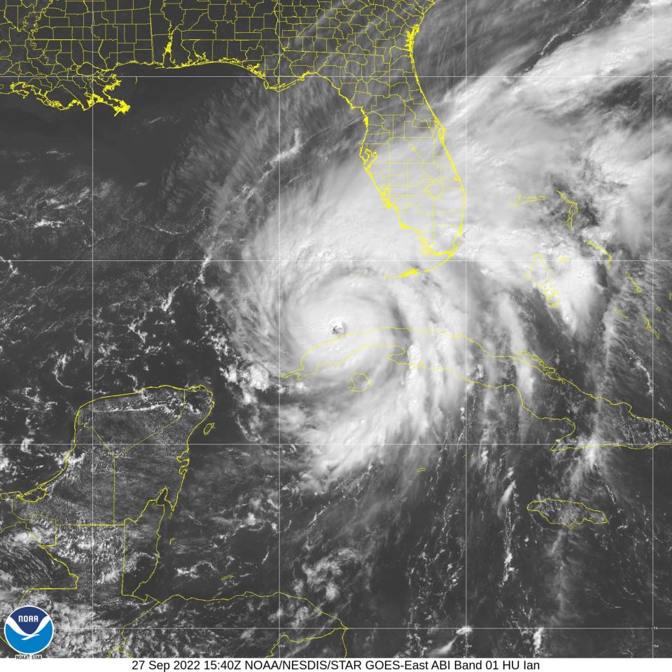
Hurricane Ian has shifted the storm's route to the southeast putting western Polk County directly in its path, according to Tuesday predictions by the U.S. National Weather Service in Tampa Bay.
The latest forecast has Ian coming up from the south through Mulberry having weakened from Category 3 to Category 1. It will likely pass directly through Lakeland heading toward Polk City and the Four Corners area, said meteorologist Rodney Wynn with the U.S. National Weather Service in Tampa Bay.
Final preparation: Polk County residents make late runs for generators, gasoline as Hurricane Ian nears
'It’s Mother Nature': Polk residents of flood-prone areas prepare for Hurricane Ian
Polk residents should be prepared to start feeling the impacts of Ian as of Tuesday night and be alert to possible tornadoes, according to Wynn.
"It's going to be a very slow moving storm, from the time it makes landfall it will take 18 to 24 hours before it passes through the area," he said. "Long-lasting impacts are expected."
Predications call for Polk to receive from 12 to 16 inches of rain, with some areas seeing up to 24 inches from Wednesday through Friday morning, according to Wynn. Sustained winds of 85 mph are likely with stronger gusts to be expected.
The county is under a Hurricane Warning through Friday and remains under a Flood Warning until the system has passed.
Need shelter from Ian?: Here's where to go in Polk County
"Rainfall and flooding is going to be the biggest threat," Wynn said. "Along with the threat of tornadoes."
Threats of tornados spun off from the storm will begin Tuesday night, according to Wynn. The hurricane's outer bands are moving over southwest Florida during the day. The eastern side, or right front leading edge "is the most prone for tornado activity," Wynn said.
As of 11 a.m. Tuesday Ian was about about 170 miles wide. Wynn said the storm could very likely cover from coast-to-coast across Florida. What's troubling for Polk is Wynn said the eye of the storm remains "well defined" and 25 miles wide.
Classes canceled: School closures continue in Polk County as Hurricane Ian bears down on Florida
"There's a lot of clearing in the eye indicative of a very strong, very well organized storm," he said.
A major determining factor of Ian's path will be an upper level trough, Wynn said. This is wind movement in the upper atmosphere above 10,000 to 20,000 feet in the air. This acts as a "steering mechanism" for the storm, according to Wynn, and will determine how much the system will slow its approach.
Sara-Megan Walsh can be reached at swalsh@theledger.com or 863-802-7545. Follow on Twitter @SaraWalshFl for storm updates.
This article originally appeared on The Ledger: Hurricane Ian shift to the southeast puts Polk County in its path

