Will Hurricane Idalia head to Asheville with more rain, record temperatures? What we know
ASHEVILLE - The Asheville area is amid a series of weather ups and downs from record-high temperatures last week to below-average temperatures and rain predicted this week.
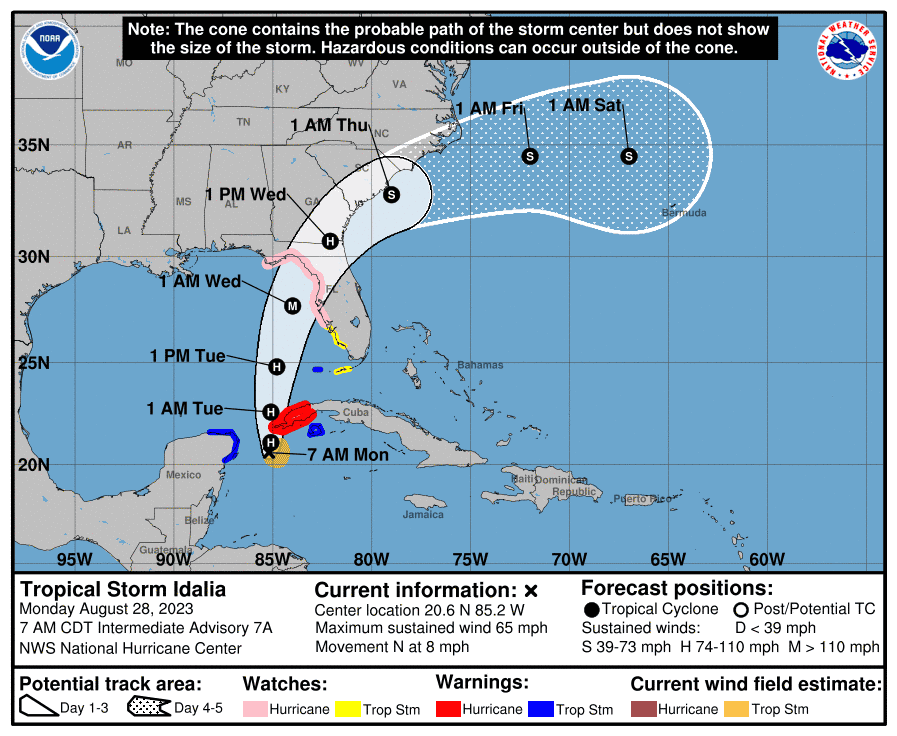
As of the morning of Aug. 28, Tropical Storm Idalia loomed in the Gulf of Mexico and was on track to intensify with hurricane-force winds by the afternoon, according to National Weather Service meteorologist Doug Outlaw.
Asheville isn’t on the direct path of the storm but will still experience indirect and unrelated rainfall and temperature changes through Aug. 31.
Hurricane Idalia impact
Tropical Storm Idalia is predicted to reach hurricane status on the afternoon of Aug. 28.
As of the morning of Aug. 28, Idalia was classified as a storm tropical storm with winds averaging 65 mph and expected to strengthen overnight into Aug. 29.
A Category 1 hurricane has sustained winds of 74-110 mph, according to the National Hurricane Center. A major hurricane has wind speeds greater than 110 mph.
Hurricane Idalia is expected to make landfall on the Florida coast early Aug. 30, Outlaw said.
“It’s moving to the North at 7 mph. It’s going to reach Florida, south of Tallahassee, early Wednesday morning,” he said.
Hurricane Idalia will strengthen over the warm warms from the Gulf of Mexico but will weaken as it moves farther inland across northern Florida and South Georgia on Aug. 30.
Hurricane Idalia is moving away from the Asheville area and toward the Charleston, South Carolina, and Savannah, Georgia, areas that will experience higher winds and more rainfall.
“Asheville’s going to get very little effects from the hurricane. It’s going to be a little breezy, but not too bad,” he said.
Most of the rain Asheville will receive will be from a northern cold front and low pressures moving along the front that’s not associated with the hurricane, he said.
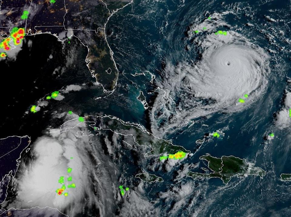
As of Aug. 28, Hurricane Franklin was passing west of Bermuda and further into the Atlantic Ocean with the only effect expected for the Carolinas to be rip currents along the beaches, Outlaw said.
Record high temperature
Asheville was predicted to reach record high temperature on Friday, Aug. 25, and that indeed did happen.
Asheville reached a record high of 94 degrees, breaking the old record of 92 degrees set on the same date in 1936, Outlaw said.
This week will be much different.
“We’re not going to reach any record highs this week. It’s going to be cooler,” he said.
Week forecast for Asheville
This week, Asheville will experience a drop in temperature and more rain leading up to a sunny Labor Day weekend.
On Aug. 28, the temperature high will reach around 81 degrees. The overnight low will be 66 degrees.
On Aug. 29, the high is predicted to hit 79 degrees with a low of 65 degrees.
On Aug. 30, the temperature will top off at 78 degrees with a low of 60 degrees.
On Aug. 31, the high will lower to 77 degrees with a low of 56 degrees.
Outlaw said it will be much cooler than last week.
“The normal high temperature for this time of the year is normally 83,” Outlaw said. “Last week, it was much above normal and this week, it’s below normal.”
However, the low temperatures are far from record-breaking.
On Aug. 31, 1916, Asheville reached a record low of 45 degrees.
On Aug. 30, 1968, the record low was 43 degrees.
On Aug. 27, a front from the North (Canada), began to creep across the area bringing cooler temperatures to Asheville. Meanwhile, temperatures across Florida and Georgia are still quite warm, he said.
The storms that crossed the area Aug. 27 moved along the slow, cold front and will bring more rain Aug. 28 and 29.
The Asheville area can expect more than 1.5-1.75 inches of rain from Aug. 28-30.
Most of the rain will come the afternoon of Aug. 28 and overnight, he said. There will be showers and storms across Buncombe County with rainfall totals nearing an inch.
More rain is forecast for Aug. 29, particularly in the afternoon.
Less rain is expected Aug. 30, attributed to Hurricane Idalia.
Labor Day weekend forecast
The Labor Day weekend in Asheville is expected to be pleasant – good news for those celebrating the holiday weekend outdoors.
On Friday, Sept. 1, the temperature will begin to rise again to reach 80 degrees.
On Sept. 2, the high will reach about 85 degrees.
The forecast calls for dry and warmer conditions, Outlaw said.
“Temperatures below normal for much of the week then it’s going to warm up above normal for the weekend,” he said. “It’s going to be a nice Labor Day weekend.”
More on Tropical Storm/Hurricane Idalia:
Idalia intensifying, threatens to slam Florida as 'major' hurricane: Live updates
Idalia has 'infernal potential' as storm takes aim at Florida, forecaster warns: Updates
Tropical Storm Idalia tracker: Follow the storm’s path as it heads toward Florida
Tiana Kennell is the food and dining reporter for the Asheville Citizen Times, part of the USA Today Network. Email her at tkennell@citizentimes.com or follow her on Instagram @PrincessOfPage. Please support this type of journalism with a subscription to the Citizen Times.
This article originally appeared on Asheville Citizen Times: Hurricane Idalia, rain, cooler temperatures forecast for Asheville

