Hurricane Idalia's dangers explained: Will forecasters' worst fears materialize?
Hurricane Idalia made landfall Wednesday as one of the more powerful storms in Florida's history, reaching some of the worst-case scenarios emergency officials have feared for years but avoiding others.
Idalia was forecast to be a Category 4 storm at landfall, arriving on a full moon when tides are naturally higher and at one of the most dangerous angles to the coast.
Although briefly reaching a Category 4 status as it approached the Florida coast, Idalia's winds dropped to 125 mph, making it a Category 3 hurricane at landfall along the Big Bend.
The National Hurricane Center had forecast Idalia to strengthen before landfall but its barometric pressure rose quickly Wednesday morning – from 940 millibars at 6 a.m. to 949 millibars at landfall at 7:45 a.m. The lower the pressure at the center of a storm, the more destructive, so the change likely lessened the damage expected to occur from Idalia's highest winds.
Idalia text message updates: Sign up to receive text updates on Hurricane Idalia and its aftermath
Timing of tides crucial as Idalia makes landfall
The hurricane center had warned the storm surge could be higher than many single-story buildings, reaching up to 16 feet in the vulnerable Big Bend region if it arrived at high tide. And Idalia's landfall coincided with the full moon happening Wednesday night, so tides were already higher than normal.
The moon's gravitational pull on the Earth's high and low tides is strongest during full and new moons. So storm surge, which piles water on top of the tide, reaches higher levels if it arrives during a full moon.
As a hurricane approaches the coast, water that has been piled up in the center flows outward toward the shore and is blocked by the upward slope of the ocean floor. The surge is when that water level is suddenly forced upward and flows over land and into rivers. A sloping continental shelf along the Gulf of Mexico makes the coastline more vulnerable than the nation's Atlantic coast, where steep slopes and a narrower continental shelf allow lower surge levels. The angle of the Big Bend exacerbates that effect.
Ultimately, Idalia's landfall occurred closer to low tide, so the flooding was not likely to meet the worst-case scenarios.
Even so, it was apparent by first light that the damage was devastating in many areas — just not as bad as it might have been if the surge pushed ashore when tides were highest. Major flooding occurred in locations along more than 100 miles of the coast, breaking numerous high water records.
In Cedar Key, Florida, the National Weather Service reported a peak surge of 6.79 feet at a federal gauge, a new record, but lower than forecast if the storm surge arrived at high tide. The previous record – 6.1 feet – was set during Hurricane Hermine in 2016. It wasn't immediately clear how the peak water will compare to the surge forecast. It sometimes takes weather experts weeks to determine the height of the storm surge across a community.
In Steinhatchee, closer to the point of landfall, the tide gauge peaked at 8.03 above the high water mark for the station, almost a foot above the previous record, also set during Hermine.
Flooding occurred all along Idalia's path, with the National Weather Service warning of storm surge along Florida's northeast coast and through the Carolinas.
Flooding in Charleston, South Carolina, Tuesday night was just a few inches below major flood levels. Charleston was feeling the influence of the arriving full moon, as well as the offshore presence of Hurricane Franklin, said meteorologist Steven Taylor. By Wednesday night, as Idalia moved closer, the tide gauge at Charleston Harbor at high tide showed the water more than a foot above major flood level, weather service records showed.
Why is the northeast Gulf Coast so vulnerable?
The contours of the Gulf of Mexico offshore in the Big Bend region, make it one of the most vulnerable locations to storm surge in the United States, wrote Jeff Masters and Bob Henson with Yale Climate Connections earlier this week. The wide continental shelf with shallow waters offshore allows water being pushed ahead of a hurricane to stack up, the pair wrote.
When Hurricane Dennis, a Category 5 storm, made landfall 150 miles to the west in 2005, the hurricane center reported it trapped a "shelf wave" of higher surge between it and the coast, pushing record-high water levels into St. Marks, devastating the small community on the coast and destroying buildings that were never rebuilt.
During Hurricane Hermine, a Category 1 storm, the Gulf surged over seven feet above ground level in the region, Masters and Henson wrote.
Storm surge fears in Tampa Bay area
For years, forecasters had feared a massive storm surge pushing into the heavily populated and vulnerable Tampa Bay area, preparing for the worst as Hurricane Ian approached last year. But with Ian making landfall to the south, water levels dropped in Tampa Bay as Ian arrived.
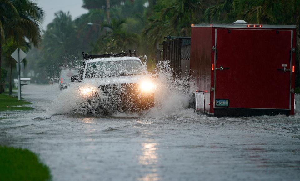
The area was not as fortunate on Wednesday morning. Water levels jumped nearly five feet higher than Tuesday's high tide at a gauge on Tampa Bay in St. Petersburg, Florida. Water was pushing into some of the creeks and streams around the bay, which had risen 2 to 3 feet.
On one tributary, the Alafia River at Riverview, the surge broke a record set during Hurricane Frances in September 2004 by about 4 inches.
A spotter reported to the weather service that homes were flooding in Port Manatee, Florida.
Gauge Failure
To the north of Tampa Bay and more than 100 miles away from the 7:45 a.m. landfall, the Gulf rocketed to a height of 4.4 feet above the high water mark in New Port Richey at 8:15 a.m., then the gauge failed. The surge had been forecast to reach 6 to 9 feet.
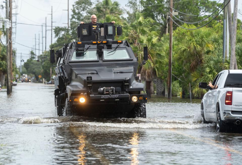
In nearby Hudson Beach, water-filled streets and flooded homes across the canal-front community. Across Pasco County, water entered an estimated 4,000 to 5,000 homes, triggering dangerous rescue operations for residents who did not evacuate, Pasco County Fire Rescue Deputy Chief Jeremy Sidlauskas said.
“We had a lot of people that were in their homes. We had people that were getting up on their roofs. We had people that were hiding out in their attics. We had all kinds of stuff that we encountered today,” Sidlauskas said. “It certainly could have been worse. But this is pretty devastating for the homes and the people in our community."
Contributing: Rick Neale, Florida Today, USA TODAY Network Florida
This article originally appeared on USA TODAY: Idalia's dangers explained: What forecasters fear from the hurricane

