'A very large hurricane': Lee impacts could hit New England; rip currents along East Coast
Hurricane Lee continued to chug across the open Atlantic Ocean on Tuesday on a path that will likely take it toward Canada over the weekend, forecasters said. Impacts from the weakened storm could affect New England and hazardous surf and dangerous rip currents are expected along the East Coast.
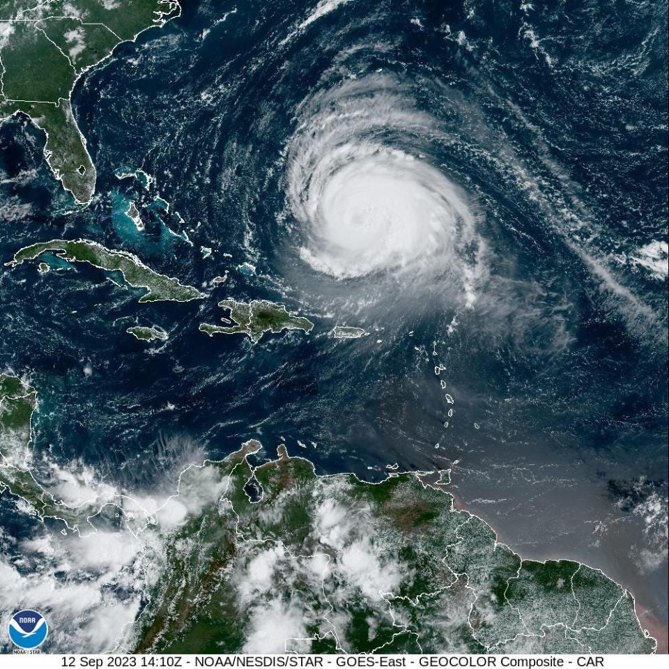
The storm, which remained a Category 3 major hurricane with winds of 115 mph Tuesday evening, was located 535 miles south of Bermuda. A tropical storm watch was issued for Bermuda, meaning that tropical storm conditions are possible there within the next two days.
The National Hurricane Center, in its 5 p.m. update, said Lee was "a very large hurricane," and that it was "growing in size." Hurricane-force winds now extend 125 miles from the center, and tropical-storm-force winds 240 miles from the center.
Meteorologist Ryan Maue said on X Tuesday evening that the hurricane center has "adjusted the track and intensity and structure of Hurricane Lee to suggest landfall in Nova Scotia prior to completion of extratropical transition." However, he added that whether Lee is declared post-tropical or not, "the wind field with hurricane-force gusts will likely extend across coastal New England."
Where will Lee hit land?
"Landfall is most likely in Nova Scotia, Canada, this weekend, but any waver in the track caused by non-tropical weather systems such as the high pressure to the east and the approaching jet stream could pull the hurricane westward toward New England or push it farther east toward Newfoundland and Labrador," said AccuWeather meteorologist Bernie Rayno.
Lee is expected to bring hazardous surf and rip current conditions to beaches across the East Coast all week, the National Hurricane Center said.
Farther east in the Atlantic, Margot has strengthened into a hurricane.
Hurricane Lee tracker: Follow path of Category 3 storm as it continues to move northwest
Lee expected to weaken into a tropical storm
Lee was forecast to weaken into a tropical storm by Sunday and likely make landfall in Nova Scotia, Canada, according to AccuWeather.
“A significant storm surge will occur along with the strongest winds and risk of property damage,” AccuWeather said in a statement.
Winds and flooding also are expected to affect Rhode Island, eastern Massachusetts, southeastern New Hampshire and central and coastal Maine, forecasters said.

Rip current risk at US beaches
Though the significant winds are likely to stay offshore for most of the U.S. coast, rip currents and dangerous surf are expected, according to the hurricane center and National Weather Service offices along the coast. Bigger waves and rip currents already have begun to reach East Coast beaches, the weather service said Monday, and that's only expected to increase.
The National Weather Service warns that "rip currents can sweep even the best swimmers away from shore into deeper water." Here's what you're supposed to do if you're swimming and get caught in a rip current: "If caught in a rip current, relax and float. Don`t swim against the current. If able, swim in a direction following the shoreline. If unable to escape, face the shore and call or wave for help."
Hurricane Lee tracker: Where is Lee headed?
This forecast track shows the most likely path of the center of the storm. It does not illustrate the full width of the storm or its impacts, and the center of the storm is likely to travel outside the cone up to 33% of the time.
New England hurricanes: Could Lee join list of notorious storms?
Margot now a hurricane, but is no threat to land
Meanwhile, Margot, the fifth named hurricane of the season, was located some 835 miles west-southwest of the Azores Tuesday evening. It had maximum sustained winds of 80 mph and was moving north at 14 mph. Margot is forecast to remain over open waters and is no threat to any land areas.
Spaghetti models for Hurricane Lee
A note about the spaghetti models: Model plot illustrations include an array of forecast tools and models, and not all are created equal. The hurricane center uses the top four or five highest-performing models to help make its forecasts.
Contributing: Cheryl McCloud, USA TODAY Network; The Associated Press; Dinah Voyles Pulver, USA TODAY
This article originally appeared on USA TODAY: Hurricane Lee updates: Latest NHC forecast, New England impacts

