Hurricane Lee: Here's what it could mean for Seacoast NH and Maine
Residents and boaters in Seacoast New Hampshire and southern Maine are being urged to prepare for Hurricane Lee as it barrels north in the coming days, though local communities may be spared from its direct landfall.
Meteorologists with the National Weather Service's Gray, Maine, location are monitoring the Category 3 hurricane currently hovering around Bermuda and its projected path toward New England and Canada later this week. The impact locally is expected to begin Friday night and carry through Saturday.
Local effects from the storm, according to meteorologist Stephen Baron on Wednesday, could include rip currents, “high, rough surf,” tropical storm-level winds, splashover at high tide and minor coastal flooding. Winds are projected to hit 38 mph in the New Hampshire Seacoast, which is just under tropical storm force winds, Baron said.
The storm is presently expected to veer north and make direct landfall in mid-coast Maine Friday night into Saturday. According to Baron, the National Weather Service is projecting low tides in the Seacoast and southern Maine as the storm hits New England.
Weather alerts: Track all current severe weather warnings, watches and advisories for Seacoast NH, Maine and around U.S.
“It does look like it’s going to do a hook into the Gulf of Maine,” he said. “How drastic it will be is to be determined.”
What is the path of Hurricane Lee?
At 11 a.m. Wednesday, the National Hurricane Center released an advisory on the hurricane, noting it was about 430 miles south-southwest of Bermuda, about 1,035 miles south of Nantucket, traveling at about 9 mph. The “very large hurricane,” the advisory states, currently has hurricane-force winds that extend 115 miles outward and tropical storm-force winds that stretch upwards of 240 miles.
“A turn toward the north-northwest is expected later today, followed by a northward turn and an increase in speed on Thursday and Friday,” a Wednesday morning bulletin states. “On the forecast track, the center of Lee will pass west of Bermuda Thursday and Thursday night and then approach the coast of New England or Atlantic Canada late this week.”
Active storms: Track storms in Atlantic in real time
From Wednesday onward, the National Weather Service adds, dangerous surf and rip currents are expected for coastal New England communities.
“It is this proximity to the coast that will govern the level of impacts experienced across western Maine and New Hampshire. Impacts will be felt far away from the center though as the wind field continues to grow,” the National Weather Service said. “Lee will bring rough surf conditions to beaches through this weekend.”
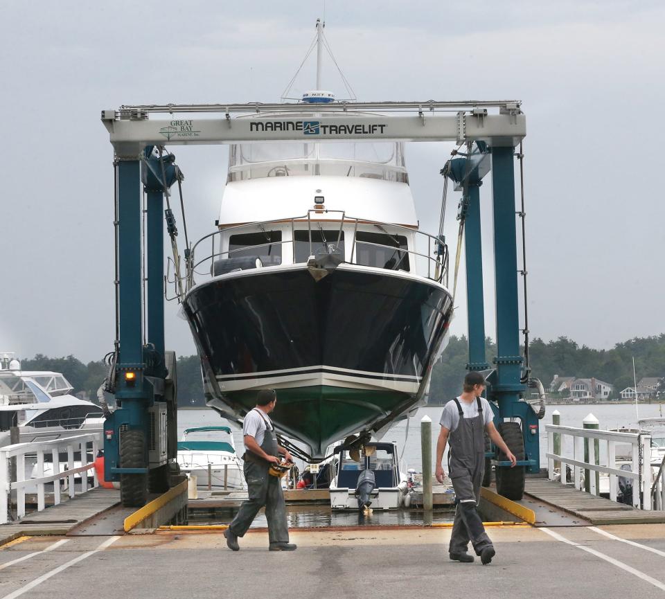
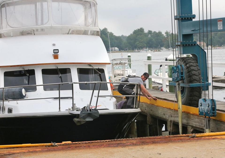
Boaters advised to haul their vessels out of the water
Leaders are advising residents living in the Seacoast and southern Maine to begin taking action now ahead of the storm.
New Hampshire Port Authority director Geno Marconi said all boaters should attempt to get their vessels out of the water, regardless of whether the hurricane directly hits the Seacoast and southern Maine.
“If I had a boat and I could take it on a trailer, I would,” he said. “Whether the hurricane hits us or we get the outside of it, I would advise people to get their boat out of the water.”
Boaters who may have to leave their boats in the water over the weekend should assess their exposure to the wind and the possibility of tidal surge, Marconi said.
Mike Bunyar, operations manager at Great Bay Marine in Newington, said boaters should consider storing their boats on their residential properties for the weekend. If boats can’t be hauled out, he recommended owners double knotting their vessels, removing sails from sailboats, adding an extra dock line to their mooring and “taking the windage off the boat.”
Boaters from Pepperrell Cove and the “mouth of the river” are using moorings in Newington, as the area is more sheltered from the storm’s potential impact, Bunyar said.
Bunyar said the business expects an uptick in boat haul-outs in the 48 hours prior to the storm, from Thursday onward.
“By tomorrow, people should be making their decision to haul out,” he said. “We’ll all be here ready to help.”
In Kennebunkport, Maine, the town has temporarily opened its Langsford Road public boat ramp without reservations for boat hauling before the storm. The town’s online reservation service will go back into effect after the storm has passed through.
Rye police, fire chiefs share safety tips, advice ahead of storm
Rye Fire Chief Mark Cotreau and Police Chief Kevin Walsh released a joint safety advisory on Tuesday. The two recommended residents know their evacuation zones, make emergency plans with their families, and to create emergency kits filled with food and water, flashlights, batteries, first aid kits, disinfectants and cleaning supplies, cell phones and chargers, among other items.
The chiefs wrote: “Don’t go out during a hurricane or tropical storm, if possible; call 9-1-1 to report emergencies, including downed power lines and gas leaks; stay away from downed utility wires (and) always assume a downed power line is live; report power outages to your utility company.”
“Be a good neighbor. Check on family, friends, and neighbors, especially the elderly, those who live alone, those with medical conditions and those who may need additional assistance,” they added.
Hampton fire chief urges people to stay out of the water
Hampton Fire Chief Michael McMahon said it is too early to announce road closures at the beach given it is unclear whether the storm will hit the Seacoast. He said even if it does not, people need to stay out of the water and respect the power of the ocean.
“Even if it stays offshore, you’re certainly going to get impact at the beach,” McMahon said. “We want people to really be aware that going into the water in any way in a situation like that can be quite dangerous.”
McMahon said people can prepare now by tying down loose items like outdoor furniture so that they won’t go flying if the storm comes.
“Those things are going to become projectiles, and that can add to property damage,” McMahon said. “It can also cause injuries.”
Central Maine Power warns of stressed trees due to 'extraordinarily wet' summer
Central Maine Power warned that this summer has been “extraordinarily wet” throughout the state and led to tree stress due to increased soil saturation, flooding, and nutrient runoff.
The primary cause of power outages in Maine this summer, the company reported, has been from stressed trees either falling or losing limbs.
“Depending on Hurricane Lee’s track and the strength of the storm’s winds, we could see worsened impacts to Maine’s power grid because of these conditions,” said Katie Manende, leader of Central Maine Power’s vegetation management program.
Central Maine Power will provide regular updates as the hurricane nears.
This story may be updated.
Max Sullivan contributed to this report.
This article originally appeared on Portsmouth Herald: Hurricane Lee impact for Seacoast NH, Maine: Here's what to expect

