Update: Hurricane Lee maintains major hurricane status. SC impacts expected soon
Hurricane Lee continues to maintain its major hurricane status as it proceeds to move west-northwestward at 12 mph. As of late Friday and early Saturday morning, Lee was a Category 3 with maximum sustained wind speeds of 115 mph.
Early Friday morning, Lee had become the season’s first Category 5 hurricane before beginning to weaken.
Although Lee has decreased to a Category 3, its dangerous impacts shouldn’t be discounted.
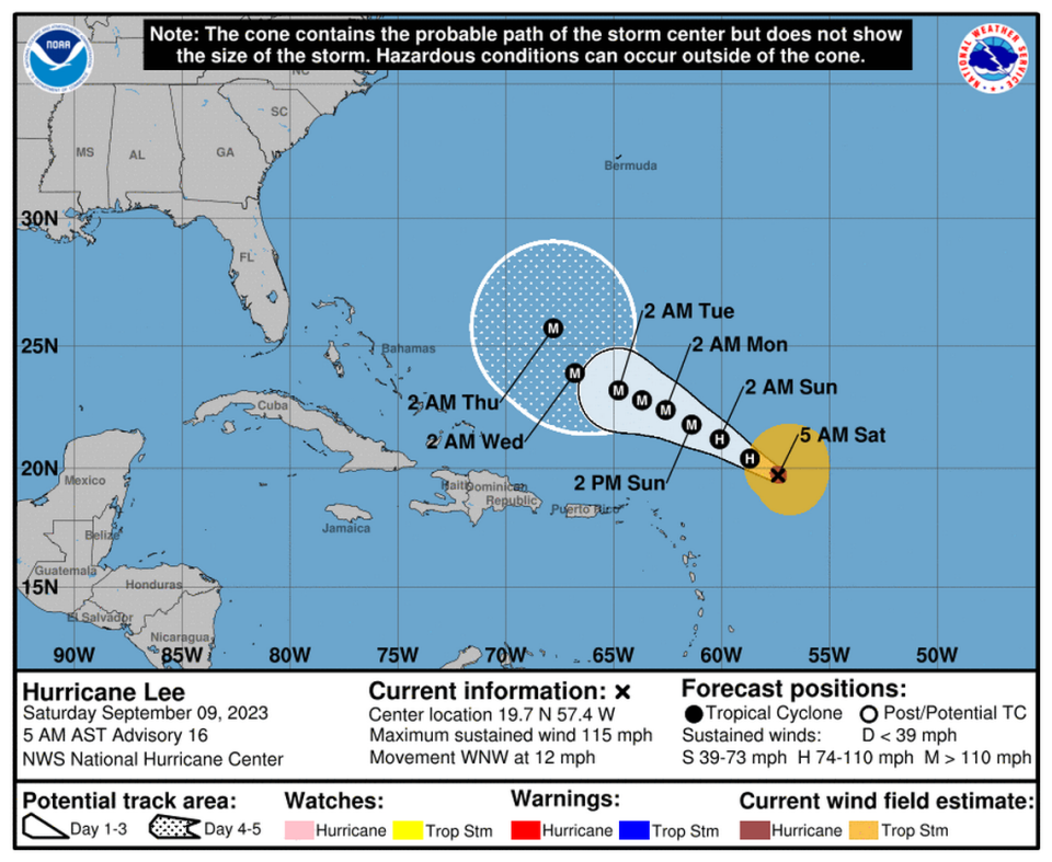
“The statistical and consensus intensity aids predict Lee could briefly weaken in the short-term, before restrengthening in about 12-24 hours,” the National Hurricane Center said in a 5 a.m. advisory.
“It is likely that Lee will continue to be a dangerous hurricane through the entire forecast period,” the NHC continued.
Hurricane Lee’s core is expected to move north of the northern Leeward Islands, the Virgin Islands and Puerto Rico this weekend and into early next week, but it is too soon to know what level of impacts, if any, Lee might have along the U.S. East Coast late next week.
Lee will cause significant boating and beach impacts along South Carolina’s coast next week. Local waters will have a rough surf and high rip current risk, and boating will be hazardous in coastal waters beginning Monday, said Frank Strait, the severe weather liaison from the South Carolina State Climate Office.
Additional beach erosion following Hurricane Idalia could also result from impacts caused by Hurricane Lee.
A new moon next week will also lead to high astronomical tides.
Early Friday morning, Hurricane Lee briefly joined a group of seven notorious Category 5 hurricanes in the Atlantic since 2016:
Hurricane Matthew in 2016
Hurricane Irma in 2017
Hurricane Maria 2017
Hurricane Michael 2018
Hurricane Dorian in 2019
Hurricane Lorenzo in 2019
Hurricane Ian in 2022
Other Tropical storm systems to watch for
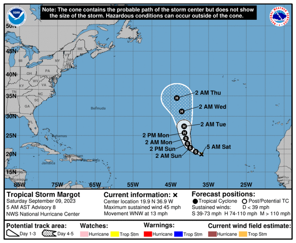
In addition to Hurricane Lee, Tropical Storm Margot is a strong tropical wave that just moved over the Atlantic from Africa, and National Hurricane Center forecasters predict that Margot will strengthen into a hurricane by Sunday.