Hurricane Lee path tracker, spaghetti models: Rhode Island forecast to feel effects Friday
Rhode Island, along with other parts of eastern New England, were bracing for the arrival of Hurricane Lee, which is expected to bring a nasty mix of heavy rain, strong winds and high seas to the region starting Friday and lasting into Saturday, forecasters said.
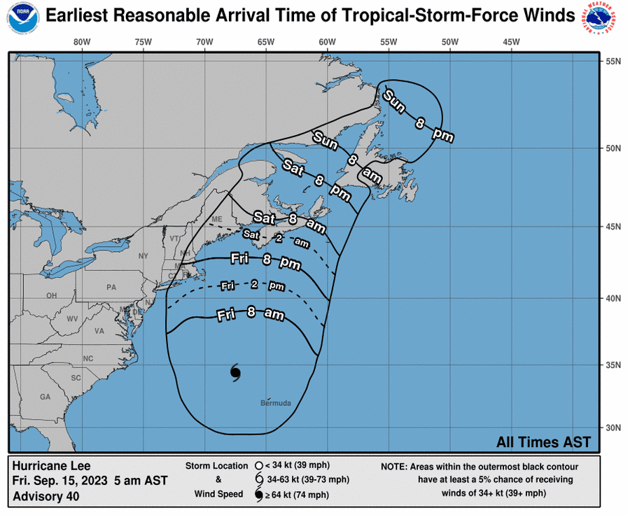
Lee is not projected to make landfall in Rhode Island or elsewhere in New England, but its impacts will still be felt across the region in part because of the size of the storm. As of Friday morning, hurricane-force winds could be felt outward up to 105 miles from the center of the storm, while tropical storm-force winds extended 320 miles.
The storm will continue to weaken from the Category 3 status it held for much of the week, "but it is still expected to be a large and dangerous storm when it reaches eastern New England and Atlantic Canada,” the National Hurricane Center said Friday.
Impacts were projected to be milder for inland areas of New England.
Ready for Hurricane Lee's impact: Here's how Providence's hurricane barrier will work
Explaining the path: Despite tropical storm watch, Hurricane Lee expected to pass offshore
Hurricane Lee projected path tracker
This forecast track shows the most likely path of the center of the storm but does not illustrate the full width of the storm or its impacts. The center of the storm is likely to travel outside the cone up to 33% of the time.
Rhode Island: A look back at hurricane damage from years past
Hurricane Lee spaghetti models
Spaghetti model illustrations include an array of forecast tools and models, and not all are created equal. The hurricane center uses the top four or five highest-performing models to help make its forecasts.
Tropical storm watch issued in Rhode Island
A tropical storm watch has been posted for coastal Rhode Island with the storm expected to affect coastal New England late Friday into Saturday.
"Hurricane Lee is forecast to pass offshore of southern New England on Saturday but its impact will extend far from the storm's center," the National Weather Service says in its local hurricane statement. "Lee should bring rough surf and possible storm surge flooding, damaging winds and bands of heavy rain to at least coastal areas of Massachusetts and Rhode Island."
Look back: NOAA predicts a busy hurricane season. Take a look back at 7 big New England storms

The primary hazards for southern New England are damaging winds, powerful surf and possible flooding.
According to Weather.com, "there is the possibility that Lee's winds in combination with saturated soils could down trees and knock out power in some areas. Coastal flooding and large, pounding surf are also likely impacts from coastal Massachusetts to Maine."
This article originally appeared on USA TODAY: Hurricane Lee path tracker, models: Rhode Island forecast for effects

