Hurricane Lee path tracker, spaghetti models: Massachusetts forecast to feel effects Friday
Parts of Massachusetts and eastern New England are bracing for the arrival of Hurricane Lee, which is expected to bring a nasty mix of heavy rain, strong winds and high seas to the region starting Friday and lasting into Saturday, forecasters said.
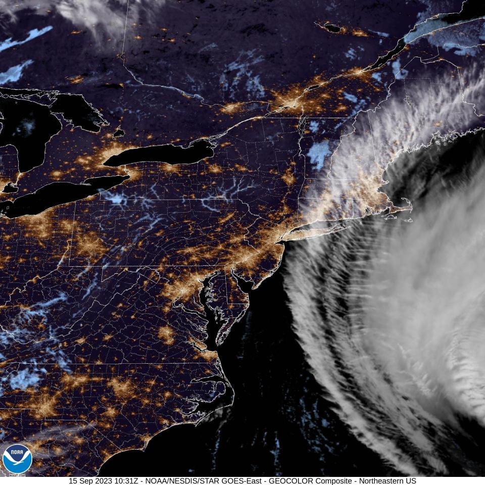
Lee remained a Category 1 hurricane with maximum winds near 85 mph Friday morning. While it is not projected to officially make landfall along the Massachusetts coast or elsewhere in New England, the storm's impacts will still be felt across the region due in part to the size of the storm.
The storm has weakened after holding Category 3 status for much of the week and will continue to diminish to post-tropical status by Saturday, “but it is still expected to be a large and dangerous storm when it reaches eastern New England and Atlantic Canada," National Hurricane Center said Friday morning.
Sandbags at the ready: Provincetown braces for Hurricane Lee
Hurricane Lee cancellations: What to look out for
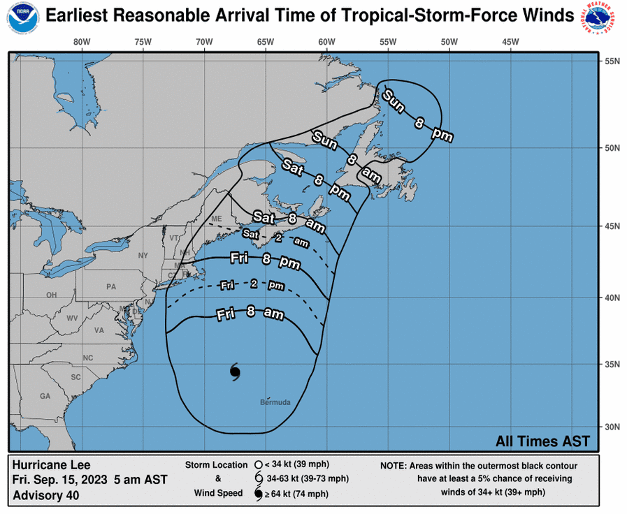
Hurricane Lee projected path tracker
This forecast track shows the most likely path of the center of the storm but does not illustrate the full width of the storm or its impacts. The center of the storm is likely to travel outside the cone up to 33% of the time.
Hurricane Lee spaghetti models
Spaghetti model illustrations include an array of forecast tools and models, and not all are created equal. The hurricane center uses the top four or five highest-performing models to help make its forecasts.t
Storm surge watch
A Storm Surge Watch has been issued for the Cape Cod region.
"There is the potential for life-threatening storm surge flooding in portions of southeastern Massachusetts, including Cape Cod and Nantucket, late Friday and Saturday," the National Hurricane Center had said in its 11 a.m. forecast discussion Thursday.
Cape Cod, Martha's Vineyard and Nantucket are expected to get the most rain and strongest wind, according to the weather service. Cape Cod and the islands could get 2 to 4 inches of rain, while eastern Massachusetts could see 1 to 2 inches.
Tropical storm warning issued
A tropical storm warning has been issued for Cape Cod and the Massachusetts coast by the National Weather Service. The Cape may see 30 to 40 mph winds with gusts up to 55 mph.
Potential impacts include "damage to porches, awnings, carports and unanchored mobile homes, according to the National Weather Service. Large tree limbs may be broken off with the potential for some trees to be uprooted. There may be hazardous driving conditions and debris on the roads.
Hurricane, tropical storm and storm surge watches were also in effect across portions of coastal New England due to the expected onslaught from Lee.
The primary hazards for southern New England are damaging winds, powerful surf and possible flooding.
According to Weather.com, "there is the possibility that Lee's winds in combination with saturated soils could down trees and knock out power in some areas. Coastal flooding and large, pounding surf are also likely impacts from coastal Massachusetts to Maine."
How to prepare for Hurricane Lee and stay safe
Flashlight, batteries, nonperishables: On Cape Cod, how to prepare for possible hurricane
The government of Massachusetts has outlined hurricane safety tips on its official website, which can be accessed here.
This article originally appeared on USA TODAY: Hurricane Lee path tracker, models: Massachusetts forecast for effects

