Lidia’s leftover rain raises flood concerns in western Mexico
Lidia dissipated early Wednesday morning after slamming into western Mexico as a Category 4 hurricane Tuesday night. But what’s left of the formerly powerful storm will unload heavy rainfall, raising the threat of flash flooding across portions of western Mexico.
Lidia’s center was shredded apart by the mountainous terrain of western Mexico early Wednesday morning, according to the National Hurricane Center. Despite the lack of an organized center, what’s left of Lidia will bring an additional 2 to 4 inches of rain to the country on Wednesday. Rainfall totals from the storm could come close to 12 inches.
Flash flooding is possible across several Mexico states, especially Nayarit, Jalisco and Colima, as heavy rain pounds the area. Heavy rain may also lead to dangerous mudslides in mountainous terrain.
Lidia had brought preliminary rainfall totals of 5.3 inches to Colima and 5.1 inches to Manzanillo as of early Wednesday.
Lidia rapidly intensified at an exceptional pace right before landfall Tuesday on Mexico’s west coast. The hurricane’s winds increased by 70 mph in 24 hours in the warm coastal waters of the Pacific Ocean. The landfall was the strongest on Mexico’s west coast since 2015’s Hurricane Patricia.
Rapid intensification is happening more often, especially immediately before landfall, because of human-caused climate change. It’s just one of the ways the climate crisis is making hurricanes more dangerous.
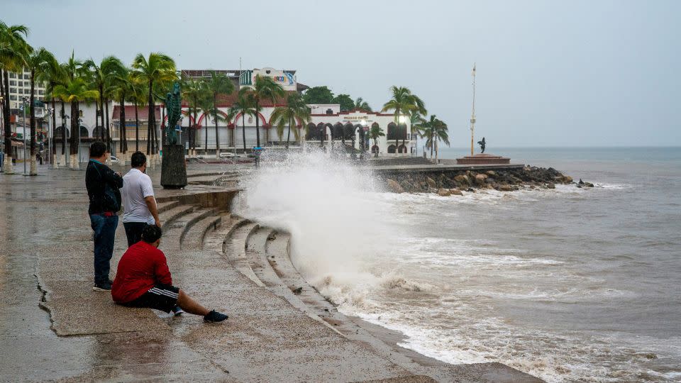
Swells generated by Lidia on Tuesday will likely cause life-threatening surf and rip current conditions along the west coast of Mexico and Baja California peninsula through Wednesday.
Moisture from Lidia’s remnants will send some rain into South Texas on Wednesday. Rain is desperately needed as this part of Texas battles severe and exceptional drought, according to the latest report from the US Drought Monitor.
For more CNN news and newsletters create an account at CNN.com

