Hydrologists say Georgia EPD choosing to use wrong data in Okefenokee evaluation
A regional coalition of 13 hydrologists recently sent a letter to the Georgia Environmental Protection Division stating the agency is using the wrong data to analyze the potential impacts of the proposed titanium dioxide mine at the Okefenokee National Wildlife Refuge.
The miscalculation, they say, greatly underestimates the mine's potential to dry out the edge of the swamp.
Additionally, comments by the U.S. Geological Survey suggest the EPD's decision-making paradigm on how to use USGS data is flawed.
At the Capitol:Okefenokee Protection Bill seeks second try at preventing mine at swamp
Catch up: Water wars on the Okefenokee heighten as EPD ends year with no permit decision
How mining can impact water levels at the swamp
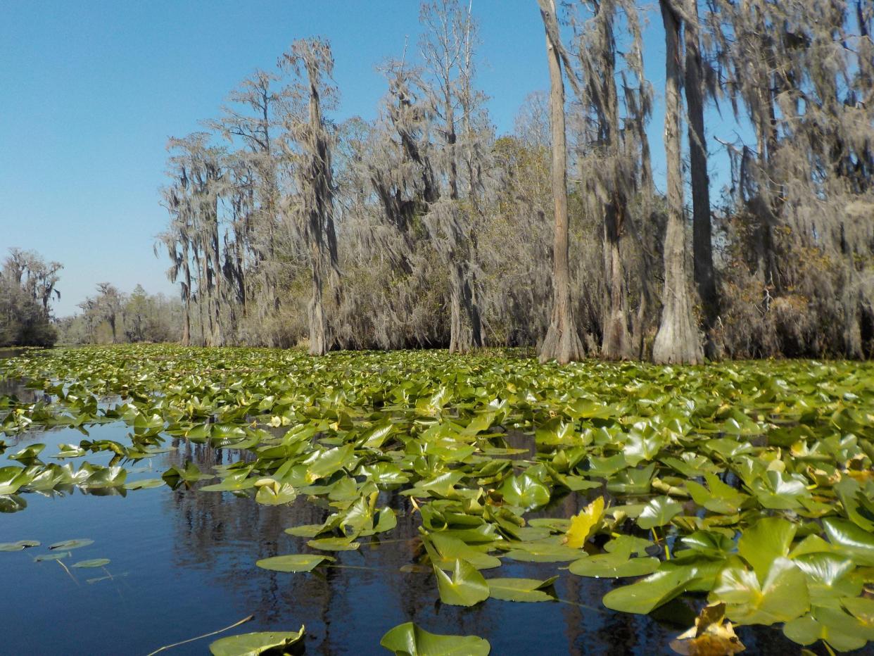
Twin Pines Minerals LLC is seeking permits from Georgia EPD to operate a strip mine along Trail Ridge, a dune feature at the edge of the Okefenokee National Wildlife Refuge that functionally holds the swamp in place.
Aside from taking a mineral out of the ground, Twin Pine Mineral's permit application outlines that mining operations would remove a million gallons of water per day from a shallow aquifer to keep dry mining pits. The company has also applied for a permit to withdraw up to 1.44 million gallons of water per day from the Floridan Aquifer, the groundwater source underlying much of the lower portions of Georgia, Alabama, South Carolina and all of Florida.
C. Rhett Jackson, a University of Georgia hydrologist who has been independently analyzing Twin Pine Mineral's mining plans, has said the mining operations would dangerously dry out the lower edge of the swamp, making it more susceptible to wildfire and drought. But to calculate whether water levels would get too low, the heated debate among scientists is which water monitoring gage is best to get the most accurate prediction of what might happen if the mine is built. In this context, hydrologists spell the word "gage," rather than "gauge."
Engaged debate over scientific methods
Jackson has been basing his analyses of the mine's impact on the Okefenokee using historical water flow data from a U.S. Geological Survey streamgage in Moniac, Georgia. A streamgage is a device that monitors water levels and other data for USGS, and this data helps hydrologists understand what water levels have been like historically in the area and gives them data to model how those levels might change under various future conditions, like drought.
The Moniac gage is the closest USGS gage downstream of the proposed Twin Pines Minerals mining site.
The EPD, on the other hand, is using a USGS gage in Macclenny, Florida, which is located downstream on the St. Marys River where water flow is 4.4 times greater than at the Moniac gage. According to the EPD, the agency is choosing to use this monitor because the Macclenny gage has higher quality ratings from the USGS than the Moniac gage.
The EPD said it will not comment on technical questions, like which gage the agency should use, until after the next 60 days of the public comments period. During this time, staff at the agency will review technical comments — like the hydrologists' letter — it receives in public comments. Afterward, the EPD will prepare a public document responding to the comments and indicating any changes to the proposal the agency makes in response to comments.
Until March 20:Public comments for Okefenokee Swamp mining plans are open
"The geographic position of (the Moniac) gage is ideal for analyzing potential effects to swamp hydrology of ... groundwater withdrawals beneath Trail Ridge," the hydrologists' letter noted.
The letter's co-signers include:
Luke Pangle, Associate Professor of Hydrology, Dept. of Geosciences, Georgia State University
James Reichard, Professor of Hydrogeology, Department of Geology and Geography, Georgia Southern University
Todd Rasmussen, Professor of Hydrology, Warnell School of Forestry and Natural Resources, University of Georgia
Larry Band, Ernest H. Ern Professor of Environmental Science, School of Engineering, University of Virginia
Stephen Schoenholtz, Director and Professor, Virginia Water Resources Research Center, Virginia Tech University
Kevin McGuire, Professor of Hydrology, College of Natural Resources and Environment, Virginia Tech University
Daniel L. McLaughlin, Associate Professor of Hydrology, Department of Forest Resources & Environmental Conservation, Virginia Tech University
Diego Riveros-Iregui, Associate Professor of Watershed Hydrology, Department of Geography, University of North Carolina at Chapel Hill
Ryan Emanuel, Associate Professor of Hydrology, Nicholas School of the Environment, Duke University
Matt Cohen, Professor of Water Resources, School of Forest, Fisheries and Geomatics Sciences, University of Florida
Chris Anderson, Professor of Wetland Science, College of Forestry, Wildlife and Environment, Auburn University
Courtney Siegert, Associate Professor of Hydrology, College of Forest Resources, Mississippi State University
USGS: "That's not how the measurement quality ratings were designed to be used"
Where the hydrologists are telling the EPD the agency is using the wrong gages, the USGS noted the EPD is using the wrong reasoning to choose its gage.
USGS hasn't done its own analysis, so the agency won't make any statements about which gage should be used in the case of the Okefenokee, nor will it tell the Georgia EPD what it should do. However, the agency did say that the EPD is using USGS's quality rating system incorrectly to make its gage-decision.
USGS gages measure how much water is flowing in a waterway and the agency has a quality rating system that describes how accurately the gage is accomplishing that job on a scale of Excellent, Good, Fair, Poor or Not Specified. Each of those labels is associated with a statistical range for accuracy; "excellent" means the data is within 2% of the actual flow, whereas good means the data is only within 5% of the actual flow. The labels describe how close the dart is to the center of the bullseye.
The EPD is using these quality ratings to say the Macclenny gage should be used to analyze the swamp rather than the Monaic gage. The agency describes this reasoning in a December 7, 2022 memo on its website which includes graphs depicting the two gages' quality ratings over the course of several decades, concluding that the Macclenny gage's quality is better over time, particularly during times of drought.
"That's not how the measurement quality ratings were designed to be used," a USGS spokesperson noted. "It’s important to understand these quality ratings are not an exact science but are estimates made by hydrographers in the field based on many factors such as how much water was present during the measurement, how many measurements could be taken that day based on water availability, and the weather."
Although technological improvements over the last decade have allowed the agency to make those quality ratings more accurate and less human-reliant, the agency said, the ratings are still not meant for government agencies to use them to decide if one gage is better than another.
Marisa Mecke is an environmental journalist. She can be reached at 912-328-4411 or mmecke@gannett.com.
This article originally appeared on Savannah Morning News: Georgia EPD using wrong USGS stream gage data at Okefenokee Swamp

