Ian to bring heavy rains, winds to NC coast as it makes 2nd landfall in South Carolina
With the path of Hurricane Ian still uncertain as to where it will make a second landfall in South Carolina after leaving a path of destruction through Florida before re-emerging and strengthening in the Atlantic, officials are warning Wilmington-area residents to stay alert and be prepared as the large, super-soaking storm moves closer to Southeastern North Carolina.
"We've seen a general move in the track of the storm east and toward the northeast, so that's pushed the general landfall location from around the Georgia-South Carolina state line north into the South Carolina Low Country," said Ian Boatman, a meteorologist with the National Weather Service office in Wilmington. "That's brought the storm potentially closer to us."
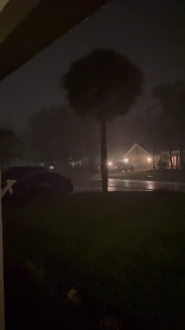
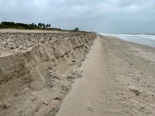
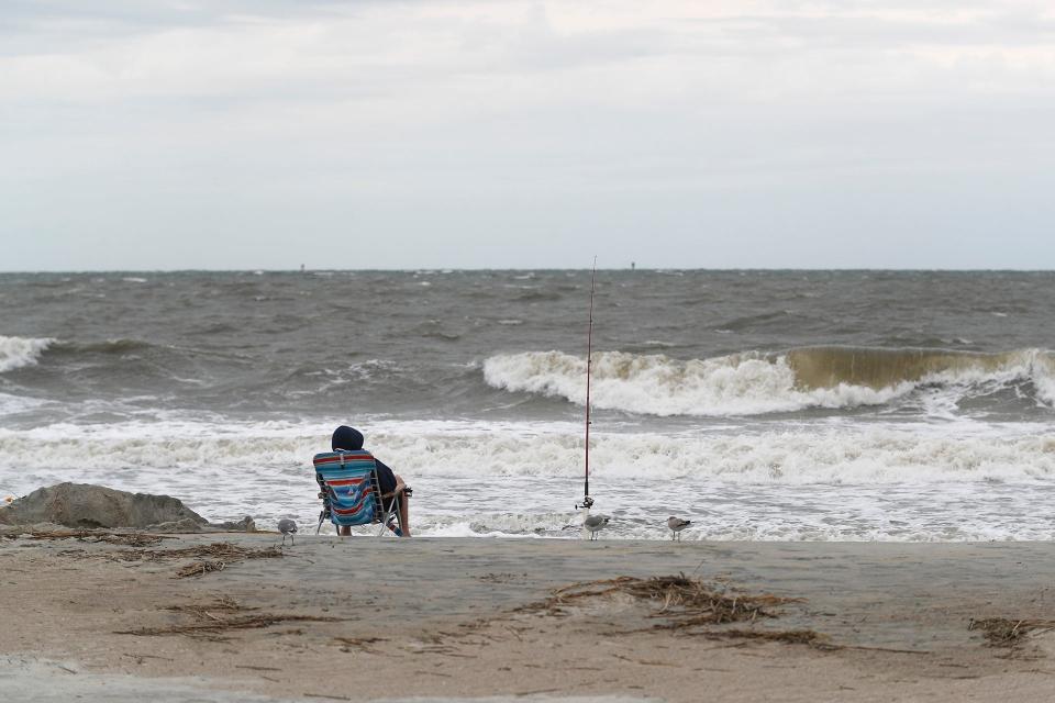
Rain remains the primary concern for the Wilmington area, although tropical storm-force winds could cause isolated problems and erosion woes for some beach areas.
WORRISOME TRENDIn a warming world, 'Cat 6' hurricanes could soon be coming to a coast near you
Ian is expected to remain a tropical storm, with sustained winds of nearly 50 mph, well after making landfall in South Carolina, likely as a weak Category 1 hurricane, Friday afternoon. It will then weaken to a tropical depression as it approaches the North Carolina state line early Saturday. Ian's path is still forecast to bend toward central South Carolina and Western North Carolina, pushing into the Ohio Valley by Sunday.
"Ian’s forward speed is faster than previously anticipated which has expedited the arrival of impacts to N.C. and shortened the time frame of the heaviest rain," stated the N.C. Division of Emergency Management in a Thursday Facebook post.
But even with the storm passing well west of Wilmington and faster than first forecast, the size of the storm coupled with a rich, moisture-filled environment means the N.C. coast won't escape Ian's reach.
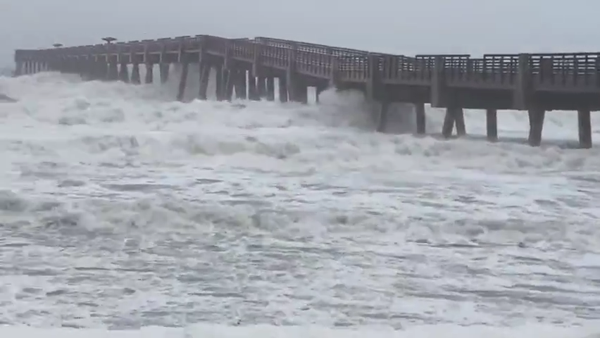
Officials are focused on the primary impacts of the weakening tropical system to be rain-based for coastal areas, although rough seas and surf could make produce erosion in beach areas and rocky waters for boaters.
"We're not going to see the effects Florida experienced (Wednesday)," Boatman said. "But regardless, we're going to see impacts from this, so we need to be ready."
Wet and windy
According to forecast predictions on Thursday, Ian is expected to dump up to 7 inches in most areas of the Cape Fear region, with higher amounts possible in isolated areas. Areas along the coast south of Cape Lookout are also forecast to see sustained winds of 30-40 mph, with gusts up to 45-50 mph.
The weather service warned coastal residents to be prepared for surge inundation, up to 3 feet in certain areas, with each high tide from Thursday through Saturday, with the worst surge during high tide Friday.
Ian also holds the potential to spawn tornadoes, but Boatman said that those are likely to be isolated incidents persisting through Friday night.
BUILDING BACK BETTERYears after Hurricanes Florence and Matthew, resiliency the focus of NC recovery efforts
Heavy rains inland could also cause problems, albeit a few days later, for coastal residents. Flood warnings are already up for some rivers in South Carolina and are expected later in some North Carolina waterways. But any impacts are expected to be minor when compared to the catastrophic flooding caused by Hurricanes Matthew in 2016 and Florence in 2018 as those storms dumped more than 2 feet of rain in places, all of which eventually made its way to the coast.
State emergency officials said flash flooding is a concern, largely due to the speed of the storm and the amount of precipitation that could be dumped over a short space of time, but primarily for inland areas.
'Stay aware'
Ahead of Ian's arrival in the Tar Heel State, Gov. Roy Cooper declared a state of emergency on Wednesday and put the state on storm footing.
“A State of Emergency is needed now so that farmers and those preparing for the storm can more quickly get ready for the heavy rain that is likely to fall in much of our state,” he said. “North Carolinians should stay aware, keep a close eye on the forecast and prepare their emergency supplies.”
Locally, officials were taking steps to prepare for what Ian could bring to the Wilmington area.
Carolina Beach has already lowered water levels in the big lake, which serves as a major drainage area for the town's northern areas, and announced Freeman Park would close Thursday afternoon. Local officials in New Hanover, Brunswick and Pender counties also advised residents to secure outdoor items or move them indoors, check their hurricane preparedness kits, and be ready to deal with downed vegetation and power outages.
Reporter Gareth McGrath can be reached at GMcGrath@Gannett.com or @GarethMcGrathSN on Twitter. This story was produced with financial support from 1Earth Fund and the Prentice Foundation. The USA TODAY Network maintains full editorial control of the work.
This article originally appeared on Wilmington StarNews: Hurricane Ian to bring heavy rains, winds to NC coast after SC landfall

