Ice accumulation, snowfall expected in Sioux Falls as winter storm hits South Dakota
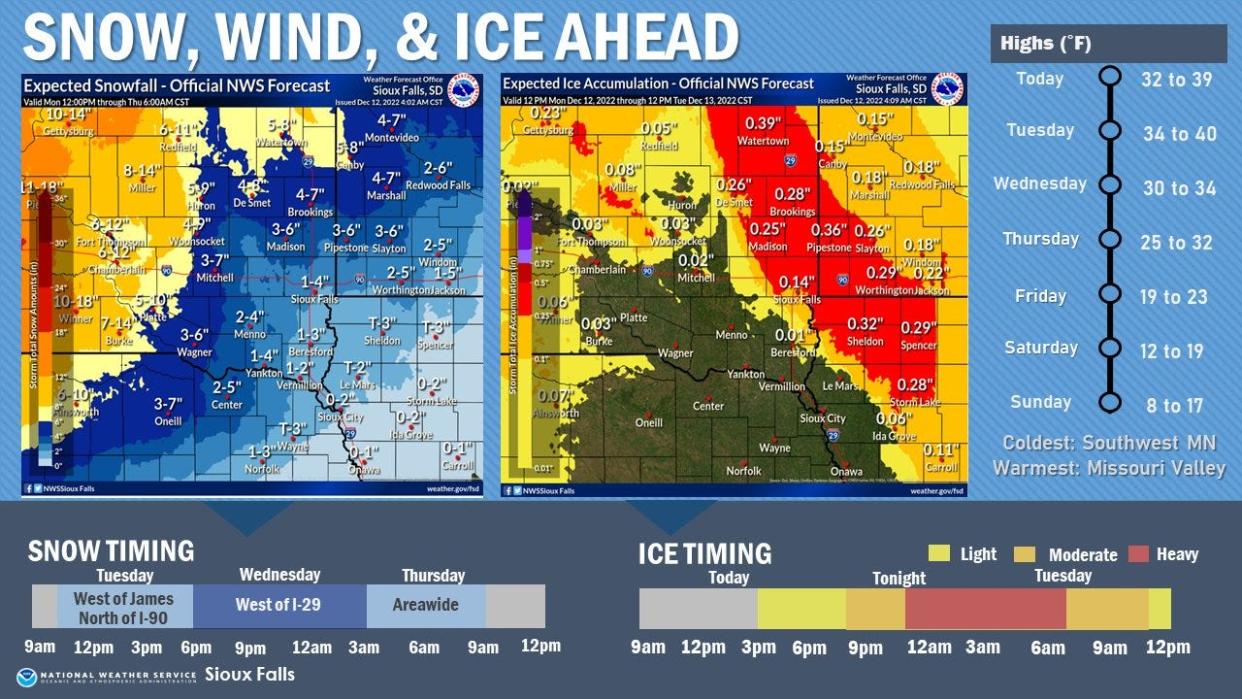
A winter storm that will move through South Dakota this week could dump more than a foot of snow on the central and western parts of the state, while some parts of eastern South Dakota could be coated in nearly a half-inch of ice.
Impacts from the storm are expected to begin Monday afternoon, with significant ice accumulation expected in Watertown and Brookings, according to the National Weather Service.
Sioux Falls is forecast to receive 0.14 inches of ice through noon on Tuesday, and Minnehaha and Lincoln counties are currently under a winter weather advisory.
While Sioux Falls could see between 1 and 4 inches of snow between now and Thursday morning, effects across the western part of the state could be much more severe, with areas currently under winter storm and blizzard warnings. Rapid City could see up to a foot of snow, and forecasts near Lead and Belle Fourche estimate nearly 30 inches could fall by Thursday morning.
More:Heavy rain expected after Thursday snowstorm could cause flooding in Sioux Falls, NWS says
With rain expected in the Sioux Falls area atop last week's snowfall, the National Weather Service has encouraged residents to clear a path to storm drains and check downspouts before the storm hits, while also shoveling snow away from the foundation of homes.
This article originally appeared on Sioux Falls Argus Leader: Sioux Falls could see 1-4 inches of snow by Thursday morning

