Iceland volcano in Grindavik erupts after weeks of earthquakes
A volcano has erupted in Iceland after weeks of intense earthquake activity, the country’s Meteorological Office said.
In a “warning” message on its website on Monday night, the Met Office states: “Eruption has started north of Grindavik by Hagafell.”
The eruption prompted the Icelandic police to declare an emergency and activate the Civil Protection Coordination Centre.
“We want to start by not asking people to go to the site at all. We don’t know how far the eruption is from Grindavík. It won’t be clear until a helicopter has flown over the site,” Hjördís Guðmundsdóttir, information officer at the Civil Protection Agency, told Iceland Monitor.
An eruption has started on the Reykjanes peninsula.
The eruption is located about 3 km north of Grindavik. The eruption began at 22.17 following the earthquake swarm that started around 21:00. https://t.co/9vYBBjNcX9 pic.twitter.com/sYLwWhUtlA— Veðurstofa Íslands / Icelandic Met Office (@Vedurstofan) December 18, 2023
Fearing a significant outbreak on the Reykjanes peninsula, authorities evacuated the nearly 4,000 inhabitants of the fishing town of Grindavik in early November and temporarily closed the nearby Blue Lagoon geothermal spa.
Residents have since been allowed to return home during the day.
Regional police warned any remaining residents to leave as soon as possible.
“An eruption has started, evacuate Grindavík IMMEDIATELY,” an announcement from officials read, Icelandic media outlet Heimildin reports.
“This is not a tourist attraction,” Víðir Reynisson, chief inspector of public safety, said at a press conference of the eruption, per the outlet.
The official added that magma is flowing at 100 cubic meters per second.
The eruption began at 22.17pm, following an “earthquake swarm” an hour earlier, according to the Met Office.
The quake that triggered the eruption may have been a magnitude 4.2, according to unverified data reported by local news outlets.
A livestream of the eruption showed the evening sky lit up in red, orange, and yellow, as lava appeared to be shooting into the air.
“There are super-high plumes of magma. Now it’s a total guess, but the highest plumes are probably 150 metres. This means that the lava is flowing very quickly from the crater,” volcanologist Þorvald Þórðarson told Iceland Monitor.
“This may be close to the worst case imaginable. Unfortunately.”
A Coast Guard helicopter is en route to the eruption site to determine its exact location and size, officials said Monday evening.
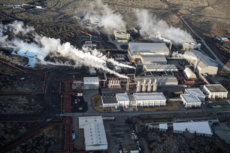
Lava from the eruption reportedly reached heights of 330 feet and was visible from the capital, Reykjavík. The eruption taking place is an estimated 2 kilometers from major infrastructure like Svartsengi geothermal power plant, The New York Times reports.
The eruption is the fourth in three years on the peninsula, a seismic hotspot, Iceland Monitor reports.
The rugged peninsula is located directly southwest of the capital.
The country, situated on tectonic plates moving in opposite directions, is nicknamed the Land of Fire and Ice and has more than 30 active volcanic systems.
Last month, Grindavik was battered with hundreds of earthquakes, prompting mass evacuations.
“Everything just seems so unreal, I feel like I’m in a dystopian movie,” Andrea Ævarsdóttir, 46, told The Independentat the time. “I’m just waiting to wake up from this nightmare.”
“Some of them [the earthquakes] were like a big truck had driven past your house, the bigger ones were like the same truck had hit your house,” she added. “Everything was shaking so bad, the floors were going up and down.”
After the town was evacuated, residents were allowed to return for limited hours to retrieve key items like family heirlooms and medication.
“Since the village was evacuated over a week ago we have been working to let residents retrieve their most heartfelt valuables in small numbers every day,” Jon Baglundsson, spokesperson for the ICE-SAR, a volunteer rescue team, told The Independent last month.
“People are mostly coming back for pictures of children, grandchildren on hard drives or whatever people store on their memories nowadays.”
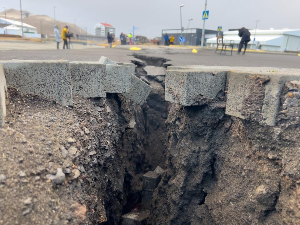
Beneath the scenic landscape of Iceland, the country was experiencing hundreds earthquakes per day in the runup to the eruption, according to the Met Office.
The quakes rattled local houses and opened fissures in roadways.

