Freezing rain, snow persists for parts of Ontario and Quebec, travel woes likely
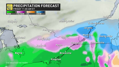
Another round of freezing rain and snowfall will build over portions of eastern Ontario and southern Quebec on Friday, targeting many of the same areas affected by prolonged freezing rain on Thursday. Widespread freezing rain warnings are in effect, including for Ottawa, Montreal, and Bancroft.
Expect slippery roads, driveways, sidewalks, and steps during the Friday morning and evening commutes. Areas that see significant ice accretion run the risk of isolated tree damage and power outages.
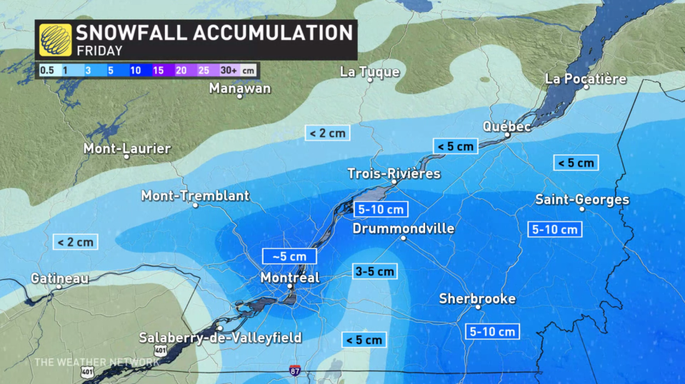
Montreal will likely see more snow activity as the system moves across the region.
MUST SEE: Freezing rain is the 'worst' type of precipitation. Here's why
Renewed freezing rain threat through Friday
Forecasters are watching the risk for another complex set up across the same areas of eastern Ontario and southern Quebec that just had a round of disruptive icing on Thursday.
Overnight temperatures in the St.Lawrence trended warmer than expected, severely impacting the threat of icing during the event. Temperatures are still expected to drop near -1°C. However, rather than freezing rain, this set up will produce wet snow. Montreal is expected to get up to 5 cm of wet and heavy snow. North of the city, snowfall amounts of 5-10 cm are possible. Those in the south will likely still see rainfall.
Precipitation will lighten in the evening, however, expect a slower commute home.
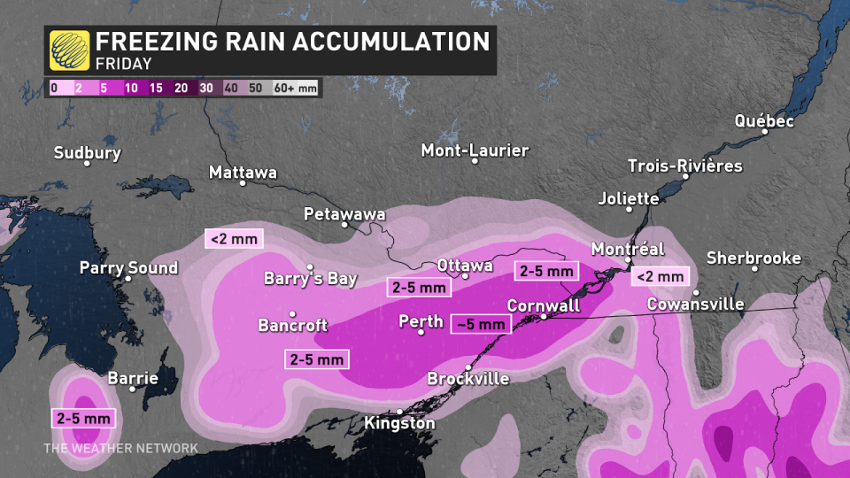
Those in eastern Ontario will still see a freezing rain set up throughout the day Friday. Freezing rain in the morning will be ongoing through the afternoon hours, wrapping up in time for the evening commute. There is a chance some will see the switch over to rainfall as the system moves out.
Drivers are urged to slow down in slippery conditions. Watch for tail lights ahead and maintain a safe following distance. You can also check current highway conditions before venturing out.
DON’T MISS: Winter takes a breather in major Canadian cities with January thaw
A couple days of colder weather are forecast early next week, especially for eastern Ontario, but much milder weather and early spring-like temperatures are forecast for the second half of next week, continuing well into the first week of February, as well.
However, winter is not over. We are watching the potential for an extended stretch of colder winter weather from mid-February through early March.
WATCH: Do you know these 'common sense' winter driving tips?
Stay with The Weather Network for the latest on your forecast across Ontario and Quebec.
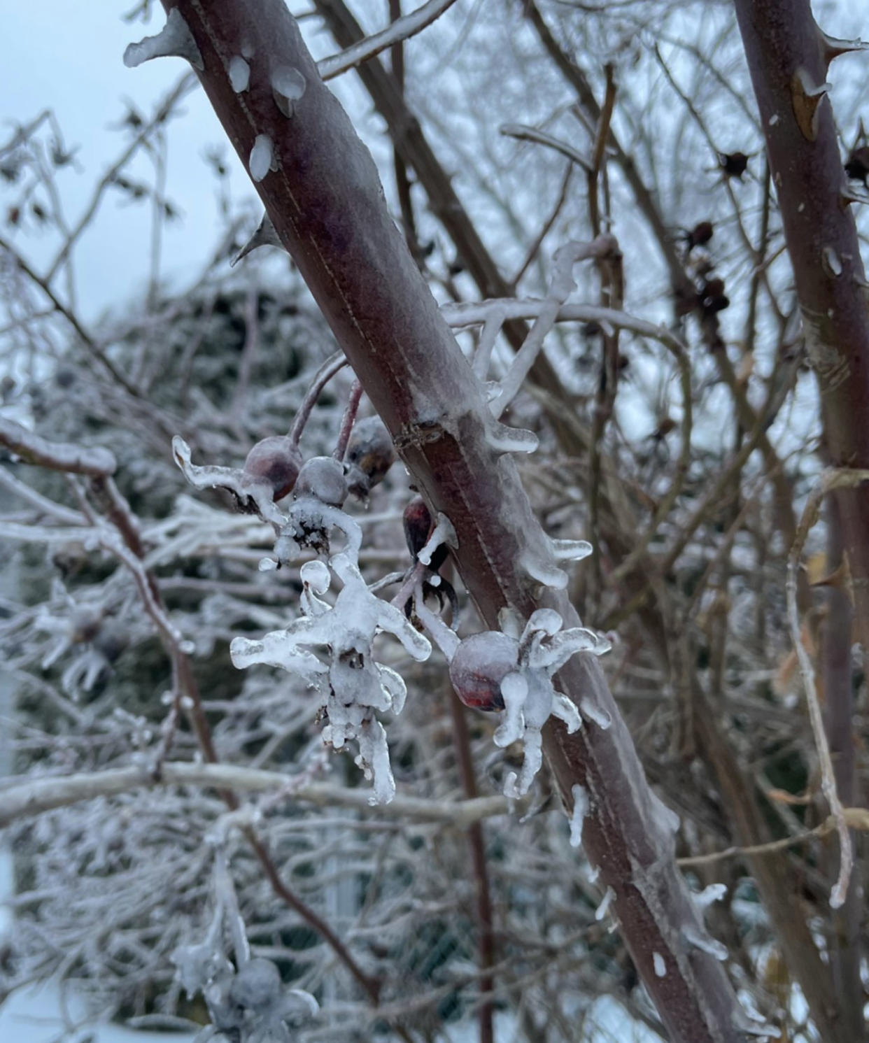
(Header image credit: @JenGilroy1/X)

