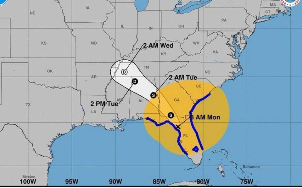
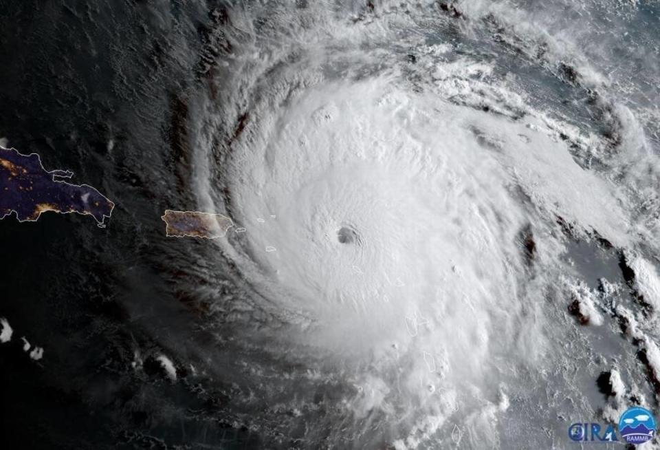
As Idalia looms, 3 major hurricanes impacted Beaufort Co. in the past decade
With Hurricane Idalia predicted to make landfall in Florida as a major hurricane, and potentially make its way to South Carolina, what other major hurricanes have made an impact on Beaufort County?
NOAA’s National Hurricane Center defines the timeline of each year’s annual official hurricane season for the Atlantic basin as occurring from June 1 to Nov. 30, with tropical cyclone activity potentially happening before and after those dates, and that the Atlantic hurricane season’s peak is on Sept. 10, with “most activity occurring between mid-August and mid-October.”
As for reasons you should be prepared, it’s best not to take such dangerous weather lightly as they can evolve quickly.
In addition to the Palmetto State’s southeastern location, “South Carolina is one of the most vulnerable states to hurricanes and tropical storms. Six coastal counties border the Atlantic Ocean. These counties have more than 200 miles of general coastline. Densely populated coastal areas, especially during peak tourist seasons, coupled with the generally low coastal elevations significantly increase the state’s vulnerability,” according to the Beaufort County Government website.
Amid the current hurricane threat coming from the Gulf of Mexico, the Lowcountry has faced numerous hurricane threats over the past number of years.
Of these threats, the region has had several instances where a major hurricane was just shy of hitting Beaufort County.
To be categorized as a major hurricane, a storm has to be ranked as a Category 3 or higher. For this to occur, the Saffir-Simpson Hurricane Wind Scale estimates the potential property damage from a hurricane’s sustained wind speed based off of a 1 to 5 scale rating; thus, giving the hurricane a Category of 1, 2, 3, 4 or 5, according to the National Hurricane Center.
It’s important to remember that how deadly a hurricane may be should not be solely relied upon by its given category. The Saffir-Simpson Hurricane Wind Scale does not take into account other potentially deadly hazards such as storm surge, rainfall flooding, and tornadoes, the NOAA’s National Hurricane Center continued.

To view Beaufort County’s 2023 hurricane preparedness video, go online and visit https://www.youtube.com/watch?v=x5mwG0plzPo.
Within the last decade, recent hurricanes that have impacted the Palmetto State include Hurricane Matthew in 2016, Hurricane Irma in 2017, Hurricane Florence in 2018, Hurricane Dorian in 2019, and Hurricane Ian in 2022, the county’s website continued. Additionally, Hurricane Joaquin, combined with a separate storm system, resulted in historic flooding from the Midlands to the Lowcountry in 2015.
Of these, only three directly and seriously impacted Beaufort County.
Hurricane Matthew
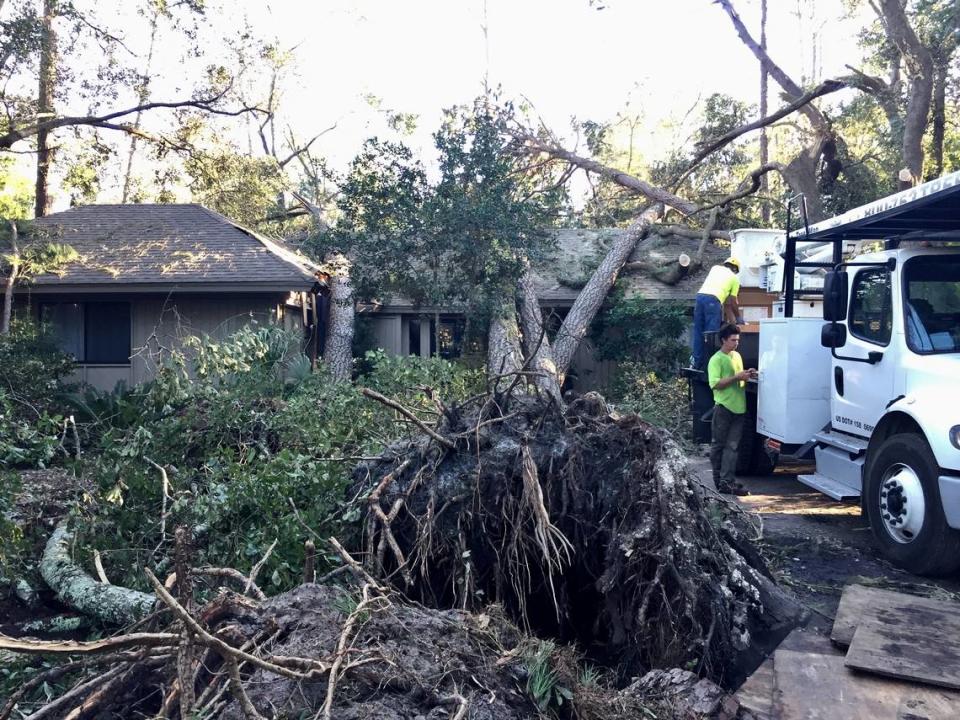
After impacting Hilton Head during the early hours of Oct. 8, 2016, Hurricane Matthew went on to flood the island and surrounding communities. Initially beginning its rampage as a Category 5 hurricane, Matthew made an impact on the island as a Category 2 hurricane after its path traveled off the coast of South Carolina.
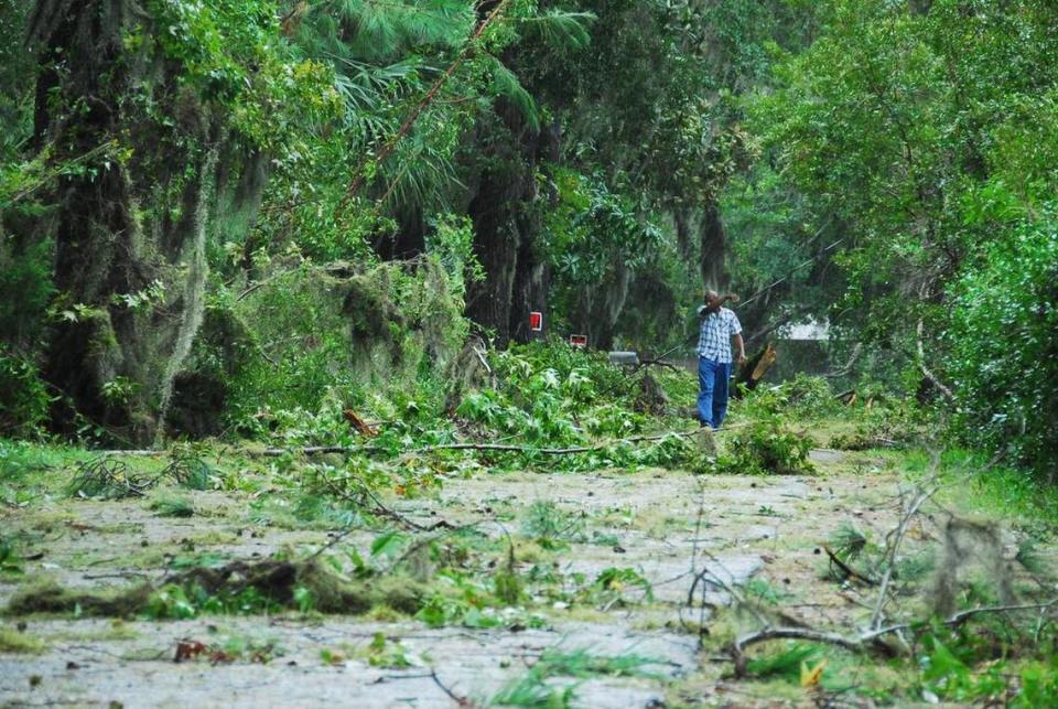
During its presence in the area, Matthew substantially flooded the local community and knocked down an estimated 120,000 trees on Hilton Head Island alone.
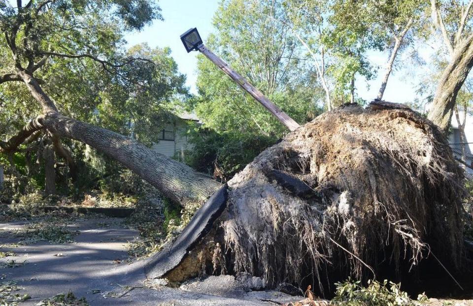
At the time, the hurricane’s wind speeds presumably reached a total of 88 mph, had a total of 14.04 inches of rainfall, destroyed many of the island’s dunes and properties and reportedly cost over $51 million in response efforts, according to previous Island Packet reporting.
Hurricane Irma
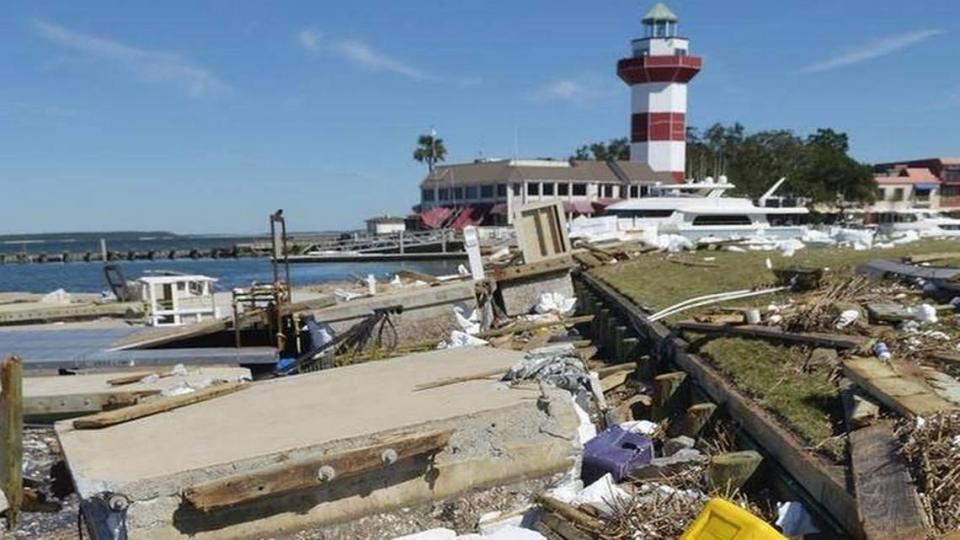
Similar to Matthew, Hurricane Irma began as a Category 5, the highest ranking on the Saffir-Simpson Hurricane Wind Scale. However, Irma only made its impact on Beaufort County as a tropical storm on Sept. 11, 2017 as it slowed while traveling through most of Florida and Georgia as the storm’s course adjusted and traveled northwest.
Irma’s main effects on the area was predominantly a flooding issue due to storm surges, which was the primary cause of more than $1.3 million in structural damage to about 203 structures on Hilton Head Island, as previously reported by The Island Packet. In the prior report, Chris Yates, the town’s building official, detailed that the areas hardest hit on the island included South Beach in Sea Pines, the Point Comfort area, the Burkes Beach area and Hilton Head Plantation.

At Hurricane Irma’s maximum strength, it had recorded maximum sustained winds of 185 mph, which was recorded on Sept. 5, 2017.
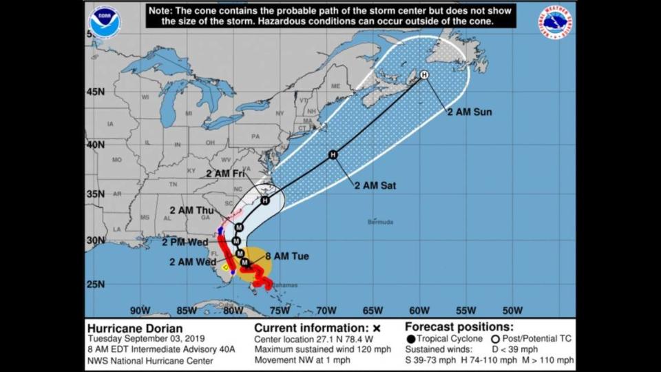
Hurricane Dorian
Staying off the coast of South Carolina in 2019 and only making an impact on Beaufort County without a direct hit, Hurricane Dorian blew damaging wind and rain onto Hilton Head Island and the rest of the county on Sept. 4-5. The hurricane caused significant tree damage throughout Hilton Head due to its high wind speeds. Dorian was ranked as a Category 3 hurricane when traveling just off the coast of South Carolina. Roughly 80 trees on Hilton Head Island were knocked down. Dorian’s maximum sustained wind speed was near 115 mph at the time.