'Isolated, severe storms' possible as tropical wave moves across Florida this weekend
A tropical wave is expected to move across Florida over the weekend, bringing increased chances for showers and thunderstorms, according the National Weather Service Miami.
"Isolated to severe storms cannot be ruled out" as the tropical wave brings "abundant and numerous storms to the peninsula over the next three days," said the Florida Division of Emergency Management.
While the disturbance had a zero percent chance for development over the next two days, chances for strengthening increase over the next seven days, and it could become a tropical depression in the Gulf of Mexico next week, according to the National Hurricane Center.
The system is one of four being tracked by forecasters at the National Hurricane Center.
Where is the tropical wave that is approaching Florida?

The system, designated as disturbance 4 on the National Hurricane Center's tropical outlook map, is located over the southeastern Bahamas and is forecast to move into the Gulf of Mexico by early next week, according to forecasters.
Chances have increased for the system to become a tropical depression as it moves into the Gulf of Mexico next week and approaches the western Gulf of Mexico coastline by the middle of next week.
Formation chance through 48 hours: low, near 0 percent.
Formation chance through 7 days: medium, 40 percent.
What impact is expected in Florida from tropical wave?

As storms move across the state, "localized flooding will be possible over urban, low-lying, poor drainage and already saturated areas," the Florida Division of Emergency Management said.
As the tropical wave moves west across Central and South Florida over the weekend, there is a risk of heavy rainfall, 2 to 4 inches in some areas. Some locations could see even higher amounts, according to the National Weather Service Melbourne.
Expect rain from late Saturday night through mid-day Sunday along the coast from Brevard County southto Martin County.
Farther south, the National Weather Service Miami warned residents in that area the "disorganized tropical wave will be approaching S. Florida tomorrow, bringing increased chances for showers and thunderstorms this weekend.
"This wave is NOT forecast to develop into a tropical system over the next two days although you will probably want to carry your umbrella."
Locally heavy rain may lead to instances of street flooding on Saturday and Sunday, forecasters added.
The National Weather Service Tampa Bay reported there is an 80 percent chance for showers and thunderstorms Saturday night and Sunday. Forecasters reminded residents to review their hurricane season plans.
Flooding possible across South and Central Florida
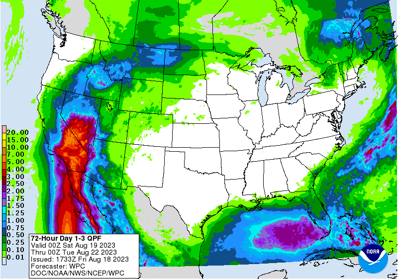
The Weather Prediction Center has set a marginal risk (level 1 of 4) for flooding across South and Central Florida over the next three days as the tropical wave passes by.
"Thunderstorms statewide will be generally slow-moving in nature, leading to elevated flooding concerns within the more organized thunderstorm activity, especially over urban areas, low-lying/poor drainage areas, and over already saturated grounds.
"Rain chances will begin to drop off Sunday night as the tropical wave moves off into the Gulf of Mexico, leaving behind drier air in its place."
This article originally appeared on Treasure Coast Newspapers: Tropical wave moving across Florida into Gulf of Mexico. See impact

