“He Just Lost It In The Weather” – Audio From F-35 Crash Response Emerges

Much about the recent crash of a U.S. Marine Corps F-35B Joint Strike Fighter in South Carolina remains unknown, but some additional details have now emerged thanks to recorded air traffic and first responder radio calls. Video of the site where debris from the jet was found has also now become available. You can read more about what is already known about this mishap in The War Zone's earlier reporting.
https://twitter.com/AlertChannel/status/1704133563384307825
The first word that something had happened came on September 17 after the F-35B's pilot ejected safely. However, the jet was on autopilot and continued on its own for some time in a 'zombie' state. Its transponder was rendered inoperable at some point in the incident, hampering subsequent efforts in the air and on the ground to locate the crash site. The public was encouraged to alert authorities to any information they might have had before the debris field was finally found around a day later.
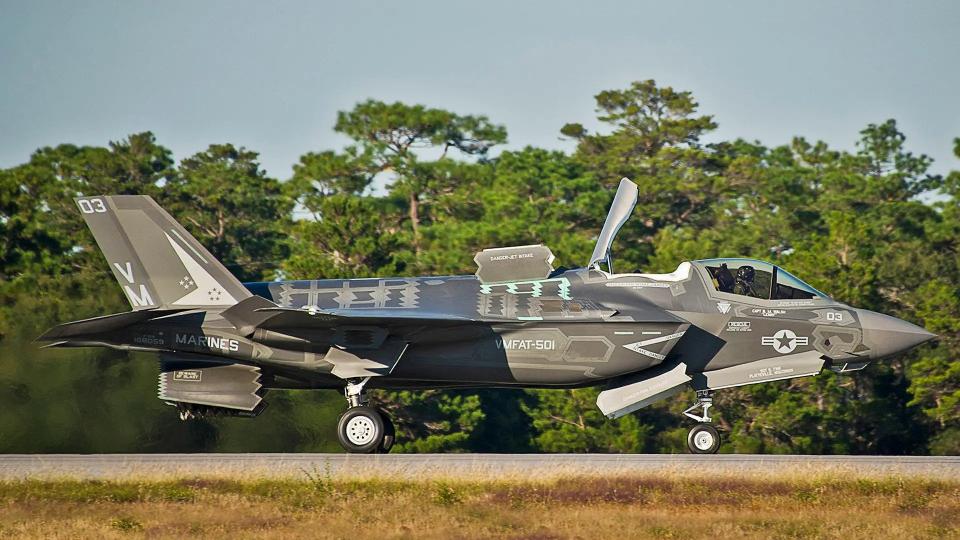
User @aeroscouting on X, formerly Twitter, shared an audio recording of radio calls on September 17 between Federal Aviation Administration (FAA) air traffic controllers at Charleston International Airport. Charleston International Airport is collocated with the U.S. military's Joint Base Charleston, which was the focal point for subsequent efforts to find the missing F-35B from Marine Fighter Attack Training Squadron 501 (VMFAT-501). VMFAT-501 is based at Marine Corps Air Station Beaufort, also in South Carolina, located to the southwest of Charleston International Airport/Joint Base Charleston.
The recording has heavy background noise and portions are entirely unintelligible. However, air traffic controllers can be heard trying to raise military pilots using the callsigns Swede 11 and 12, as well as anyone else in the area flying F-35s.
https://www.twitter.com/aeroscouting/status/1703861559976714479?s=20
Swede 11 appears to have been the callsign of the F-35B that went down over the weekend. Someone can be heard toward the end of the air traffic control recording saying that contact with Swede 11 had been lost and that they would be treated as a "NORDO, "a term for a plane without a functioning radio or that is otherwise not communicating.
X user @ChrisJacksonSC separately shared a recording of local emergency services personnel responding to the incident after the pilot of the doomed F-35B had parachuted down to the ground.
https://twitter.com/ChrisJacksonSC/status/1704006011047051386?s=20
"He's unsure of where his plane crashed," the dispatcher can be heard saying at one point. "Said he just lost it in the weather."
It's unclear whether or not this means that weather was a factor in the incident or that the pilot had simply lost sight of the aircraft as it flew on due to clouds or other ambient conditions. Available weather data does show there was scattered rain in Charleston and areas to the northwest around the time of the mishap.
The dispatcher otherwise makes clear that they are still trying to get more information about the incident at that time.
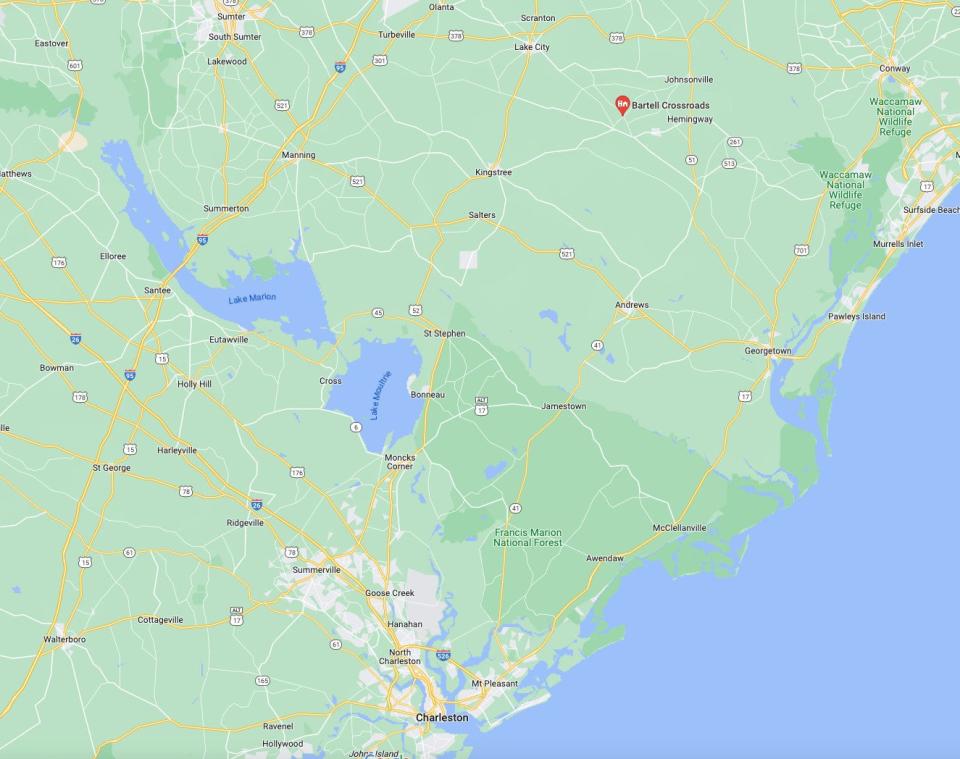
At one point the dispatcher also relays locational information about a site identified as being approximately "10 miles out from runway one-five." This appears to be a reference to Runway 15 at Charleston International Airport/Joint Base Charleston, which points northwest.
A northwesterly direction would be in line with what is known about the focus of the initial search effort for the plane, which was centered on the Lake Moultrie and Lake Marion areas. Those bodies of water are situated further to the northwest of Charleston International Airport/Joint Base Charleston.
https://twitter.com/TeamCharleston/status/1703541506915668242?s=20
The debris field was subsequently located more to the northeast of Charleston International Airport/Joint Base Charleston, as can be seen in the map below.
Video that has now emerged of where the debris was located shows damaged trees and disturbed earth. In the available clips, seen at the top of this story and below, no large aircraft components are readily visible and there do not appear to be active recovery operations ongoing. It is unclear whether this reflects the near-total destruction of the jet on or following its impact with the ground, or if more substantial parts might have ended up deeply buried in the ground.
https://twitter.com/TPostMillennial/status/1704124450084471262
An investigation into the incident is ongoing. The Marine Corps' announced yesterday that it had now ordered all of its aviation units to conduct a so-called safety stand-down "to ensure the service is maintaining operational standardization of combat-ready aircraft with well-prepared pilots and crews." This is common following major mishaps, but the loss of the incident over the weekend is also the third major Marine aircraft accident to occur in the past six weeks.
https://twitter.com/beverstine/status/1703874036202107116
As the formal review of Sunday's crash progresses, more details about this still somewhat mysterious incident are sure to continue to emerge.
Contact the author: joe@thedrive.com

