Is your Kansas City home likely to flood? These ZIP codes are most at risk, FEMA says
With severe weather and possible flooding in the weekend forecast, see if your home is at risk of flooding.
The National Weather Service warned of severe weather from Friday through Sunday, with the possibility of damaging winds, large hail and tornadoes. Between 2 and 5 inches of rain are expected this weekend, with the most intense downpours from Saturday night to Sunday morning along and east of 1-35.
With the heavy downpour and other recent rains, the Kansas City area has a risk of both flash and river flooding. None of the Kansas City area river gauges showed flooding as of midday Friday, according to the NWS’ Advanced Hydrologic Prediction Service./there’s no sort of overall flood risk of the area or county, is there?
These are the Kansas City ZIP codes most likely to flood, determined by the highest average risk–based cost of flood insurance, according to FEMA data.
If you want to know the specific flood risk for your home, use the Kansas City Parcel Viewer’s floodplain layer.
64112 around the Plaza
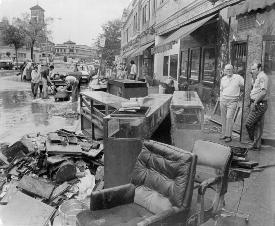
Containing the Plaza and Loose Park, this ZIP code has been struck by devastating flooding before.
In 1977, a rainstorm dumped 16 inches of rain onto the Plaza, causing Brush Creek to overflow. Onlookers described cars floating by with passengers inside and evacuations of the Alameda Plaza Hotel in a foot of standing water. The flood killed 25 people and damaged almost half of the 155 Plaza businesses.
Since then, Brush Creek has been deepened and widened to protect against flooding. The average annual risk-based cost insurance for 64112 is $3,662 per single-family home.
64146 in South Kansas City
Located in South Kansas City, wedged between Martin City and Grandview, this ZIP code has the Blue River winding through it.
On August 22, 2017, the river reached its highest crest since 1961: over 40 feet. That day, a nearby family of seven had to be rescued from their roof after waiting for eight hours. The average annual risk-based cost insurance for 64146 is $2,464 per single-family home.
64161 in the Northland
Close to Worlds of Fun, this area borders the Missouri River. A large portion of the land is part of the river’s floodplain, meaning that there is a 25% chance of flooding each 30 years. This high-risk property is owned by the city as buffer land, according to the Kansas City Parcel Viewer.
The Ameristar Casino, warehouses and homes are also located in this ZIP code. The average annual risk-based cost insurance for 64161 is $3,008 per single-family home.
Weather watches and warnings
A live data feed from the National Weather Service containing official weather warnings, watches, and advisory statements. Tap warning areas for more details. Sources: NOAA, National Weather Service, NOAA GeoPlatform and Esri.
Do you have more questions about weather in the Kansas City area? Ask the Service Journalism team at kcq@kcstar.com.

