Kansas City placed under flash flood watch as threat of strong to severe storms rises
The Kansas City area, including areas north and east of the metro, have been placed under a flash flood watch as several rounds of strong to severe thunderstorms are expected to bring heavy rains Thursday, according to the National Weather Service in Kansas City.
The watch comes as the National Weather Service’s Storm Prediction Center in Norman, Oklahoma, has placed Kansas City at a greater risk for severe weather on Thursday afternoon.
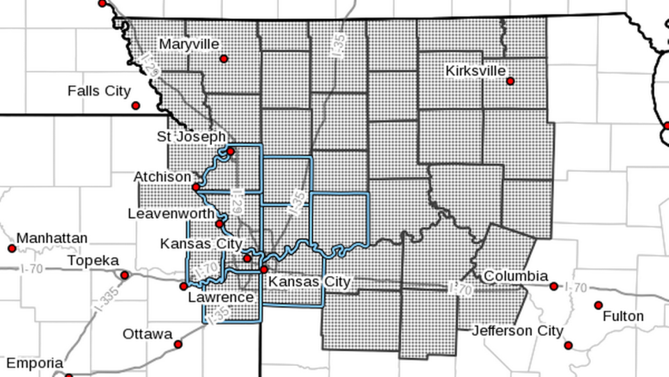
The flood watch will be in effect from Thursday afternoon through Friday morning and includes Johnson, Leavenworth and Wyandotte counties in Kansas and Clay, Jackson, Platte, and Ray counties in Missouri.
Multiple waves of showers and thunderstorms are expected starting early Thursday morning and continuing throughout the day, the weather service said.
“Several rounds of thunderstorms are expected Thursday afternoon into the overnight hours,” the weather service said in its watch. “Repeated bouts of heavy rainfall will lead to the potential for flash flooding.”
The main threats from the storms include heavy rain, damaging wind, hail and flash flooding, especially in urban areas.
The weather service urged people to monitor forecasts and prepare in case flash flood warnings are issued.

The Storm Prediction Center has placed the Kansas City metro and areas to the north and east under an enhanced risk of severe weather on Thursday. Scattered strong to severe thunderstorms are expected across a broad region of the central Plains, mid-Mississippi Valley and upper Midwest on Thursday.
“The greatest threat is currently forecast over northern Missouri and vicinity during the afternoon and evening, with a risk of large hail, damaging wind, and a tornado or two,” according to the Storm Prediction Center.
Multiple rounds of strong to severe storms are possible.
Weather watches and warnings
A live data feed from the National Weather Service containing official weather warnings, watches, and advisory statements. Tap warning areas for more details. Sources: NOAA, National Weather Service, NOAA GeoPlatform and Esri.

