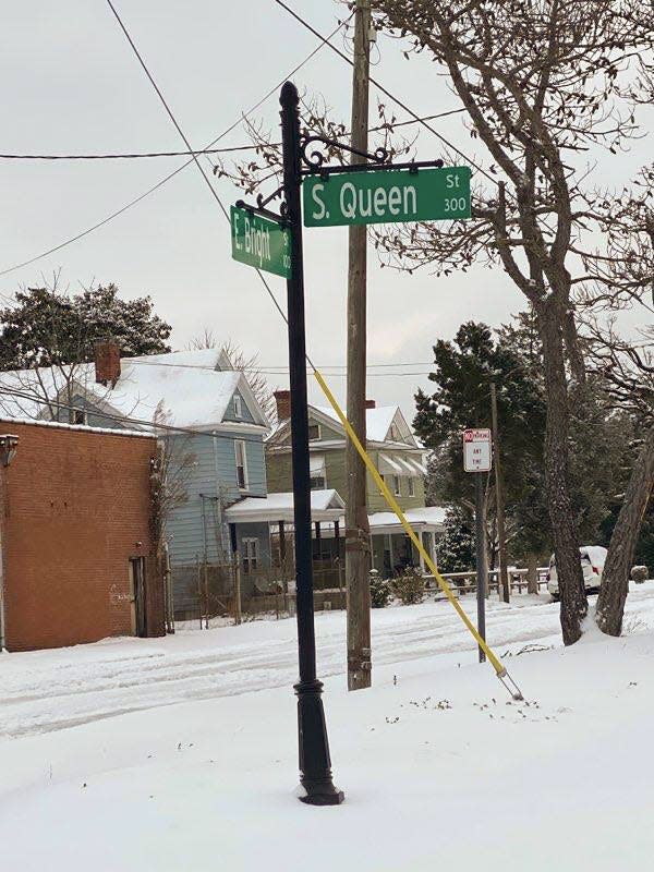
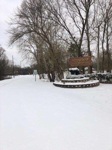
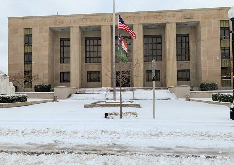
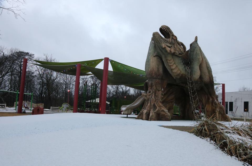
Kinston, Lenoir County sees up to 4 inches of snow in some areas
Noon: Black Ice Threat
Temperatures picked up in the area slightly as the morning progressed but snow and ice still remained on the roads causing some slick spots in Lenoir County and Kinston.
Plowing and salt applications have been completed on primary roads and crews have shifted to secondary roads, according to Kinston Public Services.
With temperatures expected to drop below freezing again Saturday night, melted snow and ice will refreeze causing dangerous black ice conditions, according to National Weather Services.
Related: PHOTOS: Kinston, Lenoir County see snowfall
Officials ask motorists to drive with extreme caution. Saturday night into Sunday morning could bring worse hazardous driving conditions as roads freeze once more.
Temperatures are expected to rise as high 45 degrees on Sunday.
This will be our final live update of the day unless breaking news occurs related to the weather.
10 a.m.: Hazardous roads remain
Snow accumulation remains on Lenoir County and Kinston roads and crews are on the scene to clear primary paths.
Eight power outages were reported near the Kinston Regional Jetport around 9:35 a.m. and power should be restored around noon, according to the Duke Energy report
Melting is expected today as temperatures rise up to 35 degrees, according to National Weather Services.
Below freezing temperatures are expected tonight with a low of 16 degrees which brings the threat of black ice. If residents must travel, use extreme caution, said Kinston public services.
9 a.m.: Snow covers Lenoir County
Wintry precipitation has ended in Lenoir County and Kinston leaving 2 to 4 inches of snow in some areas, according to National Weather Services.
There are also reports of ice accumulations leaving the roads at hazardous conditions over the next 24 hours, said National Weather Service meteorologist Casey Dail.
About 3.25 inches of snow was reported near LaGrange, the NWS said this morning.

Temperatures are expected to rise slightly above freezing with a high of 35 degrees and wind gusts up to 21 m.ph.
With temperatures expected to drop below to a low of 16 degrees tonight, black ice is a concern, Dail said.
Anything that doesn't melt could refreeze tonight, she said.
--Symone Graham
7 p.m.: Light snow reported at airport
Just after 7 p.m., the National Weather Service was reporting light snow at the Kinston Regional Jetport. The temperature was 27 degrees with 13 mph winds.
Snow is expected overnight, with sleet also possible.
A low temperature of 23 degrees is expected with wind gusts as high as 22 mph.
Snow and sleet accumulation of two to four inches is possible.
3 p.m.: Start of winter weather
Beginning at 3 p.m. and mainly after 5 p.m., freezing rain and sleet will begin to fall in most parts of Lenoir County.
Temperatures remain at the freezing mark and will drop drastically as the storm moves into Friday night.
Residents in Kinston and Lenoir will continue to see sleet before 11 p.m., then snow. Friday night's low will be around 23 degrees with a 90% chance of precipitation. Snow and sleet accumulation forecasts remain the same for the area.
Noon update: Heavy snow and sleet still expected
The last update from Lenoir County Emergency Services advised residents to not let their guards down.
After a lull of light precipitation Friday morning, significant ice and snow are still expected Friday night. Several areas in Lenoir are experiencing freezing temperatures, while most are hovering above freezing and will remain there throughout Friday afternoon.
A light wintry mix is expected Friday, but the most significant part of the storm is Friday night. There are no significant changes to the forecast for snow and ice totals.
7 a.m. update
Kinston and Lenoir County are in a winter storm warning until Saturday, according to the National Weather Service in Newport.
There will be a slight chance of freezing rain before 10 a.m. Friday in the Kinston area before turning over to sleet. Heading into Friday night, Kinston will see sleet before 10 p.m., then snow.
Temperatures will drop to around 23 degrees with a 90% chance of precipitation. Snow and sleet accumulation is expected between 1 to 3 inches.
Residents in North Lenoir County may see between 2 to 3 inches of snow overnight Friday.
Reporter Trevor Dunnell can be reached by email at tdunnell@newbernsj.com. Please consider supporting local journalism by signing up for a digital subscription.
This article originally appeared on Kinston/Jones Free Press: Kinston, NC weather updates: Winter storm warning, chance freezing rain

