Will Knoxville have a white Christmas? It'll be a (very) cold one, for sure
Knoxville might have a white Christmas this year, but it will definitely have a cold Christmas - very, very cold.
A clash between Arctic air and a winter storm system will bring frigid temperatures and a chance of snow across East Tennessee late this week, according to the National Weather Service Morristown office. Highs won't reach above freezing until Monday, but just barely.
Updated forecasts expect temperatures to drop to 5 to 15 degrees on Christmas Eve and Christmas Day. Even daytime high temperatures will be well below freezing, only reaching near 30 degrees in the valley and in the teens and 20s in the mountains.
Increasing winds could make the “feels-like” temperature as low as 10 degrees below zero in some areas. The dangerously low temperatures will make it the coldest December since 1989.
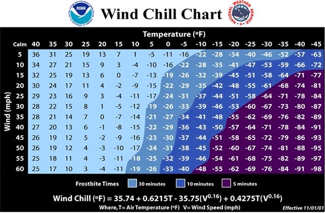
The NWS on Wednesday issued a wind chill watch for the region including East Tennessee from late Thursday night through Saturday afternoon, warning that wind chills as low as 15 below zero in lower elevations and 25 below zero at higher elevations could cause frostbite on exposed skin in as little as 30 minutes.
NWS meteorologist Tim Doyle told Knox News Wednesday the cold front could bring 40+ mph wind gusts to the area, which could also cause downed trees and power outages
The most impactful part of this storm will be the prolonged cold temps and low wind chills! Once we fall below freezing Thu night, most places won't see 32°F again until early next week! And wind chills will be into the -10 and -20s. This is exceptionally cold for our area. 2/ pic.twitter.com/5O4e6PDLls
— NWS Morristown (@NWSMorristown) December 20, 2022
After highs in the 40s and even the 50s early in this pre-Christmas week, the strong cold front moving across the country will bring extreme low temperatures and a chance of just under half an inch of snow for the Knoxville area and around 2 inches for the mountains, according to the NWS.
“The forecast has been changing from each shift here,” NWS Morristown meteorologist Kerrie Simmons told Knox News on Monday. “Thursday is when things take a turn.”
“By Friday morning on, much of the area is going to be seeing the chances for snow since we're going to be so cold. And then by later in the afternoon into the evening on Friday is when the system will be pulling off to the northeast and the chance of snow will decrease,” she said.
Homelessness in Knox County: Homelessness in Knox County: New approach shows clearer picture of who is homeless and why
Precipitation should begin as rain Wednesday night into Thursday with some snow mixing in the higher elevations. But as the temperature drastically drops, it will quickly change to just snow by Friday morning with some flurries lingering into the afternoon.
NWS meteorologist Kyle Snowdin dashed some hopes of a white Christmas when he gave Knox News a winter weather update on Tuesday.
“It's not gonna be crazy snowfall amounts with this event,” Snowdin said. “A lot of times when you get this really cold air, one of the issues is you have a lack of moisture, so it can be harder to see notable (precipitation) when it gets this extremely cold.”
The valley might only get trace amounts to 1 inch while the Smokies could see up to 2 inches. The Knoxville area is currently forecast to get just under a half inch of measurable snow.
Rain freezing on contact could be an early concern for travelers, Simmons warned. But warmer ground temperatures before the sudden change on Thursday might reduce that threat.
Knoxville's Public Service Department reported it will be prepared to efficiently clear streets of what this week’s winter event may bring because of a stockpile of salt and brine from last year’s mild winter.
“I know there's going to be a lot of people on the road for the holidays, and with winter weather on the way just make sure that you have a plan, (have an) emergency kit in your car,” Simmons advised. “And allow time between you and the next vehicle and extra time to get to your destination.”
It’s also a good idea to ensure animals, vehicles, pipes and plants are protected from the harsh elements.
Certainty of the winter storm track and snow accumulation forecast will increase throughout the week. NWS Morristown (weather.gov/mrx) will have detailed up-to-date information.
For subscribers: Is mistletoe a symbol of Christmas love or a tree killer? It's both
Ways to stay warm when it's so cold outside
With temperatures expected to drop well below freezing – below zero in some cases – as frigid Artic air and dangerous wind chills move across East Tennessee, here are a few tips to help you stay warm and safe.
NWS meteorologist Tom Doyle advises people to:
Dress in extra layers of clothing. If you're going outside, wear several layers of clothing to cover all your extremities so they won’t be exposed to the extreme cold.
Close windows, curtains and blinds to prevent cold air entering and to insulate heat. Shut doors in unoccupied rooms to preserve heat. You can also place towels or rags under doors and between cracks to help keep rooms in your home warm.
Food and drink provide energy that also help keep your body warm. But avoid alcohol and caffeine.
These measures could help you to stay warm even if you lose power.
Bring pets inside to keep them warm and protected from dangerously cold temperatures and wind chills.
Dangerous wind chills are expected with a Wind Chill Watch now in effect for all counties from 4 AM EST Friday until 1 PM EST Saturday. There is also increased concern for power outages due to downed trees during this extreme cold. #tnwx #ncwx #vawx #mrxwx pic.twitter.com/YDJ0HKqjGV
— NWS Morristown (@NWSMorristown) December 21, 2022
Preventing frozen pipes
Frozen pipes can burst and cause other issues. To avoid that disasters, let cold water drip or trickle from facets to help prevent pipes from freezing.
Insulate and wrap pipes under the kitchen and bathroom sinks and in unheated areas like garages with pipe sleeves, heat cables or even newspapers.
Keeping your heat at a steady inside temperature throughout the day and night can also help prevent frozen pipes.
Space heater safety
Space heaters can help heat rooms in your home, if used safely. NWS meteorologist Caroline Adcock told USA TODAY Network-Tennessee that space heaters should always be plugged directly into the wall, never into a surge protector. There’s an increased risk of fire if they are plugged into a surge protector because of the amount of power space heaters use.
Tips for holiday travel
The greatest risk for icy, slick roads is overnight Thursday and during the daytime on Friday. Precipitation will begin Thursday night as rain, but as the temperature drops, moisture on the roads can freeze, Doyle warned.
He advised avoiding travel if weather begins to deteriorate. But if you must be out, drive with caution. Allow space between you car and vehicles in front of you, and have an emergency kit stocked with extra blankets, food and drink and warm clothing.
If you need assistance, the Red Cross recommends not to leave your vehicle unless help is visible from 100 yards away. Always use hazard lights when stranded; turn on the engine for 10 minutes each hour and use the heater.
Devarrick Turner is a trending news reporter for Knox News. He can be reached by email at devarrick.turner@knoxnews.com. Follow Devarrick on Twitter @dturner1208. Enjoy exclusive content and premium perks while supporting strong local journalism by subscribing at knoxnews.com/subscribe.
This article originally appeared on Knoxville News Sentinel: Knoxville weather: Storm makes white Christmas possible in Tennessee
