What is La Niña? And how does it impact global weather?
La Niña - the cold phase of the El Niño Southern Oscillation (ENSO) - has a strong influence on the world's weather, just like its "warm phase" counterpart.
Quick Facts
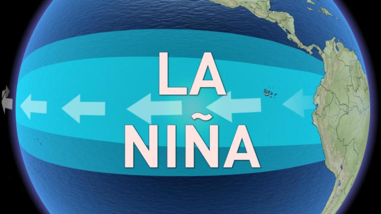
It is a large-scale climate pattern associated with cooler than normal water surface temperatures in the central and eastern equatorial Pacific Ocean
It has the opposite pattern from El Niño, which is associated with warmer than normal ocean temperatures in the central and eastern equatorial Pacific Ocean
No two La Niña events are exactly alike, but La Niña has a reputation for focusing the coldest and most active winter weather across Western Canada, with a more variable, but often milder and stormy pattern from the Great Lakes to Atlantic Canada
Over the equatorial Pacific Ocean, during a normal year, the winds cycle around in a fairly continuous conveyor belt, blowing towards the west near the water surface, rising (and bringing rainy weather) near Indonesia and northeastern Australia, flowing towards the east at upper levels and then sinking along the west coast of northern South America. Pushed by the surface winds, the warm surface waters along the equator are pushed towards the west, where they pool and cool, nutrient-rich subsurface water rises along the coast of South America to replace it.

(Credit: NOAA/Wikipedia)
When these conditions break down, as they do every so often, the conveyor belt divides into a few smaller ones, and the strong push on the surface water abates. This causes the warm water piled up in the west to slump back towards the east, in the form of what are known as equatorial Kelvin waves. This development in the Pacific is known as El Niño.
As influential as an El Niño event can be on the world's weather, one can only last so long, due to a built-in limiting factor.
When each equatorial Kelvin wave delivers its payload of heat eastward across the Pacific Ocean, it hits the South American coast and is reflected back towards the west. The reflected wave, known as a Rossby wave, travels westward along the thermocline (see the image), and at the surface to the north and south of the equator. Taking roughly six months to traverse the ocean, the Rossby wave will reach the coastlines of southeast Asia and be reflected again, back towards the east.

(Credit: NOAA/Wikipedia)
SEE ALSO: How Colorado lows and Texas lows affect our weather in Canada
This cycle continues with each successive Kelvin wave, and when each eastward-reflected Rossby wave from Asia encounters a westward-reflected Rossby wave from South America, their interaction erodes the entire El Niño pattern.
Eventually everything settles back into the normal state again.
Once in awhile - especially when you have a particularly strong El Niño - as the pattern finally breaks down, Rossby waves can continue to propagate back and forth across the ocean well after the El Niño is done. This keeps pushing the system in the direction of "normal" which results in a kind of "hyper-normal" state.
This situation, with stronger than normal westerly winds pushing warm surface waters even farther to the west than usual, thus causing an even stronger and wider upwelling of cold water in the east, is known as a La Niña.
Watch all of this happen in the video above, which shows the decay of the 2009-2010 El Niño and the development of the 2010-2011 La Niña.

Typical impacts of La Niña on Canada during winter. (Credit: Climate.gov)
When La Niña conditions develop, it usually means a colder winter for the western half of Canada, which even impinges on Ontario as well at times, and there's typically wetter conditions along the west coast and near the Great Lakes.

Typical impacts of La Niña on the world during Northern Hemisphere winter and summer. (Credit: Climate.gov)
Along with that, the eastern Pacific hurricane season tends to be quiet, while the Atlantic season ramps up - with more tropical storms and hurricanes, and more major hurricanes as well.

For example, during the El Niño of 2015, the Atlantic saw only 11 storms - 7 tropical storms and 4 hurricanes, 2 of which became major hurricanes (category 3 or higher). The following year, as the El Nino abated for the first half of the year, and conditions became more neutral during hurricane season, there were 15 storms - 8 tropical storms and 7 hurricanes, 4 of which were major hurricanes. When a weak La Niña started off 2017, with mainly neutral conditions during hurricane season and now trending back towards La Nina for winter, there have been 17 storms - 7 tropical storms, and 10 hurricanes, 6 of which were major hurricanes.
Sources: NOAA | Climate.gov

