Large hail, strong winds, tornadoes possible Thursday, Friday in North Texas weather
Some parts of North Texas could see large hail, damaging winds and tornadoes late Thursday and early Friday, according to the National Weather Service in Fort Worth.
Thursday in Dallas-Fort Worth “should be warm, breezy, humid,” according to NWS meteorologist David Bonnette, and storms aren’t expected in the metroplex until after 4 a.m. Friday.
The western area of North Texas could see severe thunderstorms develop late Thursday as a cold front moves into the area. Large hail and damaging winds could come with those storms. Tornadoes north of Interstates 20 and 30 are also possible, according to the National Weather Service.
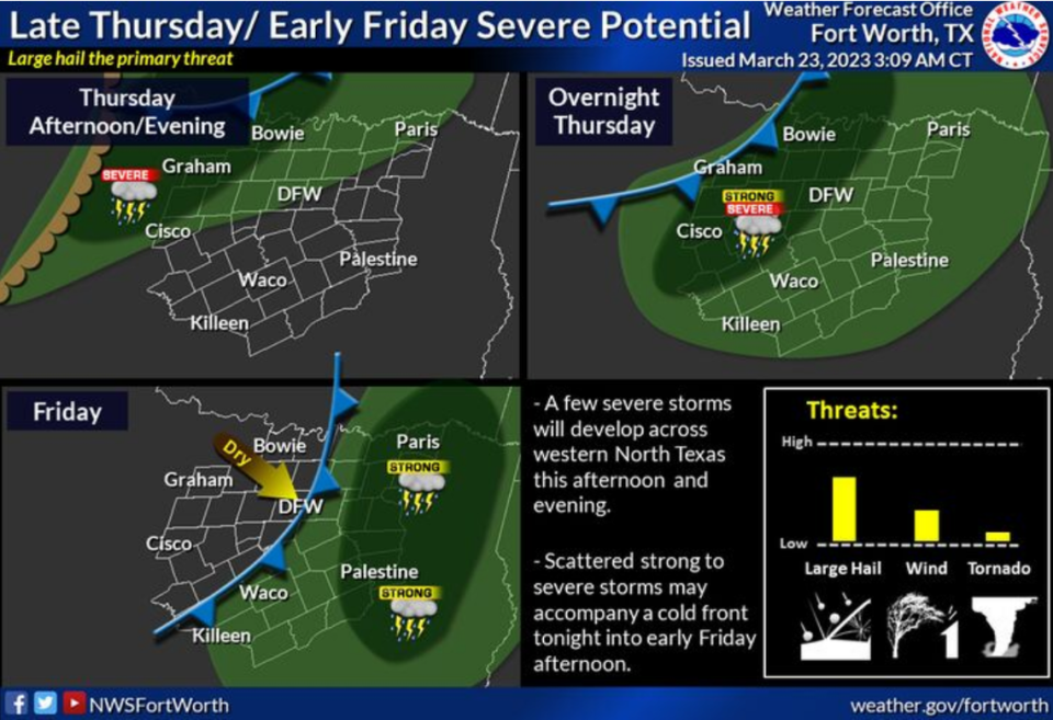
Bonnette said residents in the Metroplex could see thunderstorms during their morning commute Friday. The chance for severe weather is low and the main threat would be hail, according to Bonnette.
A cold front will move into North Texas overnight Thursday but high temperatures will remain in the upper 70s Friday and through the weekend.
3-Day Storm Outlook
This map shows the 3-day weather outlook for storms by the National Weather Service's Storm Prediction Center. Sources: National Weather Service, Esri.
Current Temperatures
Current temperatures and weather data from NOAA weather stations updated hourly. Tap on the map for current weather conditions, including humidity, wind speed. and direction. Data provided by NOAA and Esri.

