UPDATES: Priceboro Fire outside Harrisburg reaches 35% containment
This story was updated at 11 a.m. Sunday, Aug. 6
Crews continue to fight the 250 acre Priceboro Fire burning in a field 1 mile north of Mount Tom and 8 miles northeast of Eugene outside Harrisburg and reported 35% containment as of Sunday morning.
On Saturday evening, the Linn County Sheriff's Office downgraded the evacuation notices from level 3 to level 2 (be prepared to go) for all residents of Mount Tom. A level 2 notice for all residents on Coleman Road east of Interstate 5 was also downgraded to a level 1 (be ready).
The fire was first reported around 4 p.m. Friday. The cause is under investigation.
An emergency shelter for residents and their animals has been set up at the Linn County Fairgrounds at 3700 Knox Butte Road in Albany, according to the sheriff's office.
“Our lines held through the night and that’s a huge success from where we were sitting just a day ago,” Incident Commander Jeb Schumacher said in a Sunday update. “Today we will focus on plumbing and heavy mop up. We want to make sure the lines are strong and secure so the local district can concentrate on catching new fire starts when we eventually hand this back.”
Crews are planning to map the perimeter of the fire with a GPS to get a more accurate assessment and officials said they expect the current acreage of the fire to change.
At least 225 firefighters were fighting the blaze as of Sunday morning.
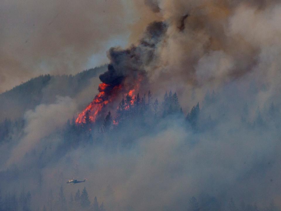
Officials said residents should expect to see aircraft and smoke above the fire on Sunday.
Linn County Sheriff Michelle Duncan said in a Saturday evening update crews were successful in putting a bulldozer line around the fire and continue to battle flare-ups. Six engines, seven crews, three helicopters, two tenders and three dozers fought the fire on Saturday, according to the Oregon Department of Forestry.
“We had a mixed bag with the weather today,” ODF district forester Chris Cline said Saturday evening. “The wind and dry conditions stoked fire activity in some areas, but the overcast was a huge help today. Crews capitalized on the weather and made big gains by fully lining the perimeter.”
At least 60 homes have been evacuated, according to the sheriff's office. One cabin was saved by crews Friday evening and the fire was stopped a quarter mile before reaching a subdivision, a Saturday update from the Oregon Department of Forestry added.
On Friday night, the fire team's efforts were focused on the active burning on the edges of the fire and any other smaller fires started by embers. To the south of the perimeter, dozer lines were placed by firefighters at the head of the fire to stop forward growth.
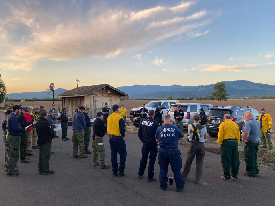
Two task forces were mobilized Friday by the Oregon State Fire Marshal and sent to Linn County to help with the growing fire. This is the third immediate response mobilization that has been activated in a week.
Unified management for efforts is being held by a Type-3 Incident Team and the Oregon Department of Forestry’s South Cascade District. Along with both teams, Oregon State Fire Marshal, crews from Oregon Department of Forestry, local fire districts, forest landowners and private contractors are also supporting the suppression efforts.
“We can’t thank our partners enough,” Cline said. “We need a lot of crews and resources to get around this fire and dig in, and we’re very thankful for all the support we received.”
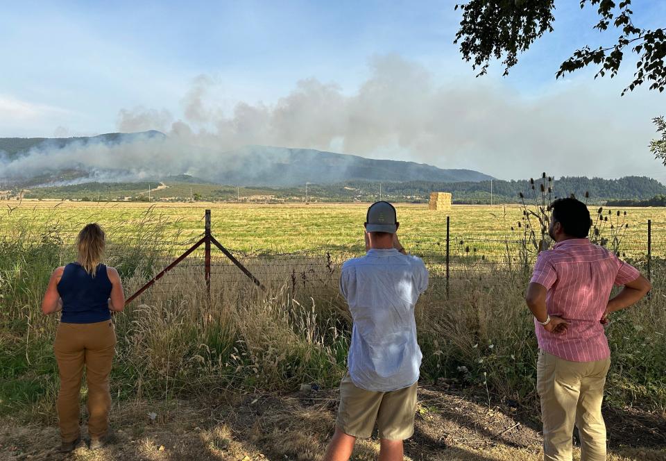
While the smoke is visible from Interstate 5, there are no current highway closures. However, those in the area can check updated road information at the Oregon Department of Transportation website. Those with questions about evacuation levels, shelters or who need assistance can call 541-812-9211.
Weather conditions were forecasted to stay hot and dry throughout the weekend, alongside some lightning in parts of the state. The Oregon State Fire Marshal added that conditions mean extra fire precautions should be taken to avoid sparking additional wildfires.

Conditions lead to increased Bedrock Fire activity
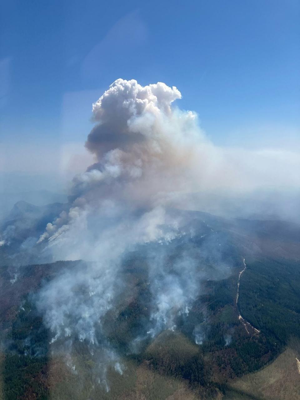
Warmer and drier weather led to activity from the Bedrock Fire. The fire has burnt 12,978 acres in the Willamette National Forest and spread over Jones, Alder and Hehe creek drainages.
Containment remains at 5% with more than 770 personnel assigned to the fire as of Sunday morning.
Officials reported a quarter inch of rain had fallen over the last two days. They said warm temperatures continued to facilitate fire growth on Saturday on the northern portions of the fire perimeter.
Lightning on Saturday caused a new fire that was quickly put out.
Firefighters on Saturday continued to hold the fire along the east side with help from air resources and continue to strengthen lines to the south.
Officials said mop up is extending deeper into the fire footprint from the perimeter and firefighters are extinguishing remaining hotspots.
Northwest Incident Management Team 13 will transfer command of the fire to Northwest Incident Management Team 12 on Sunday night.
Saturday marked two weeks since the Bedrock Fire began. The blaze started at Bedrock Campground on July 22. An emergency closure was expanded to include all recreation sites, trails, campgrounds and trailheads upstream of Fall Creek Reservoir.
A Sennebogen tree handler is working to reopen the 18 Road, a large piece of equipment that is able to stretch over 60 feet to cut hazardous trees. Additionally, drones are being used by the fire team in strategic firing operations.
“Wildland fire suppression requires different techniques and subject matter experts with specialized skills,” a Saturday morning update from the fire team said. “There are also several new technologies being used to get the Bedrock Fire under control and out.”
Flat Fire containment holds at 30%
Containment of the 33,246 acre Flat Fire held at 30% as of Sunday morning.
Throughout the past week, crews have maintained efforts to burn vegetation between the containment line and the active fire. Helicopter aerial ignitions near Lawson Creek and in the Game Lake area caused some increase in smoke on Friday.
Officials on Sunday said crews have continued to make progress on mop-up and are performing aerial ignitions to remove unburned pockets of fuel within the fire's perimeter.
At least 841 personnel were working the blaze as of Sunday.
The human-caused fire was first ignited at Oak Flat Campground on July 15 and is burning 2 miles southeast of the town of Agness.
The fire area is under a closure order issued by the Rogue River-Siskiyou National Forest, including trails, roads, campgrounds and part of the Illinois River. A level 2 public use restriction was also issued in the national forest and began Friday.
Water bucket drops from helicopters are being used by crews to reduce heat in the north fork of Indigo Creek. Saturday’s focus included increased aerial burning to keep reducing any fuel within the fire perimeter. Western and northern containment lines were being mopped up and patrolled, according to the update.
A firefighting crew flown in by helicopter will remove any other hazardous trees in the Fantz Ranch area and cool extra pockets of heat.
“This is helping to slow movement further southeast,” the update from the fire team said. “With fire traffic on Bear Camp Road, all motorists on Bear Camp Road are asked to slow down, use headlights and proceed with caution.”
Northern Rockies Incident Management Team 2 also took command of the fire on Saturday.
Abigail Landwehr is an outdoors journalism intern for the Statesman Journal. She can be reached at alandwehr@gannett.com
This article originally appeared on Salem Statesman Journal: Oregon wildfire evacuation Level 3 issued outside Harrisburg

