Tropical Storm Kay could bring flooding to Southern California after days-long heat wave
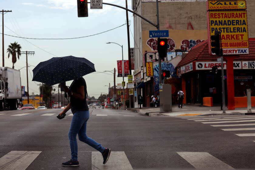
After days of record-breaking heat, Southern California will face a different set of weather challenges Friday and Saturday: the effects of a tropical cyclone.
Tropical Storm Kay, which was downgraded from hurricane status Thursday evening, is not on track to make landfall in California, but it will affect weather across much of the Southland, meteorologists said.
A flood watch is in effect Friday morning through Saturday evening in the valleys of San Bernardino and Riverside counties as well as the San Diego County valleys, according to the National Weather Service's San Diego forecast office.
Moisture from the weakening storm, which made landfall on Mexico's Baja California Peninsula on Thursday evening, is forecast to bring rain and thunderstorms that could be heavy at times, meteorologists said.
"Going from extreme heat to precipitation is not itself that weird, but the fact we have this much precipitation is pretty rare,” said Brandt Maxwell, a weather service meteorologist in San Diego.
The mountain areas east of San Diego could see up to 6 inches of rain, Maxwell said, and rainfalls of up to 3 inches are expected in some desert areas. The areas west of the mountains are likely to average only about half an inch of rain, Maxwell said. Wind gusts could be in the 50-to-80-mph range.
"They will catch the brunt of it," David Gomberg, a meteorologist with the weather service in Oxnard, said of areas to the south of Los Angeles County.
Excessive rainfall and wind discussed in the latest briefing https://t.co/yxtAozGird #TCKay #hurricane #socal pic.twitter.com/c1VcUYsrLX
— NWS San Diego (@NWSSanDiego) September 9, 2022
There is a chance of some heavy rainfall in the mountain and desert areas of L.A. County, and the L.A. Basin could see isolated pockets of heavy precipitation, Gomberg said.
The weather service has issued a flood watch for the Antelope Valley, Los Angeles County mountains and Ventura County mountains.
In general, most coastal and valley areas of L.A. County should see under an inch of rain, Gomberg said, but mountains and deserts could see 1 to 2½ inches.
Mountain areas around L.A. as well as Avalon, on Santa Catalina Island, are also expected to see gusty wind, Gomberg said. A gale watch has been called for coastal waters.
High surf is expected from Los Angeles up to Santa Barbara, with Catalina Island expected to see surf of up to 9 feet, he said. Kay is also expected to bring tidal overflow, which could cause minor flooding in coastal areas at high tide.
Storm surge is not expected, Gomberg said.
A high wind warning is in effect from 6 a.m. Friday to midnight for coastal San Diego County, including Oceanside, Vista, Carlsbad, Encinitas, Chula Vista, National City and San Diego, the weather service said.
The gusty, easterly winds could cause air travel delays and create challenges for containment efforts of wildfires that are razing parts of Southern California.
As of Thursday evening, Kay's maximum sustained wind speeds had fallen to 70 mph, according to the National Hurricane Center. The storm is forecast to continue weakening as it makes its way north.
Kay was about 370 miles south southeast of San Diego on Thursday evening and remains on course to move up the west coast of Baja California before turning west Friday afternoon, the Hurricane Center said.
Parts of Southern California were treated to a prelude of Kay's expected rainfall Thursday as residents woke up to light precipitation.
Ryan Kittell, a weather service meteorologist in Oxnard, said the rainfall was "splattered over" the Los Angeles valley and coastal areas. Montebello recorded about a third of an inch of rain and Glendora about 100th of an inch. Other areas may have received brief, scattered rain, but not enough to measure 100th of an inch, he said.
"We weren't expecting it today, that is the surprising part," Kittell said.
Farther south, Maxwell said that most places have registered about a 10th of an inch of rain.
“The storms we’ve had this morning have been moving fast enough and spotty enough,” Maxwell said. Much of it has occurred in San Bernardino and the Inland Empire.
Despite the scattered rain, Angelenos still should be wary of the heat.
California has been baking under a heat dome that has stalled over the region, making this the hottest September on record.
Four daily high temperature records were broken on Thursday.
A high of 97 degrees at Los Angeles International Airport broke the previous record of 93 degrees, which was set in 1984, the weather service in Oxnard said. Paso Robles' high of 108 degrees broke the previous record, set last year, of 106 degrees.
Anaheim's high of 103 degrees surpassed the previous record of 102 degrees, set in 2015 while Newport Beach reached 95 degrees, breaking the previous record of 90 degrees set in 1984, according to the weather service in San Diego.
This story originally appeared in Los Angeles Times.

