Live Michigan weather radar, traffic updates for April 5, 2023
An "enhanced risk" of severe thunderstorms, with the potential of producing tornadoes, large hail and damaging winds, is on tap for much of lower Michigan on Wednesday.
This is due to a "powerful low pressure system," according to the National Weather Service, that is projected to send a strong cold front through the Lower Peninsula.
"The atmosphere will be favorable for significant severe weather including tornadoes, large hail, and damaging winds," the NWS Detroit office in White Lake tweeted.
Tornado watch vs. tornado warning: Here's the difference between the two alerts
Thirty-five lower Michigan counties are under a tornado watch until 4 p.m., including the metro Detroit, Lansing, Grand Rapids, Kalamazoo, Saginaw, Flint, Jackson, Holland, Port Huron, and Battle Creek markets.
Make sure you stay prepared and know where to go in case of a tornado; here are some tips on what to do. Meanwhile, keep your eyes here for the latest weather and traffic updates.
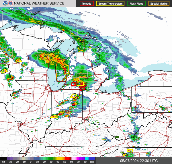
Michigan weather radar
Refresh this page every several minutes to see the latest radar. Can't see the radar below? Tap here.
Michigan traffic updates
This article originally appeared on Detroit Free Press: Live Michigan weather radar, traffic updates: April 5, 2023
