Wildfire updates: EWEB restores power, evacuation levels reduced
To provide our community with important public safety information, the Statesman Journal and The Register-Guard are making this content free to read. To support critical local journalism like this, please consider becoming a digital subscriber to The R-G or the SJ.
The east wind event hit western Oregon on Friday and Saturday as expected and is forecast to continue, bringing extreme fire danger with it, is eerily similar to the conditions leading to the 2020 Labor Day fires blowup, meteorologists said.
Follow our live coverage of the latest news on preparations, power outages and fires.
6 p.m. Sunday: EWEB restores power
As of 3 p.m. Sunday, EWEB crews have completed inspection of lines and restored power to all its customers, said Aaron Orlowski, EWEB spokesperson.
4 p.m. Sunday: Oakridge schools closed, county to open transfer station for food waste
Due to ongoing wildfire evacuations, Oakridge schools will be closed this week, reopening Sept. 19, the district announced Sunday afternoon.
Lane County Waste Management will open the Oakridge transfer station at 48977 Kitson Springs Road from noon to 3 p.m. Monday to allow residents to dispose of spoiled foods after multi-day power outages.
A refrigerator will keep food safe for up to four hours during a power outage, according to the United States Department of Agriculture. The USDA advises to discard perishable foods after four hours without power and never taste food to determine its safety following an outage.
3:30 p.m. Sunday: Lane County to close temporary evacuation site, non-emergency call center
With decreasing evacuation levels in the Oakridge and Westfir areas Lane County will be closing the temporary evacuation point at Lane Community College at 5 p.m. Sunday.
Evacuees in shelters will continue to receive services from the American Red Cross and Lane County Animal Services will continue to operate the large animal evacuation shelter at the Lane County Fairgrounds to house animals from properties in level 2 and level 3 evacuation areas.
The county will also close its non-emergency call center at 5:00 p.m. Sunday following a significantly decreased call volume. Residents seeking information after that time can call 2-1-1.
The Lane County Sheriff’s Office discouraged those with mobility limitations, special needs or who are medically fragile from returning to level 2 evacuations. Additionally, those who lack reliable transportation, or have large animals or pets that may be difficult to move are encouraged not to return.
12:30 p.m. Sunday: Some Cedar Creek evacuations loosened, part of Highway 58 reopened
The Lane County Sheriff’s office has begun to downgrade evacuation levels near the Cedar Creek Fire and Oregon Highway 58 has been reopened to milepost 37 east of Oakridge.
Level 2: Be Set
Oakridge west of Salmon Creek, south of Laurel Butte Road, and north of the Middle Fork Willamette River
The City of Westfir
Level 3: Go Now
High Prairie area, including all of High Prairie Road, Brock Road, Bar BL Ranch Road, Nubian Way, Mountain View Road, and Huckleberry Lane
Westfir-Oakridge Road from Westfir city limits to Roberts Road
McFarland Road
Oakridge north of Laurel Butte Road, and Oakridge east of Salmon Creek
Hills Creek Reservoir area south of Highway 58 and Greenwaters Park
Highway 58 remains closed from milepost 37, east of Oakridge to milepost 62 at Willamette Pass.
To see the Cedar Creek evacuation map, click here.
Read more about the Cedar Creek Fire
12 p.m. Sunday: Vitae Springs Fire evacuation levels reduced, resource center closing
Effective noon Sunday, the following evacuation areas have been reduced to level 2 and 1:
Level 2: Be Set
Vitae Springs Road between Skyline Road S to River Road
West side of Skyline Road from Vitae Springs Road to Cole Road S
Orville Road S
Riversprings Road to Prospect Ridge
Level 1: Be Ready
Marion County:
River Road S at Sawmill Road
Sawmill Road S
South side of Ballyntyne Road S
Stonehill Avenue S
Jory Hill Road S west of Elmhurst Avenue S
Elmhurst Avenue S to Nehalem Street S
Cole Road S west of Bates Road S
West side of Bates Road S to Bunker Hill Road S including the Chinook Estates neighborhood
Bunker Hill Road S to Riverside Drive S
Riverside Drive S from River Road S to Sidney Road S
West side of Sidney Road S to Buena Vista Road S
Polk County:
All areas in Polk County are no longer under evacuation advisory.
The Judson Middle School evacuee resource center will be closing Sunday. Anyone with livestock at the Oregon State Fairgrounds can work with county officials for next steps.
The fire is expected to continue to smolder for an extended period, according to the Marion County Sheriff's Office. The fire remained contained overnight and fire crews continue to assist the Salem Fire Department.
Read more about the Vitae Springs Fire here.
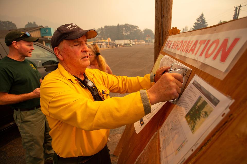
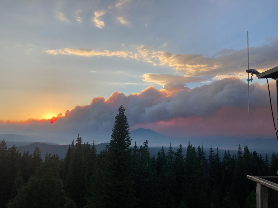
10:15 a.m. Sunday: Cedar Creek Fire grows, breaks fire lines, threatens 2,230 homes

The Cedar Creek Fire grew to 85,926 acres and fell to 0% containment Sunday morning after the fire breached existing containment lines, according to fire officials.
Oakridge and the surrounding areas remain on level 3 evacuations and Oregon Highway 58 remains closed from the Lowell Covered Bridge at Milepost 13.7 on the west end to milepost 70 near Crescent Lake on the east. As of Sunday morning there have been no changes to evacuation levels.
The fire remains to the north of Highway 58 and south of Forest Service Road 19 and east of Eagle Butte.
Saturday evening the firefighters conducted strategic burning operations near Eagle Butte, 5 miles northeast of Oakridge.
Seven task forces and an incident management team have been assigned by the Office of the Oregon State Fire Marshal to protect homes, businesses and critical infrastructure in the area.
As of Sunday morning 2,230 homes and 443 commercial structures are under threat by the fire, according to fire officials.
On the east edge of the fire, efforts are being focused on creating fire breaks along existing reams and burn-out operatios to reduce fuels. Heavy equipment will be arriving on site for use near Cultus Lake, Little Cultus Lake and along the Cascade Lakes Highway and forest service roads. Officials expect fire breaks on the east edge of the fire to take most of the week to complete.

The extreme weather that drove much of the fire’s growth over the weekend has eased and winds have calmed. Dry weather remains a concern, but fire officials expect cooler temperatures and a heavy smoke layer to have the effect of moderating fire activity.
10 a.m. Sunday: How you can help Cedar Creek Fire evacuees
Donate items for evacuees - St. Vincent de Paul of Lane County has opened a donation center at its location at 2890 Chad Drive in Eugene. The center is open from 9 a.m. to 7 p.m. Sunday. They are in need of: Clean blankets in good condition and bottled water
Donate money - The United Way of Lane County has opened a community response fund for the Cedar Creek Fire. Donations can be made at unitedwaylane.org.
Donate items for small animals - Greenhill Humane Society is in need of: New or like-new large to medium pet crates ; bedding; and pet food. Donations can be provided directly to Greenhill.
Donate items for large animals - Lane County Animal Services is accepting donations of the following at the large animal evacuation shelter at Lane Events Center. They are in need of: Hay, feed and water buckets
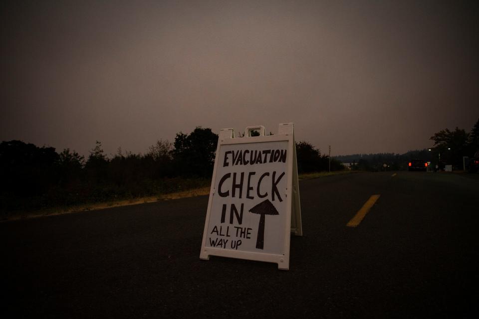
Officials are asking all people who evacuated to let the county know so they can be directed to resources. Checking in with the county will help assure that residents can be connected with resources after the fire. Evacuees can sign in with the county, as well as other resources, at bit.ly/CedarCreekFireInfo.
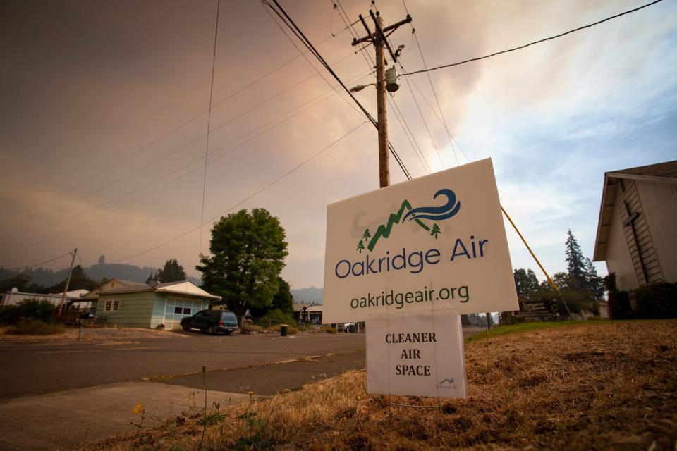
9:30 a.m. Sunday: Cedar Creek Fire continues to degrade Willamette Valley air quality
An air quality alert remains in effect for Lane County and the south Willamette Valley through 11 a.m. Monday. Wildfires burning in the region and weather conditions are causing the air quality to reach unhealthy levels.
As of 9 a.m. Sunday, the air quality in Oakridge was hazardous, 342, while Cottage Grove was nearing unhealthy for sensitive groups, 94, and Eugene at 70, a moderate range.
Air quality in the Salem area is in the 90s, nearing unhealthy for sensitive groups. East of Salem, in the Lyons area, the air quality is unhealthy, 153.
Smoke can irritate the eyes and lungs and worsen some medical conditions. People can protect themselves and their families when smoke levels are high by:
Staying inside if possible and keeping windows and doors closed. If it’s too hot, run air conditioning on recirculate or consider moving to a cooler location
Avoiding strenuous outdoor activity.
Using high-efficiency particulate air (HEPA) filters in indoor ventilation systems or portable air purifiers
Being aware of smoke in the area and avoiding places with the highest levels.
Waiting until air improves to moderate or healthy then opening windows and doors to air out homes and businesses
Following any breathing plans for medical conditions and keeping any needed medications filled
People can check air quality conditions and advisories on the Oregon Department of Environmental Quality’s Air Quality Index webpage at oraqi.deq.state.or.us/home/map, on airnow.gov or by downloading the free OregonAir app.
5:33 p.m. Saturday: Pacific Power, PGE begin to restore power to customers after safety shutoffs
Pacific Power concluded their safety-related shutoffs on Saturday evening after wildfire weather conditions decreased. Crews were able to assess safety checks, debris clearing and minor repair work in the morning, followed by the restoration of power in sections, according to Pacific Power. Roughly 12,000 customers were "re-energized" by Saturday evening.
Portland General Electric continues to work on re-energizing their 17,000 customers who experienced the safety shutoffs, confirming service Saturday afternoon for Southern West Hills while the areas of Scotts Mills, Central West Hills, North West Hills and Tualatin Mountain work toward restoration. They are also working on restoring power to Silver Falls, which was also shut off due to extreme conditions, according to PGE.
Estimated restoration times for PGE can be found here.
3:30 p.m. Saturday: Lane Electric begins restoring power to some households
On Saturday afternoon Lane Electric began restoring power to households. Members in Westfir and High Prairie outside of Oakridge will remain without power, at the direction of Cedar Creek wildfire response command. Oakridge's power was on and will remain so unless Lane Electric gets directed otherwise by emergency management.
Mutual aid crews have been called in to help in restoration. The process will continue through the day, and potentially into Sunday given current conditions.
Restoration in the McKenzie area would also be be delayed as it requires coordination with Bonneville Power Administration, who also deenergized lines in the area as a precaution.
3:16 p.m. Saturday: Power restored for some, but still out for hundreds in Scotts Mills, Lyons and Grand Ronde
Portland General Electric said Saturday afternoon that it had restored power for most of the homes impacted near the Vitae Springs Fire.
The company said it has turned power back on to 5,365 customers in the West Hills of Portland and is working on bringing power back to 9,385 people still without.
But over 1,000 people east of Silverton were still without power after preventative shutdowns and downed trees in the area near Scotts Mills. The company shut down power in Silver Falls due to the danger of fire Friday afternoon.
Another 1,000 homes near Grand Ronde also were without power after shutoffs in the area.
Pacific Power said it had 487 customers around Lyons who were still without power Saturday.
Consumers Power Inc., was showing only scattered outages as of Saturday afternoon.
3 p.m. Saturday: Fire under containment after campers evacuate Milo McIver State Park
The fire that caused campers to flee late Friday night from Milo McIver State Park is under containment and is not spreading further, according to the Canby Fire District.
Campers at Milo McIver State Park had to flee late Friday night after a wildfire ignited and spread near the park along the lower Clackamas River near Estacada. The park remains closed Saturday and likely through the weekend, according to Oregon State Parks.
The fire started in the Riverbend day-use area of the park, clearing the park by 11:30 p.m., according to Chris Havel, spokesman for the Oregon Parks and Recreation Department.
Level 3 "Go now" evacuations have been issued for the park and surrounding area and remain in place as of 3:00 p.m. Saturday. See this map for full evacuations.
2:30 p.m. Saturday: Cedar Creek Fire reaches 73,922 acres, expect active growth Saturday
The Cedar Creek Fire grew to 73,922 acres with 12% containment by Saturday afternoon after a period of extreme growth Friday and overnight. The main body of the fire remains roughly 7 miles from the community of Oakridge, according to updated maps from fire officials.
As of noon on Saturday, fire officials confirmed the flames had not crossed Highway 58. The burn remains on the north side of Highway 58, as well as south of Forest Road 19 and east of Bunch Grass Ridge.
Oakridge and the surrounding areas remain on level 3 evacuations and Oregon Highway 58 remains closed. A map of evacuation areas is available here. Multiple teams are working to protect homes and structures in Oakridge, West Fir and High Prairie, with more resources arriving later on Saturday from Washington state and Yamhill County.
11:45 a.m. Saturday: Thousands of Lane residents without power Saturday, doing their part to curb wildfires
Thousands of Lane County residents are without power this weekend after utilities shut off their electricity in anticipation of a high winds that have the potential to knock over powerlines and start more wildfires.
The Eugene Water & Electric Board and the Lane Electric Cooperative both shut off electricity to many customers starting Friday, some as early as 1 p.m. The Springfield Utility Board does not have plans to shut off power, but is monitoring and preparing for the weather, according to their website.
EWEB shut off power to about 3,000 customers from Hayden Bridge to Vida. As of Saturday morning, the company did not expect to increase that number and anticipates restoring power Sunday afternoon.
As of Saturday morning, Lane Electric Cooperative shut off power to 2,369 households, about 18% of its customers. The company shut off power to some at 1 p.m. Friday, four hours earlier than originally planed. Power will likely be restored starting Sunday morning, according to Lane Electric's website, however that may change.
"That was an action we took to mitigate the wildfire risk," EWEB spokesperson Aaron Orlowski. "Obviously, it was a tough decision, but we wanted to make sure that we reduce that risk as much as possible."
EWEB may restore power sooner or later depending on weather conditions, Orlowski said. Before re-energizing, EWEB crews will patrol lines and remove debris, make repairs if needed and will respond to emergency reports of lines down or other damage to the power system, according to a news release. Once that work is complete, EWEB will restore service. Restoration is anticipated to take longer than typical.
11 a.m. Saturday: Lane County seeking volunteers to help with large animal shelter
Lane County Animal Services is looking for volunteers with previous large animal experience to assist at the Lane Events Center large animal shelter.
Volunteers must be at least 15 years old, and minors must be accompanied by a guardian.
Volunteers will assist with feeding, cleaning stalls and other tasks related to caring for the large animals evacuated from the Oakridge area due to the Cedar Creek Fire.
Interested volunteers may go to the Lane Events Center livestock arena starting at 8 a.m. Saturday.
Donations of hay and other supplies are also welcome.
Information about large animal and companion animal sheltering is available at www.LaneCountyOR.gov/CedarCreek.
10:45 a.m. Saturday: Vitae Springs Fire 100% contained, but continues to burn

The Marion County Sheriff’s office reported the Vitae Springs fire is 100% contained as of Saturday morning, though the fire continues to burn inside the boundary.
The fire is burning in a heavily wooded, steep area south of Salem, according to a news release, which has made it difficult for firefighters to reach.
The fire started at 4 p.m. Friday in a grass field in the 4000 block of Vitae Springs Road.
According to Marion County, aircraft will be forming a retardant line around the perimeter Saturday while ground crews will mop up hot spots throughout the day.
People area asked to avoid the area, though River Road between Salem and Independence is open to cars.
10:10 a.m. Saturday: Air quality degraded across Lane County, where to go for air respite
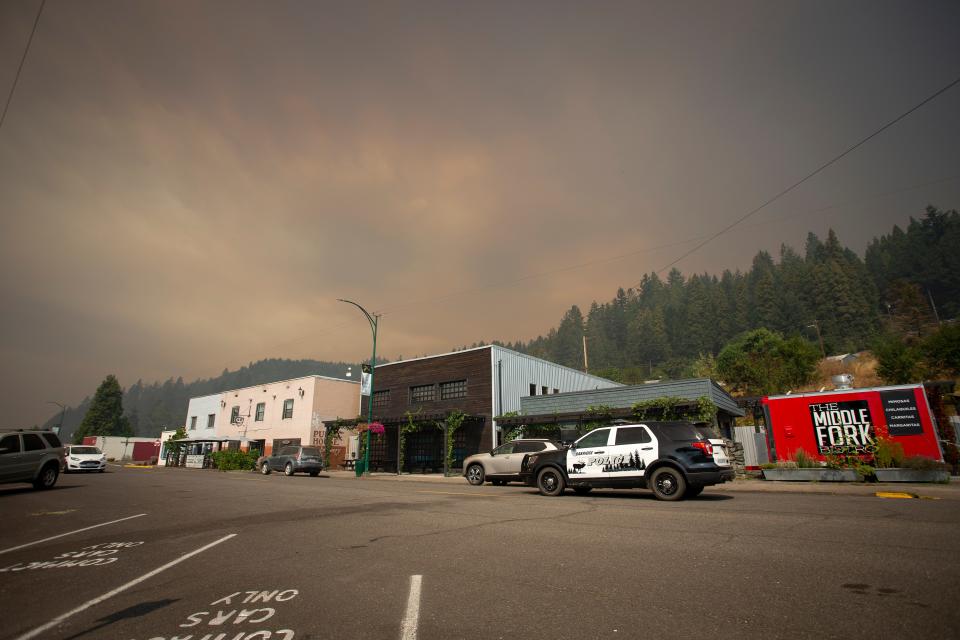
Many people living in the Eugene-Springfield area woke up Saturday morning to find another smoky sky and ash covering their cars thanks to the Cedar Creek Fire, which grew from 33,100 acres to 51,814 in 24 hours, forcing those in the Oakridge-Westfir area to evacuate Friday night.
The Lane Regional Air Protection Agency forecasts that a wind shift Saturday evening may bring some relief.
As of Saturday morning, air quality in Oakridge was "very unhealthy" measuring 207 on a scale to 300 according to the 24 Hour Air Quality Index. The Eugene Springfield area and Cottage Grove dealt with less smoke pollutants in the air however both were considered "unhealthy for sensitive groups," scoring 110 and 149, respectively.
Sensitive groups include children, people older than 65, pregnant women and people with heart disease or respiratory conditions.
Eugene libraries are open during regular hours this weekend and can give those in need respite from the smoky air. The downtown library at 100 W. 10th Ave. is opened 10 a.m. to 6 p.m. Saturday and Sunday; the Bethel Branch at 1990 Echo Hollow Road is open 10 a.m. to 6 p.m. Saturday and closed Sunday; and the Shelden Branch at 1566 Coburg Road is open 10 a.m. to 6 p.m. Saturday and closed Sunday.
Read the story here: Air quality degraded across Lane County, may improve overnight
10:05 a.m. Saturday: Cedar Creek about 6 to 8 miles from Oakridge
Oakridge and the surrounding areas remain on level 3 evacuations and Oregon Highway 58 remains closed. A map of evacuation areas is available here.
The main body of the fire is about 6 to 8 miles from Oakridge, and the fire will again be extremely active as the east winds are projected to last through the day.
"Today’s fire activity is expected to be extreme with long-range spotting and crown runs. Expect a large smoke column to develop by mid-morning," a morning report from the Cedar Creek Fire crew said. "East winds, low humidity, and high temperatures will continue today and start to ease tomorrow."
Here is the latest VIIRS satellite fire detection data from the #CedarCreekFire. This does not display fire intensity & there can be issues with false detections, but it at least provides a sense of where fire was roughly located as of 340 AM Saturday. #pdxtst #orwx pic.twitter.com/0mTin51Djy
— NWS Portland (@NWSPortland) September 10, 2022
Notes from fire crew on Saturday's activity: The fire has not crossed west of Highway 19; firefighters are working to hold and improve the east side. Spot fires crossed south of Highway 58 at Kitson Ridge. Firefighters are working to keep the fire north of Forest Road 1928.
On the east side of the fire: East of Waldo Lake, the Alaska Incident Management Team has established two branches and six divisions to work in the Deschutes National Forest side of the Cedar Creek Fire. Where possible, direct attack water drops with helicopters is occurring on the southeast edge. Crews are preparing Road 4290 from Charlton Lakes to the Cascade Lakes Highway to control the spread of the fire to the southeast.
Story here: UPDATE: Cedar Creek Fire now 51,814 acres, hasn't reached Oakridge
10 a.m. Saturday: PGE shuts down additional areas, bringing total homes and businesses without power to 37,000
Portland General Electric announced early Saturday morning five new preventative power outages in the areas of Southwest Scotts Mills, South Molalla, George, Colton and Sandy, impacting approximately 1,675 customers.
The areas are at "higher risk" due to extreme weather conditions, including wind gusts of up to 40 miles per hour, according to PGE. Power restoration could begin as early as Saturday evening if conditions allow.
9:10 a.m. Saturday: No loss of lives in Vitae Springs Fire south of Salem

People in Salem woke Saturday morning to a layer of smoke as crews fought the Vitae Springs Fire south of Salem overnight.
The fire didn’t grow overnight as crews from throughout the Willamette Valley surrounded the grass fire that ignited Friday afternoon south of Salem, fire officials said Saturday morning.
“We can confirm that was no loss of homes or lives or injuries,” said Greg Walsh, Salem’s emergency preparedness manager said Saturday morning.
Walsh said aircraft were being brought in Saturday morning to support crews on the ground that are actively fighting the fires to get it under control.
Officials said they didn’t have an estimate on the size of the fire Saturday morning, but there were approximately 119 residences that were advised to immediately evacuate in unincorporated Marion County that had been evacuated and another 516 in Marion and Polk Counties that are on alert to evacuate.
“As we’re entering the day, fire officials are actively getting an assessment on the size and scope of the fire,” Marion County Sheriff Sgt. Jeremy Landers said.
Separate fires of vegetation were reported south of Lyons and west of Silverton overnight, but they were extinguished in a matter of hours.
Walsh said crews on the Vitae Springs Fire from Salem Fire were assisted by fire crews from Dallas, Polk County, Marion County, Yamhill, Jefferson, Keizer, Turner, Stayton, Aumsville and Silverton, as well as the state fire marshal’s office.
They also had support from police from Salem, Independence, Marion County and Polk County, public works crews from Salem, and Marion County, the Salem-Keizer School District, Falck Ambulance, Marion County Search and Rescue and the Oregon State Veterinarian.
—Bill Poehler
9 a.m. Saturday: Cedar Creek Fire grows to more than 51,000 acres
Strong east winds stoked the Cedar Creek Fire in the past 24 hours, growing to 51,814 acres, and fire officials expect to face similar high winds Saturday.
The fire, which gained more than 18,700 acres since Friday, is making large gains to the east, fire officials said Saturday morning.
Firefighters faced extreme fire behavior Friday with wind-driven runs, crown fires (where fire spreads from the tops of the trees), and long-range spotting (where the fire is lofted by a convection column of air and spreads beyond the fire area).
Today, officials are expecting the fire will run 5-10 miles to the west, pushed by east winds. There’s still a possibility the fire could threaten Oakridge.
Also contributing to the fire danger, Red Flag Warning conditions will continue with a very unstable atmosphere, extremely low humidity, and very hot temperatures.
The Cedar Creek Fire started by lightning on Aug. 1. Currently there are 862 fire personnel fighting the fire. It is 12% contained as of Saturday morning.
—Michelle Maxwell
9 a.m. Saturday: Evacuation areas for Vitae Springs Fire
Those in the immediate area of evacuation were on Vitae Springs Road between Skyline Road South and River Road, the West side of Skyline Road from Vitae Springs to Cole South Road, Orville Road South and Riversprings Road to Prospect Ridge.
The areas under Level 2 "be set" evacuation notice:
Marion County
River Road S at Sawmill Road.
Sawmill Road South.
South side of Ballyntyne Road South.
Stonehill Ave South.
Jory Hill Road South west of Elmhurst Avenue South.
Elmhurst Avenue South to Nehalem Street South.
Cole Road South west of Bates Road South.
West side of Bates Road South to Bunker Hill Road South including the Chinook Estates neighborhood.
Bunker Hill Road South to Riverside Drive South.
Riverside Drive South from River Road South to Sidney Road South.
West side of Sidney Road South to Buena Vista Road South.
Polk County
East of Corvallis Road from the Independence Bridge to Davidson Road.
North of Davidson Road and Wigrich Road east to the Willamette River.
Landers said officers from the sheriff’s office and the Red Cross went door to door to alert those who needed to evacuate Friday night.
Officials said the evacuation levels likely will be in place until Sunday.
Power was preemptively shut off to thousands in South Salem Friday night, and as of Saturday morning, Portland General Electric said 164 customers south of Salem were without power.
Nearly 3,000 Pacific Power customers in Santiam Canyon cities like Stayton, Lyons and Scio were without power after wins knocked down power lines Friday night.
—Bill Poehler
8:30 a.m. Saturday: Shelters open for evacuees of four Oregon wildfires
The Red Cross Cascades Region has opened shelters for wildfire evacuees of the following fires, Cedar Creek Fire burning near Oakridge, Van Meter Fire just outside of Klamath Falls, Vitae Springs Road Fire near Salem, and the Milo McIver State Park Fire in Clackamas County.
Vitae Springs Road Fire near Salem: Judson Middle School, 4512 Jones Rd. SE, Salem, OR 97302. The State Fairgrounds had been opened as a site for people to evacuate their animals, as well.
Cedar Creek Fire near Oakridge: Lane Events Center 796 W 13th Ave. Eugene, OR 97402
Milo McIver State Park Fire in Clackamas County: Clackamas Community College, Randall Hall, Yellow #2 Parking Lot. 19600 Molalla Ave, Oregon City, OR 97045
Van Meter Fire outside of Klamath Falls: Klamath County Fairgrounds 3531 S 6th St. Klamath Falls Oregon, 97603
Individuals and families affected by the wildfire and in need of shelter assistance are encouraged to simply show up at the Red Cross shelter for help. For more on what to bring to a shelter and the latest information: visit https://redcrossblog.org/disaster/.
10:40 p.m. Friday: Wildfire at Milo McIver State Park brings Level 3 evacuations near Estacada
A wildfire at Milo McIver State Park has brought Level 3 evacuations — meaning “go now” — for the park and surrounding area.
The Clackamas County Sheriff’s Office said an active fire at the park near Estacada brought evacuations for the area of “Feldheimer to Hayden and Springwater to the Clackamas River.”
"We are evacuating people and our resident staff out the back of the park now, near the bat barn area as the entrance is burning," Oregon Parks and Recreation Department director Lisa Sumpton said. "I haven’t gotten the all clear just yet. Should be soon."
The park is just downstream of the area that burned almost exactly two years ago in the Riverside Fire.
More information will be provided when it becomes available.
10 p.m. Friday: Evacuation centers at LCC, fairgrounds open

The first evacuees from the Oakridge-Westfir area began arriving at the temporary evacuation center Lane Community College on Friday night.
The Oakridge-Westfir area is under a Level 3 “Go Now” evacuation order because of the Cedar Creek Fire.
At the fairgrounds, Lane County Health and Human Services Assistant Director Kachina Inman said she expects her team will be working through the night helping evacuees.
Officials are asking all people who evacuated to let the county know so they can be directed to resources. Checking in with the county will help assure that residents can be connected with resources after the fire, Inman said.
“We want to make sure we’re connecting them to the proper resources,” Inman said. “We’re really trying to get people here who don’t have a place to go.“
People who can check in on their phones and have accommodations should check in with the county online. There are devices at LCC that evacuees can use.
Evacuees can sign in with the county, as well as other resources, at https://bit.ly/CedarCreekFireInfo
Read more about the evacuees and evacuation center resources here.
9:30 p.m. Friday: Pacific Power outage update
Pacific power Friday night said the forecasted easterly winds near the Cascades and foothills have appeared in predicted strength and are expected to remain high through Saturday.
It has preemptively cut off power in these areas to avoid active power lines falling in the wind and starting fires:
Stayton east through the Santiam Canyon (2,953 customers).
Sweet Home (5,982 customers).
Scio (260 customers).
Lincoln City (1,756 customers).
Glide east along Umpqua Highway (1,066 customers).
Temporary community resource centers will open again Saturday from 8 a.m. until 10 p.m.:
Douglas County – Glide High School – 18990 N. Umpqua Highway, Glide.
Marion County – Bethel Baptist Church – 645 Cleveland St., Aumsville.
Linn County – Sankey Park – 877 14th Ave., Sweet Home.
8 p.m. Friday: Resources for Lane County residents
Lane County residents needing emergency information due to wildfires or outages can get it by dialing 2-1-1.
Lane County is directing residents to three respite centers if they need to escape poor conditions at their own homes. The centers can provide food, water, shelter from heat and smoke, as well as filtered air.
The Upper McKenzie Community Center: 54745 McKenzie River Dr. in Rainbow. Will be open 10 p.m. Friday to 7 p.m. Saturday. The center may remain open if power is still out Sunday.
Oakridge City Library: 48326 East 1st St. in Oakridge, will be open at its regular hours.
Veneta and Lowell are not opening respite centers at this time, according to the county.
Large Animals and livestock: Oakridge-area residents under an evacuation notification can bring their large animals and livestock to the horse arena at Lane Events Center, located at 796 W. 13th Ave. in Eugene, if they have no other option for their animals. People must call or text Lane County Animal Services at (541) 285-8227 before arriving or leave a message if the call is missed. Donations of hay and other supplies for large animals are being accepted at Lane Events Center. Residents unable to evacuate animals can fill out a form for possible assistance: https://lanecounty.wufoo.com/forms/request-animal-rescue/
Small animals: Oakridge-area residents under an evacuation notification can bring companion animals to Greenhill Humane Society if they have no other option. Space is limited, so residents should call 541-689-1503 before arriving with animals. Greenhill Humane Society can also help provide evacuees with crates and pet food, as well. Donations are being accepted to help support evacuated companion animals. Contact Greenhill before making a donation of goods. Greenhill Human Society is at 88530 Green Hill Road in Eugene.
7:20 p.m. Friday: Level 3, go now, evacuation for Oakridge, Westfir and High Prairie
The Cedar Creek Fire is prompting level 3 (Go now) evacuation notifications in the Oakridge, Westfir and High Prairie areas, both within city limits and in the surrounding unincorporated areas.
Level 3 notice means leave immediately. Do not take time to gather things. Go now!
There is immediate and imminent danger and you should evacuate immediately. DO NOT delay leaving your property to gather any belongings or make efforts to protect your home. Drive carefully, turn on your headlights, and follow any directions from public safety personnel.
Residents are advised to travel west.
A map of evacuation areas is available at www.LaneCountyOR.gov/CedarCreek.
If you choose to ignore this notice, public safety personnel may not be available to assist you further.
Residents are encouraged to evacuate to the Temporary Evacuation Point at Lane Community College, 4000 E. 30th Ave., in Building 16.
Lane Transit District is providing buses to help people who do not have transportation to evacuate. The buses will be staged at:
Oakridge High School, 47997 W 1st St.
First Baptist Church, 47606 School St.
5:10 p.m. Friday: PGE shuts down power to 30,000, says power could be restored by late Saturday
Portland General Electric completed its plans to shut down power to 30,000 homes and businesses in 12 areas with high fire risk as a safety measure given extreme wildfire danger.
However, they said, if there is no damage to their systems, power could be restored by Saturday evening, when the east wind event is forecast to slow and end, the utility said in a news release.
"Damage to our equipment and/or system could create delays in restoration timing," the company said. "To help reduce the impact on affected customers and communities, PGE will provide updates at least every 24 hours until power is fully restored."
4:30 p.m. Friday: Gov. Brown invokes Conflagration Act for Cedar Creek Fire
Gov. Kate Brown invoked the Emergency Conflagration Act Friday afternoon in response to the Cedar Creek Fire. The declaration allows the Office of State Fire Marshal to mobilize resources to support Lane County fire service agencies.
Brown determined a threat to life, safety and property exists because of the fire, and the threat exceeds the firefighting capabilities of local firefighting personnel and equipment, according to a news release.
"The Cedar Creek Fire grew rapidly towards Oregon communities this morning, and the fire's growth potential in the coming days is troubling, requiring additional resources to battle the fire and support the state's response," she said.
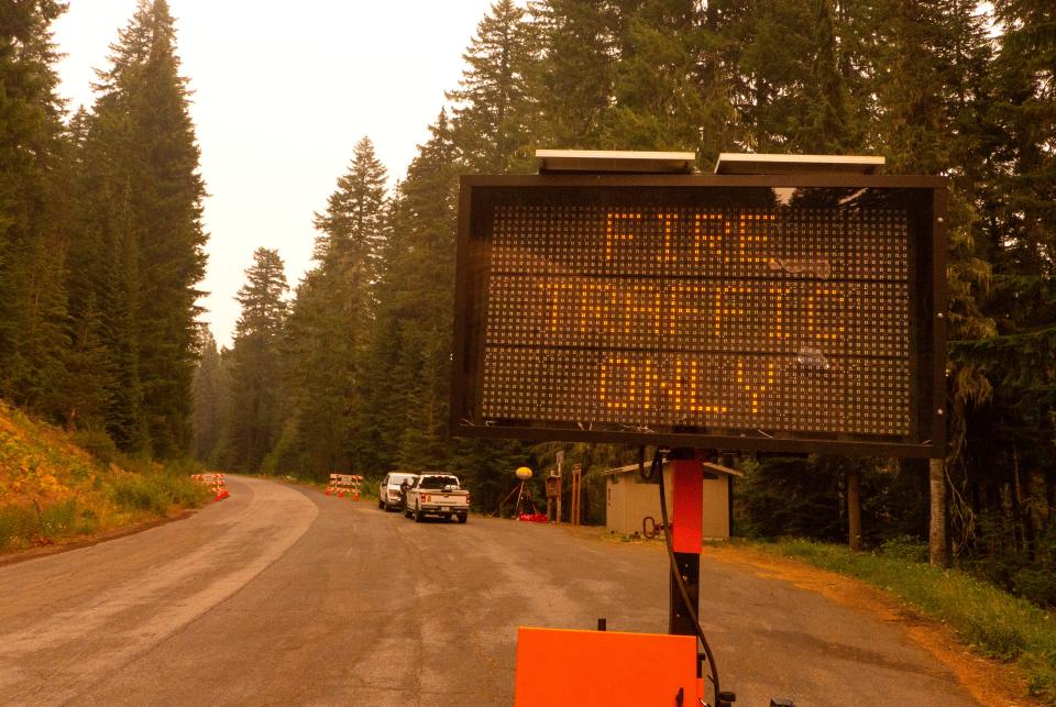
4 p.m. Friday: Willamette Highway 58 closed near Oakridge
The Oregon Department of Transportation reported around 4 p.m. Oregon Route 58, also known as the Willamette Highway, is closed due to fire activity between the east end of Oakridge, at milepost 37, and Crescent Lake, at milepost 70.
Travelers should take alternate routes and avoid the area.
Check TripCheck.com or call 5-1-1 for current road conditions.
3:30 p.m. Friday: Oakridge air quality rapidly declining
Air quality in Oakridge is now "hazardous," according to Oregon Department of Environmental Quality monitoring.
Oakridge, to the west of the 33,000-acre Cedar Creek Fire, went from the "very unhealthy" category of air quality to "hazardous" by mid-afternoon. "Hazardous" air is dangerous for anyone to breathe, regardless of their health status.
The primary air pollutant associated with wildfires is particulate matter released by burning forests.
There are several locations in Lane County serving as respite centers for people seeking to escape smoke and power outages, but Lane County Public Health spokesman Jason Davis said the county is not directing people to the Oakridge locations anymore because the area is now under a Level 2 evacuation notice.
Air quality in Eugene and Springfield also is declining. Monitors in those cities show the current air quality to be in the "moderate" category, considered "acceptable" to breath, but inching toward becoming unhealthy for sensitive groups.
—Adam Duvernay
2:15 p.m. Friday: Now all of greater Oakridge/Westfir under level 2 "be set" evacuation
Extremely hazardous fire weather conditions and increased fire activity have prompted another increase in evacuation levels for areas around the Cedar Creek Fire, Lane County announced. In addition to all previously issued evacuation notices remaining in effect, the Lane County Sheriff’s Office has issued the following evacuation level increases:
Level 2 - "be set" for the greater Oakridge, Westfir and High Prairie areas are now at level 2, both incorporated and rural areas.
Level 2 means: You must prepare to leave at a moment’s notice, and this may be the only notice that you receive to evacuate as needed.
A map of evacuation areas is available at www.LaneCountyOR.gov/CedarCreek.
— Michelle Maxwell
2 p.m. Friday: East wind event on track, peak comes afternoon for valley, overnight for Cascades
Meteorologists said Oregon’s east wind event is proceeding mostly as expected, with sustained wind speeds mostly in the 20 MPH range with gusts as high as 40 to 50 mph on exposed Cascade Range ridges across western Oregon.
Humidity is also extremely low across the state, fueling the extreme fire weather and statewide red flag warnings.
“We haven’t reached the time of max wind speeds yet,” National Weather Service meteorologist Rebecca Muessle said. “We’re still expecting things to ramp up for another few hours before we hit a peak in the Willamette Valley and it’s likely to be not until overnight that we’ll peak in the Cascades.”
The winds are expected to stay gusty through Saturday morning before tailing off in the afternoon and evening.
People can track real time wind speeds here.
— Zach Urness
1:30 p.m. Friday: Level 2 evacuation for area just south of Oakridge
The Lane County Sheriff's Office has increased the evacuation level to Level 2 "Get Set" for Hills Creek Reservoir area south of Highway 58 to Larison Cove and Greenwaters Park.
Level 2 means people must prepare to leave at a moment’s notice, as it may be the only notice they get to evacuate.
A map of evacuation areas is available at www.LaneCountyOR.gov/CedarCreek.
12:30 p.m. Friday: Cedar Creek Fire now 33,100 acres, next 24 hours may bring extreme growth toward Oakridge
In some ways the dice already has been rolled on the Cedar Creek Fire, and at this point, all firefighters can do is see where it lands.
The east winds have arrived on a fire that was at 33,100 acres overnight but was already growing Friday, bringing new evacuation levels outside Oakridge. The fire is going to move, for sure, but how far remains the key question for the next 24 hours.
The fire remains about 12 to 14 miles from Oakridge. The strongest winds are forecast to arrive Friday afternoon through Saturday morning. A level 2 evacuation order — meaning be ready to leave at any moment — was issued Friday morning for the High Prairie area northeast of Oakridge. Oakridge-Westfir remains on level 1, meaning “be prepared.”
“The east winds are pushing the fire west and we’re definitely going to have very, very difficult fire conditions until the end of the day Saturday,” Cedar Creek Fire spokesman Bud Sexton said.
“Suppression actions may be limited,” a Friday morning report said.
See the full story here.
— Zach Urness
Noon Friday: Updated outage times for PGE customers
Portland General Electric has put out updated times for outages to begin in certain areas:
Mt. Hood Corridor and Foothills (power is now off)
Columbia River Gorge (power is now off)
Oregon City (between noon and 2:30 p.m.)
Estacada (power is off)
Scotts Mills (power is off)
Portland West Hills (between noon and 2 p.m.)
Tualatin Mountains (between noon and 2 p.m.)
North West Hills (between noon and 2 p.m.)
Central West Hills (between noon and 2 p.m.)
Southern West Hills (between noon and 2 p.m.)
Silverdale/Corbett: (power is off)
Silver Falls areas (power is off)
— Alia Beard Rau
Noon Friday: Oakridge, surrounding schools dismiss early
Students at Oakridge School District and neighboring districts were sent home at 10:30 a.m. Friday following continued spread of the Cedar Creek Fire and power outages.
The district has kept families and community members updated through social media and alerts, monitoring the fire's progress.
As of Friday morning, the Cedar Creek Fire has covered 33,099 acres to the west and north of Waldo Lake, approaching Oakridge from the east. Local Oakridge officials announced a Level 2 evacuation notice, meaning residents must prepare to leave at a moment's notice. Level 2 evacuation is in effect for the High Prairie area, including all of High Prairie Road, Brock Road, Bar BL Ranch Road, Nubian Way, Mountain View Road and Huckleberry Lane.
"We will work with the emergency management team in any way possible to support our community during this stressful time," stated a post on the Oakridge School District's Facebook page.
The district also canceled all after-school activities, including a scheduled away football game.
McKenzie School District: McKenzie School District in Blue River released students at noon.
"We just lost power at school," stated a post on the district's Facebook. "We are getting things organized to send students home at noon today."
Crow-Applegate-Lorane School District: Crow-Applegate-Lorane School District also released students early Friday afternoon. In a public post, the district stated all students would be sent home after lunch services at 12:30 p.m.
The district assured that "everyone" was safe, but there will be no after-school programs. Currently, power is out at Applegate Elementary, and phones will be unavailable until Sunday.
— Miranda Cyr
10 a.m. Friday: Pacific Power continues to monitor wind conditions, anticipates shut-offs later today
Pacific Power officials said they are continuing to monitor the concerning weather system closely.
As of 9:30 a.m. Friday, early forecasted easterly winds near the Cascades and foothills were beginning to develop in the company’s service area.
As the weather system progresses throughout the day, the company is still anticipating Public Safety Power Shutoffs for specific communities and will provide advance notification to affected customers when possible before turning off their power.
The communities under monitoring and watch include parts of:
Polk County
Marion County
Linn County
Lincoln County
Tillamook County
Douglas County
Temporary community resource centers are available and will remain open Friday and Saturday until 10 p.m. (unless service is restored earlier).
For all non-emergency questions about the power shutoff, customers and the public should call Pacific Power at 1-888-221-7070.
8:32 a.m. Friday: Cedar Creek Fire grows to 33,099 acres, North Waldo, Islet campgrounds at risk
The Cedar Creek Fire didn’t grow a ton overnight, increasing to 33,099 acres, which is up from about 31,000 the day before.
However, the fire has spread down the eastern shoreline of the lake and North Waldo Campground is now within the fire perimeter and the fire border is very close to Islet Campground.
It’s not clear whether those areas have been impacted or protected by fire crews. But more information will be available when crews give a full morning briefing later on Friday.
8:17 a.m. Friday: Community centers open in Salem / Santiam Canyon area
Medical and community centers have opened for people whose power has been shut down in the areas outside Salem. Here's a list of them:
Medical device charging centers:
Santiam Hospital & Clinics: 1401 N 10th Ave., Stayton; Open 24 hours. Community members will need to check in at the emergency department.
Silverton Hospital; 342 Fairview St., Silverton; Open 24 hours. Community members will need to check in at the main entrance.
Community resource centers
Bethel Baptist Church, Aumsville; Services: Cooling center, snacks, charging stations, accessible restrooms, water; Location: 645 Cleveland St. Aumsville; Hours: 8 a.m. to 10 p.m. on Friday and Saturday; Phone: 503-749-2128; *No Pets
Stayton Public Library; Services: Cooling Shelter; Location: 515 N. 1st Ave. Stayton; Hours: Friday 11 a.m. to 5 p.m.; Saturday 10 a.m. to 7 p.m.; Phone: 503-769-3313. *No Pets
Foothills Church, Stayton; services: Air conditioning, accessible restrooms, water, charging stations; Location: 975 Fern Ridge Road, Stayton; Hours: Saturday from 2 p.m. to 7 p.m. Phone: 503-428-2591
Sankey Park, Sweet Home. Services: Charge devices, cooling station and access other amenities; Location: 877 14th Ave., Sweet Home; Hours: 8 a.m. to 10 p.m. on Friday and Saturday; Phone: 888-221-7070 to reach Pacific Power for more information.
Silverton Senior Center. Services: Air conditioned, charging station, accessible restrooms, water; Location: 115 Westfield Ave., Silverton; Hours: 9 a.m. to 9 p.m. Friday and Saturday. Phone: 503-873-3093. *Limited pet availability
Silverton Safeway. Services: water and ice, charging and Wi-Fi, portable restroom trailer and hand washing stations; Location: 301 Westfield St., Silverton. Hours: Safeway is open from 6 a.m. to 11 p.m.
10:30 p.m. Thursday: PGE power shutoff plans for 30,000 homes
Portland General Electric will shut down power to 30,000 homes across a sprawling area from the Columbia Gorge to Silver Falls early Friday morning.
PGE said it will shut down power in 12 areas. These are the locations and the estimated time the power shutoff will begin:
Mt. Hood Corridor and Foothills (shutdown will begin sometime between 3 a.m. and 6 a.m.).
Columbia River Gorge (5 a.m. and 8 a.m.)
Oregon City (8 a.m. and11 a.m.)
Estacada (3 a.m. and 6 a.m.)
Scotts Mills (5 a.m. and 8 a.m.)
Portland West Hills (10 a.m. and 1 p.m.)
Tualatin Mountains (10 a.m. and 1 p.m.)
Northwest Hills (10 a.m. and 1 p.m.)
Central West Hills (10 a.m. and 1 p.m.)
Southern West Hills (11 a.m. and 2 p.m.)
Silverdale (5 a.m. and 8 a.m.)
Corbett and Silver Falls areas (5 a.m. and 8 a.m.)
To search for a specific address on a PGE map, see this page.
"Crews will be standing by, and as weather conditions allow PGE, will begin to physically inspect power lines and equipment and make any repairs necessary to safely restore power," the utility said. "PGE will provide updates at least every 24 hours until all customers regain power through email, text, social media, press releases, and at portlandgeneral.com."
— Zach Urness
10:30 p.m. Thursday: Resource centers available
Power companies are opening community resource centers in areas expected to be impacted by power shutoffs.
Aumsville: Bethel Baptist Church, 645 Cleveland St.; open 8 a.m. to 10 p.m. Friday and Saturday, unless power is restored earlier.
Banks: Banks Jim’s Thriftway, 12350 NW Main St.; open 7 a.m. to 7 p.m. daily until power is restored.
Estacada: Estacada Baptist Church, 29101 SE Eagle Creek Road; open 7 a.m. to 7 p.m. daily until power is restored.
Glide: Glide High School, 18990 N. Umpqua Highway; open 8 a.m. to 10 p.m. Friday and Saturday, unless power is restored earlier.
Sheridan: Sheridan High School, 433 S Bridge St.; open 7 a.m. to 7 p.m. daily until power is restored.
Silverton: Silverton Safeway, 301 Westfield St.; open 7 a.m. to 7 p.m. daily until power is restored.
Sweet Home: Sankey Park, 877 14th Ave.; open 8 a.m. to 10 p.m. Friday and Saturday, unless power is restored earlier.
Welches: Welches Elementary School, 24901 E Salmon River Road; open 7 a.m. to 7 p.m. daily until power is restored.
— Alia Beard Rau
10 p.m. Thursday: Willamette National Forest bans all open fires
All open fires in Willamette National Forest were outlawed Thursday night as fire danger levels increased to "extreme" across the 1.8 million acres of national forest east of Salem and Eugene.
All campfires, charcoal or briquette fires, pellet fires or any other open fires are prohibited under the forest order. Campfires are banned in campground rings and in high-elevation wilderness areas.
Portable cooking stoves and lanterns using liquefied or bottled fuel are still allowed as they can be instantly switched off.
— Zach Urness
7:45 p.m. Thursday: EWEB announces 48-hour extended outage for 3,000
Eugene Water & Electric Board announced Thursday evening that about 3,000 customers in the McKenzie Valley from Oak Point up to Vida and down to Walterville will be without power from 5 p.m. Friday through Saturday evening.
Due to forecasted weather conditions creating extreme fire danger, in consultation with local emergency managers and fire officials, EWEB will enact Public Safety Power Shutoffs in its McKenzie Valley service territory.
Power outages will start as soon as 5 p.m. Friday, EWEB announced. Customers are advised to prepare for at least 48 hours without power.
Power outages will impact customers east of Hayden Bridge up to Vida, including the following areas:
Camp Creek and Upper Camp Creek
Cedar Flats
Deerhorn
Walterville
EWEB will restore service as soon as possible once weather conditions allow. Before re-energizing, crews will patrol lines and remove debris, make repairs if needed and will respond to emergency reports of lines down or other damage to the power system. Once that work is complete, EWEB will restore service.
Restoration is anticipated to take longer than typical.
Weather-related outages could happen outside of Public Safety Power Shutoff areas. The best time to prepare is now. Check that your outage kit is stocked and ready. Things to include are:
Flashlights or headlamps.
Battery-powered or hand-crank radio, fans.
Extra batteries.
Car chargers for cell phones and electronic devices.
Stored/bottled water for people and animals (especially if you rely on electricity to pump water).
Frozen cold packs or water frozen in bags or plastic bottles (keep ready in your freezer).
Emergency phone numbers.
Visit eweb.org/wildfire for more information.
— Michelle Maxwell
7:15 p.m. Thursday: Pacific power updates shutoff times
Pacific Power has updated its estimated shutoff times, although it warns the times could be sooner if conditions warrant. Wind-prone rural areas deeper in the mountains will be shut off first.
Douglas County: 6 a.m. Friday from Toketee Falls east to Diamond Lake, with additional areas added at about 4 p.m.
Linn County: 6 a.m. Friday, Sweet Home east along Highway 20, with additional areas added at about 4 p.m.
Marion County: 6 a.m. Friday, Lyons east along Highway 22, with additional areas added at about 4 p.m.
Lincoln County: 10 a.m. Friday.
Tillamook County: 10 a.m. Friday.
Polk County: 10 a.m. Friday.
— Alia Beard Rau
7 p.m. Thursday: Lane Electric announces extended power shutoff
Due to the extreme risk of wildfire in its service territory and continued forecast of potentially strong winds, Lane Electric Cooperative announced Thursday evening it will implement a public safety power shutoff starting at 5 p.m. Friday through the evening of Saturday.
The outage will impact nearly all Lane Electric members, but the city centers of Oakridge, Lowell, and Veneta will continue to have power to provide key services.
"This decision was made after carefully considering current wildfire risk, predicted weather forecasts, consulting emergency officials, and through conversations with local utilities," the announcement said.
With high heat in the forecast, the utility is encouraging people to plan accordingly for the extended outage.
Crews will begin power restoration during daylight hours on Sunday morning.
For tips from Lane Electric for preparing for outages, go to laneelectric.com/outages/power-outage-tips
— Michelle Maxwell
Preparation for outage:Tips to prepare for potential power shutoffs in Oregon during extreme wildfire danger
6 p.m. Thursday: Level 1 (be ready) evacuation issued for Oakridge, Westfir areas
Increased fire activity has prompted an increase in evacuation levels for greater Oakridge and Westfir areas around the Cedar Creek Fire.
The evacuation includes greater Oakridge and Westfir areas. This includes High Prairie and other rural outlying areas surrounding Oakridge and Westfir.
Read about other preparations:High winds put Oregon wildfire watchers on alert, especially for Oakridge area
Level 1 means:
Be aware of the danger that exists in the area, monitor emergency services websites and local media for information.
This is the time for preparation and the precautionary movement of people with special needs, mobile property and (under certain circumstances) pets and livestock.
Make sure that you have adequate fuel to evacuate as needed.
Officials are asking residents to keep cell phones and any other devices used to receive emergency alerts charged.
In addition, all previously issued evacuation notices remaining in effect can be found at www.lanecounty.org.
— Michelle Maxwell
5 p.m. Thursday: Schools closed
Several schools have announced they will be closed Friday due to expected power outages:
Mari-Linn School.
Santiam Canyon School District.
Silver Falls School District.
Sweet Home School District.
— Alia Beard Rau
4 p.m. Thursday: The latest power outages
Pacific Power, Portland General Electric and Consumers Power. Inc. announced they may shut off power due to anticipated high winds to decrease the risk of power lines being knocked down and starting fires.
In September 2020, Pacific Power was blamed for many of the Labor Day wildfires that ignited in the windstorm after power lines were knocked down. Numerous lawsuits blaming the utility for the fires have been filed, including a class action suit of nearly 2,500 properties, many in the Santiam Canyon.
The power companies now have plans in place designating areas where they may cut off power during such wind events. The plans are called Public Safety Power Shutoff plans.
Check here for the latest power outage locations:
— Alia Beard Rau
This article originally appeared on Salem Statesman Journal: Wildfire updates: EWEB restores power, evacuation levels reduced

