Live updates: Ice storm warning for Tri-State in effect from Wednesday night through Friday
The freezing rain and snow that fell in Evansville and Henderson throughout much of Thursday could make an appearance again Friday morning, with possible accumulation of up to an inch more.
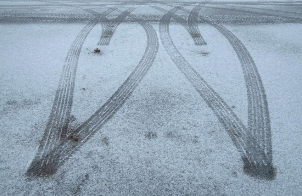
Officials also expect continued bad road conditions in the overnight and early-morning hours as temperatures fall to the lower 20s. Tree damage and power outages remain possible.
And the storm's accumulation won't be melting right away, with forecasters calling for temperatures as low as 3 degrees and no higher than the mid-20s for Friday and Saturday.
Sunday is expected to warm up slightly, with a high of 38 degrees and a low of 19.
An ice storm warning from the National Weather Service office in Paducah, Kentucky, remains in effect for the entirety of Southwestern Indiana and Western Kentucky through 6 a.m. Friday.
Evansville Vanderburgh School Corporation, Evansville Catholic schools, Warrick County schools, Signature School, Henderson County Schools, the University of Evansville and the University of Southern Indiana have canceled classes for Friday. Nearly every area school was shuttered Thursday.
We'll continue to post updates on power outages, ice and snow accumulations, and closures here.
Evansville weather: Ice storm warning issued for Tri-State
Evansville, Henderson news updates
Friday, 8:16 a.m.: Some good news north of the river. CenterPoint's outage map reflects only two power outages as of 8:15 a.m. in its service area, reflecting o
Friday, 8:01 a.m.: It's still a tough one out on the roads this morning in the Evansville area.
Warrick: Most secondary roadways are completely snow and ice covered. This picture is from Lynch Road near SR62. pic.twitter.com/WMlx564UGo
— Sgt. Todd Ringle (@ISPEvansville) February 4, 2022
Thursday, 8:14 p.m.: At least 760 Evansville residents are without power, according to CenterPoint Energy.
Thursday, 6 p.m.: The University of Southern Indiana campus is closed Friday. Classes and all events are canceled.
Thursday, 5:13 p.m.: Sgt. Todd Ringle of the Indiana State Police tweeted that I-69 in Gibson County is "completely snow covered, slick, and hazardous." ISP asks anyone driving on I-69 to reduce speed and increase distance from vehicles ahead of you.
Thursday, 4:23 p.m.: More than 3,500 people were without power as of Thursday afternoon, the Evansville Emergency Management Agency said.
As of 4 p.m., there were 22 outages affecting 3,521 electric customers in Vanderburgh County.
Thursday, 4:11 p.m.: All classes, services and events for Ivy Tech will be virtual on Friday, the school announced.
That includes the Evansville, Princeton and Tell City campuses. All buildings will be closed.
Thursday, 3:48 p.m.: The Civic Center will open late Friday. City and county government offices will open at 10 a.m.
Both circuit and superior courts will be closed, however. The clerk's office will be as well.
Civic Center Employees
Building Authority will provide a shuttle service from the Back 40 parking lot:
9:30 - 10:30 a.m.
Shuttles will be waiting in the Back 40 lot.
3:30 - 5:15 p.m.
Shuttles will pick up departing employees in front of the Civic Center. https://t.co/1Eco0ehPAw— Noah Stubbs (@NoahStubbs) February 3, 2022
Thursday, 3:45 p.m.: The University of Evansville is closed Friday, school officials said in an alert to students and staff.
All in-person classes and scheduled events are canceled. All buildings will be locked except for the Ridgway University Center, which will be open for meals.
Thursday, 3:14 p.m.: City of Henderson public offices will remain closed Friday.
Essential services will continue. Sanitation will attempt its usual Friday routes. Rapid Transit will not be available Friday; the transit situation will be evaluated Friday afternoon to determine status for Saturday.
Thursday, 3 p.m.: Henderson County Schools will be closed Friday with virtual instruction required. All childcare locations are closed and there will be no meal pickup.
Thursday, 2:50 p.m.: State officials are explicitly warning people not to travel in Southwestern Indiana.
Vanderburgh County's travel status has now changed to a “watch,” according to the Indiana Department of Homeland Security's website. “Watch” status means conditions are threatening to public safety. Only essential travel is recommended.
Posey and Warrick counties are also in "watch" travel status. Gibson is in “warning” status, the highest level of local advisory.
Thursday, 2:42 p.m.: More closures.
Evansville Catholic schools and the Evansville Vanderburgh Public Library system will be closed Friday. EVPL closed early on Thursday, as well.
Thursday, 2:21 p.m.: Power outages are climbing in the Evansville area.
According to CenterPoint's outage map, more than 900 people were without electricity on the city's Southwest Side, near Claremont Avenue. There was another sizable outage just off Middle Mount Vernon Road (488 customers), as well as scattered issues throughout the area.
Thursday, 2:07 p.m.: EVSC is closed Friday.
"Once again, teachers will post pre-recorded virtual lessons and assignments in Google Classroom by 10:00 a.m. tomorrow, so students will be able to access these lessons at any point after that time," officials said in an alert.
Thursday, 1:58 p.m.: Just hours before showtime, country singer Morgan Wallen postponed his concert at the Ford Center.
The 7 p.m. show was set to be the opening date on his U.S. tour, appropriately titled "Dangerous," considering the conditions.
The show is rescheduled to April 14, according to his verified Instagram account. Wallen also rescheduled shows in Charleston, West Virginia, and Allentown, Pennsylvania, due to weather.
Trucks emblazoned with Wallen's name had been parked in the city's back 40 lot for days, and the singer was already in town yesterday, rehearsing for the show.
Several would-be concertgoers took to the Ford Center's Facebook page to complain.
"This should have been called yesterday!" one wrote. "We drove 8+ hours and made it to town. Now we wasted vacation and a hotel stay."
Thursday, 1:40 p.m.: More than 4,000 households in Western Kentucky are without power, according to Kentucky Emergency Management Director Michael Dossett.
“The storm front is impacting our westernmost counties at this time with icing beginning at minimum prediction levels, with associated power outages," Dossett said. "...This event will play out well into the evening and nighttime hours. This system is still on track to be an extremely hazardous, life-threatening event."
Our crews will do everything that can be done to make roadways passable, but the best advice remains for the public to stay off the roads,” Kentucky Transportation Cabinet Secretary Jim Gray said.
Thursday, 1:13 p.m.: CenterPoint's outage map again listed more than 3,000 people without power in Parkers Settlement in Posey County.
It was the biggest outage of the afternoon so far. Only 10 or so Evansville residents were powerless as of 1 p.m.
Thursday, 12:43 p.m.: As temperatures continue to drop this afternoon, Kentucky state troopers in Henderson warned that road conditions are deteriorating quickly and advised motorists to stay home.
According to KSP spokesman Trooper Corey King, the storm is progressing east and beginning to freeze the Audubon Parkway and the Green River Bridge.
As of 10 a.m., Henderson police had responded to two crashes – one slide-off near the Twin Bridges and another on the Audubon Parkway. Another vehicle slid off the roadway near the Zion exit and came to rest upside down. None of the wrecks resulted in injuries.
🚨HENDERSON Co🚨
Troopers working a wreck on the Audubon Parkway near the Zion exit.
No one injured.
Slow down, ice is forming on main surfaces@kystatepolice pic.twitter.com/tziSsvKVe4— Trooper Corey King (@KingofKSP) February 3, 2022
“If the trend continues the way we anticipate, if we start seeing the freezing rain and the continued contact or the freeze on contact, you’re going to start seeing more and more slide-offs…, wrecks (and) rear-ends,” King said.
Fallen trees and tree limbs are also expected to impede roadways later this afternoon. Drivers are encouraged to stay alert.
If you are involved in a wreck or stop to help someone who is, King says to prepare your car with essential items such as blankets, a fully charged cellphone, a bottle of water and a full tank of gas.
“You want to use that motor (and full tank) to help keep the heat in your vehicle," he said. "If you slide off the roadway and everything’s OK ... go check your tailpipe and look underneath your vehicle to make sure there’s no obstructions to your exhaust because you don’t need those deadly gases getting in your vehicle."
Thursday, 12:26 p.m.: Power outages were starting to climb in Posey County.
CenterPoint reported more than 2,500 customers without electricity in Parker's Settlement, as well as 538 in Wadesville.
They were resolved quickly, according to the outage map. Areawide losses of power still remain low.
Thursday, noon: "Roads are definitely slick wherever you go, and conditions are deteriorating quickly," Indiana Department of Transportation spokesman Jason Tiller said on a video posted to INDOT Southwest's Twitter page.
Here's the latest #INDOTWinterOps update. We have about 140 #YellowTrucks out! pic.twitter.com/qD2Is7EJdP
— INDOT Southwest (@INDOTSouthwest) February 3, 2022
He said areas to the north were getting hit hard with snow, while the majority of precipitation in Evansville continued to be freezing rain.
He warned that any roads that manage to thaw this afternoon will refreeze when temperatures plummet this evening.
Thursday, 11:04 a.m.:
Between midnight and 11 a.m., Troopers at Evansville have responded to:
▪️4 property damage crashes.
▪️4 Slide offs
▪️2 Assist motorist calls
Majority of incidents this morning were on I-64.
Traffic continues to be light. We appreciate those that decided to stay home today. pic.twitter.com/BBeaHGHyxq— Sgt. Todd Ringle (@ISPEvansville) February 3, 2022
Thursday, 10:52 a.m.: Evansville Regional Airport saw several flight cancelations Thursday morning, but they all came at the discretion of the airlines.
“Sometimes (airlines) are reluctant to bring an aircraft into an ice-impacted area,” spokeswoman Leslie Fella said.
Some flights to Chicago, Charlotte, Atlanta and Dallas Fort-Worth were called off Thursday morning, while others remained on schedule. Travelers can track the status of their flights here.
None of the cancelations had anything to do with conditions at EVV. Safety crews had whipped the runway into “excellent condition,” Fella said.
Thursday, 10:40 a.m.: From south of the Ohio River: Henderson Municipal Power and Light reported that the ice so far today hasn’t been significant enough to cause outages. “We’re in good shape for now,” said Brad Bickett, power supply director.
2009 comparison: Ice storm is headed for Evansville and Henderson. Here's how it compares to 2009 disaster.
Thursday, 10:22 a.m.: NWS meteorologist Christine Wielgos said we’re seeing mostly freezing rain and sleet, but that should start to change over to snow this afternoon.
Evansville could see 1-2 inches of powder, with higher amounts more likely in Gibson and Pike counties, as well as across the state line in southeastern Illinois.
Ice accumulations totaling around one quarter-inch were still expected across southwestern Indiana, with higher totals to the east in Spencer and Daviess counties. Owensboro and Madisonville in Kentucky will see more ice as well.
NWS is monitoring possible changes in the system, specifically colder layers of air that could alter the amount of snowfall.
Thursday, 10:17 a.m.: Your trash isn't getting picked up today in Evansville. They'll let you know about tomorrow.
ALERT: Trash & Recycling collections suspended. Republic Services will re-evaluate the situation for Friday’s routes. Follow @EWSU for updates. @EvansvilleINGov #EWSU pic.twitter.com/dVPiNv7XLc
— Evansville Water Sewer Utility (@EWSUtility) February 3, 2022
Ice and snow totals: Here's how much snow and ice have been reported in Evansville, Henderson areas
Thursday, 9:36 a.m.: CenterPoint Energy, which provides power and natural gas to Southwestern Indiana, reported that its system was performing well despite the icy conditions, and the utility was not experiencing widespread outages.
“As soon as we change to snow, the threat for distribution outages will significantly decrease,” said Natalie Hedde, a utility spokeswoman.
Thursday, 9:30 a.m.: Mayor Lloyd Winnecke was riding with Evansville road crews this morning. Conditions, they said, are deteriorating.
Riding with street crews this morning.
Our drivers say conditions have deteriorated in the last couple of hours.
Please use caution. pic.twitter.com/ebpBdRsVCu— Mayor Lloyd Winnecke (@MayorWinnecke) February 3, 2022
Thursday, 9:05 a.m.: NWS Paducah reported a tenth of an inch of ice accumulation in Newburgh, with an additional tenth-inch of ice causing sagging on tree limbs. A quarter-inch of ice was reported in Evansville.
So far, power outages have been minimal. As of 9 a.m., CenterPoint listed eight customers without electricity: six of which were in Warrick County.
Thursday, 9:01 a.m.: The Kansas concert scheduled for The Victory on Thursday night is postponed. The wayward sons will have to carry on somewhere else tonight.
Thursday, 8:05 a.m.: It's getting serious.
Donut Bank closed today. Weather.
— John Martin (@ECPjohnmartin) February 3, 2022
Stuck inside?: Warm, comforting bread pudding recipes for winter weather from four Evansville-area bakers
Thursday, 8:03 a.m.:
Warrick: Current conditions on I-64 at the 33mm. Roads are ice covered. pic.twitter.com/oo0xZvPXbN
— Sgt. Todd Ringle (@ISPEvansville) February 3, 2022
Thursday, 8:02 a.m.: The Kentucky State Police are reporting slick conditions on Henderson County highways, and are responding to a slide-off on U.S. 41 at U.S. 60. Sleet is falling there, the state police said, and road conditions are deterioriating.
Thursday, 7:30 a.m.: The Vanderburgh County Emergency Management Agency relayed a spotter report that reported a mix of freezing rain and sleet in the northern parts of Evansville, with ice accumulating on cars. Roads are now slick from ice.
Thursday, 6:36 a.m.: The Indiana State Police report that snow is beginning to fall along Interstate 64 near the Indiana-Illinois state line.
Posey: Snow is now falling near the IN/IL state line. I-64 is becoming snow covered. Drive responsibly! pic.twitter.com/lUE7seSn9i
— Sgt. Todd Ringle (@ISPEvansville) February 3, 2022
Thursday, 5:20 a.m.: Vanderburgh County's travel status has now changed to an "advisory," according to the Indiana Department of Homeland Security's website. An advisory is the lowest level of local traffic advisories, and means that routine travel could be restricted because of the effects from the ice storm. Posey, Warrick and Gibson counties are also in "advisory" travel statuses.
Wednesday, 4:44 p.m.: Henderson Mayor Steve Austin issued a State of Emergency executive order for Henderson, with all offices closed and only essential city government services still operating Thursday. The city will re-evaluate the situation early Friday morning.
Austin's order closely follows a statewide order issued by Kentucky Governor Andy Beshear, who called the weather system "the real deal." Beshear signed an additional order Wednesday which is described as "protecting Kentucky residents from price gouging" on essentials such as gasoline and food in the coming days.
Wednesday, 4:17 p.m.: Approximately 240 Indiana National Guardsmen have been activated "to assist state and local civil authorities to prevent the loss of life due to severe winter weather conditions throughout the Hoosier state," according to a news release.
They will "man command and control nodes in the northern, central and southern parts of the state as well as form highway assistance teams to help stranded motorists," according to the release.
Evansville-area school closings
Southern Indiana power outages
For information on power outages in Southern Indiana, click here to visit the CenterPoint outage page.
For Western Kentucky outages, click here for the KU/LG&E outage map.
Indiana, Kentucky road conditions
Here's where you can find information regarding safety tips for traveling in winter weather.
Indiana:
Indiana's real-time traffic conditions. You can also call 800-261-7623.
County travel advisories and statuses
Kentucky:
Kentucky's real time traffic information. You can also call 866-737-3767.
Contact Ray Couture at rcouture@courierpress.com or on Twitter @raybc94
This article originally appeared on Evansville Courier & Press: Live Evansville-area weather updates: Winter storm totals, closures

