Weather: One death reported after tornado in Barnsdall, Oklahoma
For the latest updates on recovery efforts and power outages, find our Tuesday coverage here.
Only a week after dozens of deadly tornadoes tore across Oklahoma, the state faced another bout of storms Monday that caused wind damage in the Oklahoma City area and significant damage in northeast Oklahoma.
The storms passed through western and central Oklahoma without producing those strong tornadoes, but northeastern Oklahoma communities of Barnsdall and Bartlesville experienced a damaging tornado that caused injuries. It was the second time in about a month that a tornado hit Barnsdall.
The line of storms finally passed through OKC after midnight. Straight-line wind caused damage in Moore, and a possible tornado struck south OKC on a path toward Choctaw. Information about damage or injuries from this storm was not immediately available.
As a precaution, numerous institutions closed early on Monday and canceled events, including the University of Oklahoma, OKC Public Schools and the Oklahoma County courthouse.
Tornado watch canceled for OKC area
The National Weather Service, at 1 a.m. Monday, said the tornado watch for the Oklahoma City area had been canceled and that the severe threat had ended for the night.
1:00 am - The tornado watch has been canceled for:
-Wichita Falls
-Lawton
-Norman/Moore
-Oklahoma City
The severe threat has ended for the night.— NWS Norman (@NWSNorman) May 7, 2024
- Ryan Sharp
Report: One dead after tornado in Barnsdall
Tulsa TV station KOTV was reporting one person had died after a tornado hit Barnsdall late Monday. KOTV said Osage County Sheriff Eddie Virden confirmed the death.
Washington County Emergency Manager Kary Cox said early Tuesday that Bartlesville had taken a direct hit from a tornado late Monday.
Cox was urging residents in the area to stay off the roads to allow first responders to be able to get to those affected by the storms.
Barnsdall, with a population a little over 1,000, is about 140 miles northeast of Oklahoma City. Bartlesville is 20 miles northeast of Barnsdall.
- Ryan Sharp
Dangerous storms have moved out of Oklahoma City
As of 12:15 a.m., all severe storms have moved out of Oklahoma City. A line of thunderstorms continued east of Norman. No additional severe storms are expected for Oklahoma County.
-Dale Denwalt
Power lines down in OKC, use caution
Areas in the Oklahoma City metro area that were struck with high wind and a possible tornado have power lines on the ground. Use caution when driving through areas that were impacted by tonight's storms.
OG&E is reporting at least 26,000 of its customers are without power just after midnight, including thousands of residences and businesses in Moore. Additional outages were reported in Midwest City and Choctaw.
-Dale Denwalt
Possible tornado northeast of Choctaw
A possible tornado indicated on radar continued northeast of Choctaw. This storm moved through Moore, Oklahoma City and Midwest City before reaching eastern Oklahoma County.
The storm is moving fast, about 60 miles an hour, according to meteorologists with News 9. It will continue northeast in Lincoln County.
-Dale Denwalt
Tornado warning in south OKC, Del City, Midwest City
The National Weather Service issued a tornado warning for Oklahoma County, which includes the southern parts of Oklahoma City. The warning includes Midwest City, Valley Brook, Del City, Choctaw and Harrah.
-Dale Denwalt
Damaging winds in Moore
A severe storm moving into the Oklahoma City metro area is causing power flashes from strong wind. News 9 storm chaser Tom Pastrano reported on air that he observed power flashes and hail.
The region is under a severe thunderstorm warning, and NWS Norman cautioned that wind could reach 80 miles an hour.
-Dale Denwalt
OKC under severe thunderstorm warning
A severe storm warning has been issued for Oklahoma County west of Interstate 35. The warning includes Edmond, Oklahoma City, Moore, Norman and communities to the west, and will continue until at least 12:15 a.m.
The National Weather Service reported a strong storm was moving east toward the OKC area.
Severe Thunderstorm Warning including Oklahoma City OK, Yukon OK and Bethany OK until 11:30 PM CDT. This storm will contain wind gusts to 70 MPH! pic.twitter.com/uXDNOT8pr0
— NWS Severe Tstorm (@NWSSevereTstorm) May 7, 2024
Just northeast of Oklahoma City near Chandler, a severe storm capable of producing a tornado is moving east toward Stroud. NWS Norman issued a tornado warning for that storm.
Chandler - A potentially tornadic storm is headed your way. Take shelter now! Do NOT wait to see it coming! https://t.co/BQNLHx58NI
— NWS Norman (@NWSNorman) May 7, 2024
-Dale Denwalt
Power outages across Oklahoma
Severe storms, including tornadoes, has caused more than 11,000 customers of OG&E and PSO to lose power.
Most of the outages are around the Barnsdall and Bartlesville areas where a tornado passed through the cities. Highway access to Barnsdall is currently closed, and officials are warning people to stay away.
-Dale Denwalt
Storm approaching OKC turns severe
A severe thunderstorm warning was issued for a storm near Alfalfa in Caddo County. This storm is moving east-northeast toward the Oklahoma City metro area.
Severe Thunderstorm Warning including Binger OK, Eakly OK and Gracemont OK until 11:15 PM CDT pic.twitter.com/raEVCbdpd7
— NWS Severe Tstorm (@NWSSevereTstorm) May 7, 2024
-Dale Denwalt
Tornado emergency for Bartlesville, Barnsdall
National Weather Service in Tulsa reported a life-threatening tornado is approaching Bartlesville and Dewey.
Tornado Emergency continues for Bartlesville OK, Dewey OK and Barnsdall OK until 10:15 PM CDT pic.twitter.com/VAT73VYmXb
— NWS Tornado (@NWStornado) May 7, 2024
This tornado struck Barnsdall in Osage County, kicking up debris that could be seen on radar. Storm chaser Brandon Copic's live stream showed significant damage in Barnsdall, including damaged homes.
Scanner traffic indicated a call for mutual emergency aid in Barnsdall to help rescue someone trapped in their home.
-Dale Denwalt
New storms forming in southwest Oklahoma
At least one thunderstorm has begun to form near Hobart in southwestern Oklahoma, according to National Weather Service radar data.
Because this region of Oklahoma hasn't yet seen storms today, this cell does not have to compete with others as it grows.
945 pm - We're watching the area from near Rocky to near Quanah, where satellite shows attempts at storm development.
Recent high-res model guidance suggests that these storms will struggle to develop, but the environment remains very dangerous. We'll watch them closely. pic.twitter.com/u4uSxXyzZV— NWS Norman (@NWSNorman) May 7, 2024
-Dale Denwalt
Tornado confirmed in Osage County
A tornado was spotted in Osage County east of Hominy and approaching Barnsdall. This tornado appears to have caused damage. The storm is moving northeast and will eventually reach Bartlesville.
Tornado confirmed in SE Osage County. Debris being lofted into the radar signal E of Hominy, moving toward Barnsdall and eventually Bartlesville. #okwx pic.twitter.com/qR2bhgFzbI
— 𝘑𝘢𝘮𝘦𝘴 𝘈𝘺𝘥𝘦𝘭𝘰𝘵𝘵 📡🌪️🤓🍷🏴☠️ (@jamesaydelott) May 7, 2024
The National Weather Service issued a tornado warning emergency in advance of the storm passing over Barnsdall.
-Dale Denwalt
Flash floods could impact Kingfisher
Kingfisher County, which is known for a history of devastating floods, is currently under a flash flood warning until just after midnight.
The warning extends in a line from Weatherford to Stillwater.
Flash Flood Warning including Stillwater OK, Watonga OK and Kingfisher OK until 12:15 AM CDT pic.twitter.com/hzX4tqZMuI
— @NWSFlashFlood (@NWSFlashFlood) May 7, 2024
-Dale Denwalt
Tornado warning for storm west of Okarche
NWS Norman issued a tornado warning for a storm near Greenfield in Blaine County and northern Canadian County.
The storm is moving east toward Okarche. The warning is active until 9:45 p.m. This is the supercell that will move into the Oklahoma City metro area.
Tornado Warning including Okarche OK and Greenfield OK until 9:45 PM CDT pic.twitter.com/kBTtS3DFOM
— NWS Tornado (@NWStornado) May 7, 2024
A second tornado warning was issued for a storm near the city of Cleveland in northeastern Oklahoma. That storm is moving northeast toward Barnsdall.
-Dale Denwalt
Severe weather threat continues after dark
A line of severe storms, some of them supercells with circulation, continues to move east-northeast. The storms have so far remained outside of the Oklahoma City metro area.
The south end of the storm is along Interstate 40 and will likely reach Oklahoma City, Edmond and Guthrie areas between 9:15 and 9:30 p.m. Farther north, the storms extend into Kansas.
All active tornado warnings have expired, but additional alerts are likely until early Tuesday morning.
A line of severe storms continues across our area this evening, with potential for redevelopment overnight as a cold front moves in. Here's the latest timing. pic.twitter.com/jvocnJKB6s
— NWS Norman (@NWSNorman) May 7, 2024
-Dale Denwalt
Tornado confirmed near Covington, Oklahoma
At 8 p.m., NWS Norman reported a confirmed tornado located near Covington. Residents in Hayward or Lucien are urged to take shelter now.
-Cheyenne Derksen
Moments ago Brett Adair had a tornado develop at close range to him just south of Covington, Oklahoma. Join live on the Live Chasing App, on the web at https://t.co/c9enU4hWhZ, or on the Live Storms Media Youtube channel!
Hwy 74 and Flynn Road.
(Lat 36.26, Lon -97.59)… pic.twitter.com/w2pmj0zCY8— Live Storms Media (@LiveStormsMedia) May 7, 2024
Storms trigger power outage south of Enid, Oklahoma
OG&E's Outage Map shows at least 1,900 customers without power in southern Garfield County. The outage includes communities of Drummond, Waukomis and Bison.
The storm has produced multiple lowerings and is rain-wrapped, making it impossible to see. A spotter with the Garfield County Sheriff's Office reported a tornado on the ground and debris near Douglas.
-Dale Denwalt
New tornado warning issued west of Oklahoma City
The National Weather Service issued a tornado warning for Custer and Blaine Counties in western Oklahoma. The supercell is just a few miles north of Interstate 40 moving east-northeast.
Tornado Warning including Arapaho OK, Custer City OK and Indianapolis OK until 8:15 PM CDT pic.twitter.com/FT4LejBt3F
— NWS Tornado (@NWStornado) May 7, 2024
-Dale Denwalt
Funnel has crossed Highway 81 at Bison
A possible tornado has passed over Bison in the past few minutes, heading northeast toward Fairmont. According to scanner traffic from the Garfield County Sheriff's Office, tornado sirens in Fairmont are sounding.
Softball-size hail has been spotted from this storm. There are no reports of serious damage at this time.
-Dale Denwalt
Tornado has formed near Okeene
A tornado has formed southeast of Okeene, moving east-northeast.
Live video by News9's Val Castor showed the early stages of the tornado as it reached the ground at about 6:45 p.m.
This storm is currently under a tornado warning that includes Waukomis and Hennessey, which are farming communities south of Enid.
-Dale Denwalt
Storm chaser @CoreyGerkenWX had a fantastic view of the tornado-warned supercell west of Hennessey, Oklahoma a few moments ago. #OKwx pic.twitter.com/ZGKq6WWp2P
— RadarOmega (@RadarOmega) May 6, 2024
National Weather Service updates
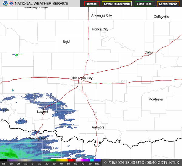
Live radar Oklahoma weather
Weather alerts: See where tornado watch, tornado warnings issued
Tornado watch vs tornado warning: What's the difference, which is worse?
When there's a tornado watch: Be prepared — tornadoes are possible in and around the area mentioned in the watch. Be ready to act quickly.
When there's a tornado warning: Take action now. A warning means someone saw a tornado or one was indicated by weather radar. Under a tornado warning, there's imminent danger to life and property. Everyone should move to an interior room on the lowest floor of a sturdy building and avoid windows.
NWS:How to prepare for a tornado
-Cheyenne Derksen
Storms will produce large hail
One of the major risks with today's severe weather will be large hailstones that form in the large supercells rumbling across the state.
Meteorologist Sean Waugh shared a photo of this stone found just south of Canton.
Just shy of 3” stone, severely melted, on OK58 3 mi south of Canton. @NWSNorman pic.twitter.com/kKEUdLvIkT
— Sean Waugh (@MesonetMan) May 6, 2024
Hail can cause property damage and injuries.
-Dale Denwalt
Tornado potential increases after 6 p.m.
In a message to its followers on social media, the NWS office in Norman issued a reminder that the forecast this evening has not changed.
The chance of tornadoes forming is greatest in the evening hours, especially after dark tonight.
5:33pm - IMPORTANT - our message has not changed! We still expect the tornado potential to increase after 6:00 pm and persist well into the evening hours. The storms in NW OK are moving into a more favorable environment. We are not done. We're just getting started.
— NWS Norman (@NWSNorman) May 6, 2024
As of 5:35 p.m., a line of severe thunderstorms was in western Oklahoma moving northeast. The only tornado warning in Oklahoma is for the storm west of Enid near Cleo Springs. NWS extended the tornado warning until 6:30 p.m.
Tornado Warning including Enid OK, Helena OK and Lahoma OK until 6:30 PM CDT pic.twitter.com/WOCLEd2XPO
— NWS Tornado (@NWStornado) May 6, 2024
-Dale Denwalt
Tornado warning includes Alva
The National Weather Service issued a tornado warning for several small communities in northwestern Oklahoma for a storm approaching Alva.
Tornado Warning including Alva OK, Waynoka OK and Dacoma OK until 5:15 PM CDT pic.twitter.com/DhoqOb2Olz
— NWS Tornado (@NWStornado) May 6, 2024
The storm is currently over Woods and Woodward Counties, moving east-northeast. Multiple tornado warnings are expected today throughout the evening. A PDS tornado watch exists for 41 Oklahoma counties, and includes the Oklahoma City metro area.
-Dale Denwalt
Waffle House index? No, Waffle House didn't close today
Numerous posts on X (formerly Twitter) claim that Waffle House locations in today's affected storm area had closed, hearkening back to the famous Waffle House Index that is an unofficial benchmark for the impact of a natural disaster, like a hurricane, which has the ability to affect corporate logistics and local store personnel across a wide area.
The index is a real thing, but there's no evidence that the 24/7 restaurant chain has activated any emergency plans on Monday. A phone call to the headquarters in Georgia went unanswered after business hours, and there are no storm-related posts on Waffle House social media.
When an Oklahoman reporter visited a local Waffle House Monday afternoon, it was indeed still open. Asked about the rumors they would be closing, one employee laughed at the idea. Customers can still order the full menu.
In fact, as the National Weather Service has already said, many people won't even see a severe storm today.
-Dale Denwalt and Jessie Christopher Smith
National Weather Service updates severe weather timeline as storms enter Oklahoma
The National Weather Service in Norman has issued a new storm timeline for parts of Oklahoma, as storms entered the western part of the state.
Just before 3:30 p.m. Monday, a severe thunderstorm warned storm was heading towards Woodward, Mooreland and Arnett.
Storms were predicted to enter central and central-northern Oklahoma as early as 4 p.m., but most likely around 5 p.m., before traveling towards the Oklahoma City metro.
Our latest thinking on storm timing has changed slightly. We are anticipating a later start to storms for most areas. Find your location on the map below to see when you can expect storms. #okwx #texomawx pic.twitter.com/e6A86DvyMq
— NWS Norman (@NWSNorman) May 6, 2024
- Jana Hayes
Oklahoma PDS tornado watch issued for 41 counties
The National Weather Service has issued a "Particularly Dangerous Situation" tornado watch for 41 counties in Oklahoma until 11 p.m., including cities like Woodward, Enid, Ponca City, Stillwater, Oklahoma City, Norman, Clinton, Altus, Lawton, Ardmore and Ada.
According to the National Oceanic and Atmospheric Association weather glossary, "the Particularly Dangerous Situation (PDS) wording is used in rare situations when long-lived, strong and violent tornadoes are possible."
A Particularly Dangerous Situation (PDS) Tornado Watch has been issued until 11 PM CDT. #okwx #texomawx pic.twitter.com/1LA4a6es4O
— NWS Norman (@NWSNorman) May 6, 2024
- Jana Hayes
Are there public storm shelters in OKC?
The City of Oklahoma City does not have any public storm shelters.
According to the City, this is because of the danger that comes with driving to a shelter during severe weather.
"Many deaths attributable to tornadoes are attributed to being in a vehicle," according to the City of Oklahoma City. "Traffic congestion from hundreds or thousands of other residents trying to get to public shelters could have tragic consequences."
Instead, residents are encouraged to shelter in place.
- Jana Hayes
Where to take shelter during tornado warning
If you don't have a shelter or a basement, seek cover in the innermost room, hallway or closet on the lowest level of the house or building. You should put as many walls between you and the outside as possible, staying away from windows and doors.
Additional protection such as helmets, pillows, cushions and thick blankets are recommended. Wear sturdy shoes in case you have to walk through debris.
- Jana Hayes
Oklahoma severe weather closings
Oklahoma City Public Schools announced it would cancel all after-school and evening activities due to potential severe weather. The district's board of education meeting has also been canceled, according to an email.
The First Americans Museum and the Oklahoma History Center also announced they would be closing this afternoon ahead of the severe weather.
The University of Oklahoma campus will close at 3:30 p.m., according to an alert. It's finals week, and any exams scheduled for after 3:30 are to be rescheduled and employees are not expected to work remotely.
Check the data page below to see all weather-related closings and cancellations:
- Jana Hayes
National Weather Service: What to know about Oklahoma storms, tornadoes Monday
According to the National Weather Service in Norman, there are a few key points meteorologists want Oklahomans to know before storms arrive Monday:
Just because you don't live in an area categorized as "high" risk doesn't mean you're out of the worst danger. Every storm that appears Monday could be capable of producing dangerous tornadoes and destructive hail.
Many Oklahomans will not see a storm at all. There could be two to three, or there could be 10. But if you see a storm near you, assume it's a dangerous storm.
The NWS expects storms to form supercells shortly after forming and remain supercells rather than forming squall lines or break into clusters.
Potential for tornadoes will increase after dark.
The presence of clouds or a cap (a layer of warm air above the surface) will not prevent storms from forming today.
Check the weather before leaving work or school this afternoon. Consider delaying your trip if there are storms nearby.
1045am - we just did a briefing for close to 400 of our emergency management and television partners. We thought it would be good to share some of the key point we discussed with them. #okwx #texomawx pic.twitter.com/7gY2oiyIh2
— NWS Norman (@NWSNorman) May 6, 2024
- Jana Hayes
What is a supercell? What is a squall line?
The National Weather Service in Norman said it expects Monday's storms to quickly develop into supercells instead of forming squall lines. What is the difference between the two terms?
A squall line, according to the National Severe Storms Laboratory, is a line of storms usually accompanied by "squalls" of high wind and heavy rain. They can be hundreds of miles long but are usually only 10 to 20 miles wide, tend to pass quickly and will not produce tornadoes as often as supercells.
A supercell is a long-lived, highly organized storm that feeds off of a tilted and rotating updraft. The rotating updraft, called a mesocyclone when detected by radar, can be as large as 10 miles in diameter and up to 50,000 feet tall and be present 20 to 60 minutes before a tornado forms.
According to NSSL, "most large and violent tornadoes come from supercells."
- Jana Hayes
What time will storms hit Oklahoma?
Timing of severe storms has been moved to slightly earlier in the day, and the National Weather Service in Norman is encouraging Oklahomans to plan to be in their safe place "sooner rather than later."
"In general, timing has moved up (earlier) an hour for central and southeastern sections of our area," NWS Norman said on social media. "This is getting too close to rush hour for central Oklahoma for comfort."
At the earliest, storms could start around 1 p.m. for western Oklahoma, making it to the risk area including Lawton, Oklahoma City and Stillwater as early as 3 p.m. However, the most likely timing for storms in OKC and other central locations is starting around 5 p.m. and ending by 2 a.m.
9:30 AM - In general, timing has moved up (earlier) an hour for central and southeastern sections of our area. This is getting too close to rush hour for central Oklahoma for comfort. Please make arrangements to be near your safe place sooner rather than later.#okwx #texomawx pic.twitter.com/lNlMDITohd
— NWS Norman (@NWSNorman) May 6, 2024
- Jana Hayes
What does 'high risk' for tornadoes mean?
When severe thunderstorms are possible for an area, the National Weather Service Storm Prediction Center releases convective outlooks, which include five risk levels for severe thunderstorms and tornadoes: marginal, slight, enhanced, moderate and high.
Parts of central and northern Oklahoma were upgraded to the highest risk level Monday morning. According to NWS Norman, here's what each risk level means:
Marginal: Isolated severe storms are possible. Severe storms will produce hail, damaging winds and/or possibly tornadoes.
Slight: Isolated to scattered severe storms are expected. Severe storms will produce hail, damaging winds and/or tornadoes.
Enhanced: Scattered to numerous severe storms are expected. Several severe storms will produce very large hail, damaging winds and/or tornadoes.
Moderate: Scattered to numerous severe storms are expected. Many severe storms will produce very large hail, damaging winds and/or tornadoes.
High: Numerous severe storms are expected. Severe storm outbreak will produce tornadoes, damaging winds and/or very large hail.
According to NWS Norman, "if you are in ANY risk area, no matter the color, word, or number, pay attention and be ready in case you are impacted by severe thunderstorms."
- Jana Hayes
Oklahoma Gov. Kevin Stitt on Oklahoma tornado risk
Oklahoma Gov. Kevin Stitt said the state is "planning for the worst and praying for the best" in a social media post Monday morning.
"The State Emergency Operations Center is activated and all relevant agencies are on alert ahead of expected severe weather tonight," Stitt said.
- Jana Hayes
Storm Prediction Center: Central, northern Oklahoma at high risk for tornadoes
The National Weather Service's Storm Prediction Center updated its outlook Monday morning to categorize parts of central and northern Oklahoma, including Oklahoma City, under a "high" risk for tornadoes Monday.
According to the National Weather Service in Norman, this level of risk indicates that a severe storm outbreak is coming that will produce tornadoes, damaging winds and/or very large hail. Cities in the high risk area include Norman, Edmond, Midwest City and Moore, according to the Storm Prediction Center.
The National Weather Service also said "strong, long-track tornadoes (are) possible with any storm in any risk area."
- Jana Hayes

What time will the storm hit?
According to NWS Norman, severe weather is expected to start around 1 p.m. in Woodward, 5 p.m. in Lawton, OKC and Stillwater, and 8 p.m. in Ada and Ardmore.
- Cheyenne Derksen
Live Oklahoma power outages map
See live updates on how weather is impacting OGE power.
This article originally appeared on Oklahoman: Oklahoma weather: Storm system drops tornadoes on rural communities
