Live updates: Storm brings snow, rain and blizzard warning for Southern California
The coldest storm so far this season brought snow, rain and freezing temperatures to Southern California this week. Here's the latest news and photos from around Ventura County and the region:
Grapevine reopens
Traffic officials reopened the Grapevine Sunday afternoon after sunny skies melted ice.
National Weather Service officials said a weaker storm moving into the region Sunday night may impact the Grapevine again. Snow levels will be lowest on Tuesday and Wednesday, forecasts indicate.
NOW OPEN ✅
I-5 through #TejonPass has reopened to traffic. Drive cautiously - maintenance and emergency crews are still at work. Thanks for your patience as our crews worked overnight to remove snow and A LOT of ice.
And thank you, Sun ☀️, for helping melt ice this AM. pic.twitter.com/nq1d6qxcNW— Caltrans District 7 (@CaltransDist7) February 26, 2023
Grapevine closed into Sunday afternoon
California Highway Patrol officials from the Fort Tejon office said ice buildup will keep the Grapevine closed through Sunday morning.
They hope to open the route sometime Sunday afternoon.
Due to a significant amount of ice build up on the roadway the Grapevine will remain closed. Crews are working hard to clear the ice and make the roadway safe for travel. We are hoping to reopen the Grapevine sometime this afternoon. Please be patient. pic.twitter.com/1Q0aDfxn9S
— CHP Fort Tejon (@CHPFortTejon) February 26, 2023
Sunday morning Grapevine status
As of 6:30 a.m. Sunday, the Grapevine section of I-5 remained shut by snow and ice, among other routes, Caltrans reported.
For Ventura County travelers considering heading north to reach Interstate 5, Highway 166 north of Santa Maria, which connects Highway 101 to the 5, also remained shut Sunday morning, according to Caltrans road information.
Highway 33 north of Ojai remains closed through Los Padres National Forest as it has been since early January storms damaged the route.
❄️WEATHER-RELATED CLOSURES🌧
6:30 a.m. (Feb. 26): Multiple highways remain closed due to snow & ice. Please avoid the closed routes and do not try to access the closed mountain routes for recreation until we can safely reopen them. Closure information below👇 pic.twitter.com/8auauMdX31— Caltrans District 7 (@CaltransDist7) February 26, 2023
Chilly night ahead
With most rain and snow in the rear view Saturday night, the exiting storm system will still leave its chilly fingerprint behind.
Overnight lows Saturday into Sunday are expected to dip toward 40 degrees or the high 30s in Ventura County's coastal areas, said Rose Schoenfeld, meteorologist with the National Weather Service in Oxnard.
Further inland, temps will droop to near freezing in the Fillmore and Piru areas, with lows in the mid-30s, she said.
Moorpark, Simi Valley and Thousand Oaks could see lows in the high 30s.
A chance of showers continues along with more sprinklings of snow in mountain areas.
In the Grapevine area, temperatures are forecast to stay below freezing overnight, keeping existing snow on the ground in place, Schoenfeld said.
The accumulated snow, coupled with the possibility of more snowfall and fewer winter-weather resources than areas where snow is commonplace have all contributed to the Grapevine's overnight closure, she said.
Snow to keep Grapevine closed overnight Saturday
The tail end of a cold storm will keep Interstate 5 along Tejon Pass closed overnight, Caltrans officials announced Saturday evening.
The mountainous corridor that connects Ventura and Los Angeles counties to the Central Valley — the so-called Grapevine — remained impacted by snow, with more snowfall expected, the state traffic agency said.
Officials had no estimate for when the route might open.
I-5 update: Due to continued and projected snowfall, #Interstate5 through #TejonPass will remain closed overnight. Opening depends on conditions through the pass. Snow from Templin Hwy to Ft Tejon, reaching as low as 2000 ft elevations. Use US 101 as alternate N-S route. pic.twitter.com/66K760Xbvq
— Caltrans District 7 (@CaltransDist7) February 26, 2023
Grapevine...still closed
Snow kept the Grapevine close as of 5 p.m. Saturday, Caltrans officials said.
Highway 166 north of Santa Maria, which connects Highway 101 and Interstate 5 and serves as a detour when the Grapevine is shut, also remained closed.
Some other regional routes, including Highway 14 in the Santa Clarita area, had reopened.
Topanga Canyon Boulevard had also reopened after a mudslide closed it earlier Saturday, the state traffic agency reported.
Snow-capped peaks in the 805 proved too powerful a draw to keep motorists away, reporter John Palminteri noted when tweeting photos of cars jamming Gibraltar Road in Santa Barbara County despite "road closed" signs and barriers.
ROAD CLOSED signs ignored by snow lovers in the Santa Barbara hills. Dangerous conditions have existed since the January storms. Santa Barbara Co. Sheriff called for additional enforcement. (Photos: Santa Barbara Co. Public Works.) pic.twitter.com/cyZC3TI6CQ
— John Palminteri (@JohnPalminteri) February 26, 2023
Mud closes Topanga Canyon Blvd.
Caltrans officials said early Saturday afternoon a mudslide had closed Topanga Canyon Boulevard from Pacific Coast Highway to Grand View Drive, blocking a route inland from PCH east of Malibu.
🚧TRAVEL ADVISORY🚧 NB+SB lanes of Topanga Canyon Blvd (Route 27) from PCH (Route 1) to Grand View Dr in @CountyofLA CLOSED due to mudslide. Unknown duration. Seek alternate routes. pic.twitter.com/RjkF8RfhIp
— Caltrans District 7 (@CaltransDist7) February 25, 2023
Grapevine snow continues
Snow continues to block the Grapevine, Caltrans officials said shortly after noon on Saturday.
Regional four-day snowfall totals as of 10 a.m. Saturday showed Mount Wilson, elevation 5,700 feet, getting 35 feet of snow, that National Weather Service reported. Frazier Park had 23 feet.
Estimates for Ventura County mountains weren't immediately available.
STILL SNOWING: I-5 Grapevine continues to see heavy winter conditions at Apple Canyon near Pyramid Lake in @CountyofLA. Closure is from Parker Rd to Grapevine Rd. @CaltransDist7 continues to work around the clock to clear roadways, drains and debris. pic.twitter.com/h4uusTYpWB
— Caltrans District 7 (@CaltransDist7) February 25, 2023
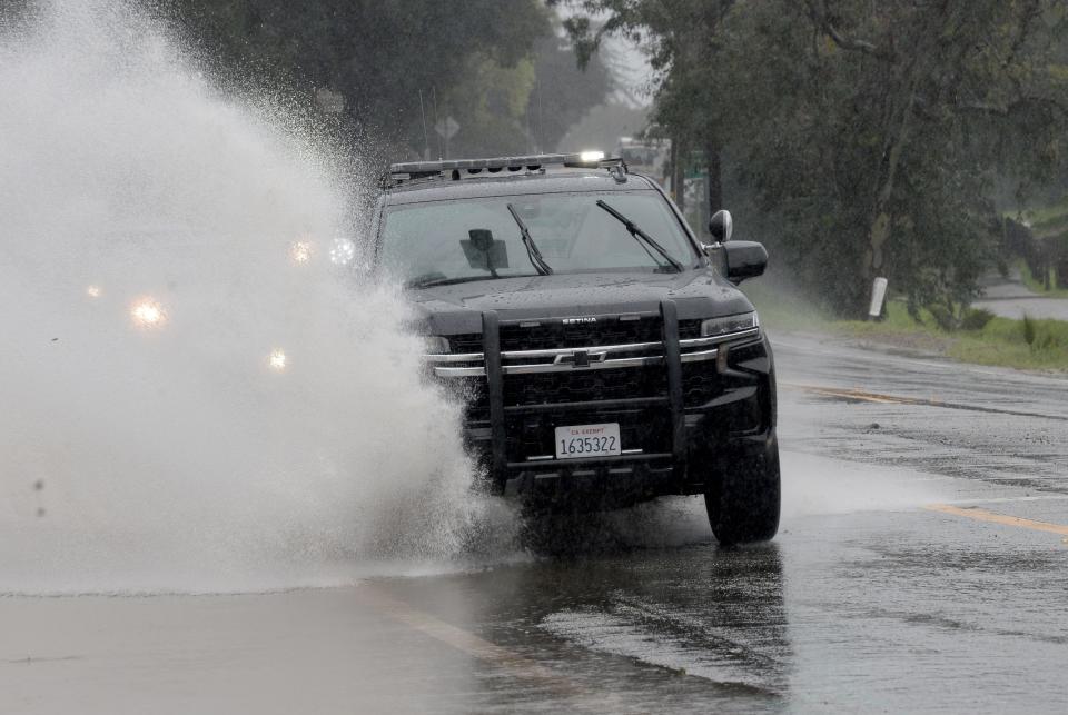
Rainfall totals
The storm's heaviest rain had passed through Ventura County by Saturday morning, said meteorologist Rich Thompson of the National Weather Service, although showers could linger. Thunderstorms and bouts of heavy rain were still possible.
Here are some four-day rainfall totals for Ventura County as of 10:20 a.m. Saturday, per the weather service:
Matilija Dam, 10.67 inches
Westlake Village, 6.25
Thousand Oaks, 5.82
Piru, 4.87
Fillmore, 3.72
Santa Paula, 3.69
Saticoy, 3.4
CSU Channel Islands, 3.31
La Conchita, 3.13
Moorpark, 3.05
Simi Valley, 3.02
Oxnard Civic Center, 2.87
Ventura, 2.8
Ojai, 2.15
Camarillo Airport, 2.14
Sunday should be mostly clear before more rain arrives Monday through Wednesday, Thompson said, but the incoming storm won't be as powerful.
Frozen things from the sky
Hail and graupel reports in the east county popped on up Twitter late Saturday morning, including at the California Highway Patrol office in Moorpark.
⚠️Continue to drive with CAUTION⚠️Officers heading out for shift caught this cell moving through @CityofMoorpark painting a white swath as it moves north east towards SR-126. Remember, hail = ice = slippery! @MoorparkSheriff @MoorparkAcorn @GoVCTC #hail @ChpVcc @CHP_Coastal pic.twitter.com/0FD6yqGWaR
— CHP Moorpark (@CHPMoorpark) February 25, 2023
And hat tip to ReporterDawn, formerly of the Star and the Acorn, for meteorological acumen while sharing graupel in Agoura.
Graupel in Agoura! pic.twitter.com/AGnU7h5rsY
— Dawn Megli (@ReporterDawn) February 25, 2023
Helicopter view
Ventura County's Aviation Unit posted videos of recent activity involving helicopter crews.
On Saturday morning, Copter 9 flew over Matilija Dam as the crew surveyed rivers and roads:
Copter 9 out on a morning reconnaissance to survey our roads and waterways. @VCFD @VCSOVentura pic.twitter.com/0bKGwutSOX
— VenturaCoAirUnit (@VCAirUnit) February 25, 2023
Overnight, a county helicopter helped search from above when RVs in the Valencia area were washed into a river:
Last night we responded to the Valencia RV Park for multiple RV’s swept into the river due to high water and riverbank erosion. Short video searching one of the RV’s. @VENTURASHERIFF @VCFD @kcalnews pic.twitter.com/uxRXO171jF
— VenturaCoAirUnit (@VCAirUnit) February 25, 2023
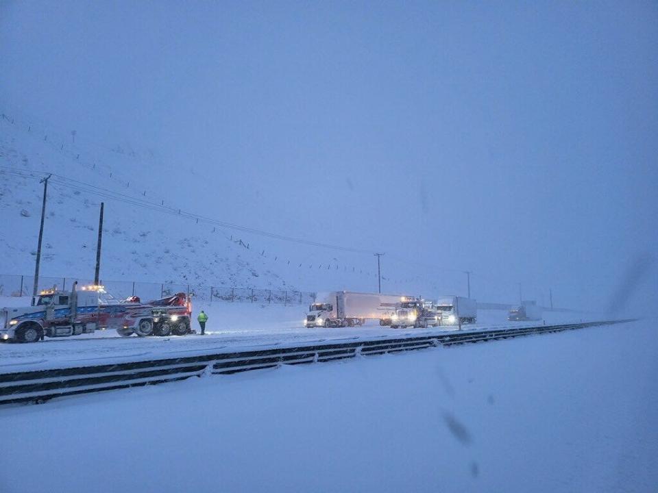
Snow and ice cover Grapevine
The California Highway Patrol's office at Fort Tejon tweeted photos of the Grapevine Saturday morning covered with snow and ice.
As of 9 a.m., officials had no estimated time for the mountainous Interstate 5 corridor to reopen.
The Grapevine remains closed due to heavy snow and ice. It is unknown at this time when the Grapevine will be reopen. Crews are working diligently to remove snow and ice from the road. As new information becomes available regarding possible escorts and reopening we will update pic.twitter.com/rmfpJEqnLv
— CHP Fort Tejon (@CHPFortTejon) February 25, 2023
Evacuation warnings assessed
Patrick Maynard, who directs Ventura County's Office of Emergency Services, said Saturday morning he had reviewed the status of the county's evacuation warnings initially issued Thursday.
Maynard provided an update shortly before 9 a.m.:
Camp Chaffee near Casitas Vista Road: Will remain under an evacuation warning until 3 p.m. Saturday to allow time for the creek to recede.
Creek Road/Old Creek outside Ojai: Evacuation will be lifted at 9 a.m. Some mud and debris remains in the roadway in both areas; however, nothing hazardous is present.
Matilija Canyon Road: The road remains impassable due to water flow but debris looks minimal compared to January's storms. A helicopter copter will launch around 9 a.m. to do an aerial recon of the area so officials can further evaluate the status of the roadway. The area will remain under an evacuation warning until further notice.
The bulk of the rain system had made its way through Ventura County as of Saturday morning, Maynard said. Officials expect isolated showers, windy conditions and possibly a thunderstorm over the next 18 hours.
No significant threat of issues remain, he said. More information is available at the emergency services website at vcemergency.com.
Grapevine closed
Snow again closed the Grapevine early Saturday, the California Highway Patrol and Caltrans reported.
As of 7:30 a.m., there was no estimated duration.
Motorists had been advised to use Highway 101 as an alternate route since Highway 114 in Santa Clarita was closed by snow, Caltrans said around 7:45 a.m., and highways 58 and 138 were also closed.
Highway 166 north of Santa Maria, which closed Friday, also remained closed as of Saturday morning, closing off a route from Highway 101 to Interstate 5.
Such closures often slow Highway 101 in Ventura and Santa Barbara counties as more vehicles, including big rigs, use the coastal corridor.
*I-5 is CLOSED through the Grapevine*
I-5 closed from Parker Road in Castaic to Grapevine Road due to snow & icy road conditions. The "snow gate" is open at Lake Hughes Road in Castaic to allow northbound traffic to make U-turns. Unknown duration. pic.twitter.com/VA6frG6QjO— Caltrans District 7 (@CaltransDist7) February 25, 2023
Ventura River flood warning
The National Weather Service warned of flooding on the Ventura River as of about 12:15 a.m. Saturday, with the warning lasting until 8 a.m. Saturday.
Measurements taken near Foster Park showed a crest near 19 feet, with possible impacts on Highway 101 near downtown Ventura.
A River Flood Warning remains in effect until 8am Saturday. The crest of 18.9 feet should be happening right now. Hwy 101 may be impacted near downtown Ventura. Use caution if driving through the area. #Ventura #Flood #VTArain pic.twitter.com/CI2ITWkjRK
— NWS Los Angeles (@NWSLosAngeles) February 25, 2023
Water rescue near Ojai
Firefighters responded to a rescue near Ladera Road northeast of Ojai city limits around 10:35 p.m. Friday, where people were said to be stuck in a vehicle.
A sheriff's helicopter had been called in but was cancelled, said Ventura County Sheriff's Capt. William Hutton.
Ultimately, a helicopter and rescue swimmer did rescue a driver from the vehicle, the Ventura County Fire Department reported.
Separately, shortly before midnight California Highway Patrol officials had requested a closure of Highway 150 from west of Santa Ana Road, near Lake Casitas, to Gobernador Canyon Road near Carpinteria.
#LaderaWaterRescue #VCFD firefighters with assistance from Copter 4 rescue a driver trapped a vehicle in raising flood waters. Copter 4 lowers a #FF rescue swimmer to the roof of the vehicle, the rescuer pulls the victim onto the roof and both are hoisted to safety. @VCFD pic.twitter.com/qkPWWkCG8g
— VCFD PIO (@VCFD_PIO) February 25, 2023
Water-rescue crews called out in Ventura
Firefighters responded to a water rescue along the Ventura River around 10:15 p.m. , staging near Main and Peking streets in Ventura.
Radio traffic from the scene indicated two people were stuck on an island south of the bridge. They did not appear to be immediately at risk from the water.
Thunderstorm warning includes Simi, TO
Storm activity continued in the east county as of 10 p.m. Friday, with the National Weather Service issuing a severe thunderstorm warning until 10:45 p.m.
Severe Thunderstorm Warning including Santa Clarita CA, Thousand Oaks CA and Simi Valley CA until 10:45 PM PST pic.twitter.com/KXhV7uRyM0
— NWS Los Angeles (@NWSLosAngeles) February 25, 2023
Trees downed around Thousand Oaks
Around 9 p.m. Friday, authorities responded to a number of downed trees and minor crashes in Thousand Oaks.
A car crashed into a downed tree at Lynn Road and Avenida de los Arboles shortly before 9 p.m. The driver suffered minor injuries and did not need to be taken to the hospital, said Ventura County Sheriff's Capt. William Hutton.
"There are just a lot of downed trees calls," he said. The sheriff's office is contracted with Thousand Oaks for police services.
After 9:30 p.m., four homes in the 200 block of Yellowstone Avenue in Thousand Oaks were evacuated after a tree fell and caused a gas leak, according to authorities. Few additional details were available.
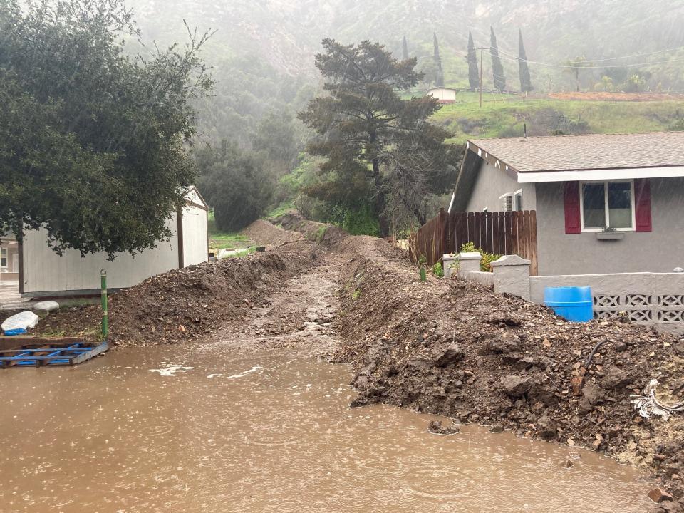
Trees, rocks, mud impact roads around county
Emergency responders were busy Friday night as reports of flooded roads, fallen trees, downed power lines, rocks and mud impacted streets and highways around Ventura County.
Some callers also reported flooding inside homes and other issues.
Some incidents as of 9 p.m. included:
A vehicle stuck in mud on southbound Highway 101 near Seacliff, with traffic slow along the corridor.
Rocks, a tree and power lines blocking lanes of Highway 150 west of Lake Casitas, between the lake and Carpinteria.
A vehicle in floodwater on Highway 150 near Santa Ana Road, as Coyote Creek waters rose. A man was reportedly rescued from the vehicle.
Fallen trees and other issues were also reported on local streets and neighborhoods.
Weak tornado watch issued for Oxnard, Ventura and Port Hueneme
An alert of a weak tornado has been issued for Oxnard, Ventura and Port Hueneme until 9 p.m., the National Weather Service said.
A weak tornado, also known as a waterspout, could cause minor damage with spinning winds of up to 50 to 60 mph, said Joe Sirard, meteorologist for the National Weather Service.
A special weather statement has been issued for Oxnard CA, San Buenaventura CA and Port Hueneme CA until 9:00 PM PST pic.twitter.com/bj6LxZX16i
— NWS Los Angeles (@NWSLosAngeles) February 25, 2023
More Ventura County areas added to flood watch list
More Ventura County areas were added to the flood watch list, which is set to expire at 10 p.m., according to National Weather Service reports.
Areas include:
Ventura and Ventura Harbor
Oxnard
Camarillo
Port Hueneme
Newbury Park
Point Mugu
Point Mugu State Park
Westlake Village
Agoura Hills
Minor flooding is ongoing or expected in these areas, according to the weather service. Minor flooding is possible along creeks and small streams, including Conejo Creek downstream of Highway 101 near Camarillo.
The rain will likely trigger shallow mud and debris flows, minor rock falls, and flooding capable of local damage, especially in steep terrain in and near burn scars, according to the weather service.
Latest rain and snow totals
Frazier Park has seen 13 inches of snow pile up over the last three days, 5 inches of which fell between 11 a.m. and 4 p.m. Friday, according to National Weather Service reports.
No updates were given for:
Mount Pinos: 12 inches
Mountain High: 16 inches
Pine Mountain Club: 6 inches
Lockwood Valley: 10 inches
In a tweet, the weather service said it expected snow to return to lower elevations after 10 p.m. Friday and warned drivers to avoid the recently-opened Tejon Pass.
Here are preliminary rainfall totals over the last three days from the National Weather Service as of 4 p.m. Friday. The totals may be misrepresented because of snowfall, according to the weather service.
Agoura Hills: 3.03 inches
Anacapa Island: .99 of an inch
Camarillo: 1.03 inches
CSU Channel Islands 1.65 inches
Fillmore: 1.77 inches
La Conchita: 1.06 inches
Moorpark: 1.33 inches
Newbury Park: 2.18 inches
Ojai: 1.89 inches
Oxnard (National Weather Service location): 1.45 inches
Piru: 1.57 inches
Port Hueneme: .44 of an inch
Rocky Peak: 2.24 inches
Santa Paula: 1.88 inches
Saticoy: 1.61 inches
Simi Valley: .88 of an inch
Thousand Oaks: 2.40 inches
Ventura: 1.20 inches
Westlake Village 2.44 inches
CHP escorting traffic on Grapevine
California Highway Patrol units from the Fort Tejon and Newhall areas are escorting vehicles through the Grapevine in both directions.
The Grapevine has reopened but one lane in each direction is closed, said Caltrans spokeswoman Allison Colburn.
Road conditions on the Tejon Pass on Interstate 5 will remain very wet through the night, according to the CHP Fort Tejon Twitter account, and motorists are advised to not pass the CHP officers conducting the escorts.
Crews are continuing the monitor the roadway for changing weather and conditions and motorists are asked to drive cautiously, according to the Caltrans District 7 Twitter account.
OPEN ✅ I-5 through #TejonPass has reopened in both directions with CHP escorting motorists! Crews are continuing to monitor the roadway, so please drive cautiously, as conditions and weather patterns may change. Call 800-427-7623 for road closures and info. pic.twitter.com/NpkE9J1PL9
— Caltrans District 7 (@CaltransDist7) February 25, 2023
Highway 166 between Highway 101 in Santa Maria and Highway 33 near Taft remains closed.
'In like a lamb'
February came in like a lamb after January storms drenched Ventura County and much of the state.
But it's going out like a lion, climatologist William Patzert said of Friday’s storm.
In much of Ventura County, average February rainfall is under 4 inches.
“I expect us to smash that here in the next couple of days and early next week,” said Patzert, formerly at NASA's Jet Propulsion Laboratory in Pasadena.
After a little break on Sunday, the rain is expected to return Monday and Tuesday.
Caltrans closes part of Highway 166 after mudslides, flooding
State authorities closed Highway 166 between Highway 101 in Santa Maria and Highway 33 near Taft around noon Friday, according to California Highway Patrol records.
The closure locked down 65 miles of the road that connects Highway 101 to Interstate 5 after flooding and mudslides covered parts of the road, said Alexa Bertola, a spokeswoman for California Department of Transportation District 5.
Bertola said the department had no estimate for when the highway would reopen.
With the Grapevine closed over Tejon Pass on Interstate 5, Highway 166 typically provides a detour for northbound motorists from Ventura, Santa Barbara and LA counties as a connection between the 101 and the 5. Southbound motorists on the 5 likewise use the 166 as a detour.
Closure of both freeways can sometimes snarl roads in the region if drivers get backed up for extended periods.
Flash flood warning issued for parts of Ventura County
The National Weather Service has issued a flash flood warning to parts of Ventura County including Ojai, Fillmore and Simi Valley through 10 p.m. Friday.
Flash Flood Warning continues for Simi Valley CA, Santa Barbara CA and Lompoc CA until 10:00 PM PST pic.twitter.com/MKqm9pUZMg
— NWS Los Angeles (@NWSLosAngeles) February 24, 2023
Heavy rain will likely continue through much of Friday with additional rainfall of 2 to 5 inches possible, according to a tweet from the National Weather Service.
Tow truck drivers roaming until 7 p.m.
The Ventura County Transportation Commission's freeway service patrol will navigate highways 101 and 118 without a break in service Friday because of the storm.
Tow truck drivers are roaming certain segments of the highways looking for stranded motorists until 7 p.m., according to a VCTC Tweet.
Our Freeway Service Patrol will have extended hours Friday, Feb. 24, because of the storm. FSP drivers will be available to help motorists on certain segments of US 101 and Highway 118 between 6 a.m. and 7 p.m. Learn more about FSP here: https://t.co/90RUvabj0T pic.twitter.com/nphbZeNfqu
— VCTC (@GoVCTC) February 24, 2023
Tow truck drivers will change flat tires, provide a gallon of fuel and tow vehicles to a safe location off the freeway where motorists can arrange for additional assistance, according to the VCTC website.
Authorities warn of possible tornado
On Friday morning, authorities warned of a possible tornado in northern Santa Barbara County.
The National Weather Service said it had no confirmation that a tornado had formed. But its radar readings showed a supercell thunderstorm off the coast had moved to shore, prompting the warning.
Once it moved ashore, it dissipated quickly, said Ryan Kittell, a meteorologist with the National Weather Service in Oxnard.
Heavy rain still to come
Around 1 p.m. Friday, heavy rain was falling around Ojai and farther north. But elsewhere in Ventura County, many areas had lighter or more moderate rainfall.
That's because some of the heaviest rain had stalled over Los Angeles and Santa Barbara counties, said Ryan Kittell, meteorologist with the National Weather Service in Oxnard. The band over Santa Barbara is expected to move in Ventura County later Friday afternoon or evening, he said.
When that happens, the county will experience the brunt of the "very cold" storm. By Friday evening, periods of intense rain could reach half an inch to an inch an hour.
"We do expect quite a bit of flooding over the roads developing, if not earlier, certainly by tonight," Kittell said.
Lockwood Valley roads close
Close to 2 feet of snow had piled up in Lockwood Valley by noon Friday and even more blanketed the nearby mountains.
Gusty winds came in waves throughout the day and the snow continued to fall, said Ventura County Sheriff's Deputy Josh Vulich at a station off Lockwood Valley Road in the Los Padres National Forest.
Our Lockwood Valley station saw over a foot of snow last night! We hope everyone is staying safe during this storm. pic.twitter.com/nPthWx659t
— Ventura County Sheriff (@VENTURASHERIFF) February 24, 2023
“Pretty much every road is closed,” he said. “The road crews are working on Lockwood Valley Road between Frazier Mountain and Chico Larson Road."
Vulich said he had not had any reports of significant damage. The road closure had kept people safe and off the roads for now. But he expected to see a lot of folks come up on Sunday to check out the snow after the storm had passed.
Snow blankets Mount Pinos
The National Weather Service reported three-day snowfall totals as of 11 a.m. Friday for these Ventura County spots.
Mount Pinos: 12 inches
Mountain High: 16 inches
Pine Mountain Club: 6 inches
Lockwood Valley: 10 inches
Frazier Park: 8 inches
See the storm sweeping through county
County reports rainfall totals
Here are rainfall totals from the last 24 hours as of 9 a.m. Friday. The preliminary figures were reported by the Ventura County Watershed Protection District.
Camarillo: .71 of an inch
Fillmore: .9 of an inch
Matilija Canyon: 2.94 inches
Moorpark: .83 of an inch
Ojai: 1.62 inches
Oxnard: .91 of an inch
Port Hueneme: .44 of an inch
Santa Paula: 1.06 inches
Simi Valley: .88 of an inch
Thousand Oaks: .66 of an inch
Ventura: .76 of an inch
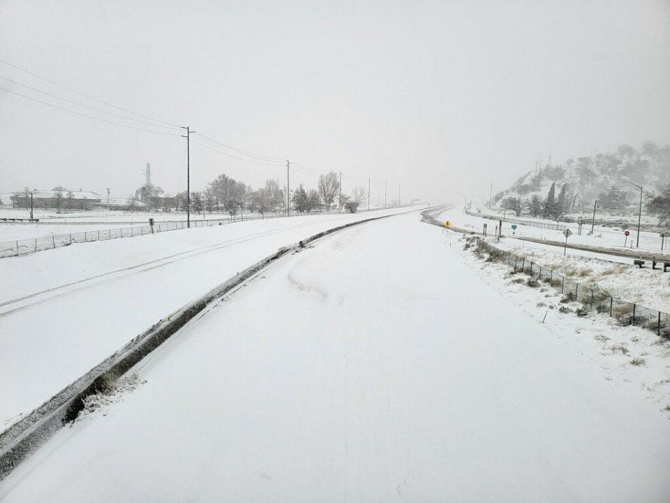
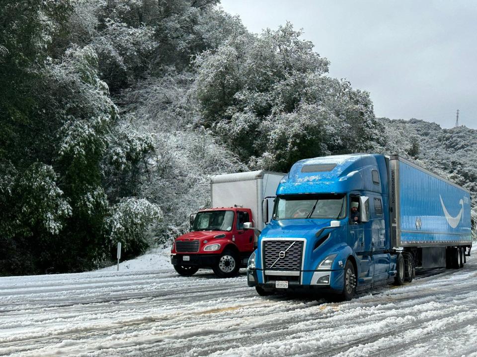
A snow-covered Grapevine
Snow blanketed the Grapevine on Friday morning. The interstate remained closed with no estimated time for reopening, according to a tweet from the California Highway Patrol.
Caltrans is working hard on clearing the snow and ice from the roadway, the CHP said.
Crews patrolling hot spots
Snowfall at lower elevations reduced the amount of rainfall early on in the multi-day storm. But as the snow shifts to higher elevations, more rain could cause problems on local roads.
“We’re just watching hour by hour,” Dave Fleisch, the county's assistant public works director, said Friday morning.
The agency had trucks patrolling throughout the county, particularly in areas that typically flood and those damaged in January storms, he said. The hot spots include Matilija Canyon north of Ojai as well as Camp Chaffee and Nye roads in the Ojai Valley.
State Highway 33 and Matilija Canyon Road took some of the biggest hits last month. Parts of the roads washed out, and others were buried in mud and rocks.
Authorities report no major issues
Ventura County Sheriff's Office of Emergency Services reported no major storm-related problems by 9 a.m. Friday.
But it is early, OES Director Patrick Maynard said. The storm appears to be shaping up to dump much of the heavier rain on the county Friday afternoon, likely between 3 and 7 p.m., Maynard said.
In the past 24 hours, much of the county recorded below an inch of rainfall. Matilija Canyon above Ojai received just over 3 inches of rain and spots along the Highway 33 corridor ranged from 1 1/2 and 2 inches.
Intense downpours to hit Ventura County
Intense downpours and isolated thunderstorms were shifting toward southern Ventura County and southeast Santa Barbara around 8:30 a.m. Friday.
Very heavy rain, road flooding, small hail and gusty winds were possible, the National Weather Service said. The agency also cautioned that ocean waterspouts and land-based tornadoes were possible through noon Friday.
Intense showers & isold thunderstorms are shifting eastward toward southeast Santa Barbara & southern Ventura Counties. Expect potential for very heavy rain, road flooding, small hail, & gusty winds. Ocean waterspouts & land-based tornadoes are possible through noon. #CAwx #rain pic.twitter.com/wXgYU7qh5o
— NWS Los Angeles (@NWSLosAngeles) February 24, 2023
Pea-sized hail, waterspouts possible
The National Weather Service issued a special marine warning for winds potentially greater than 50 knots and steep waves in waters off Santa Barbara and Ventura counties.
The warning, issued shortly after 8 a.m. Friday, covers the water from Point Sal to Santa Cruz Island, including San Miguel and Santa Rosa islands, and from Point Mugu to San Mateo Point, including Catalina and Anacapa islands.
Pea-sized hail and waterspouts are possible, the agency said. The warning remains in effect until 10:15 a.m.
'Very disruptive' storm
Climatologist William Patzert described the storm as “very strong” and “very cold.”
The system came out of northern Canada, dropping down the coast of California. Typically, storms lose intensity as they move south. But this one is maintaining its horsepower, said Patzert, formerly at NASA's Jet Propulsion Laboratory in Pasadena.
He called Friday the “big show” for Southern California. Some areas could get 4 to 8 inches of rainfall, and spots in the mountains may see blizzard conditions.
“This is going to be a very disruptive and potentially dangerous system,” he said.
Snow on I-5
Authorities reported about 8 to 10 inches of snow through the Tejon Pass Friday morning. Interstate 5 is closed in the area from Grapevine Road to Parker Road, Caltrans said in a tweet.
Popular preserve closes
The Ventura Land Trust closed the popular Harmon Canyon Preserve as of Friday morning.
The popular hiking area in the Ventura hillsides closed for several weeks earlier this year after getting pummeled in January storms. The downpours washed out roads, mud slid down hills and several sinkholes opened up, one an estimated 30-feet deep.
This closure should not last as long, according to the trust. The preserve generally closes one day for every quarter-inch of rainfall to allow for trail maintenance and the soil to dry out. Periodic rain is expected in the area through Wednesday.
Blizzard, wind, flood warnings in effect
As the storm intensifies, the National Weather Service issued warned of potentially hazardous conditions in Ventura County. Here is the list as of 4 a.m. Friday.
Blizzard Warning: Ventura County mountains. Expires 4 p.m. Saturday.
High Surf Advisory: Ventura County beaches. Expires 8 a.m. Saturday.
Wind Advisory: Ventura County’s central and southeastern valleys, beaches, inland coast, Lake Casitas, Ojai Valley, Santa Monica Mountains. Expires 1 a.m. Saturday.
Flood Watch: Ventura County’s central and southeastern valleys and inland coast, Ojai Valley, Lake Casitas. Expires 1 a.m. Saturday.
Flood Watch: Santa Monica Mountains. Expires 1 a.m. Saturday.
Flood Watch: Ventura County mountains. Expires 4 p.m. Saturday.
Heavier rain on the way
As of 6:30 a.m. Friday, Ventura County was on the edge of the brunt of the storm.
Some heavier rain and snow was hitting areas above Ojai and local mountains. But the heavier activity – downpours, isolated thunderstorms and possibly a waterspout – was slamming the western side of Santa Barbara County, said Eric Boldt, a meteorologist with the National Weather Service in Oxnard.
"We're looking at quite a bit of heavy rain throughout the day in Ventura County," Boldt said. "I would say late morning, through the afternoon and into the evening, that's when we're going to be hit hardest here locally."
On Saturday, the low pressure system heading down the California coast will move right over top of Ventura County, he said. That means more unstable conditions, heavy downpours, small hail and some lightning.
Snow closes interstate
The California Highway Patrol and Caltrans closed I-5 through the Tejon Pass around 4 a.m. Friday because of snow and low visibility. Highway 101 was the only viable alternative route.
❄️OPERATION SNOWFLAKE❄️
Due to significant snow fall and poor visibility, @CHPFortTejon & Caltrans have decided to CLOSE I-5 through the Tejon Pass. Closure duration unknown. US 101 is the only viable alternate route. See https://t.co/cxZ0jW7S5n for freeway impacts. pic.twitter.com/WFmwFFIWVQ— Caltrans District 7 (@CaltransDist7) February 24, 2023
Rain pushes into Ventura County
As of 8 p.m. Thursday, shower activity was expanding into western Ventura County, said meteorologist Robbie Munroe with the National Weather Service office in Oxnard.
A warm front had set up offshore that was pushing the rain toward the area, he said. The warm front was more pronounced than anticipated, he said, which could lift some expected snow levels higher than previously forecast, although some snow could still fall as low as 2,000 to 3,000 feet.
Rainfall was likely to increase through the night along with a cold front. The heaviest and most widespread precipitation was expected Thursday night through Friday afternoon, Munroe said. Showers that linger through Saturday could also bring thunderstorms.
Snow at higher elevations, especially above 5,000 feet, could reach 2 to 5 feet, creating dangerous conditions. A rare blizzard warning for mountain areas includes possible whiteouts and strong winds. The weight of snow, coupled with wind, could down trees, disrupt power and damage roofs.
An avalanche expert at the weather service has concerns about steep terrain in mountain areas where snow and wind combine, Munroe said. The greatest threat for an avalanche is typically within 24 hours of a storm.
Record low tied at LAX
A low of 41 degrees recorded at Los Angeles International Airport Thursday tied the record low for the date set in 2019, the National Weather Service said.
During a heavy rain squall around 11 a.m., the temperature fell from 51 to 41 degrees in less than an hour, the agency reported.
No records were noted for the Camarillo Airport station or the weather service office in Oxnard, the two sites in Ventura County where the agency tracks historical data.
Early snow impacts passes
Snow fell on Highway 154 in Santa Barbara County Thursday afternoon, closing the route over San Marcos Pass, elevation 2,200 feet, for a time. After dusting the Santa Ynez Valley, the storm moved into the Ojai Valley, bringing bouts of rain and dropping some snow on surrounding mountainsides.
Weather could close Highway 154 intermittently as the brunt of the storm arrives, officials said.
In Ventura County, Highway 33 remains closed above the Matilija Hot Springs area, as it has been since heavy rainstorms washed away portions of the route in early January.
Some snow fell along the Grapevine section of Interstate 5 Thursday, but as of 6:45 p.m. Thursday, the highway was open.
You can check on updates for state highways and freeways at the Caltrans road information site.
County issues evacuation warnings
The Ventura County Sheriff's Office of Emergency Services on Thursday issued evacuation warnings for several areas hit hard by last month's storms. Repairs and cleanup are still underway, leaving spots more vulnerable.
An evacuation warning means people should be prepared to leave but the threat is not yet imminent. The warnings take effect at 3 p.m. Thursday through 10 a.m. Saturday unless conditions stabilize:
Matilija Canyon Road in areas north of Fairview Road, including North Fork and Camino Cielo, in Ojai
Creek Road near San Antonio Creek and Old Creek Road in Ojai
Camp Chaffee at Casitas Vista Road near Camp Chaffee
Ventura Beach RV Park in Ventura (through 6:00 p.m. Friday)
Forecast calls for snow, rain
The brunt of this week's unusually cold storm is expected to sweep through Ventura and Los Angeles counties Friday and Saturday, bringing more snow, heavy rain and gusty winds.
The forecast called for 2 to 5 inches in the county's coastal and valley areas from Thursday through Saturday. In higher elevations, 2 to 5 feet of snow above 4,000 to 5,000 feet and 6 to 12 inches of snow from 2,000 to 4,000 feet.
On Thursday, some bouts of rain moved through Ventura County, with snow dusting peaks visible from the Ojai Valley and Santa Paula, among other spots.
This story will be updated.
This article originally appeared on Ventura County Star: Storm brings snow, rain and blizzard warning for Ventura County

