Power restored for 6,000 customers, another 600 still in the cold
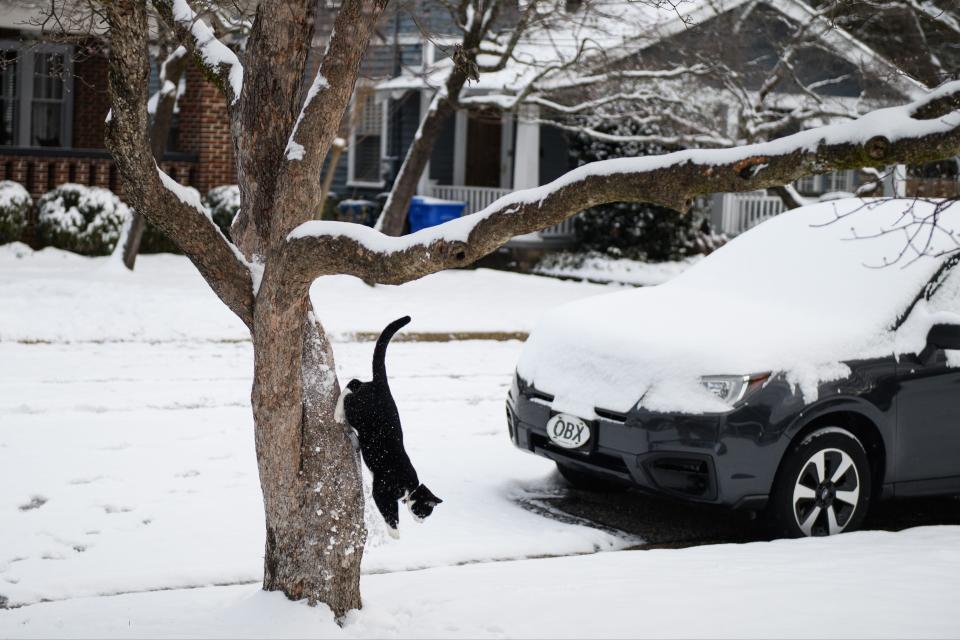
Fayetteville was blanketed in snow Saturday morning.
It is expected to stay on the ground throughout the day in the Fayetteville area, potentially refreezing overnight.
Closings: Offices closed as Fayetteville, Cumberland gird for winter storm
5:45 p.m. — Power restored for about 6,000 people
As of 5:45 p.m. Saturday, electricity had been restored for about 6,000 Lumbee River Electric Membership Corporation customers after power was knocked out for about three hours, according to Walter White, the company's vice president of corporation services.
Still, about 600 more customers in Cumberland and Hoke counties remain without power. White expects crews to be finished work on restoring power to the remaining homes and replacing the broken transmission pole just after midnight Saturday.
Crews were able to reroute electricity for the majority of customers through other power lines running throughout Fayetteville.
— Kristen Johnson
5:30 p.m. — Some LREMC customers could get power back soon, repair still on
Some Lumbee River Electric Membership Corporation customers could get their power restored within the next few hours, according to Walter White, vice president of Corporation Services.
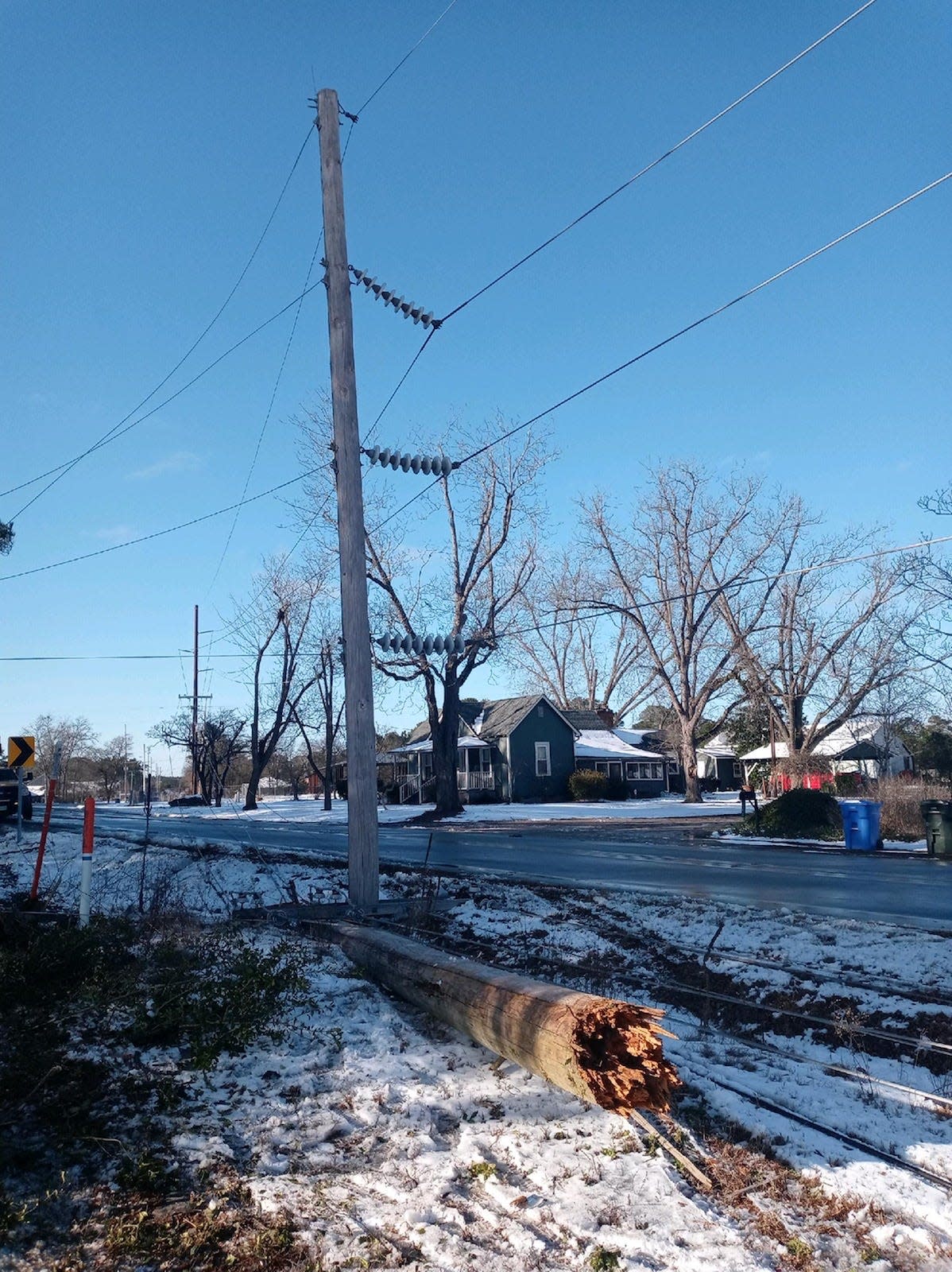
Crews were on Fisher Road repairing a transmission pole that was struck by a truck about 2:30 p.m. Saturday, knocking out electricity to more than 6,200 customers in Cumberland County.
White said the truck slid off the road and hit the pole, snapping it in half.
As of 5:30 p.m., crews were working to switch some of lines that are down to operating lines. The switch will restore power for some customers before crews are expected to complete the 10-hour job.
Fort Bragg closes facilities early
Due to the threat of black ice forming this evening, Fort Bragg is closing its facilities no later than 6 p.m., with the potential for early closures for Sunday evening.
All installation gates will continue operate with normal weekend hours and the installation shuttle will operate normal routes as long as roads remain safe, but do expect delays.
Many of the Family and Morale, Welfare, & Recreation facilities will be operating on adjusted schedules, with most normal weekend facilities opening at noon on Sunday.
All AAFES/Exchange facilities closed at 5 p.m. with the exception of Old Glory, which will close at 6 p.m. On Saturday, the facilities will have a delayed opening of 10 a.m. except Old Glory, which will open at 8 a.m. Both commissaries will operate on a delayed opening at 10 a.m. on Sunday.
Clinics and urgent care are closed on weekends. The emergency room will remain open, as well as inpatient wards. The COVID-19 testing drive thru site status for Sunday is to be determined, be sure to follow Womack Medical Center’s website and Facebook page for updates.
For up-to-date information about WAMC’s operating status, visit the Womack Facebook page at https://www.facebook.com/WomackAMC. You can also call 910-907-WEAT (9328) or visit the WAMC website at https://tricare.mil/mtf/womack.
— Kristen Johnson

4 p.m. — Lumbee River EMC power outages in Cumberland, Hoke counties
More than 6,000 Lumbee River Electric Membership Corporation customers were without power in Cumberland County on Saturday afternoon after a transmission pole on Fisher Road in the Jack Britt area was struck by a vehicle, according to Interim President and CEO Randall Jones.
Jones said at 4 p.m. crews were at the site of the broken pole working to replace the pole and restore power. The job is expected to take about 10 hours, according to Jones. He says fixing the pole is "not an easy process."
An additional 520 customers in Hoke County were also affected.
— Kristen Johnson
2:39 p.m. — Power outages reported by Lumbee River EMC
More than 6,000 people have been affected by power outages in Cumberland County by the Lumbee River Electric Membership Corporation, which services more than 54,000 people in Cumberland, Hoke, Robeson, and Scotland counties.
Some outages were reported in Fayetteville in the Jack Britt district. According to the Lumbee River power outage map, the cause of the outages is currently unknown.
An estimated time of restoration is listed on the website.
— Kristen Johnson
11:30 a.m. — Temperatures rising, power outage cleared
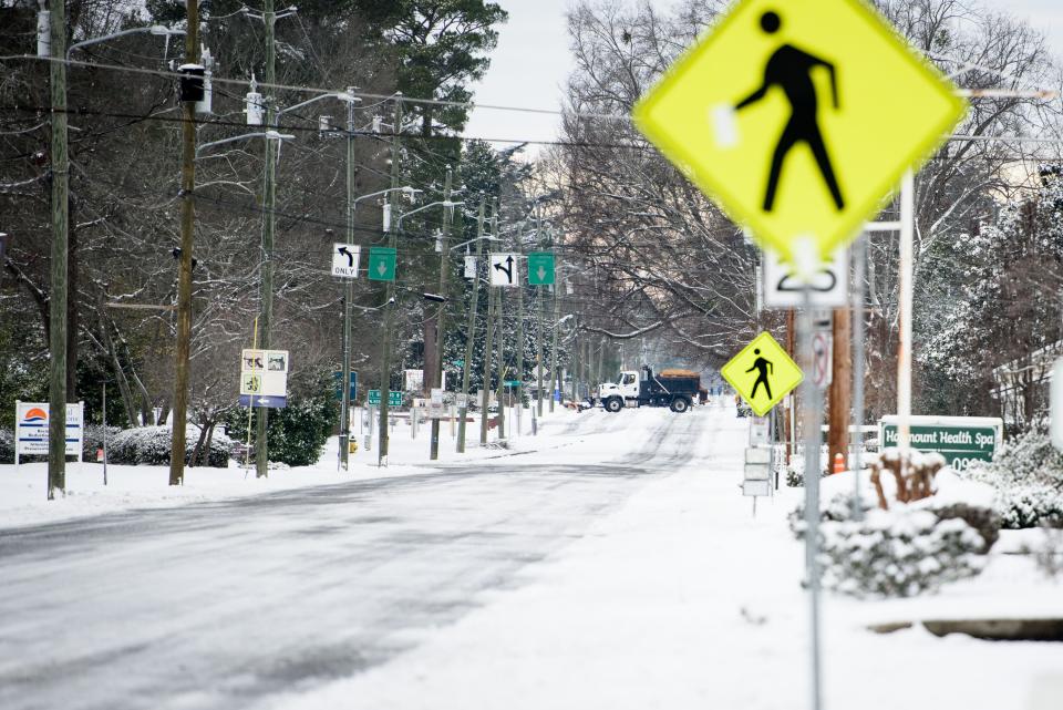
Temperatures are continuing to rise in Fayetteville at 28 degrees as of 11 a.m. The National Weather Service predicted the high to be up to 34 degrees with mostly sunny skies.
Bus and FASTTRAC services will not be operating Saturday due to the current road conditions, according to the city of Fayetteville. Services are expected to resume on a normal schedule on Sunday, depending on conditions.
More information about FASTTRAC services can be found on their website or by calling 910-433-1747.
As of 11:20 a.m., the power outage in the Cross Creek area of the city was cleared.
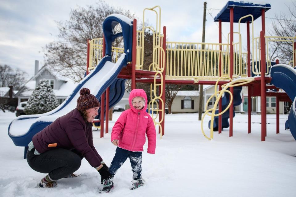
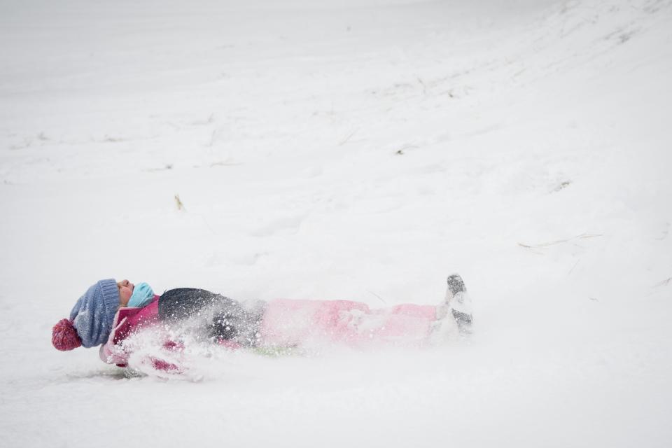
Keep sending in your snow photos as we will add them to our reader-submitted gallery!
This will be our final live update of the day unless breaking news occurs related to the weather
— Kristen Johnson
10 a.m. — Cold morning, mall closure, and power outages
As of 10 a.m. Saturday morning, temperatures have risen by one degree to 25 in Fayetteville with a wind chill of 13 degrees at a speed moving north at 15 mph.
The National Weather Service said temperatures will still rise today to around 36 degrees and will be mostly sunny. Slippery roads and black ice are still a hazard this morning.
In addition to several closures in the Fayetteville area, Cross Creek Mall will not be open Saturday due to the weather conditions.
The Fayetteville Public Works Commission reported at 10 a.m. there is one active outage in Fayetteville in the Cross Creek area and fewer than five people are affected. PWC serves about 36,541 customers in that area and 84,805 people throughout the city.
Keep sending in your snow pictures with information on where they were taken and who is in the pictures to newsroom@fayobserver.com.
— Kristen Johnson
9 a.m. — The snow is here to stay a while; bitter cold morning
The snow is expected to stay on the ground throughout the day in the Fayetteville area.
Most dark surfaces like pavements and roadways should start to clear up by late morning as temperatures rise, said Jimmy Taeger, a senior forecaster with the National Weather Service. However, snow on grass and other areas, especially in shades spots, will stay on the ground for longer.
Still, melted snow on the roads could mean more wet surfaces making travel challenging tonight as temperatures drop, turning the water into ice.
The highest reported snowfall was 4 1/2 inches in the Bonnie Doone area of Fayetteville, Taeger said. Most of the city saw between 2 to 4 inches of snow, with most areas getting 3 or more inches of snow.
More snow reports from around the Fayetteville area are expected to come in over the next few hours, National Weather Service meteorologist Dan Leins said.
As of 9 a.m., it was 24 degrees in Fayetteville with a wind chill of 14 degrees. Temperatures are expected to rise to the upper 30s today.
We love your snow pictures! Keep sending them to us with information on where they were taken and who is in the pictures to newsroom@fayobserver.com.
— Kristen Johnson

6 a.m. — Sun after the snow; here's what to expect for Saturday
More than 3 inches of rare snow blanketed Fayetteville and the surrounding areas last night Saturday morning. A hazardous weather outlook is in effect for central parts of the state throughout the day.
As of 6 a.m., it was 24 degrees with winds moving north at 12 mph. The wind chill was at 13 degrees. The high will be 36 degrees with mostly cloudy skies becoming gradually sunny throughout the day. Wind chill values will remain as low was 13 degrees with gusts as high as 20 mph.
Tonight, temperatures are predicted to drop to 18 degrees with a calm wind. No more snow or ice are predicted to accumulate.
Slick roads and areas of black ice will remain a hazard for the Fayetteville area through the morning. If travel is necessary, the National Weather Service recommends people slow down and use extra caution while walking or driving.
Send us your snow photos with information on where they were taken and who is in the pictures to newsroom@fayobserver.com.
— Kristen Johnson
8 p.m. — Snow beginning to stick; what to expect tonight
Skibo Road is typically a busy thoroughfare on a Friday evening, but traffic is light tonight, as what few motorists remaining on the road are dealing with snow that has begun to stick on the roadway.
Still a few motorists out, as snow is sticking to Skibo. #ncwx pic.twitter.com/O4KtUF626Y
— RachaelRiley (@RachaelRiley85) January 22, 2022
It's actually starting to stick! pic.twitter.com/LI4IQTPUdP
— Jacob Pucci (@JacobPucci) January 22, 2022
As of 8 p.m., it was 28 degrees with 13 mph winds and light freezing rain at Fayetteville Regional Airport. Temperatures are expected to dip to 22 degrees overnight, with a wintry mix of snow, sleet and freezing rain forecasted to fall.
Cumberland County is expected to see up to four inches of snow by Monday morning, though the bulk of the snow is expected to fall overnight tonight. With sunny skies expected for Saturday, it should be ideal weather to head outside and enjoy the snow.
If you do, show it off! Send us your photos in the snow to newsroom@fayobserver.com, message them to us on Facebook or tag @fayobserver on Instagram.
— Jacob Pucci
6:20 p.m. — Crash blocking lanes in Hope Mills
Update: The crash was cleared and the road fully reopened around 7:10 p.m., according to the North Carolina Department of Transportation.
A crash on NC-59 (Chicken Foot Road) in Hope Mills, near U.S. 301, is blocking one lane and is causing delays in the area. The lane closure was reported around 6:05 p.m., according to the North Carolina Department of Transportation.
— Jacob Pucci
5:35 p.m. — New storm update from the NWS
The National Weather Service in Raleigh has posted its 4:30 p.m. storm update on YouTube as snow begins to fall across central North Carolina. Cumberland County is still forecasted to see up to four inches of snow.
— Jacob Pucci
5:15 p.m. — Snow, sleet, freezing rain starting to fall; Fort Bragg opening delayed
Snow and sleet are being reported in and around Fayetteville.
As the winter weather started moving in, Fort Bragg announced a delayed opening for some facilities on Saturday.

All installation gates will operate at normal weekend hours. The installation shuttle will continue running normal routes, weather permitting.
Many of the family and morale, welfare and recreation facilities will be operating on adjusted schedules, with most normal weekend facilities opening at noon.
Old Glory Express will open at 8 a.m. and all other Exchange facilities will open at 11 a.m., including both commissaries. Honeycutt Express will be closed due to annual inventory.
Clinics and urgent care are closed on weekends. The emergency room will remain open, as well as inpatient wards. The COVID-19 testing drive-thru site will be closed Saturday, Jan. 22.
More information about the situation at Fort Bragg can be found on the post's Facebook page.
At long last, the winter storm has arrived. Here are a few looks at what's going on right now in the Fayetteville area.
By NC standards, this is a blizzard ❄ pic.twitter.com/dFb4OJi9FW
— Jacob Pucci (@JacobPucci) January 21, 2022
And some pictures of the sleet https://t.co/Y7HgT0Hl3K pic.twitter.com/rohSVAN2tv
— Paul Woolverton (@FO_Woolverton) January 21, 2022
Sleet and Freezing Rain in Fayetteville. @NCWeatherhound @RaleighWx @webberweather @EthanClarkWX @_jwall @FloodedAlpaca69 pic.twitter.com/7OO5DmnH4H
— Tom Hatch (@tomhatch4unc) January 21, 2022
Snow falling in Harnett County. pic.twitter.com/F0CBGATC0e
— Steve DeVane (@WriterDeVane) January 21, 2022
— Jacob Pucci
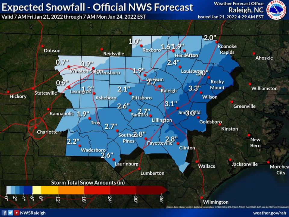
4:15 p.m. - New forecast shows more snow for Fayetteville
The National Weather Service in Raleigh is now forecasting higher snowfall totals across the Fayetteville area and beyond.
In its latest forecast at 3:36 p.m., the weather service showed Cumberland County receiving three to four inches of snow. That's up from earlier forecasts, which had the county in the two-to-three-inch range. Some spots in Cumberland County south of Fayetteville are forecasted to see a light coating of ice.
Our updated afternoon snow and ice forecasts. pic.twitter.com/4a1sLVhtBx
— NWS Raleigh (@NWSRaleigh) January 21, 2022
Some spots, such as Goldsboro in Wayne County, are now projected to see up to six inches of snow.
— Jacob Pucci
3:45 p.m. - Libraries will remain closed Saturday
All libraries, animal services and solid waste facilities in Cumberland County will remain closed Saturday due to the storm. All Cumberland County government offices were already closed Friday because of the weather.
Libraries in Moore County will be closing at 5 p.m. Friday and will remain closed Saturday, the county's department of public safety announced.
Cumberland County opened an emergency shelter at Smith Recreation Center at 1520 Slater Ave. that will be available until noon Sunday. As of 3 p.m. Friday, 20 people are using the shelter, the county announced.
— Jacob Pucci
1:45 p.m. - National Weather Service updates forecast, more snow expected
The National Weather Service in Raleigh released its updated snowfall map from noon today, showing a slight increase in the total snowfall expected.
Here's the updated snowfall map from noon. Minimal changes from the previous one (many locations in the 2-3" range went from the lower part of the range to the higher part of the range), but we will issue another map after our full afternoon forecast package is released around 4. pic.twitter.com/Vv8L7JFQEe
— NWS Raleigh (@NWSRaleigh) January 21, 2022
While the vast majority of Cumberland County remains in the 2-to-3-inches zone, the NWS tweeted that many locations in the 2-to-3-inch range went from the lower part of the range to the higher part of the range.
— Jacob Pucci
1 p.m. - Cooper, state officials urge caution as National Guard stands ready
Though the worst of the storm has yet to come, roads are slick and numerous crashes have already been reported, prompting Gov. Roy Cooper to issue a statement cautioning would-be drivers to stay off the roads, if possible.
"Roads will become more dangerous and power outages are still expected tonight in southeastern counties,” the statement reads. “If you can, stay put and off the roads as that’s the best way to stay safe.”
More than 110 National Guard troops with more than 40 high-clearance vehicles are currently staged in counties in the eastern part of the state, where ice accumulation is expected to be highest.
North Carolina Emergency Management offered the following tips to stay safe in severe winter weather:
Keep cellphones, mobile devices and spare batteries charged in case your power goes out
Keep fresh batteries on hand for weather radios and flashlights.
Dress warmly. Wear multiple layers of thin clothing instead of a single layer of thick clothing.
Properly vent kerosene heaters and ensure generators are operated outside and away from open windows or doors to prevent carbon monoxide poisoning.
Never burn charcoal indoors or use a gas grill indoors.
Use battery-powered sources for light, instead of candles, if your power goes out.
Use a National Oceanic and Atmospheric Administration weather radio or a weather alert app on your phone to receive emergency weather alerts.
Store an emergency kit in your vehicle. Include scraper, jumper cables, tow chain, sand/salt, blankets, flashlight, first-aid kit and road map.
Gather emergency supplies for your pet including leash and feeding supplies, enough food for several days and a pet travel carrier.
Do not leave pets outside for long periods of time during freezing weather.
Look out for your friends, neighbors and the elderly during winter weather and power outages.
— Jacob Pucci
12:30 p.m. Winter advisory upgraded to winter storm warning
Cumberland County’s winter weather advisory has been upgraded to a winter storm warning by the National Weather Service.
The warning remains in effect until 7 a.m. Saturday, according to the National Weather Service in Raleigh.
Snow accumulation between 2 to 4 inches is expected between 7 p.m. Friday and 3 a.m. Saturday.
We have just expanded our Winter Storm Warning farther to the west. The western edge of heavier snowfall has shifted to the west with the latest model runs, particular during the evening hours. We will post an updated storm total snowfall map shortly. pic.twitter.com/F00rdLWcdb
— NWS Raleigh (@NWSRaleigh) January 21, 2022
The difference between the warning and advisory is that advisories are issued if snowfall is expected to be at least 1 inch in a 12-hour period, said Tom Green, a Raleigh-based NWS meteorologist.
Warnings are issued if 3 inches of snow or more is expected in a 12 hour period, Green said.
“We certainly expected snow to move in late this afternoon into this evening,” Green said. “So we’re expecting snow to move into this evening. That is still the case. However, it appears the snow is going to be a little heavier than we forecast on the western side into the evening hours."
— Rachael Riley
11:30 a.m. Be aware of indoor winter safety
As a winter weather advisory is in effect for Cumberland County and surrounding areas, the National Weather Service urges residents to be mindful of indoor safety and to check smoke and carbon monoxide detectors.
According to the NWS graphic that the town of Spring Lake shared on its Twitter page, carbon monoxide poisoning is a greater risk during winters storms “when doors and windows stay closed and fireplace and gas heaters are in use.”
#springlakenc pic.twitter.com/0SKhxkYp2J
— Town of Spring Lake (@springlakenc) January 21, 2022
Warming up a car in a garage or when a tailpipe is obstructed by snow or ice can also cause a risk of being exposed to “deadly” carbon monoxide levels, the graphic warns.
According to the National Fire Protection Agency, carbon monoxide is a colorless, odorless gas created by fuels from gas, wood, coal, propane oil and methane, when burned incompletely.
“In the home, heating and cooking equipment that burn fuel are potential sources of carbon monoxide,” the agency’s website states. “Vehicles or generators running in an attached garage can also produce dangerous levels of carbon monoxide.”
Symptoms of carbon monoxide poisoning, according to the agency “can be confused with flu symptoms, food poising and other illnesses.”
Symptoms include shortness of breath, nausea, dizziness, lightheadedness or headaches.
The National Fire Protection Agency recommends the following safety tips:
• CO alarms should be installed in a central location outside each sleeping area and on every level of the home and in other locations where required by applicable laws, codes or standards. For the best protection, interconnect all CO alarms throughout the home. When one sounds, they all sound.
• Follow the manufacturer’s instructions for placement and mounting height.
• Choose a CO alarm that has the label of a recognized testing laboratory.
• If the audible trouble signal sounds, check for low batteries. If the battery is low, replace it. If it still sounds, call the fire department.
• If the CO alarm sounds, immediately move to a fresh air location outdoors or by an open window or door. Make sure everyone inside the home is accounted for. Call for help from a fresh air location and stay there until emergency personnel.
• A generator should be used in a well-ventilated location outdoors away from windows, doors and vent openings.
— Rachael Riley
10:30: Winter weather advisories in effect
A winter weather advisory will remain in effect for Cumberland County and surrounding counties until 7 a.m. Saturday.
Snow accumulations could be between 1 to 3 inches, according to the National Weather Service advisory.
According to a 9 a.m. briefing from the NWS in Raleigh, patchy light freezing rain is expected to develop east of Interstate 95.
Light snow is expected to expand across the area by late afternoon.
The briefing states that snow accumulations between 2 to 4 inches are expected east of Interstate 95 on Friday evening and that snow accumulations will stop by 4 a.m. Saturday.
NWS weather models show that Fayetteville is expected to have 2.8 inches of snow.
According to the briefing, areas south of Fayetteville to Goldsboro are expected to have the greatest chances of freezing rain and ice accumulation Friday evening.
Between one-tenth to one-fourth inch of ice is possible.
The briefing states that sleet is also possible east of Goldsboro and Fayetteville.
— Rachael Riley
9:30 a.m. NDCOT: Avoid driving
The North Carolina Department of Transportation is asking drivers to stay off the roads if possible, as National Weather Services advisories indicate there could be “black ice.”
At least one crash was reported before 5:45 a.m. Friday along Interstate 95 near Dunn, according to the North Carolina Department of Transportation.
https://t.co/pygKhDRZcv, I-95, South, MM 70, Near Dunn, Vehicle Crash, Lane Closed, at 1/21 5:41 AM
— NCDOT I-95 Traffic (@NCDOT_I95) January 21, 2022
DOT officials expressed concerns that Friday’s rain could wash off brine and salt to roads its crews treated.
"Staying off the roads will make it easier for our crews and emergency responders to do their jobs,” Beau Memory, chief operating officer for the NCDOT, said.
Officials said more than 800 employees and contract crews are working to prepare roads and that employees are on standby with chainsaws and heavy equipment to remove downed trees and debris.
Officials asked that motorists who are out to slow down and give crews space to safely work.
Other tips for driving include:
• Do not use cruise control.
• Approach bridges and overpasses with extreme caution. Do not apply your brakes while on a bridge.
• Come to a complete stop or yield the right of way when approaching an intersection where traffic lights are out. Treat this scenario as a four-way stop.
• Drive smoothly, without sudden accelerating, braking or turning.
• If you begin to slide, take your foot off the gas and turn the steering wheel in the direction of the slide. Applying the brakes will cause you to further lose control of your vehicle.
• Avoid using brakes if you start to slide. If you have to use breaks, apply a gentle steady pressure to anti-lock brakes or pump the brake pedal gently for standard brakes.
• Wait for your vehicle to slow down enough to regain traction before gently accelerating.
• For rear-wheel skids, turn the steering wheel in the direction your rear wheels are headed. Instead of focusing on what your vehicle might be headed toward, focus on getting out of the skid.
• For front-wheel skids, shift into neutral and don't try to steer immediately. When your vehicle begins to slow down, steer in the direction that you want your vehicle to go. Then, put the vehicle into gear and gently accelerate.
— Rachael Riley
🧊 Black ice will be possible tonight through Friday morning! Widespread rainfall across central NC today will leave roads wet tonight as temperatures fall into the 20s. Expect isolated patches of black ice, especially on bridges, overpasses, and any runoff locations. #NCwx pic.twitter.com/w2UyychBzJ
— NWS Raleigh (@NWSRaleigh) January 21, 2022
8:30 a.m. Shelters open
The Salvation Army of the Sandhills is operating under a “white flag” status because of the winter weather, according to a news release.
The white flag inclement weather status went into effect Thursday evening, and a daytime warming station is scheduled for Friday between breakfast and dinner.
This service is also offered on a first-come, first-served basis, the news release states.
Intake for the shelter at 245 Alexander St. will start at 5 p.m. Friday and is also on a first-come, first-served basis.
Cumberland County opened a shelter at 1520 Slater Ave. that will be available until noon Sunday, a county news release stated.
“Although all Cumberland County residents are welcome, the intent for this warming shelter is for individuals who have no other shelter options during a winter weather event,” the county release states.
Meals are provided.
COVID-19 screening will be conducted at the shelter, and people who test positive will be placed in isolation or quarantine areas, the release stated.
Pets will not be allowed at the shelter because of a lack of staff from COVID-19 and position vacancies.
— Rachael Riley
7:30 a.m.: Winter weather suspends some Fort Bragg operations
Fort Bragg is the latest to join schools and government buildings to close Friday because of winter weather.
According to a news release, normal operations will be suspended “except for key and mission essential personnel.”
“Adverse weather employees will be required to report to work as scheduled or remain at work,” the news release states. “Non-adverse employees should not report for duty.”
Civilian employees and service members who are unsure whether they should report to work must refer to their chain of command for further guidance
Baez School Age Center and Bauguess Child Development Center will be the only child development center open for essential staffing from 5:30 a.m. to 6 p.m.
Schools on Fort Bragg are also closed, and Monday is a teacher work day with no students.
Womack Army Medical Center and its outlying and specialty care clinics are also closed.
The emergency rooms, in-patient wards and urgent care will remain open.
Old Glory Express and Linden Oaks Express will be the only Exchange facilities open, from 8 a.m. to 5 p.m.
Fort Bragg Commissaries will also be closed, with a delayed opening possible for Saturday depending on the “updated installation status.”
All other facilities are closed, to include physical fitness centers.
According to the National Weather Service, areas of black ice are possible through mid-morning.
"Runoff from rain that fell across the area on Thursday and Thursday night, may freeze into patches of black ice on untreated roadways and surfaces this morning," the NWS said in a Special Weather Statement.
Temperatures will fall just below freezing Friday morning. The greatest potential for black ice will be across bridges, overpasses, and shaded locations.
"Slow down and use caution while traveling. Black ice is difficult to see. Use caution while walking and traveling," the statement said.
To check the latest road conditions for North Carolina visit DriveNC.gov.
— Rachael Riley
6:30 a.m.: Snow expected in Fayetteville on Friday evening
The greatest chance for snow in the Fayetteville area will be Friday evening, according to the National Weather Service.
Meteorologist Jimmy Danco said the area could see snowfall between 7 p.m. and 2 a.m.
“That looks to be the period of the best chance of snow, and then give a couple of hours on either side of that time frame for lighter snow, but that window appears to be the heaviest,” Danco said.
NWS models show a slight chance of sleet between 1 p.m. and 2 p.m.
Danco said about 2 to 3 inches of snow could fall in the area throughout the night with things “tapering off overnight” into Saturday at about 4 a.m.
Temperatures throughout the day will hover around the freezing mark at 32 degrees, with wind chill values at 19 degrees.
Lows are expected to dip to 23 degrees.
— Rachael Riley
This article originally appeared on The Fayetteville Observer: Fayetteville, NC weather: Snow in Fayetteville Saturday

