Winter weather descends on Davidson County. Here's what forecasters predict for the Piedmont.
It is looking more and more likely that the area is going to see its first major winter storm over the weekend.
As of Friday morning, the National Weather Service has issued a winter storm watch for the Piedmont from late Saturday night through Sunday night with heavy mixed precipitation expected.
According to the National Weather Service in Raleigh, “Accumulating snow is likely Saturday night before a storm system brings multiple types of wintry precipitation Sunday through early Monday”.
Want to know more about what is happening in Davidson County? Support local journalism, subscribe to The Dispatch.
As of 8 a.m. Friday, the weather service predicted a slight chance of rain and snow before 10 p.m. Saturday, then snow likely overnight. The precipitation is expected to change over to a mixture of snow, sleet and freezing rain Sunday morning and then snow and freezing rain likely in the evening.
Accumulation amounts have fluctuated because of the uncertainty of the type of precipitation and the timing of the storm. The National Weather Service has estimated snow and sleet accumulation of 2 to 4 inches.
"Snow and ice totals can vary greatly over short distances. We strive to be correct and right for every spot, but given that things can vary over short distances, there's always going to be a small area or zone where things just don't workout. Winter storms can change frequently; forecasts change especially here in the Carolinas,” said representatives with the National Weather Service during an online briefing.
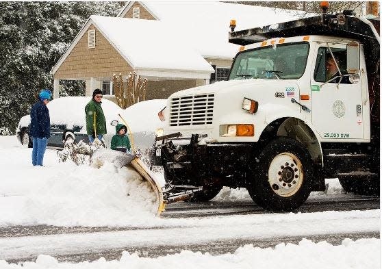
Because this storm is expected to produce a significant amount of snow and ice, it will create treacherous road conditions and a high probability of power outages.
More stories: Road changes ahead: NCDOT moving forward with pending projects in Davidson County
Representatives with the North Carolina Department of Transportation said the organization has already begun putting brine on roadways in preparation for the storm. Local municipalities have also begun prepping equipment to treat the roads and respond to any potential power outages.
NCDOT said people should begin preparing now so they won’t need to be on the roadways during and after the storm. It is highly recommended not to travel on Sunday and Monday unless it is an emergency.
The Red Cross suggests gathering food and supplies in advance in case you need to stay home for several days without power. Keep in mind each person’s specific needs, including medications.
If you have a fireplace, consider keeping a supply of firewood or coal. Make sure you have fuel for portable generators or kerosene heaters, as well as batteries for radios and flashlights.
It is suggested to fully charge cell phones in advance of the storm.
Also, bring animals indoors or create an enclosed place where other animals can be comfortable in severe winter weather.
related: Davidson and Randolph Counties suffer power outages Monday morning
Although the weather forecast is reporting temperatures in the mid-40s on Monday, the lingering effect of the winter storm may last several days.
Residents should monitor local news stations; social media and other websites for any school and business closings.
General news reporter Sharon Myers can be reached at sharon.myers@the-dispatch.com. Follow her on Twitter @LexDispatchSM.
This article originally appeared on The Dispatch: Weekend storm predicted to bring significant amount of snow and ice
