Looking to bike in L.A.? Here are 9 trails to get you rolling
You don’t have to drive far to enjoy pedaling your bicycle if you live in Greater Los Angeles.
Here are nine relatively flat bike paths of various distances that are all within 50 miles of downtown L.A. They can be found at TrailLink.com, part of the Rails-to-Trails Conservancy.
L.A. County
Length: 5.7 miles
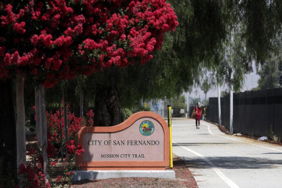
Trail end points: Roxford Street and San Fernando Road, Sylmar, and Branford Street and San Fernando Road, Pacoima
Parking: Sylmar/San Fernando Metrolink station
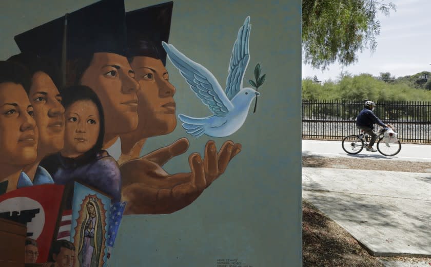
This trail runs along San Fernando Road and Metrolink commuter and Union Pacific rail lines from Sylmar to Pacoima. It cuts through the city of San Fernando, where it's marked as the Mission City Trail. The bikeway is fully landscaped and lighted, with fencing separating the trail from the busy train tracks.
Length: 8.8 miles
Trail end points: South Fork River Trail at McBean Parkway and Lost Canyon Road under Antelope Valley Freeway/California 14
Parking: Bridgeport Park, River Village Park, Discovery Park as well as Camp Plenty Road Trailhead, Camp Plenty Road and Soledad Canyon Road, Santa Clarita
This paved trail runs along the Santa Clara, one of Los Angeles County's last unchanneled rivers. It connects several of Santa Clarita's neighborhoods. It also links three other trails in the city. Both the San Francisquito Creek Trail and South Fork River Trail can be accessed from the trail's start at McBean Parkway. Alternatively, join the Chuck Pontius Commuter Trail at Bouquet Canyon Road or Soledad Canyon Road.
Length: 17.3 miles
Trail end points: Los Angeles River Trail at Imperial Highway, South Gate; and Peck Road Water Conservation Park, Arcadia
Parking: Available at several parks along the trail, including Crawford Park and Treasure Island Park in Downey; John Anson Ford Park in Bell Gardens; Grant Rea Park in Montebello; and Peck Road Water Conservation Park in Arcadia.
This trail runs through Los Angeles County along its namesake waterway. The trail extends northeast from its junction with the Los Angeles River Trail, which heads north to Vernon and south to Long Beach, to Peck Road Water Conservation Park. The Whittier Narrows Recreation Area is the most scenic element along the trail's route. Trail users can also connect to the winding San Gabriel River Trail from the recreation area on a trail spur extending southeast from San Gabriel Boulevard.
Length: 1.6 miles
Trail end points: Royal Oaks Park at Royal Oaks Drive and Vineyard Drive and Buena Vista Street south of Orange Avenue
Parking: Royal Oaks Park at the eastern trail head and Royal Oaks Drive and Buena Vista Street
This short path offers dramatic views of the San Gabriel Mountains and Angeles National Forest. The trail is a well-maintained asphalt pathway as it leaves Royal Oaks Park. It features a large bridge that provides access over the trail to a connecting neighborhood. A few benches and water fountains line the trail.
Ventura County
Length: 7.8 miles
Trail end points: Tierra Rejada Road and Stargaze Place; and Yosemite Avenue and Damon Street, Simi Valley
Parking: Rancho Simi Community Park, 1765 Royal Ave.; and Simi Valley train station, 5050 East Los Angeles Ave. The Simi Valley station is accessible by Metrolink and Amtrak trains.
This route begins at Tierra Rejada Road on the west side of Simi Valley, where it is initially unpaved. It traces Arroyo Simi, a small waterway that flows through the valley. Though the trail runs through urban areas and along rail corridors, parts of it have lovely views of the surrounding mountains.
San Bernardino/L.A. counties
Pacific Electric Inland Empire Trail
Length: 18.1 miles
Trail end points: Claremont Boulevard, Claremont, and North Cactus Avenue, Rialto
Parking: Accessible from wherever city streets intersect the trail.
This trail follows the old Pacific Electric Railway. One of its last remaining railway depots along the San Bernardino line is in Rancho Cucamonga on Etiwanda Avenue, where the avenue intersects the trail. The segment in Upland is nicely landscaped, leading through residential neighborhoods and commercial corridors before ending in Claremont, which offers shopping and the Claremont Colleges.
Orange, Riverside, San Bernardino counties
Length: 50.3 miles
Trail end points: Huntington Beach Bicycle Trail at California 1/Pacific Coast Highway, Huntington Beach, and South Waterman Avenue, San Bernardino.
Parking: Numerous access points and places to park along the trail
This route follows the Santa Ana River, cement-lined through much of Orange County but free flowing in Riverside and San Bernardino counties. The popular trail, currently in two disconnected segments, links inland neighborhoods, businesses and shopping districts with the beach.
Length: 18.4 miles
Trail end points: Santiago and Live Oak Canyon roads, Whiting Ranch, and Aliso and Wood Canyons Regional Park, Laguna Niguel.
Parking: Numerous access points and places to park along the trail
The route runs through the heart of Mission Viejo from South Laguna to Rancho Santa Margarita and includes a number of parks with rest areas and kiosks providing information on the area's history. The trail goes gradually uphill from the ocean end; it's a fun downhill ride on the way back. The trail turns to sand for about a quarter mile after passing under Laguna Hills Drive.
Length: 12 miles
Trail end points: San Gabriel River Trail, Long Beach; Foster Road, Santa Fe Springs; South La Mirada Boulevard, Buena Park; Imperial Highway, La Habra.
Parking: Midway along the trail, Don Knabe Community Regional Park, Cerritos.
This trail follows the channeled bank of Coyote Creek and provides access from much of inland Orange County to the Pacific Ocean on the connecting San Gabriel River Trail. Don Knabe park has water, restrooms and a lake. At its southern end, the trail connects to the 38-mile San Gabriel River Trail, which continues south to Seal Beach and north to Azusa at the base of the San Gabriel Mountains. Both trails are part of the OC Loop, a regional trail network that will one day span 66 miles throughout Orange County.

