Looking to stretch your legs this summer? Here's 8 places to go hiking in Greater Gardner
Looking for an opportunity for some outdoor activity this summer? Eager to take in spectacular views or even just stretch your legs while communing with nature?
There are many places located within Gardner and the surrounding communities which provide a chance to leave the hustle and bustle of work behind and enjoy the relative peace and quiet the woods, fields, streams, ponds and mountains offer have to offer.
According to the Massachusetts Department of Conservation and Recreation, the average hiker pace is estimated at 1 ½ miles per hour. So be aware of how long the hike will take and when sunset will occur. Wear appropriate clothing and sturdy footwear, bring a map and share your plans with a family member or friend before you head out on your hike.
Ready to get started? Here is a list of eight places in Greater Gardner to hike this summer.
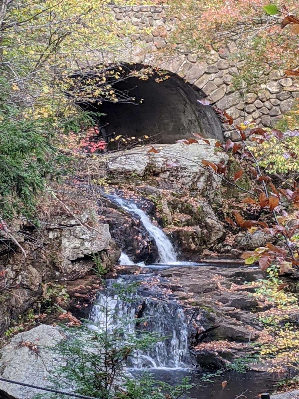
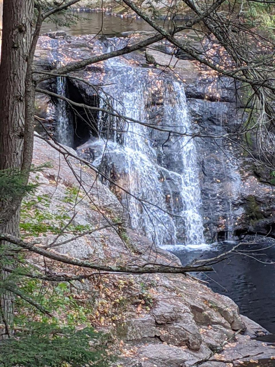
You’ll fall for the views at Doane’s Falls in Royalston
Address: Doane Hill Road, Royalston
Difficulty: Easy
The shortest hike on our list is among the furthest outside of downtown Gardner, but the views on this 0.4-mile hike just may be the sweetest. From underneath a stone bridge, Lawrence Brook tumbles down a series of plunging and cascading waterfalls toward Tully Lake.
The trail can be accessed at the top or the bottom of the hill, but the official trailhead is located at the bottom. Be mindful of the tree roots and rocks which must be navigated in the steeper sections of the trail.
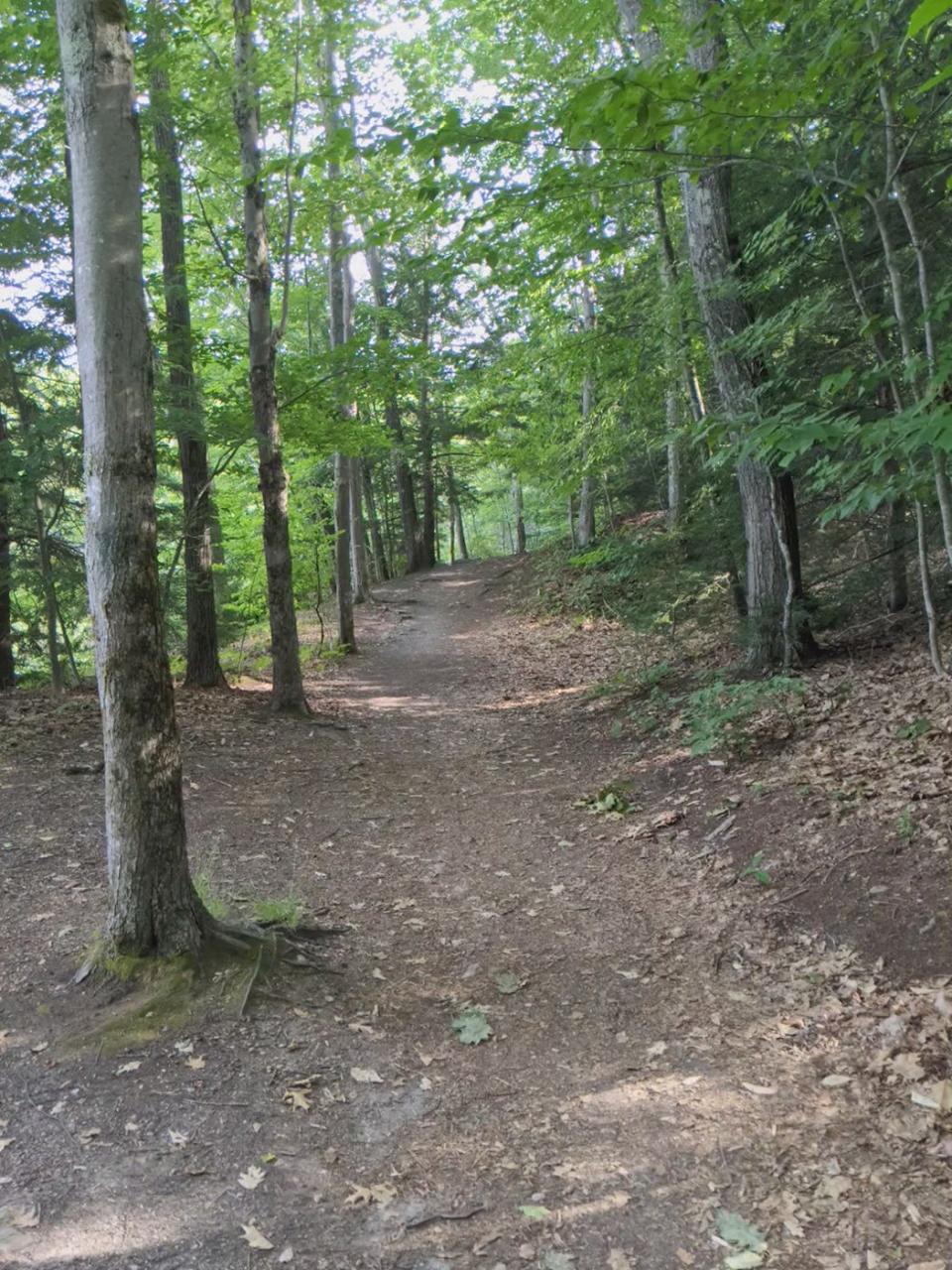
Dunn State Park offers two trails for hiking enthusiasts
Address: 280 Pearl St., Gardner
Difficulty: Easy
A well-known destination for swimming, fishing, canoeing/kayaking and for family picnics, Dunn State Park offers two mile-long trails for folks who long to take a stroll through the woods or around the pond.
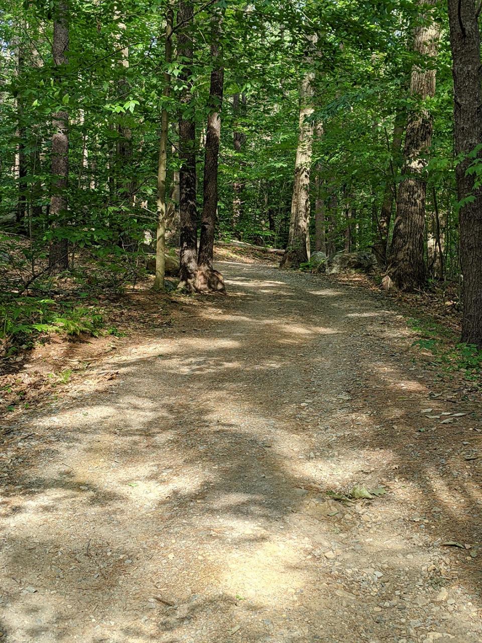
As its name suggests, the Woodland Trail winds through a section of the park’s forest and, thanks to its packed stone dust surface, is fully accessible to wheelchairs and strollers.
For views of the pond, hikers will want to take the Dunn Pond Loop trail. The path’s surface is comprised of firm peat, leaves, rocks and occasional tree roots. The trail includes five staircases with steep rises and steps made of railroad ties. Deemed a Healthy Heart Trail, the Dunn Pond Loop will get your heart pumping — especially if you participate in some of the exercise stations that dot the route.
Discover the Lake Wampanoag Wildlife Sanctuary
Address: Raymond Street, Gardner
Difficulty: Easy to moderate
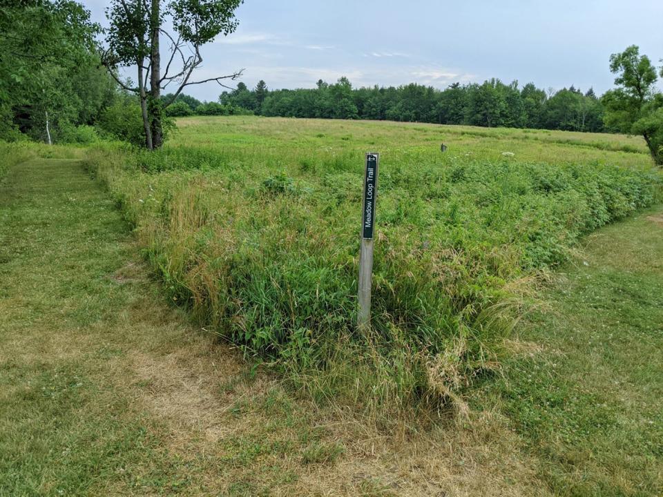
A Mass Audubon Society site, the Lake Wampanoag Wildlife Sanctuary offers four trails and the opportunity to see dragonflies, butterflies, multiple species of grassland birds and possibly deer and moose.
The Meadow Trail is a mowed grass path through a field which features a series of Tree Swallow nesting boxes and connects to an even shorter trail, the Pondshore Trail, which follows the edge of a farm pond.
The Moosehead Trail is the longest trail available at the sanctuary and can be accessed near the parking area or at the southern end of the Meadow Trail. According to the Mass Audubon Society’s trail map of the area, this path passes farm ponds, seasonal wetlands and through a forest of spruce and balsam fir trees.
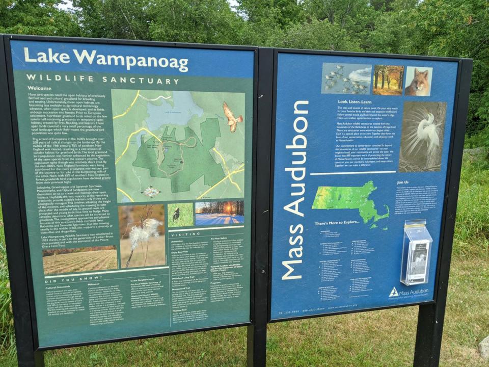
The Woodland Loop Trail is a shorter trail that branches off and returns hikers to the Moosehead Trail and winds through a mixed evergreen and hardwood forest. Woodland trails are marked with blue and yellow disks. Blue leads away from the parking area, while the yellow markers return hikers to the parking lot.
The field trails are not marked, but generally speaking hiking uphill leads you away from the parking lot, while hiking downhill will return you to the sanctuary’s entrance.
More: A star runner at Gardner High, Jim LaFreniere quit to play football. Now he's an avid hiker.
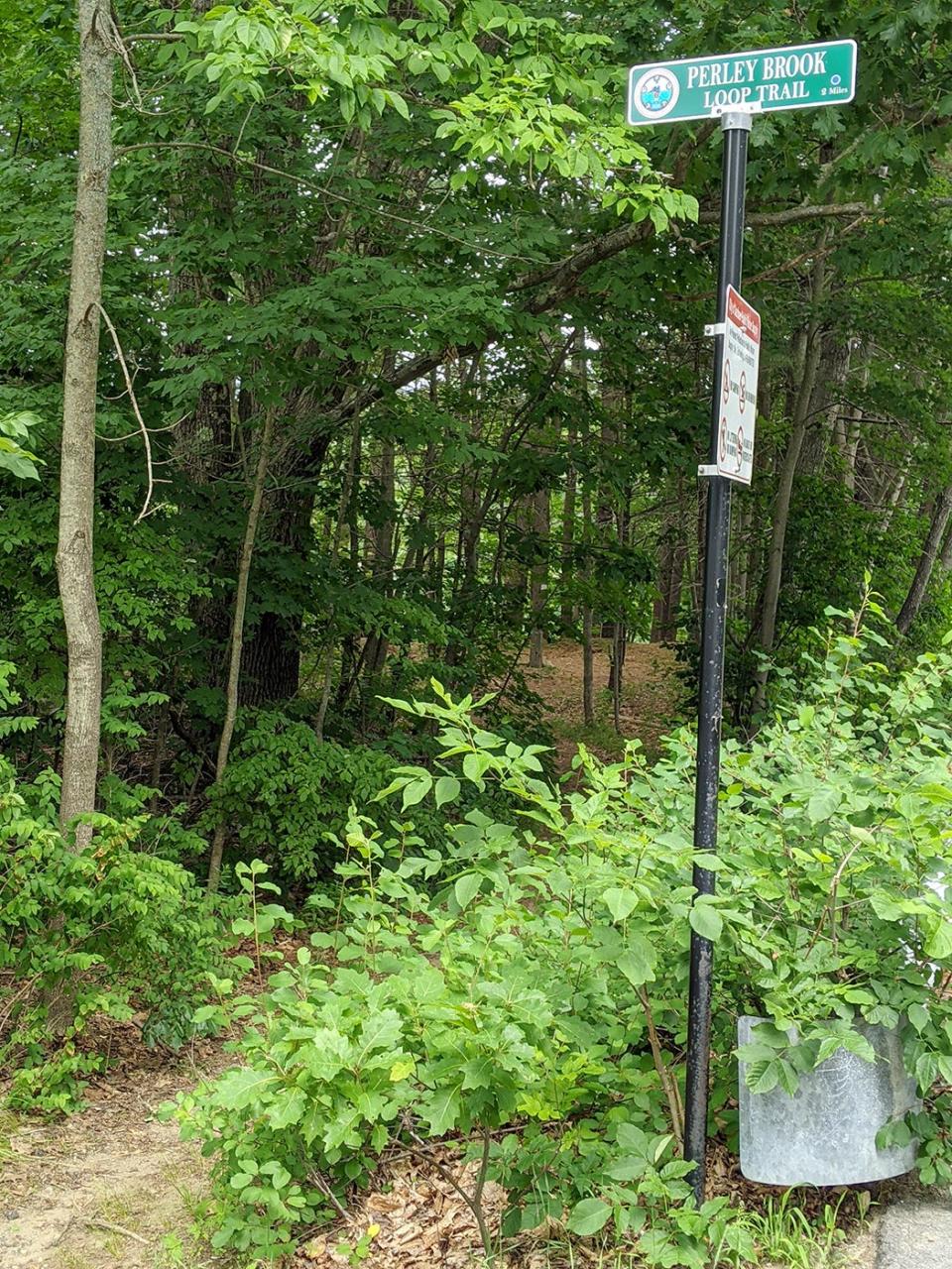
For more water views head to Perley Brook Reservoir
Address: 110 Clark St., Gardner
Difficulty: Easy
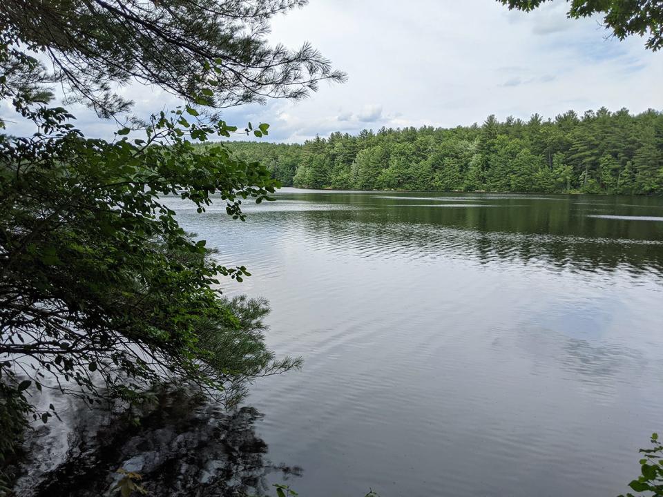
In addition to serving as a public water source for the city of Gardner, the Perley Brook Reservoir offers hikers a 2-mile, relatively flat loop trail around the perimeter of the body of water.
With plenty of shade and good trail conditions, the Perley Brook Loop Trail is a terrific learning trail for new hikers or families with young kids who want to explore nature, but don’t necessarily want to take part in an all-day excursion.
Once you’ve parked, cross Clark Street, turn left and walk about 150 feet and the trailhead is marked with a sign.
Walking the North Central Pathway is good exercise, too
Address: End points are located on Summer Street in Winchendon and Pearl Street/Route 101 in Gardner.
Difficulty: Easy
For a choose-your-own walking adventure, try this approximately 8.9-mile asphalt rail trail that winds from Winchendon to Gardner. Start near the Winchendon YMCA and the path parallels Whitney Pond before arriving at another parking lot at the intersection of Route 12 and Glenallen Street. Continue on another two miles before the path ends at North Ashburnham Road.
Another option is to use the parking lot at the intersection of Old Gardner Road and Route 140/Gardner Road. Picking up the path here you can walk the pathway nearly three miles through forests and bogs to the next crossing at the Route 140/Green Street intersection.
For the final stretch is located on the opposite side of Route 140 and continues another 1 ½ miles before ending near the Crystal Lake Cemetery in Gardner.
More: Gardner awarded $200,000 for bike path extension
More: Blazing a trail at Sunset View Farm
For a longer hike, trails at the Mt. Jefferson Conservation Area, Hubbardston & Templeton State Forests link together
Address: Three parking areas can be found on Mount Jefferson Road, in addition to parking available on New Templeton Road in Hubbardston and on Hubbardston Road in Templeton.
Difficulty: Moderate
With multiple trails available, hikers can develop their own paths to see as much, or as little, of the three spaces as they want. A picnic seating area is available at the trailhead in the Mount Jefferson Conservation area before the start of the Behind the Chimney Trail and the Gates Hill Trail. The former connects with the Canesto Brook Trail, while the latter connects with the Old Cross Trail, both of which are in the Hubbardston State Forest.
With a pair of bridges, the Mill Pond Trail also crosses over the Canesto Brook. Additional Hubbardston State Forest trails include the Mussy Ridge Trail, the Laurel Trail, the Canesto Hill Trail and the Copperas Mine Trail. The last two connect with the Red Oak Trail and the Link Trail, respectively, in Templeton State Forest.
Individually, only the Gates Hill Trail is longer than a mile, but linking a few trails together to make a loop can quickly produce a fun, multi-mile hike. For a full picture of how the trails intersect, hikers can find the trail map here.
You’ve probably skied down Wachusett Mountain, but have you hiked it?
Address: 499 Mountain Road, Princeton
Difficulty: Moderate
Looking for a slightly more challenging hike close to home? Why not try a Massachusetts Department of Conservation and Recreation signature hike of Wachusett Mountain?
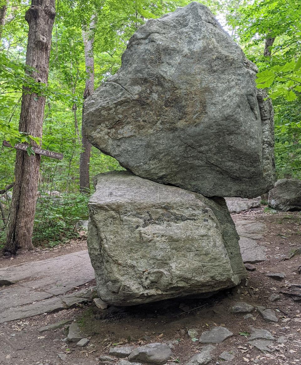
To give this 3.8-mile round trip adventure a whirl, you’ll want to park at the ski area and look for signs for Balance Rock Trail that is your starting point. This trail brings you to Balance Rock, a boulder stacked on top of another boulder by moving glaciers thousands of years ago.
Peak performer: 'Bicycle Brendan' ups the stakes again with NE6 summit challenge
More: NE6 summit challenge fundraises $2,000 for the Alzheimer's Association
After crossing Balance Rock Road, you’ll connect with Old Indian Trail, a path which cuts across several of the mountain’s ski slopes on its way to the summit. After enjoying the views and a respite at the summit, complete the loop by following the Harrington Trail in a southwest direction and stay to the right to join the Semuhenna Trail back down to the Old Indian Trail, the Balance Rock Trail and eventually your vehicle in the ski area parking lot.
Perhaps Mount Watatic is more your style?
Address: Trailhead is on Route 119 in Ashburnham
Difficulty: Easy to moderate
If you’re not sure you’re ready to ascend Wachusett Mountain — or you're looking for a less crowded hiking spot — why not give the 3-mile loop at Mount Watatic State Reservation a try?
Once parked at the trailhead, follow signs to reach the Mt. Watatic summit — roughly a 1.1-mile trek — Mt Watatic summit, before following the Wapack Trail north to the Nutting Hill Ledges and then looping bac to the parking lot by following the posted signage.
The summit provides views of the Boston skyline and of Wachusett Mountain on a clear day.
This article originally appeared on Gardner News: Here's 8 places to go hiking this summer in Greater Gardner

