Low-level snow possible in B.C. as Arctic air plunges south
This isn’t a drill. Get ready to see some snowflakes across parts of British Columbia’s Lower Mainland this weekend as a low-pressure system meets chilly air spilling south from the Arctic.
Falling freezing levels and a chance for precipitation will bring an opportunity for snowflakes all the way down to Vancouver as we head through the weekend. We’ll also have to watch out for gusty winds during the day on Saturday.
DON’T MISS: Canada's November Forecast: Winter weather moves in
Our unsettled pattern of late is a dramatic turnaround from the extended and extreme drought we’ve experienced across B.C. in recent months.

An Alaskan low tracking down the B.C. coast will bring precipitation to the South Coast through the weekend. Chilly air following the low southward will force freezing levels to fall heading into early next week.
This setup will lead to heavy snow across the mountains and even the chance for wet snowflakes at lower elevations. We could see a trace of snow across parts of the Lower Mainland, and some folks may even see a dusting across North Vancouver and Burnaby.
STAY SAFE: Slippery as ice: Brightly-coloured leaves mask dangerous threat
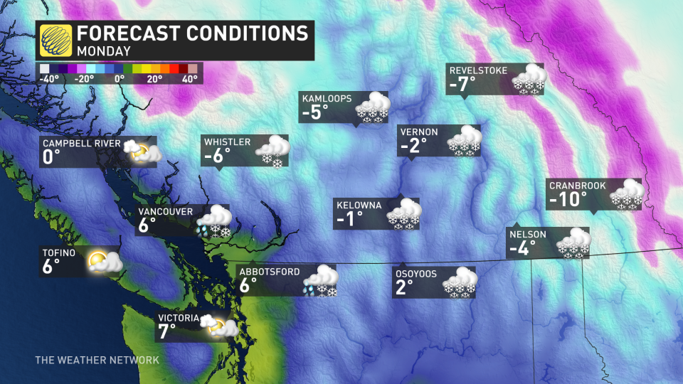
Conditions will remain chilly across B.C. heading into early next week. Daytime highs will struggle to climb above the freezing mark for much of the B.C. Interior, with highs hovering in the mid single digits across the Lower Mainland.
Colder-than-normal conditions will persist as we head into the middle of next week.
Thumbnail image courtesy of Ron Macdonald
Check back for all the latest updates on the forecast across British Columbia.

