Low-lying Hampton Roads will likely be impacted by tidal surge beginning Sunday
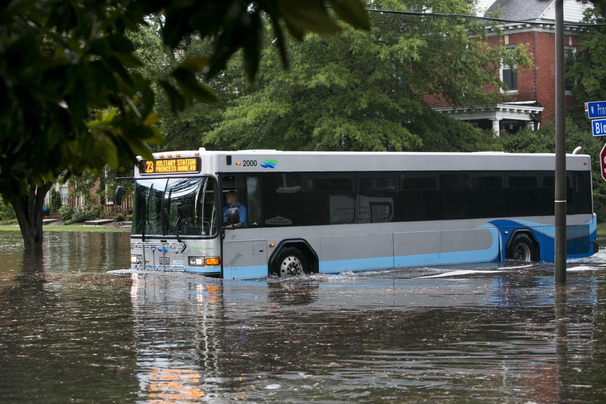
Low-lying roads are likely to experience moderate to major flooding Sunday, as Hampton Roads’ river tides rise nearly 6 feet.
The tidal surge will begin Sunday as a result of strong north and northeastern winds, which the National Weather Service in Wakefield predicts will drive waters 5.9 feet above low tide levels by 3:30 p.m.
The weather service forecast comes on the heels of the weekend’s severe thunderstorms. Multiple days of wind currently forecasted to blow 15-20 mph, combined with rain and the high tide cycle, will trap water in the region’s rivers, said Ryan Rogers, a NWS meteorologist.
“Low pressure will move off shore Saturday and stall east of our area,” Rogers said. “Whenever we get a prolonged period of northeastern winds, coastal flooding is likely.”
The strong winds and intermittent rain is expected to continue through Sunday night, but moderate flooding may persist well into next week.
“We are basically adding water to rivers that can’t get rid of it,” Rogers said. “The water doesn’t have anywhere to go so it just sloshes around.”
Flooding will occur on the region’s rivers, including: Elizabeth (Lafayette), Lynnhaven, Nansemond and Back River, according to Skip Stiles, executive director of Norfolk-based Wetlands Watch. This occurs because the rivers flow north.
“We have north-facing river systems without much head — they do not have much river flow, so there is not much to push the water out,” Stiles said.
Stiles said Norfolk’s Hampton Boulevard will likely be flooded by Sunday afternoon.
“Sunday morning, around 9 or 10 a.m., the water will start gurgling up underneath Hampton Boulevard, and by the 3:30 p.m. high tide, the water will be 4, 5 or 6 inches deep on the boulevard — and it will just keep going up,” Stiles said.
Anyone in flood-prone areas should be on alert for rising water as they head into this weekend.
Anticipating high water, Norfolk will open parking garages and plans to close it’s flood gates. Norfolk city residents will be able to park in the York garage and Brambleton lot until Monday at noon, pending no reassessments of the flood, according to Jim Redick, director of the Norfolk Emergency Preparedness and Response. Old Dominion University will also open campus parking garages from 5 p.m. Saturday through 5 p.m. Wednesday.
Norfolk Public Works anticipates closing the flood gates starting with the pedestrian gate at the bow of the USS Wisconsin and proceeding to Brooke Street by Sunday’s 3:30 p.m. high tide.
Kelly Straub, spokesperson for the city of Norfolk, said residents are encouraged to use the Waze app, “as it warns drivers of flooded areas and can help re-route them.” The city launched the integration of locally developed technology with the navigation app Waze in January.
NWS Wakefield’s Friday forecast predicts this weekend’s water levels will be greater than that of the “king tide,” one of the highest tides of the year when the Earth, moon and sun align, which occurs in November. The November king tide was 5.3 feet above usual levels.
Caitlyn Burchett, 727-267-6059, caitlyn.burchett@virginiamedia.com

