Lubbock, South Plains get badly needed rainfall
Lubbock made up much of its rainfall deficit for the year thanks to several potent lines of thunderstorms Monday and Tuesday, bringing flooded roadways and other reports of storm damage across the region.
The National Weather Services in Lubbock reported 2.5 inches of rainfall over the last two days at Preston Smith International Airport, with many areas seeing well over 3 inches of rainfall and most seeing at least an inch across the South Plains. That additional rainfall put Lubbock at 3.96 inches of precipitation for the year - about 1.86 inches below the year-to-date average.
“We needed that badly,” said Harrison Sincavage, a meteorologist with the National Weather Service in Lubbock. “So it's definitely going to put a dent in the drought, I can say that with confidence.”
Over the 24 counties, NWS Lubbock covers in the South Plains/Rolling Plains region, Sincavage said some areas saw a little over seven inches of rain in the past two days. A radar projection shared by the weather service indicated heavier rainfall totals were seen in western portions of the region between Morton and Muleshoe, along with portions of southern Lubbock County.
“So this was a very, very wetting rain and with everything greening up to this may actually have an effect on our temperatures, possibly this weekend,” he said, noting the forecast that has Saturday and Sunday temperatures reaching the 100-degree mark. “It's still going to be hot, but a couple of degrees lower.”
The next storm front is predicted to hit again next Tuesday and Wednesday of next week, and while it's only bringing a relatively low chance for precipitation, Sincavage said it is still too early to tell.
Storms that are isolated and rotate form supercells that can produce tornadoes, like the four tornadoes spotted near the Morton and Hockley County area on Monday, Sincavage said.
Strong winds in excess of 80 mph in some areas, including Hockley County, led to power outages and reports of damage to structures.
The Levelland Fire Department reported its crews were assessing some of the damage Tuesday morning. They shared photos of a damaged barn, irrigation pivots and pump jacks as well as downed powerlines just north of State Highway 114 near Brazil Road.
While there were reports of land spouts in Tuesday's storms, Sincavage said those are considerably less potent than tornadoes.
“(Landspouts are) kind of like when you see the pictures of the waterspouts in southern Florida,” he said. “They're not quite like a dust devil because it was attached to a cloud, but they hardly move anywhere, and they're very weak.”
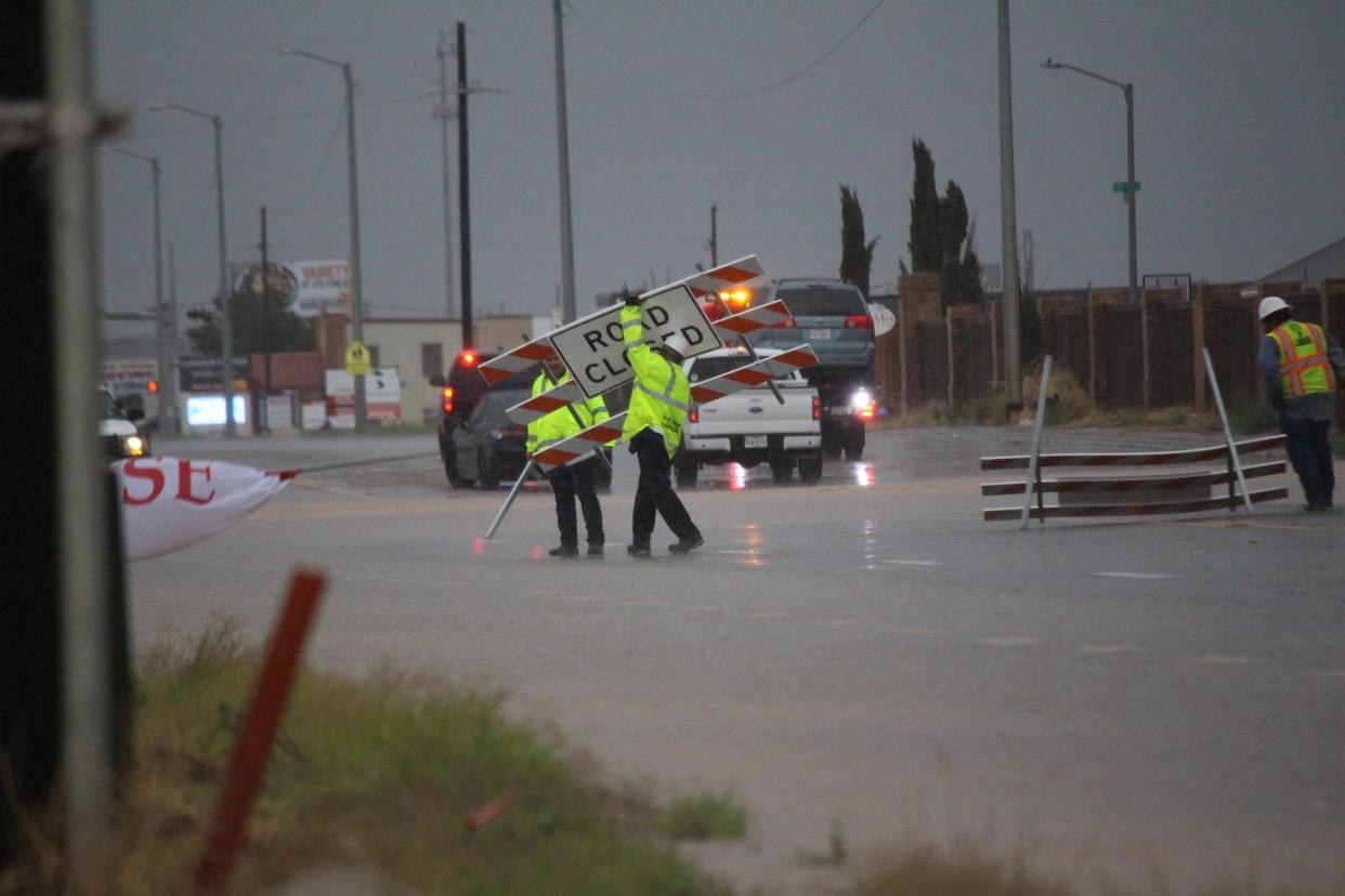
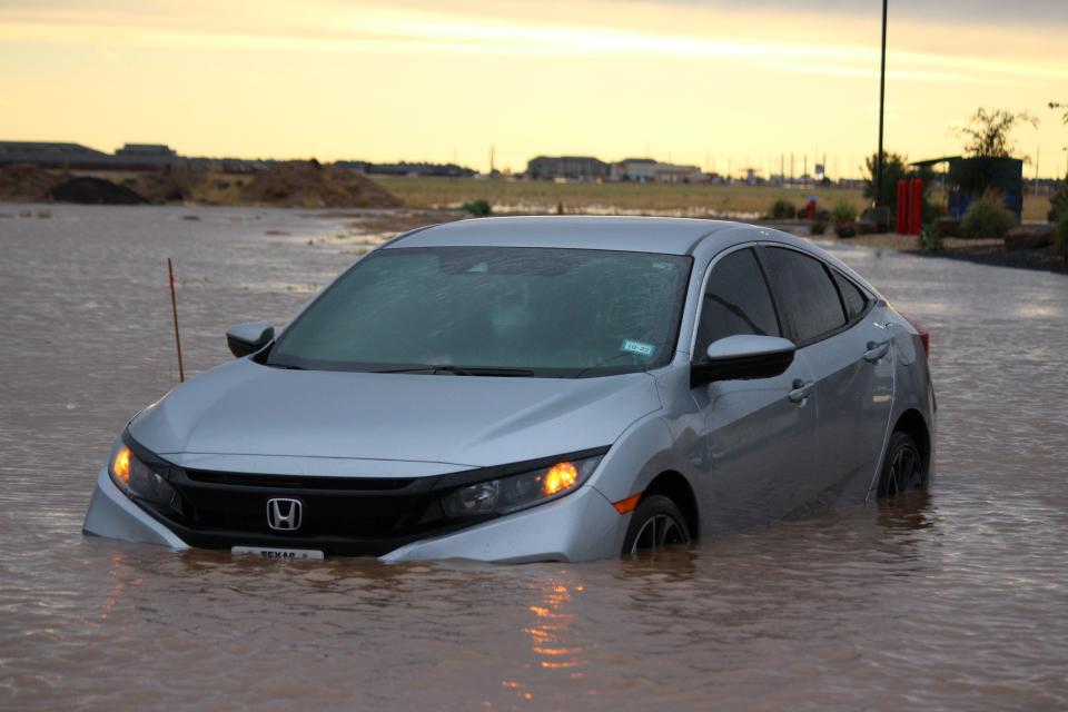
Tuesday's heavy rains prompted a flood warning in southern Lubbock County and portions of Hockley County during the evening hours, with Lubbock police reporting officers responded to at least one vehicle stalled out in water. Officials had been quick to close off several major thoroughfares as water covered the roadways, including portions of University, Indiana and Quaker avenues south of 114th Street.
This article originally appeared on Lubbock Avalanche-Journal: Lubbock area gets badly needed rainfall, more possible next week

