Experts warn of rapid intensification of storm that could hit landfall in Florida next week
The Caribbean Sea is brewing a tropical cyclone that has the Florida Peninsula in its crosshairs, and forecasters warning of a rapid intensification that could slingshot the system to major hurricane strength as it nears the Sunshine State.
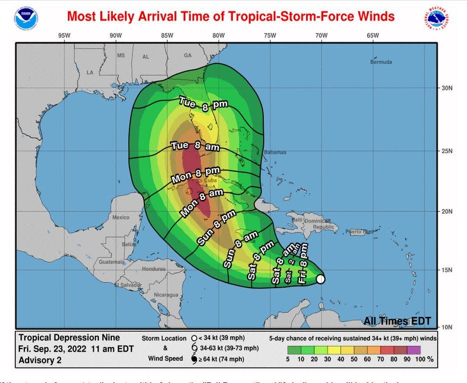
As of 5 p.m. Friday, the disturbance dubbed Tropical Depression Nine was still gaining strength in the Caribbean with 35-mph winds and moving west-northwest. A turn toward the north as it approaches western Cuba is expected Monday before it begins to gorge on the 83- to 85-degree, high-octane waters of the Gulf of Mexico.
State of emergency declared: Gov. Ron DeSantis declares 'state of emergency' for 24 counties for Tropical Depression 9
More: How early is too early to start preparing for hurricane season in Florida?
Hurricane preparation: What supplies do you need for a storm? Here's a list
National Hurricane Center meteorologists said the track forecast Friday was a spread from the eastern Gulf of Mexico to east of Miami, and could change significantly depending on the forward speed of the system and an expected dip in the jet team that will pick the system up and move it east. The question is where will it pick it up and when.
The hurricane center upgraded Tropical Depression 10, which is off the coast of Africa and expected to dissipate quickly, to Tropical Storm Hermine at 5 p.m. Friday. That would make TD Nine, Ian.
►HURRICANE GUIDE: Everything you need to know to prepare for a storm
Tropical Depression Nine could become Category 3 hurricane for Florida
If the storm follows the official Friday track, its center would be approaching Sarasota on Wednesday afternoon with 115-mph Category 3 winds.
Tropical-storm-force winds could be felt in Palm Beach County as early as Tuesday afternoon into evening with the southwest coast of the state feeling winds of 39 mph or higher winds Tuesday morning.
“The one thing to remember five days out is the track error is 200 miles,” said Todd Kimberlain, senior meteorologist for the South Florida Water Management District. “But it could be a potentially large, powerful and destructive hurricane if it doesn’t lose any steam.”
It's important to note that the storm could go anywhere inside the forecast cone, not just down the center. About 30% of the time, the storm travels outside the cone, and effects can be felt far afield of the storm's center.
Gov. Ron DeSantis declared a state of emergency Friday afternoon for 24 counties, including Palm Beach County, Martin and St. Lucie.
How to prepare for a hurricane
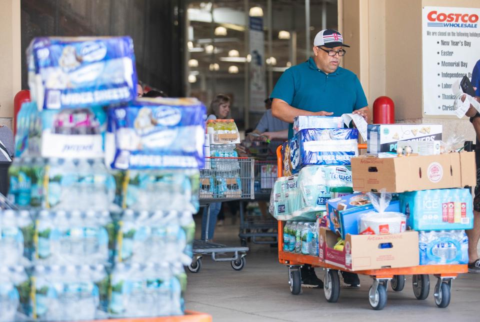
Kimberlain emphasized that now is the time to gather supplies and make plans if evacuation orders are made. Evacuations are based on storm surge, not wind. So-called "shadow evacuations," where people flee who are not in an evacuation zone or unsafe home should be avoided as it adds dangerous traffic to roadways.
Palm Beach County Emergency Management Director Mary Blakeney said it was too early to know if evacuations would be called, but the Emergency Operations Center is ramping up with regular calls with National Weather Service meteorologists and state emergency officials.
Hurricane season in Florida: Watches and warnings. Why you should know the difference
Did you know?: What is a hurricane watch and when to put up shutters
More: Hurricane hacks for your dog, if you want coffee, in case you lose power or ride the storm
She stressed that people celebrating Rosh Hashanah, which begins Sunday and lasts through Tuesday, should try to stay tuned to the weather and emergency forecasts. Also, she fears new residents, who may have not experienced Hurricane Wilma, will think a storm making landfall on the west coast will have less impact on the east coast.
“Just because it may come to us as a west-coast approaching storm, we all learned from Hurricane Wilma that those storms can do significant damage to our county,” Blakeney said. “These storms can be very big, and intense and wide.”
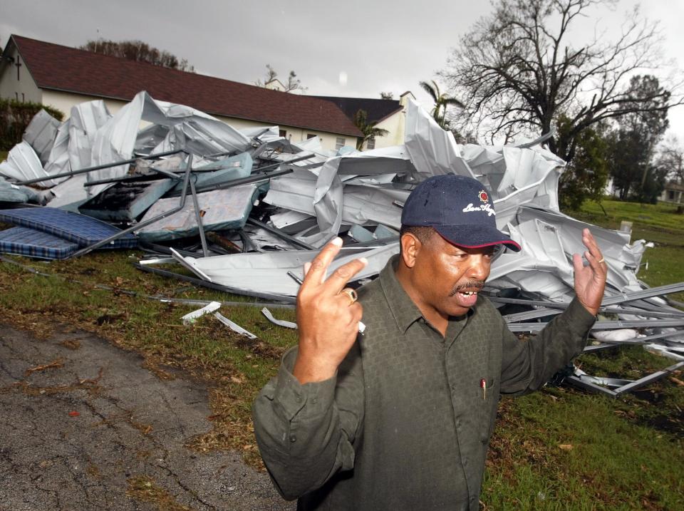
Wilma hit southwest Florida with Category 3-force gales of 120 mph. By the time it reached Palm Beach County, it was a strong Category 2 storm that tossed hundreds of railroad cars from their tracks in Clewiston, left more than 6 million Floridians without electricity, leveled a Lake Worth church, blew trailer parks to bits and blasted windows out of condos on A1A.
Many parts of Palm Beach County went more than a week without power. The last was restored about 19 days following the storm.
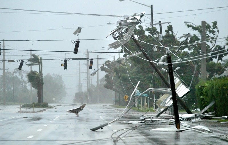
South Florida has not experienced a landfalling hurricane since Irma in 2017, which bullied through the Keys as a Category 4 and up the west coast of the state. Palm Beach County felt wind gusts of 91 mph, which were enough to topple trees, tear streetlights from their perches, rip signs from the ground and shred shrubbery.
Tropical Depression Nine formed early Friday, eight days after leaving Africa as a tropical wave. It was struggling with wind shear from Hurricane Fiona early Friday, but as it moves west and northwest, the wind shear dies and a more juicy atmosphere reigns.
University of Miami senior research associate Brian McNoldy said on social media the Caribbean is “primed to support explosive development.”
Water north of Cuba is between 83 and 85 degrees, pure fuel for a tropical cyclone.
“The environment is going to start to change late in the weekend, and Monday it will intensify a lot more quickly,” Kimberlain said. “It will be favorable for rapid intensification.”
But as I've mentioned, the western Caribbean is primed to support explosive development... hopefully that doesn't happen. pic.twitter.com/Uv51Nn6dnD
— Brian McNoldy (@BMcNoldy) September 23, 2022
Rapid intensification is when a storm’s wind speeds grow by 35 mph in 24 hours or less. It can take a high-end Category 1 storm to a Category 4 in a day, catching people off guard.
Forecasting for rapid intensification was nearly unheard of 10 years ago, but technology has given meteorologists more confidence and is specifically forecast in the NHC’s Friday 11 a.m. advisory.
“The latest NHC intensity forecast has been increased from the previous one and explicitly calls for rapid intensification as the cyclone crosses the northwestern Caribbean Sea,” wrote Brad Reinhart, a hurricane specialist at the NHC.
A tropical storm watch was issued for Jamaica at 5 p.m. Friday, with tropical storm conditions possible on the island by Sunday. A hurricane watch was issued for the Cayman Islands, with hurricane conditions possible by early Monday and tropical storm conditions possible by late Sunday.
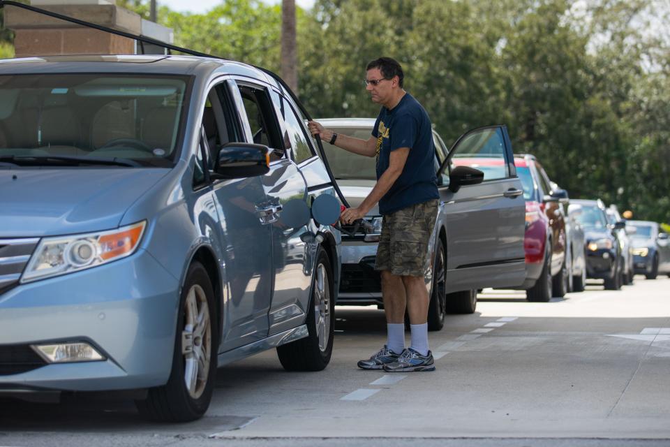
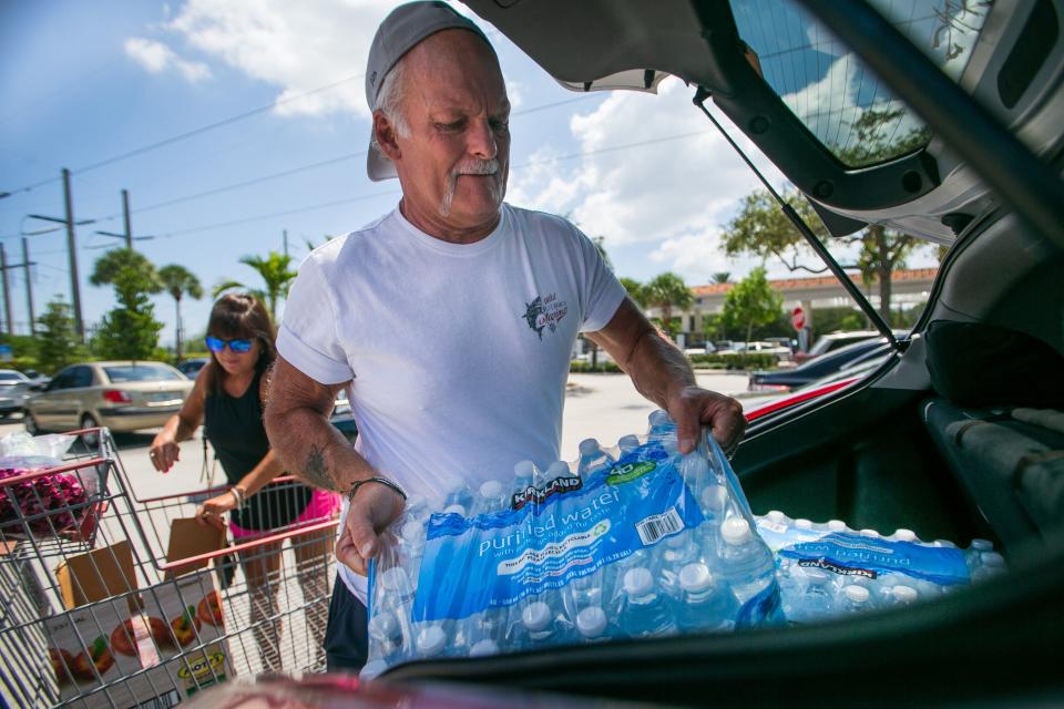
Tony and Shelly Kay, both of Delray Beach, were buying water and other supplies at Costco in Boca Raton on Friday. The couple had moved to Florida from Texas in July 2021, and if Tropical Depression Nine turns into a hurricane, it would be the couple's first hurricane experience. "I'm kind of excited," Tony said. "We got a generator and we're prepared."
Palm Beach Post multimedia journalist Andres Leyva contributed to this story.
This article originally appeared on Palm Beach Post: Hurricane tracker Florida: How to prepare for a category 3 storm

