After a rainy Saturday, a major storm will bring rain, possible flooding to NC next week
After a storm Saturday that is bringing rain and occasional downpours to the Triangle, a second, more powerful system is expected to move in Monday night that could drop much more precipitation in Raleigh and elsewhere in North Carolina.
Here’s what we know so far.
The early forecast
▪ This weekend: The National Weather Service says the Saturday storm is expected to result in a total of a half-inch to 1 inch of rain and should be out of the state by late Saturday, followed by calmer weather on Sunday and Monday.
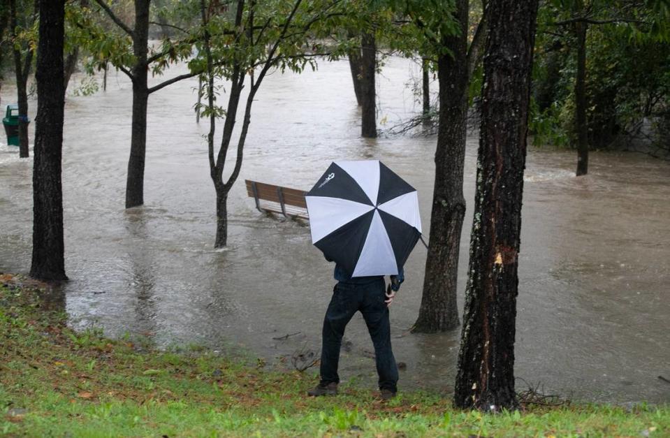
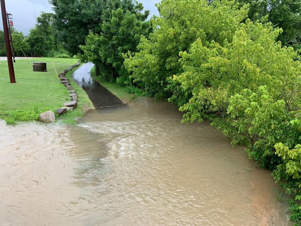
▪ Early next week: However, meteorologists say a major storm system will move out of the lower Mississippi Valley Monday night and arrive in North Carolina early Tuesday with the potential to drop 1 to 3 inches of rain through Tuesday night. Up to 4 inches are possible in parts of the western Piedmont, forecasters say.
Those rainfall amounts are comparable to the totals accompanying some hurricanes and tropical storms that have passed by the state. During Hurricane Dorian in September 2019, for example, Raleigh received 2.28 inches of rain. Last September, Raleigh got 2.81 inches of rain from Tropical Storm Ophelia.
Tuesday’s storm could cause river flooding, especially in the Rocky, Haw and Neuse river basins, and flash flooding, forecasters say.
Temperatures on Tuesday are expected to be in the low to mid-60s.
Strong winds are possible
Forecasters say the storm also will bring sustained winds of 15 mph to 25 mph with gusts up to 35 mph possible, especially in the Sandhills and the southern-central coastal plain.
Thunderstorms are possible, especially to the south and east of Raleigh, and meteorologists will be watching for the potential for violent storms, though early forecasts say the potential is low.
Wednesday is expected to be dry but still breezy.
Why are we getting so much rain?
Chalk it up to what is likely developing into the fifth-strongest El Niño weather pattern since 1950, when meteorologists began tracking the phenomena.
While the El Niño was expected, it strengthened more than originally anticipated so its effects have been felt earlier and more intensely.
A report issued in December by the National Weather Service’s Climate Prediction Center said a major index of an El Niño’s strength — water temperatures in a particular region of the Pacific Ocean, along with other measures — indicate this El Niño is particularly strong and is likely to continue through the winter before fading away next spring.
The stronger the El Niño or La Niña, the more likely that the actual winter pattern will match the average model forecast pattern,” NOAA’s Nat Johnson wrote in his blog last month. El Niños, as well as their opposites, La Niñas, are naturally occurring weather phenomena that usually appear every two to seven years as a function of the way the Pacific Ocean interacts with the air above it.
El Niños happen when the Trade Winds — winds that blow along the equator, east to west over the Pacific — weaken, causing the warmer water to move east toward South America, accumulating there before moving north to California and south toward Chile, the News & Observer has reported.
In North Carolina and across the Southeast, an El Niño can mean that winter is cooler than average because of more cloud cover, though recent El Niños have coincided with warmer winters in the region. El Niños also typically result in wetter-than-average winters here.
Rain so far has wiped out much of NC’s drought
Corey Davis, assistant state climatologist, said Thursday that November and December definitely brought additional rain to the state, wiping out most of the drought in the eastern half of the state.
Areas in the western half of North Carolina still need rainfall, but Davis said the event Tuesday and more rain this month and in February could erase the drought entirely before the El Niño fades sometime between April and June.
Davis said December was the seventh-wettest in North Carolina in records dating back to 1895. At RDU, he said, officials recorded the second-wettest December ever, with 7.01 inches of rain for the month, compared to the highest amount of 7.78 inches in December 1907.
“It has been an amazing turnaround,” Davis said. “That drought was pretty well entrenched, and for one month of rainfall to make that big of a difference was pretty impressive.”
Davis said December 2023 also was the 19th-warmest on record in the state.

