Mapped: Latest location of Iceland volcano eruption and lava flows shown in new images
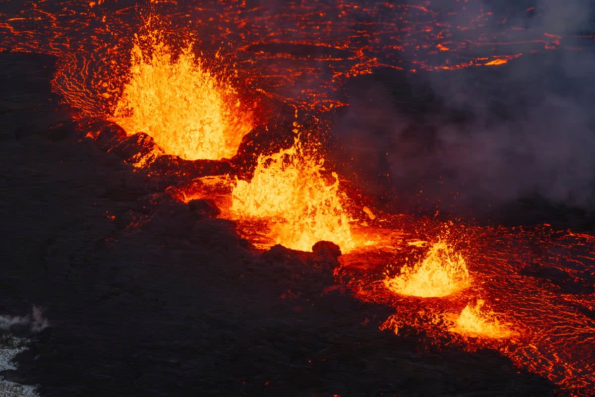
A volcano in southwest Iceland has finally erupted, spewing rivers of lava from at least a four-km-long fissure, weeks after scores of earthquakes jolted the Reykjanes peninsula.
The eruption late on Monday spewed lava and smoke more than 100 metres into the air after weeks of intense seismic activity that prompted the evacuation of the entire fishing town of Grindavik.
The Icelandic Met Office (IMO) on Tuesday said the crack was still three kilometres away from the Grindavik and that the power of the volcano was decreasing.
However, the IMO warned that more vents were expected to open as the lava flow continued well into Wednesday. "While the eruption continues at Sundhnúksgíga, there is an increased likelihood that more vents may open along the original fissure as well as further north or south.
“Looking back at the lead-up to the eruption reveals that there were approximately 90 minutes between the first indicators and the start of the eruption. Therefore, the warning time for new vent openings at Sundhnúk could be very short," the met office said.
The IMO shared a map on its website showing the latest position of the nearly four-km-long fissure (marked in red) east of the Svartsengi geothermal plant and northeast of the fishing town of Grindavik.
Iceland’s foreign minister Bjarni Benediktsson has raised concerns for the “critical” Svartsengi power station, located nearly 4km west of the volcano.
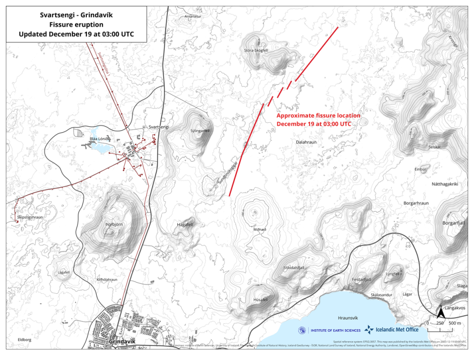
Mr Benediktsson said that authorities have built a barrier around the geothermal plant to protect it from the lava flows but concerns remained for the infrastructure. "There is a critical power plant there which is immensely important for the inhabitants of the peninsula," he said in a statement.
The eruption was "much larger than the ones we've had in the last three years", he added.
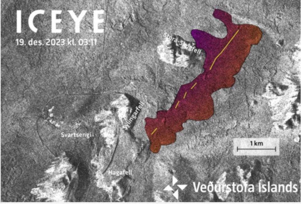
A separate satellite image shared by the IMO shows the new eruptive fissure (yellow line) and lava flows (colored area) east of the geothermal plant.
The volcano erupted nearly 48km from the capital of Reykjavik and about 28 miles from Keflavik International Airport.
The Icelandic government in a statement said flights to and from the airport would continue despite the proximity to the eruption.
“The eruption does not present a threat to life,” a government statement said. “There are no disruptions to flights to and from Iceland and international flight corridors remain open.”
Meanwhile, authorities have warned that the eruption was releasing “considerable” toxic gases which could lead to gas pollution in the capital.
“Please be advised that this eruption is releasing considerable toxic gases and people are strongly advised against visiting the site of the eruption while responders and scientists assess the situation,” the Icelandic Icelandic Tourist Board told CNN on Tuesday.

