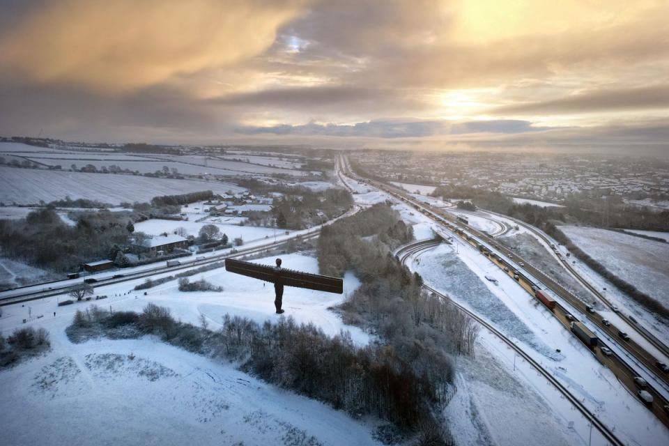
Mapped: Snow and ice Met Office warnings as UK hit by overnight freeze
The UK has been hit by a wave of snow and ice this weekend as a major incident was declared and flights were grounded.
The coldest overnight temperature this winter was recorded in northern Scotland, the Met Office said, as Altnaharra in the Highland region dropped to -12.5C.
It comes as thousands of people across Cumbria woke up without power on Sunday morning after heavy snowfall affected Electricity North West’s service.
East Midlands Airport was forced to temporarily close its runway after heavy snow blanketed the ground.
The airport said in a tweet at about 8.10am today: “Due to snow, our runway is temporarily closed. We will update you as soon as possible.”
On Saturday morning, Glasgow Airport suspended all flights as many inbound flights were diverted, delayed or cancelled. The inbound Wizz Air flight from Budapest landed at Edinburgh, while a Ryanair jet from Malaga touched down in Prestwick.
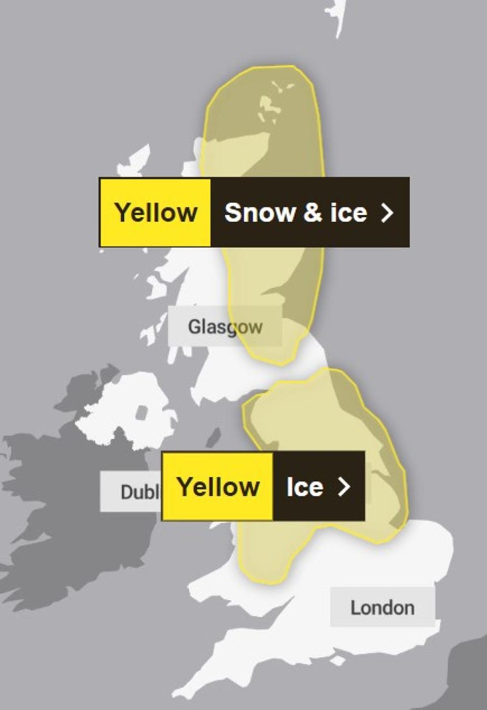
Yellow weather warnings for snow and ice are currently in place in large parts of Scotland, the Midlands, Wales and the North East, with snow and ice set to disrupt roads and railways.
There is a yellow warning for rain from midnight until 6pm Monday which affects most of southern England, Wales and the West Midlands.
For the latest on the cold weather across the UK, follow our live blog
The freezing weather is being caused by a blast of cold air from northern Scandinavia, resulting in a particularly cold snap for many northern and eastern parts of the UK.
After a relatively mild November, temperatures plummeted this week with snow falling on Wednesday morning across parts of Yorkshire and Scotland. The flurries continued into Thursday evening with North Yorkshire Police reporting 100 cars stuck on the A171, between Whitby and Scarborough.
And on Friday morning, icy conditions on the roads resulted in 20 schools in County Durham closing.
In London, where commuters woke up to temperatures of -4C on Friday morning, mayor Sadiq Khan activated a “severe weather emergency protocol” for accommodation to be opened for rough sleepers.

The first snow of the season was even reported in parts of the capital including West Hampstead, Ealing and Islington.
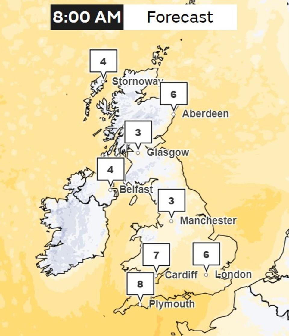
Met Office spokeswoman Nicola Maxey said: “Last night was a cold night across the country with a widespread frost as temperatures fell well below freezing for most.
“Colder conditions are now covering all areas of the UK and we will see little change as we go into the weekend.
“Daytime temperatures will be rooted in single figures and overnight temperatures falling well below freezing in many places. We will continue to see wintry showers at times and where these showers fall as rain there is a risk of icy patches forming.”
The yellow weather warnings in place warn of disruption to roads and railways, and of the risk of icy patches on roads, pavements and footpaths.
Alongside the Met Office warnings, the government’s UK Health Security Agency has amber cold health alerts in place for five regions: the East Midlands, West Midlands, North West, North East and Yorkshire and the Humber until December 5.
The alerts warn of the cold weather impacting the regions’ health services.

