What maps from the 1700s and 1800s tell us about the creation of Newport
NEWPORT — Despite its reputation as a historical time capsule, the city of Newport has gone through many changes since it was first settled in 1639. We went through some of the maps available online and through the Newport Public Library to see some of these changes in action.
What’s in a street name?
The oldest map available online is a plan of the then-town of Newport from 1777, a year after the United States declared its independence from Great Britain and seven years before Newport would be incorporated into the new country as the city of Newport. The map is available to view on the Library of Congress’ website.

Many Newport streets and wharfs have the same names as they did back then, including major thoroughfares such as Thames Street, Spring Street and Long Wharf, however many streets and wharfs received major rebranding over the years.
Bellevue Avenue and Touro Street
The street listed as “Jew Street” at the top of the 1777 map, for example, is the original name for Bellevue Avenue, and the attached “Griffin Street” would later be named Touro Street. This is because, although the neighboring synagogue was established 14 years before the map was drawn, it wouldn’t get the name “Touro Synagogue” until 1822, when Newport native Abraham Touro’s will bequeathed $10,000 to the synagogue.
Saving history: 'It’s a piece of history': A homeowner's fight to save one of Newport's oldest buildings
Memorial Avenue
Although the 1777 map does not extend past downtown, another map of Newport hosted on the Library of Congress’ digital archive, dated 1878, has a much larger and more detailed view of the rest of the city. Memorial Avenue is visible on this map, however, it's labeled as Bath Road. A later map from 1936, which is available through the Newport Public Library archives, also shows Bath Road in the location where Memorial is today. This is because the street would not be called Memorial Avenue until the late 1960s after it was combined with Levin Road and Cannon Street.

Missing landmarks
While most of Newport’s oldest historic landmarks, such as Old Stone Mill Tower, Great Friends Meeting House and White Horse Tavern pre-date the 1700s, there are some iconic fixtures of modern Newport missing from older maps.
We're not alone: A look at other places named Portsmouth around the world
Fort Adams
The 1777 map, although limited in scope, may omit most of what we know as Newport today for a reason. Fort Adams, which sits near the southernmost tip of Aquidneck Island, would not be built until 1799 as a part of the newly independent country’s First System of coastal forts.
Salve Regina and The Breakers
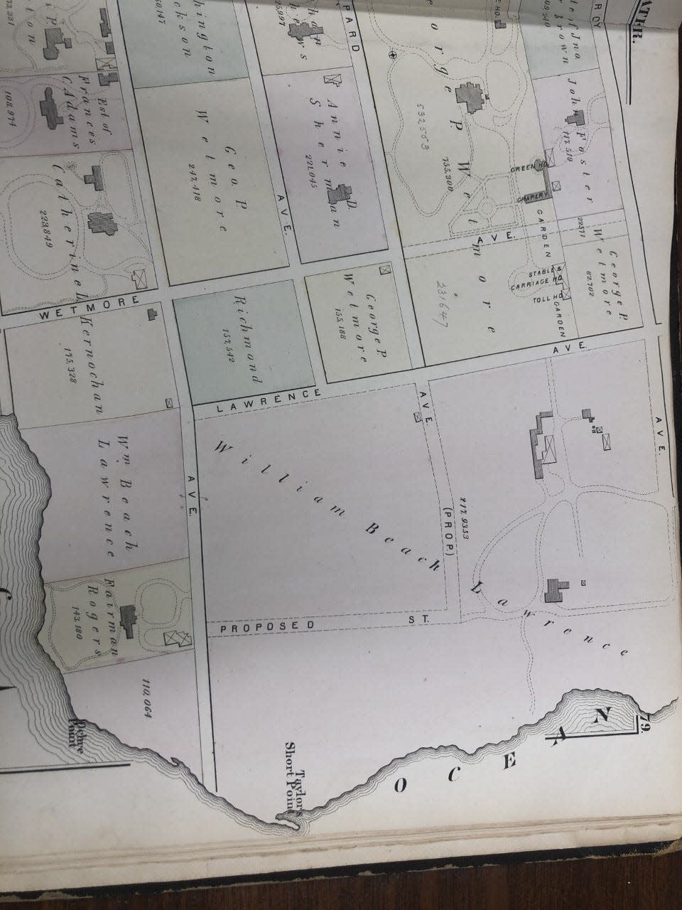
Likewise, the 1777 map does not extend southeast enough to show the future location of the Bellevue Avenue summer mansions which began cropping up around the mid 19th century. An atlas from Newport Public Library dated 1878 reveals a plot on Ruggles Avenue bordering the ocean owned by former R.I. Lt. Gov. William Beach Lawrence. This property was purchased by a man named Pierre Lorillard IV the year this map was drawn, whose summer home, called The Breakers, would be completed on said property that same year.
Learning from the past: Tiverton restaurant's anti-Semitic meme leads to lessons on Holocaust horrors
Cornelius Vanderbilt II would later purchase the land and the mansion on it in 1885 and build The Breakers mansion we see today after the original was destroyed in a fire in 1892.
Salve Regina University, which currently surrounds the area around The Breakers, would also not be founded until 1934.
Miantonomi Park
The 1878 atlas also shows several divided parcels of land south of Maple Avenue and bordered by Malbone Road to the West and Hillside Avenue to the East. The majority of this land would later be purchased in 1881 by Anson Stokes for farmland. The Stokes family later sold the land to the city in 1923. A map from 1936, also available at the Newport Public Library, labels the property as Miantonomi Hill.
This article originally appeared on Newport Daily News: Newport maps from 1700s, 1800s offer a glimpse into creation of city

