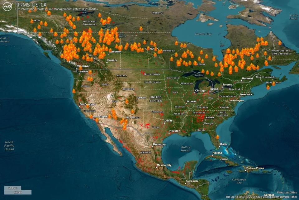
Maps show where the Canadian wildfires are burning

Canada is experiencing its most destructive wildfire season on record, as hundreds of blazes burning from coast to coast continue to send tremendous plumes of smoke into the atmosphere — and over the U.S.
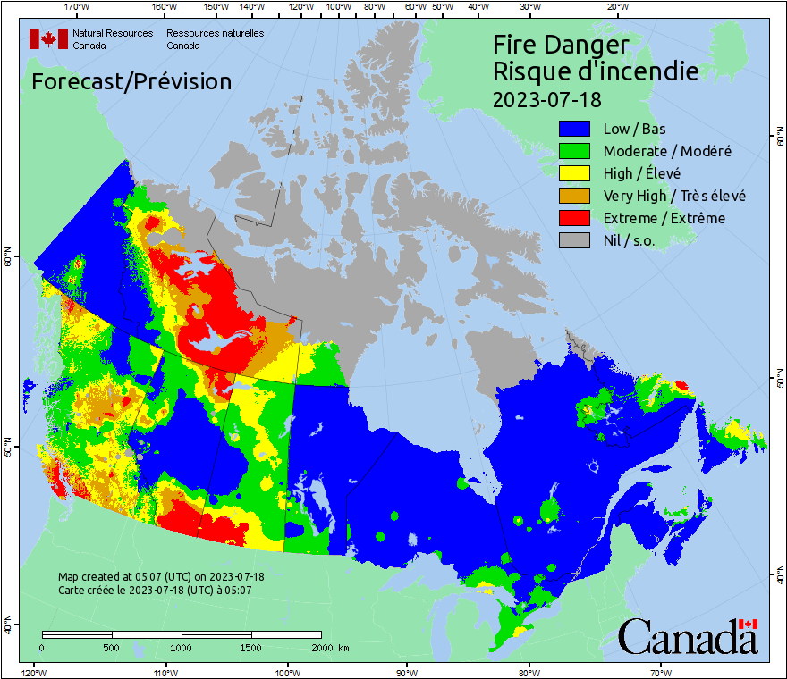
A map updated daily by the Canadian Interagency Forest Fire Centre shows how widespread the wildfires have become. Eastern provinces like Quebec, Ontario and Nova Scotia have been hit particularly hard this year by large and at times uncontrollable blazes.
Officials on Tuesday reported 391 active fires in British Columbia, along Canada's west coast. To the east, Alberta had the second-highest number of active blazes with 125 while Quebec, which borders New England, had 107.
Wildfire season typically happens around this time of year in Canada, which is home to about 9% of the world's forests. But with the season occurring annually from May until October, devastation seen from the outset this year put the country almost immediately on track for its worst season in more than 30 years.
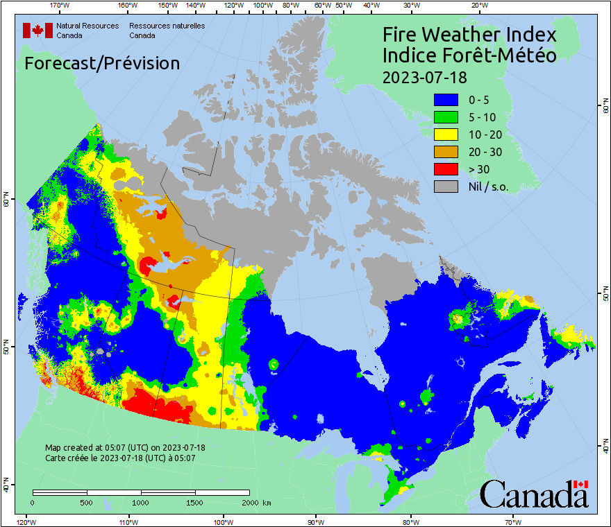
The broad extent of the fires — from the westernmost provinces to the eastern ones — is unusual, particularly so early in the year, Canadian government officials have said. Political leaders, including President Biden, and environmental experts have pointed to the causal link between rising temperatures driven by climate change, as well as drought, and the extreme wildfire season that Canada is experiencing now. Plus, as CBS News previously reported, harsh weather conditions in Canada are fueling the fires and making it harder for firefighters to combat the flames.
As of its most recent update, the interagency fire center has recorded 4,202 wildfires since the beginning of 2023. The fires have scorched at least 10.9 million hectares — or over 26.9 million acres — of land across Canada this year. In June, the acreage burned this year surpassed the amount of land burned in 1989, which previously held Canada's annual record, the country's National Forestry Database reported.
There were 906 active fires burning in Canada on Tuesday, according to the latest interagency tally. The agency's overall tally increased from 881 active fires reported on Monday.
Wildfire smoke traveling south from eastern Canadian provinces brought a marked spell of haze, fumes and copper skies to the northeastern U.S. in June. The smoke has again resulted in hazy skies and triggered air quality alerts impacting Americans.
On Tuesday, air quality in Washington, D.C., Montreal and New York City were among the top 10 worst major cities in the world, according to the Swiss air quality technology company IQAir.
As of Tuesday, most of Canada's active fires were classified as "out of control," with 594 blazes in that category. Of the remaining wildfires being monitored, 204 were considered "under control" and another 108 were "being held," which is the label assigned when a fire is not under control but also is not moving.
Canadian officials have declared a "national preparedness level 5" in response to the wildfires, which means the country will deploy any resources necessary to combat the flames. Mr. Biden said in June that firefighters from the U.S. would be sent to Canada to assist in the effort, alongside others from Australia, New Zealand and South Africa, a research officer from the Canadian Forest Office previously told CBS News.
According to the interagency center, U.S. firefighters were deployed to Canada on May 8, a month before wildfire smoke began drifting across the border and throughout the Northeast U.S. Since then, about 2,000 federal firefighters have been sent to Canada in rotations.
As of July 17, there were 401 federal firefighters in Canada, many of them in Quebec, the agency said. The specialized crews include hot shots, smoke jumpers and fire management personnel from a range of federal agencies including the U.S. Forest Service, Bureau of Land Management and National Park Service.
-Alex Sundby contributed reporting.
Man harnesses power of the sun to create art
Formerly conjoined twins go home from hospital after separation

