Late March snowstorm expect to dump 2 inches of snow on Green Bay, Appleton, Manitowoc; 3-6 inches in Milwaukee
A late March snowstorm is expected to bring at least 3 inches of wet, heavy snow Saturday to Milwaukee, Fond du Lac, Sheboygan, Fond du Lac, Oshkosh, Manitowoc, Appleton, Green Bay and Door County, according to the National Weather Service.
"Even though we're in spring, it's still pretty common to see these kinds of storms here this time of year," said Jaclyn Anderson, a meteorologist with the National Weather Service in Milwaukee/Sullivan.
Here's what we know so far about what to expect Saturday.
How much snow is expected to fall?
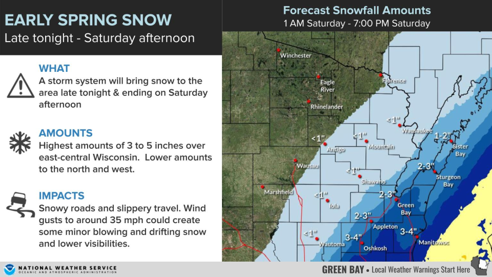
Some parts of northeastern Wisconsin are forecast to see between 2 to 4 inches. The most snow is expected further south and east, in communities like Manitowoc, Sheboygan and Oshkosh. Appleton, Green Bay and Door County could still see at least 2 inches.
The main axis of the storm is forecast to cross over southeastern Wisconsin. East of a line from New Glarus to Fond du Lac, 3 to 6 inches of snow are possible. There's potential for even higher snowfall in Milwaukee, Waukesha, Port Washington, Racine and Kenosha.
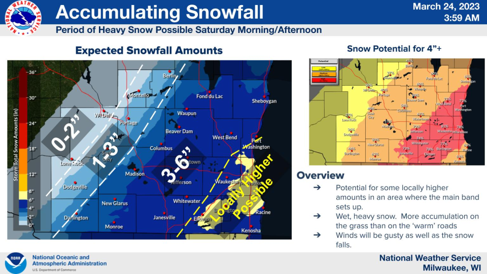
However, the storm is forecast to have a sharp cutoff. Unless the storm track shifts again, communities further west are much less likely to see winter weather, with only around an inch of snow or none at all.
When will the snow start falling?
While snow could start falling as early as Friday night, peak snowfall is expected between 6 a.m. and 1 p.m. Saturday, the NWS said.
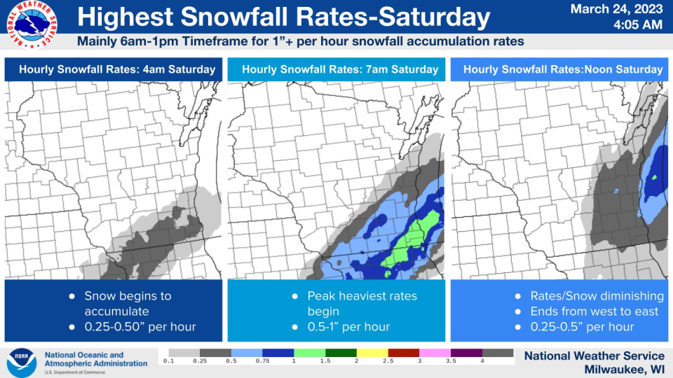
The snow is forecast to start accumulating in south-central Wisconsin around 4 a.m. Saturday, moving further north and east as the morning continues.
Mid-morning is when the snowfall is expected to peak, Anderson said. During that time, the rate of snowfall could be as much as an inch per hour.
By noon, the storm is expected to have mostly moved east, trailing off Saturday afternoon, the NWS said.
Will the storm impact travel?
The snow is not expected to accumulate as much on the roads because of warmer ground temperatures. Still, there's potential for "sloppy, slick" roads, especially as the morning wears on and snowfall rates increase, Anderson said.
Wind gusts of 30 to 35 miles per hour are also expected during the snowstorm, which could also cause visibility issues Saturday morning.
What could still change before Saturday?
"There's a pretty big disagreement between the (forecast) models" on where the storm track finally ends up, Anderson said.
The storm could still shift west or east before Saturday. Less snow is possible if it shifts east, but if it instead moves the other direction, eastern Wisconsin could see even more.
"There could be a big change in snowfall possibility over the hours," she said.
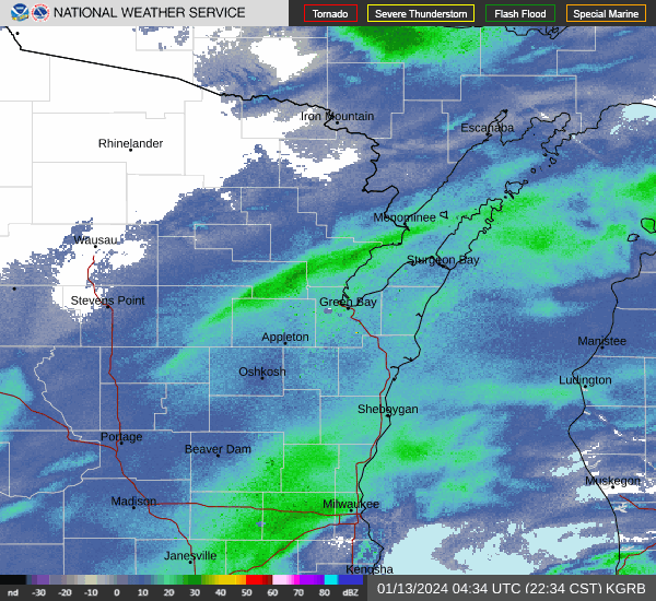
Wisocnsin weather radar
Can't see the image? Click here.
Rebecca Loroff is a breaking and trending news reporter for USA TODAY NETWORK-Wisconsin. Contact her at rloroff@gannett.com.
This article originally appeared on Green Bay Press-Gazette: Late March snowstorm to hit Green Bay, Appleton, Milwaukee, Manitowoc

